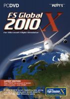
After many years of SRTM (and its limits, such as availability of data just between 60° North and 60° South as well as resolution over all of just 76m) we leave it behind us and set foot to new shores. New much better data sources have been discovered and used.
So this is the first version of FS Global to offer a WHOLE world coverage including areas not covered by SRTM such as Antarctica, Greenland, Iceland, Russia and Scandinavia to name a few. In order to reduce data size we have selected the appropriate resolution for each area. It does not make sense to render the Great Plains in the USA or northern parts of Germany in a LOD 12 (9m) resolution. Flat is flat. Higher resolution here is not visible to the eye in Flight Simulator. It just needs more space on your hard drive and more time to load in FS. Bear that in mind when you read about resolution on this web site and others.
Below is a list of just a few improvements over previous versions of FS Global (so you get what was in the previous version PLUS that! e.g. we do not list the Alps in LOD 12, as they already were LOD12 in FS Global 2008)
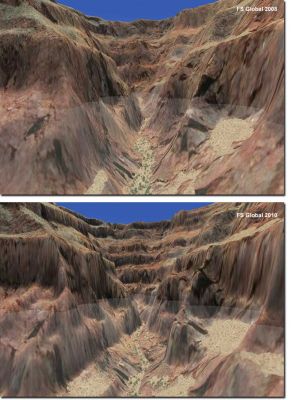
- LOD12 (FS mesh and source data in 9m resolution!) for Hawaii (complete) and the southwest of the US, south of 38°N and west of 108°W (ca. Mesa Verde -> Point Reyes)
- High quality coverage of North America (and Canada!): nationwide LOD11 (19m)
- Greenland, Iceland and Scandinavia in LOD 9 (76m; standard SRTM resolution)
- Additional high resolution areas in Europe in LOD11 (19m): High Tatra, Scotland, Hardangervidda (Norway)
- Huge areas in the north of Russia in LOD9.
- Antarctica in LOD8
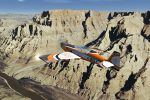
- Sophisticated new algorithm for correct views of ridges and peaks (most of them should have been higher and will now be nearer to actual value)
- New algorithm for reducing irrelevant data for higher data compression
- New algorithm for finding and correcting errors
- Airport patches for prominent problem areas
- A tool for the user to correct wrong airport elevations
 Don't forget... We have a huge selection (over 24,000 files) of free mods and add-ons for MSFS, FSX, P3D & X-Plane in the file library. Files include aircraft, scenery, and utilities All are free-to-download and use - you don't even need to register. Browse on down to the file library here.


1 comments
Leave a ResponseThe content of the comments below are entirely the opinions of the individual posting the comment and do not always reflect the views of Fly Away Simulation. We moderate all comments manually before they are approved.
I suggest to pay more attention to cruising and approach charts, free and payware.