
FSX Henrys Lake Airport Scenery
Henry’s Lake Airport (U53) scenery recreates Idaho’s backcountry near Yellowstone for Microsoft Flight Simulator X, covering about 25 square miles with refined terrain, custom ground detail, and lively shoreline scenes like campgrounds, boats, streams, and fishing spots. It upgrades operations with a paved runway, ATIS, and a long-range RWY 6 ILS, and requires common scenery object libraries.


 United States of America
 - File: henrys_lakeidaho_fsx.zip
- Size:1.55 MB
- Scan:
Clean (26d)

- Access:Freeware
- Content:Everyone
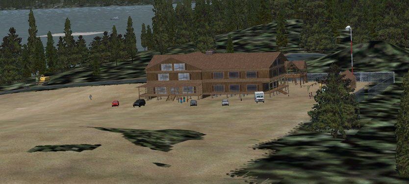
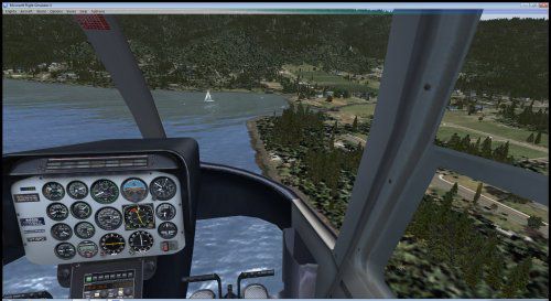
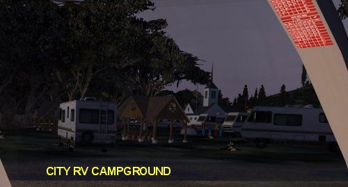
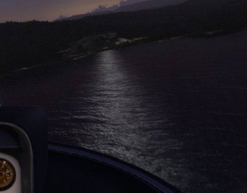
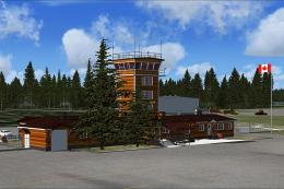
This enhanced environment brings Idaho’s Henry’s Lake region (airport code U53) into sharp focus within Microsoft Flight Simulator X. Its coverage expands roughly 25 square miles to capture scenic terrain near Yellowstone, adding custom ground details and objects for a more authentic backcountry experience. Developed by Jimmy R. Martin, this freeware package incorporates camping areas, streams, boats, and even fishing spots, so sim pilots can immerse themselves in the rugged outdoor atmosphere from the air—or while virtually boating around the lake.
Terrain Refinements and Local Features
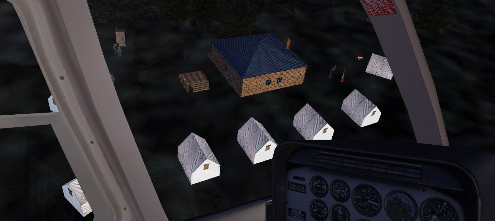
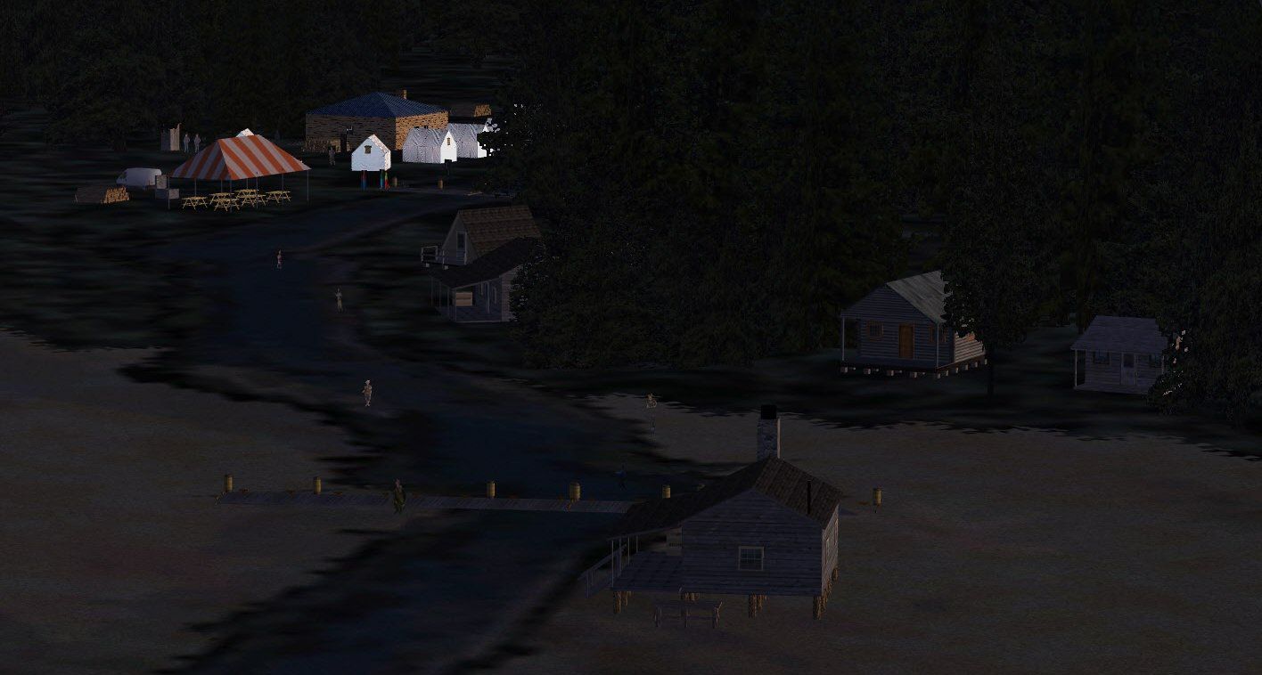
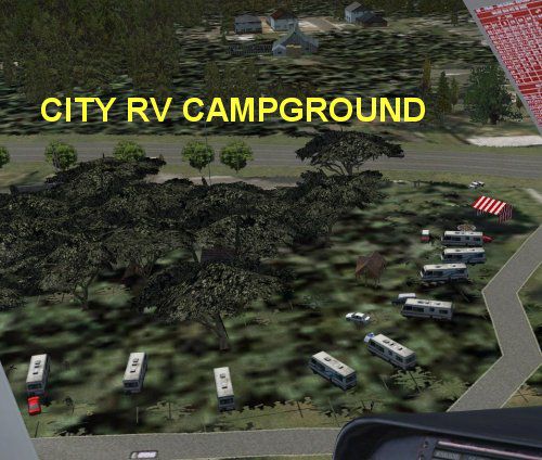
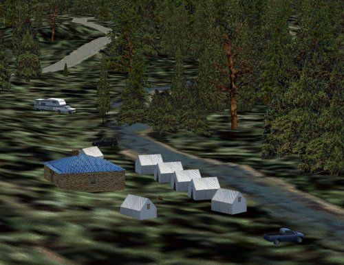
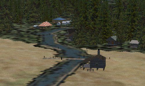
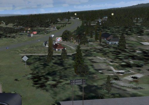
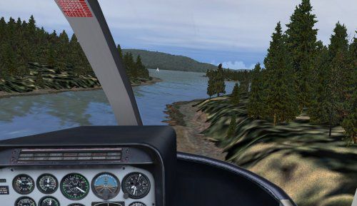
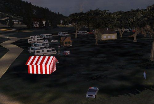
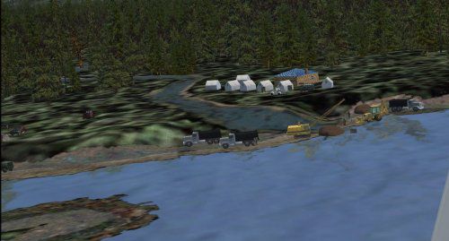
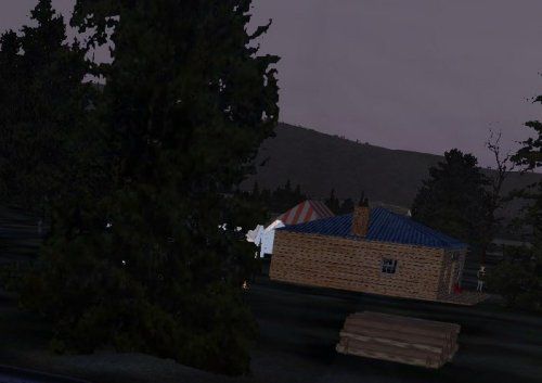
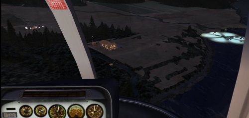
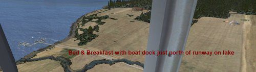
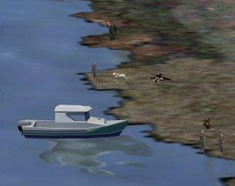
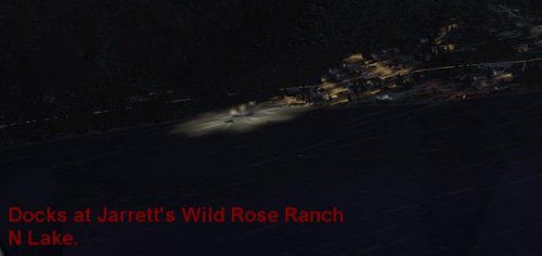
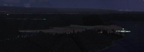
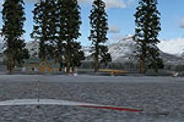
This add-on includes a meticulously adjusted landscape that hugs the mountain range just west of KWYS, offering improved elevation data and extra details around the lake perimeter. Numerous [scenery library] items populate campgrounds, vehicles, and fire pits near the shoreline, reflecting the developer’s personal touch. Subtle touches like campers by rivers, docked boats on the waterfront, and families fishing along tributary streams add an organic sense of realism to the region.

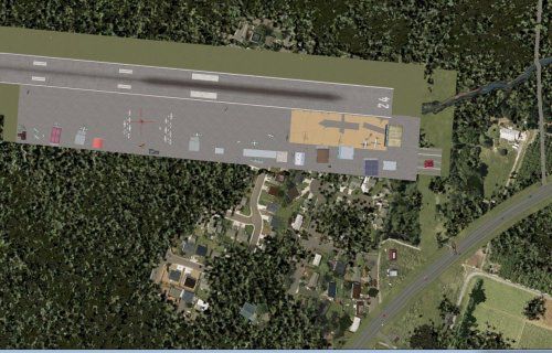
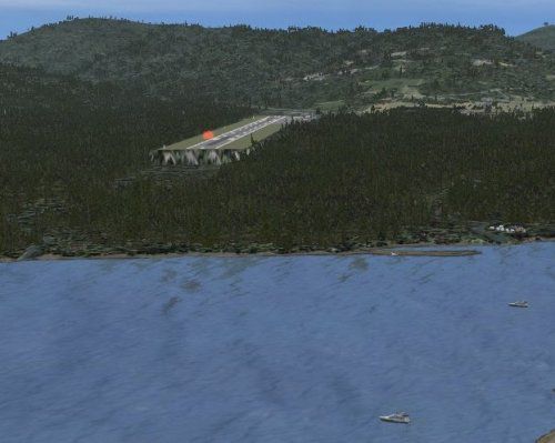
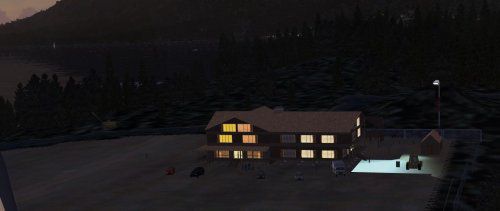
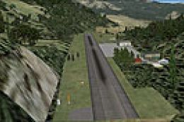
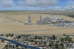
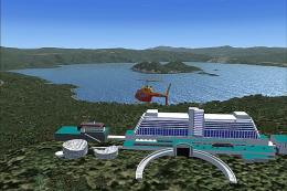
Henry’s Lake Airport Area.
Modular Setup and Dependencies
Before installing, remove any earlier renditions of U53 scenery to prevent conflicts. This package draws from over 486 objects in the default FSX (Microsoft Flight Simulator X) library plus common external scenery libraries for outdoor settings, so an up-to-date static objects installation is recommended. While originally intended for FSX, functionality in other simulators such as FS9 has not been fully tested. If needed, an additional update is available (FIXHENRYS_LAKEIDAHO_FSX.ZIP) for minor tweaks.
Improved Runway and Navigation Aids
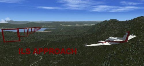
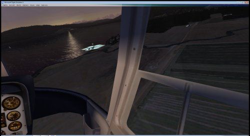
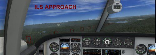
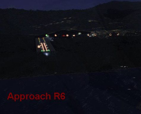
Among the airport modifications, the developer has hardened the runway surface by converting it to blacktop. Moreover, there’s an incorporated [ILS] (Instrument Landing System) that can be locked onto from up to 27 miles away, ensuring more precise alignment for RWY 6 during adverse conditions. An [ATIS] (Automatic Terminal Information Service) broadcast has also been installed to keep pilots updated on weather changes, making those mountain approaches safer and more immersive.
Immersive Camping and Recreational Details
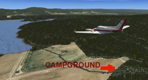
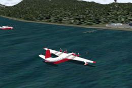
In addition to the operational improvements, the campground just south of the airport features carefully placed motorhomes, fire pits, and fishing-friendly shorelines. These elements echo the real-world ambience of Henry’s Lake, noted for its trout fishing and scenic mountain backdrop—areas that Jimmy R. Martin recalls from personal outdoor adventures. There are numerous smaller inlets and hidden corners where small boats and anglers can be spotted, rewarding low-level exploration by helicopter or floatplane.

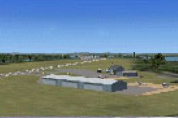
Campground and Shoreline Enhancements.
Key Notes
- Region: Henry’s Lake (U53), Idaho, near Yellowstone
- Coverage: Approximately 25 square miles including surrounding foothills
- Objects: 486+ library items from FSX and external scenery libraries
- Approach: Runway 6 with ILS capture up to 27 NM out
- Weather Advisory: In foul weather, follow ATIS instructions for safest ingress
All of these enhancements deliver a more vivid landscape for flight simulation. By flying in and out of U53, or simply hovering above the lake, sim pilots can enjoy the distinctive environment that Jimmy R. Martin has painstakingly recreated.
Images & Screenshots


Finding the Scenery
- FSX/Prepar3D Coordinates:
-
44.62500000,-111.38800000
Use the downloaded flight plan file by launching FSX/P3D, selecting "Load Flight Plan" in the flight planner, and choosing the .pln file. Your aircraft will be positioned directly at the add-on’s location. - Decimal Degrees (DD):
-
Latitude: 44.625000°
Longitude: -111.388000° - Degrees, Minutes, Seconds (DMS):
-
Latitude: 44° 37' 30.000" N
Longitude: 111° 23' 16.800" W
Map Location
The archive henrys_lakeidaho_fsx.zip has 54 files and directories contained within it.
File Contents
This list displays the first 500 files in the package. If the package has more, you will need to download it to view them.
| Filename/Directory | File Date | File Size |
|---|---|---|
| file_id.diz | 07.11.10 | 303 B |
| Henry's Lake U53.txt | 07.11.10 | 21.33 kB |
| Inclement weather approach.txt | 07.11.10 | 400 B |
| PRINT SCREEN | 07.11.10 | 0 B |
| PS0077.jpg | 07.11.10 | 19.27 kB |
| PS0078.jpg | 07.11.10 | 51.86 kB |
| PS0079.jpg | 07.11.10 | 40.10 kB |
| PS0080.jpg | 07.11.10 | 35.40 kB |
| PS0081.jpg | 07.11.10 | 29.58 kB |
| PS0083.jpg | 07.11.10 | 59.25 kB |
| PS0086.jpg | 07.11.10 | 27.88 kB |
| PS0089.jpg | 07.11.10 | 24.05 kB |
| PS0091.jpg | 07.11.10 | 49.54 kB |
| PS0093.jpg | 07.11.10 | 14.20 kB |
| PS0094.jpg | 07.11.10 | 33.64 kB |
| PS0095.jpg | 07.11.10 | 31.66 kB |
| PS0096.jpg | 07.11.10 | 27.65 kB |
| PS0098.jpg | 07.11.10 | 9.72 kB |
| PS0100.jpg | 07.11.10 | 73.37 kB |
| PS0101.jpg | 07.11.10 | 12.72 kB |
| PS0102.jpg | 07.11.10 | 19.60 kB |
| PS0103.jpg | 07.11.10 | 8.07 kB |
| PS0105.jpg | 07.11.10 | 20.71 kB |
| PS0106.jpg | 07.11.10 | 15.87 kB |
| PS0107.jpg | 07.11.10 | 34.80 kB |
| PS0112.jpg | 07.11.10 | 35.74 kB |
| PS0113.jpg | 07.10.10 | 117.28 kB |
| PS0114.jpg | 07.11.10 | 21.71 kB |
| PS0115.jpg | 07.10.10 | 126.73 kB |
| PS0116.jpg | 07.10.10 | 81.29 kB |
| PS0121.jpg | 07.11.10 | 7.72 kB |
| PS0123.jpg | 07.11.10 | 21.01 kB |
| PS0124.jpg | 07.11.10 | 11.83 kB |
| PS0125.jpg | 07.11.10 | 16.17 kB |
| PS0131.jpg | 07.11.10 | 27.26 kB |
| PS0134.jpg | 07.11.10 | 10.60 kB |
| PS0135.jpg | 07.11.10 | 18.34 kB |
| PS0137.jpg | 07.11.10 | 22.47 kB |
| PS0139.jpg | 07.11.10 | 30.66 kB |
| pspbrwse.jbf | 07.11.10 | 57.78 kB |
| WEB.gif | 07.11.10 | 9.42 kB |
| scenery | 07.11.10 | 0 B |
| Thumbs.db | 05.27.08 | 6.00 kB |
| U53_ADEX_JRM.ad2 | 07.11.10 | 125.47 kB |
| U53_ADEX_JRM.ad2.bak | 07.11.10 | 124.35 kB |
| U53_ADEX_JRM.ade.bak | 07.06.10 | 363.76 kB |
| U53_ADEX_JRM.BGL | 07.11.10 | 8.77 kB |
| U53_ADEX_JRM_CVX.bgl | 07.11.10 | 340 B |
| U53_InstantScenery 2_jrm.bgl | 07.11.10 | 24.98 kB |
| WEB.gif | 07.11.10 | 9.42 kB |
| web.txt | 07.11.10 | 303 B |
| Henry's _Lake IDAHO_FSX | 07.11.10 | 0 B |
| flyawaysimulation.txt | 10.29.13 | 959 B |
| Go to Fly Away Simulation.url | 01.22.16 | 52 B |
Complementing Files & Dependencies
This add-on mentions the following files below in its description. It may be dependent on these files in order to function properly. It's possible that this is a repaint and the dependency below is the base package.
You may also need to download the following files:
Installation Instructions
Most of the freeware add-on aircraft and scenery packages in our file library come with easy installation instructions which you can read above in the file description. For further installation help, please see our Flight School for our full range of tutorials or view the README file contained within the download. If in doubt, you may also ask a question or view existing answers in our dedicated Q&A forum.

0 comments
Leave a Response