FS2004 ChartMap V3
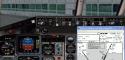
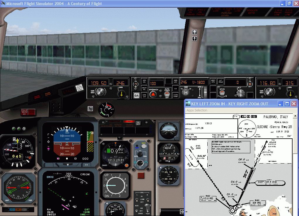
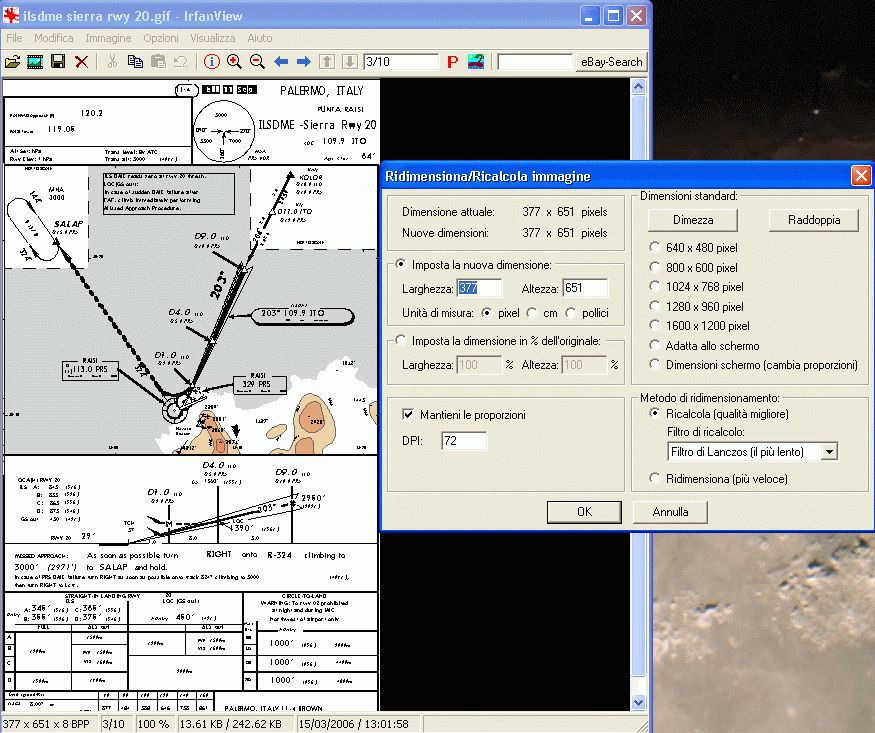
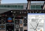
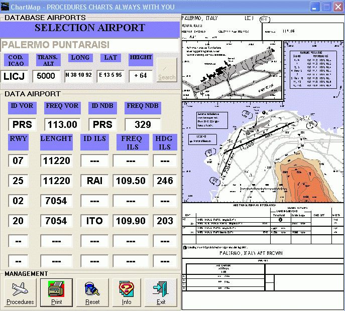
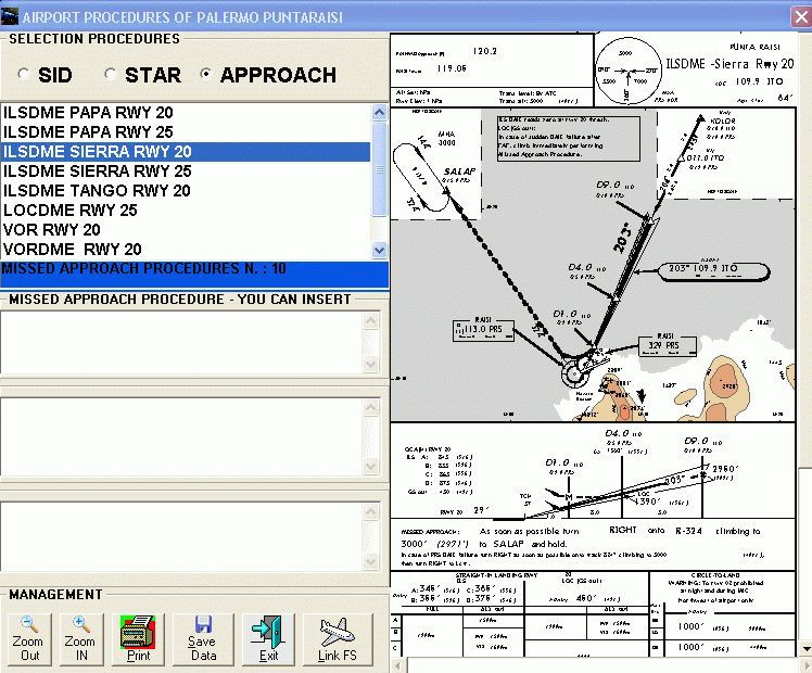
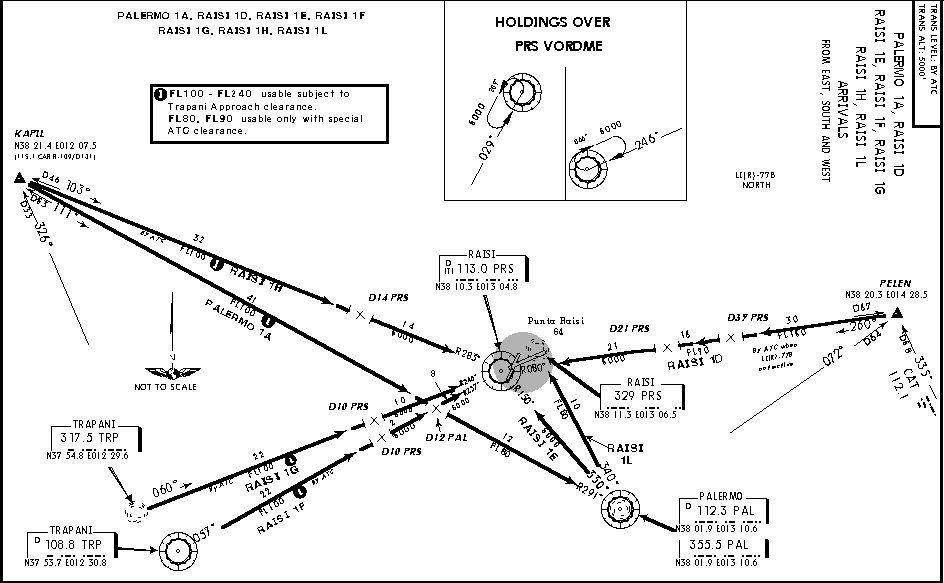
ChartMap V3 keeps airport and procedure charts visible on screen while flying in FS2004, turning quick lookups into a single airport-name search. The stand-alone Windows utility stores multiple chart sets, supports creating and printing new procedure charts, and offers an intuitive interface with Italian and English language support.

 3.8/5
(2)
3K downloads
FS2004
3.8/5
(2)
3K downloads
FS2004
- File: Chartmapvers30.zip
- Size:2.92 MB
- Scan:
Clean (25d)

- Access:Freeware
- Content:Everyone
Images & Screenshots


The archive Chartmapvers30.zip has 152 files and directories contained within it.
File Contents
This list displays the first 500 files in the package. If the package has more, you will need to download it to view them.
| Filename/Directory | File Date | File Size |
|---|---|---|
| Readme.txt | 04.12.06 | 2.45 kB |
| Aeroporti | 04.12.06 | 0 B |
| BRINDISI CASALE | 04.12.06 | 0 B |
| Aeroporto | 04.12.06 | 0 B |
| BRINDISI CASALE.txt | 04.09.06 | 296 B |
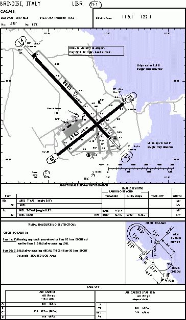
| LIBR.gif | 03.15.06 | 17.88 kB |
| Thumbs.db | 04.09.06 | 8.50 kB |
| Approach | 04.12.06 | 0 B |
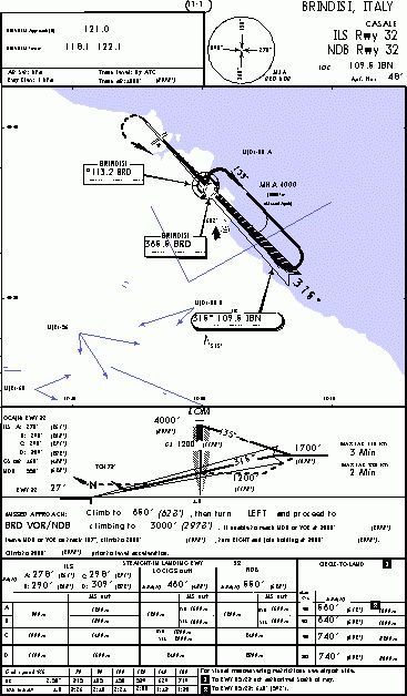
| ILS RWY 32.gif | 03.15.06 | 15.32 kB |
| Thumbs.db | 04.08.06 | 6.00 kB |
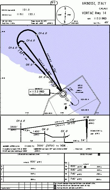
| VORTAC RWY 14.gif | 03.15.06 | 17.93 kB |
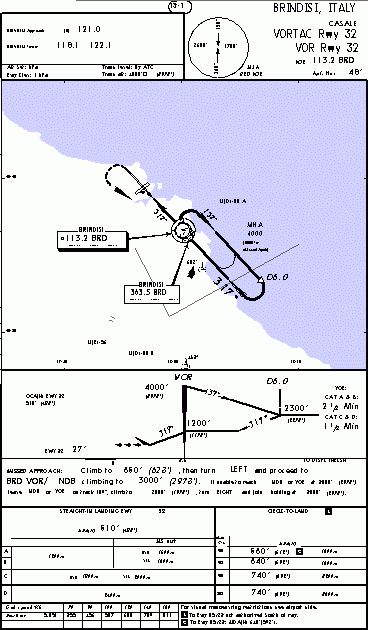
| VORTAC RWY 32.gif | 03.15.06 | 15.63 kB |
| LIBR_Agent.txt | 04.12.06 | 0 B |
| Sid | 04.12.06 | 0 B |
| DOLON 5A 5B.gif | 03.15.06 | 11.62 kB |
| ROBOT 5A 5B.gif | 03.15.06 | 15.60 kB |
| Thumbs.db | 04.08.06 | 5.50 kB |
| Star | 04.12.06 | 0 B |
| Thumbs.db | 03.15.06 | 31.50 kB |
| dallas9.wav | 01.24.01 | 300.62 kB |
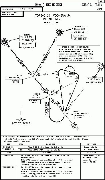
| GENOVA SESTRI | 04.12.06 | 0 B |
| Aeroporto | 04.12.06 | 0 B |
| GENOVA SESTRI.txt | 04.09.06 | 293 B |
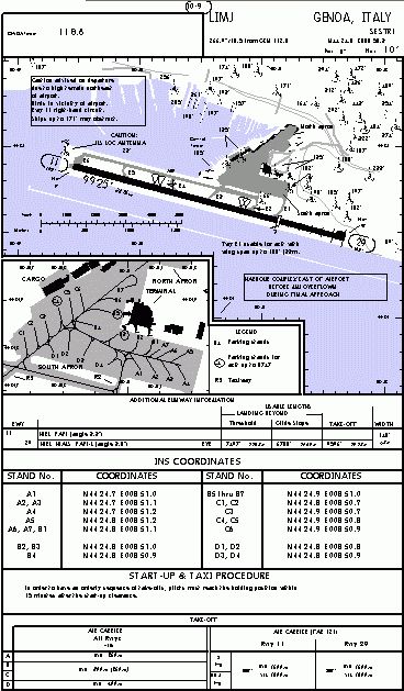
| LIMJ.gif | 03.15.06 | 20.59 kB |
| Thumbs.db | 04.09.06 | 5.00 kB |
| Approach | 04.12.06 | 0 B |
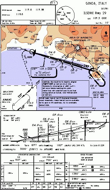
| ILS DME RWY 29.gif | 03.15.06 | 20.78 kB |
| Thumbs.db | 04.08.06 | 6.00 kB |
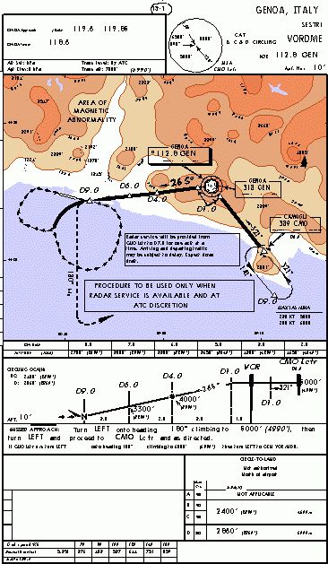
| VOR DME CIRCLING.gif | 03.15.06 | 23.29 kB |
| LIMJ_Agent.txt | 04.12.06 | 0 B |
| Sid | 04.12.06 | 0 B |
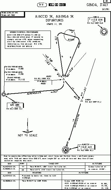
| AJACCIO 5K ALBENGA 5K.gif | 03.15.06 | 9.32 kB |
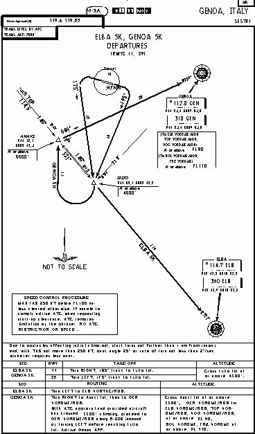
| ELBA 5K GENOA 5K.gif | 03.15.06 | 10.36 kB |
| Thumbs.db | 04.08.06 | 6.00 kB |
| TORINO 5K VOGHERA 5K.gif | 03.15.06 | 10.71 kB |
| Star | 04.12.06 | 0 B |
| Thumbs.db | 03.15.06 | 24.00 kB |
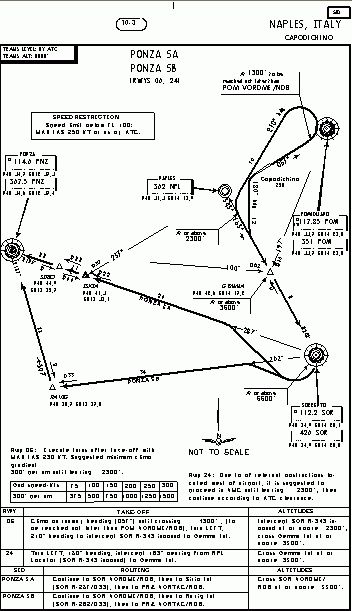
| NAPOLI CAPODICHINO | 04.12.06 | 0 B |
| Aeroporto | 04.12.06 | 0 B |
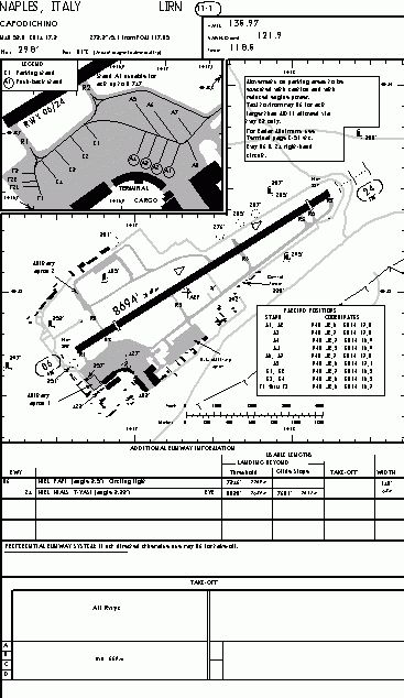
| lirn.gif | 03.15.06 | 14.47 kB |
| NAPOLI CAPODICHINO.txt | 04.09.06 | 294 B |
| Thumbs.db | 04.09.06 | 8.50 kB |
| Approach | 04.12.06 | 0 B |
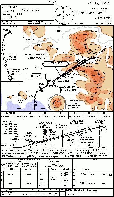
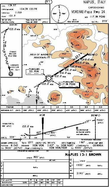
| ILS DME PAPA RWY 24.gif | 03.15.06 | 20.93 kB |
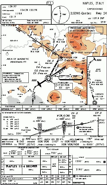
| ILS DME QUEBEC RWY 24.gif | 03.15.06 | 20.30 kB |
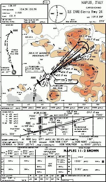
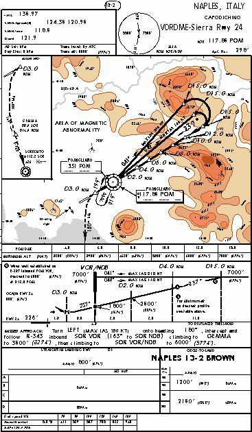
| ILS DME SIERRA RWY 24.gif | 03.15.06 | 21.77 kB |
| ILS DME VICTOR RWY 24.gif | 03.15.06 | 18.75 kB |
| Thumbs.db | 04.09.06 | 7.00 kB |
| VOR DME PAPA RWY 24.gif | 03.15.06 | 19.19 kB |
| VOR DME RWY 06.gif | 03.15.06 | 24.30 kB |
| VOR DME SIERRA RWY 24.gif | 03.15.06 | 20.48 kB |
| LIRN_Agent.txt | 04.12.06 | 0 B |
| Sid | 04.12.06 | 0 B |
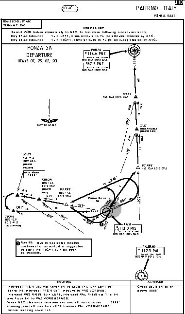
| PONZA 5A 5B.gif | 03.15.06 | 10.48 kB |
| PONZA 5C 5D.gif | 03.15.06 | 10.59 kB |
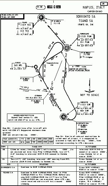
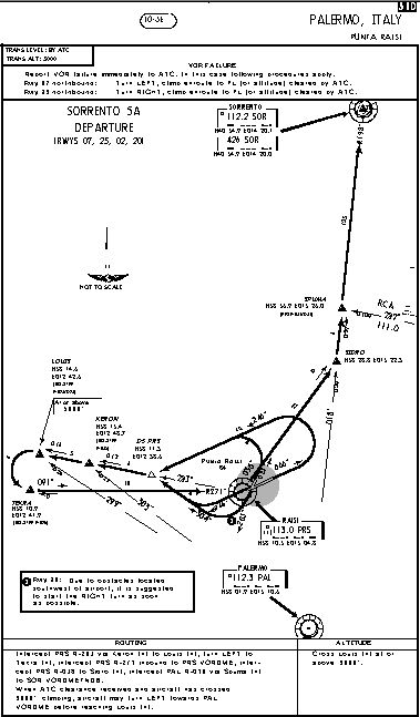
| SORRENTO 6A - TEANO 6A.gif | 03.15.06 | 10.98 kB |
| TEANO 6B 6C.gif | 03.15.06 | 12.86 kB |
| Thumbs.db | 04.11.06 | 21.00 kB |
| Star | 04.12.06 | 0 B |
| BENTO 1A 1B 1C 1D.gif | 03.15.06 | 9.36 kB |
| ISKIA 1A 1B 1C 1D.gif | 03.15.06 | 8.87 kB |
| Thumbs.db | 04.09.06 | 12.50 kB |
| Thumbs.db | 04.09.06 | 117.00 kB |
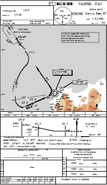
| PALERMO PUNTARAISI | 04.12.06 | 0 B |
| Aeroporto | 04.12.06 | 0 B |
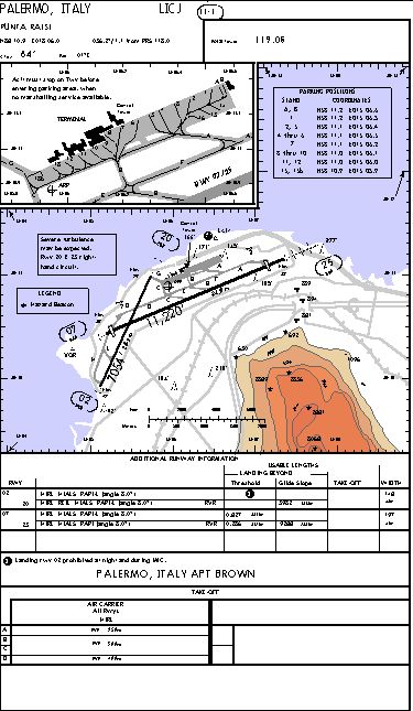
| licj.gif | 03.15.06 | 17.03 kB |
| PALERMO PUNTARAISI.txt | 04.09.06 | 300 B |
| Thumbs.db | 04.09.06 | 5.50 kB |
| Approach | 04.12.06 | 0 B |
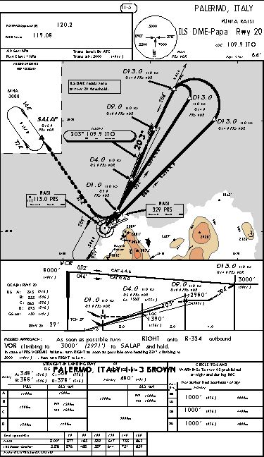
| ilsdme papa rwy 20.gif | 03.15.06 | 14.62 kB |
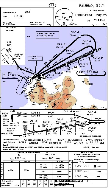
| ilsdme papa rwy 25.gif | 03.15.06 | 15.80 kB |
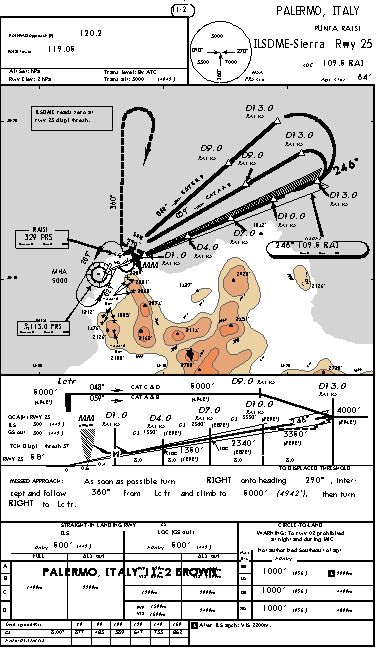
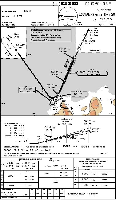
| ilsdme sierra rwy 20.gif | 03.15.06 | 13.61 kB |
| ilsdme sierra rwy 25.gif | 03.15.06 | 15.55 kB |
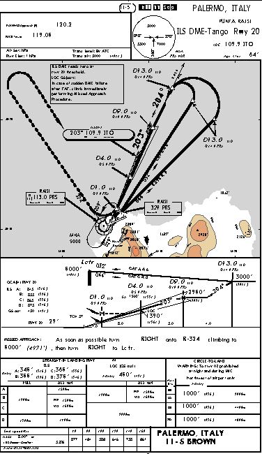
| ilsdme tango rwy 20.gif | 03.15.06 | 14.62 kB |
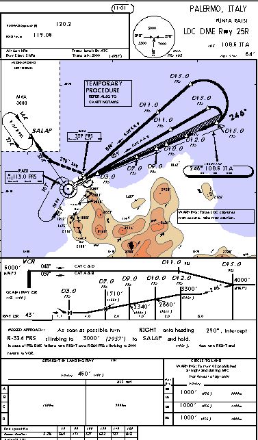
| locdme rwy 25.gif | 03.15.06 | 15.21 kB |
| Thumbs.db | 04.09.06 | 30.50 kB |
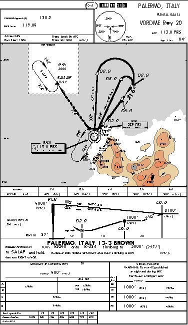
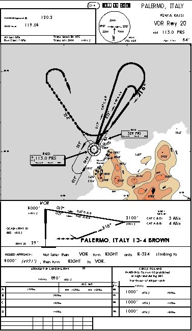
| vor rwy 20.gif | 03.15.06 | 12.68 kB |
| vordme rwy 20.gif | 03.15.06 | 13.80 kB |
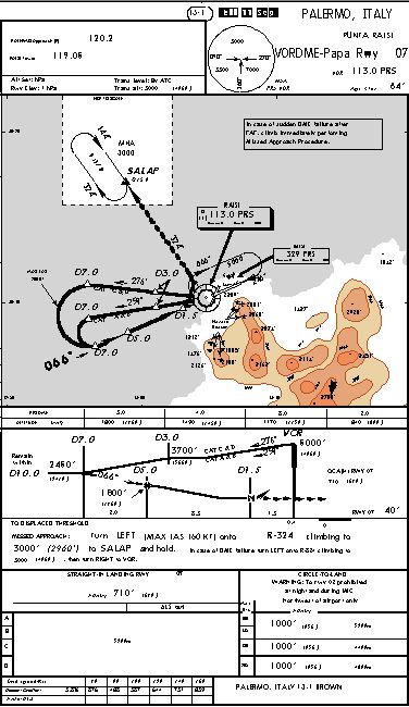
| vordme papa rwy 07.gif | 03.15.06 | 13.85 kB |
| vordme sierra rwy 07.gif | 03.15.06 | 12.83 kB |
| LICJ.wav | 04.12.06 | 635.27 kB |
| LICJ_Agent.txt | 04.12.06 | 730 B |
| Sid | 04.12.06 | 0 B |
| GIANO 5A - (RWYS 07 25 02 20).gif | 12.22.03 | 4.66 kB |
| KAPIL 5A - (RWYS 07 25 02 20).gif | 03.15.06 | 8.04 kB |
| LURON 5A (RWYS 07 25 02 20).gif | 03.15.06 | 9.90 kB |
| LURON 5B (RWYS 07 25 02 20).gif | 03.15.06 | 8.29 kB |
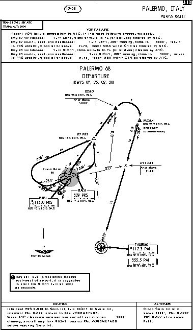
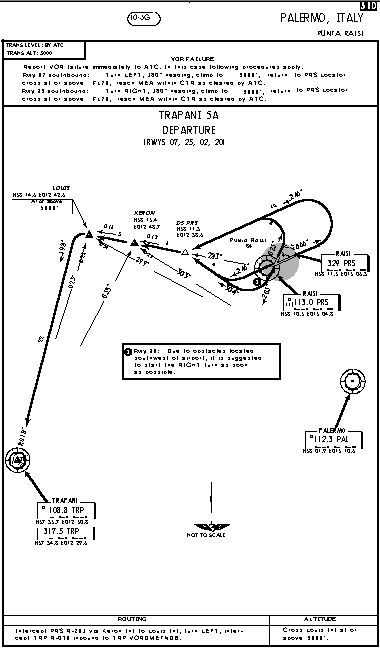
| PALERMO 5A (RWYS 07 25 02 20).gif | 03.15.06 | 9.86 kB |
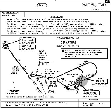
| PALERMO 6B (RWYS 07 25 02 20).gif | 03.15.06 | 9.65 kB |
| ROSAS 5A (RWYS 07 25 02 20).gif | 03.15.06 | 8.32 kB |
| ROSAS 5B (RWYS 07 25 02 20).gif | 03.15.06 | 9.69 kB |
| Thumbs.db | 04.09.06 | 42.50 kB |
| TRAPANI 5A (RWYS 07 25 02 20).gif | 03.15.06 | 9.24 kB |
| Star | 04.12.06 | 0 B |
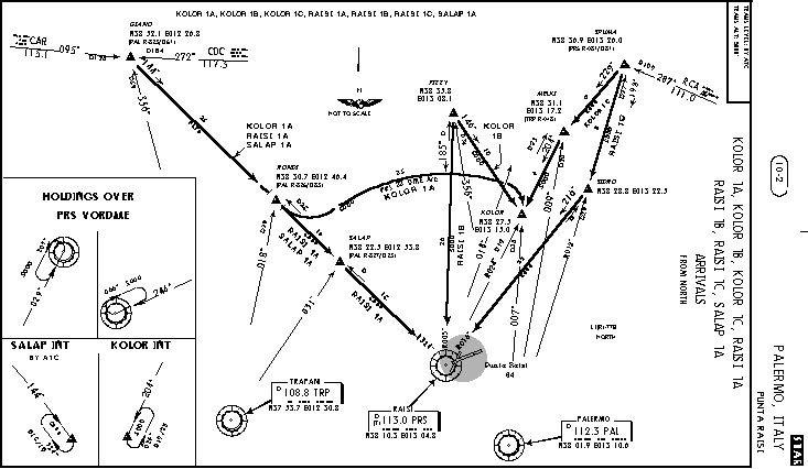
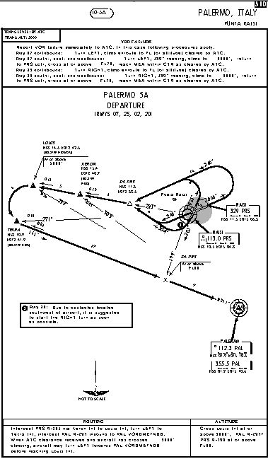
| KOLOR 1A 1B 1C RAISI 1A 1B 1C SALAP 1A.gif | 03.12.06 | 13.51 kB |
| PALERMO 1A RAISI 1D 1E 1E 1F 1G 1H 1L.gif | 03.12.06 | 18.53 kB |
| Thumbs.db | 04.09.06 | 13.00 kB |
| Thumbs.db | 03.15.06 | 133.50 kB |
| ZbThumbnail.info | 07.28.04 | 15.49 kB |
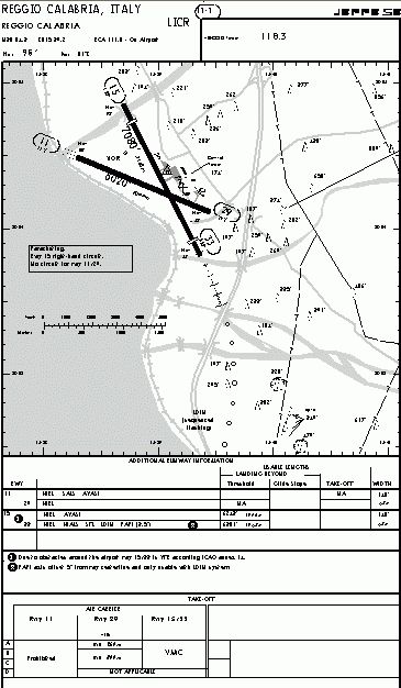
| REGGIO CALABRIA | 04.12.06 | 0 B |
| Aeroporto | 04.12.06 | 0 B |
| LICR.gif | 04.11.06 | 19.38 kB |
| REGGIO CALABRIA.txt | 04.11.06 | 294 B |
| Approach | 04.12.06 | 0 B |
| LOC+VORDME RWY 33.gif | 04.11.06 | 23.49 kB |
| VOR PAPA RWY 15.gif | 04.11.06 | 25.66 kB |
| LICR_Agent.txt | 04.12.06 | 0 B |
| Sid | 04.12.06 | 0 B |
| CATANIA 5A - PIGER 5A.gif | 04.11.06 | 11.21 kB |
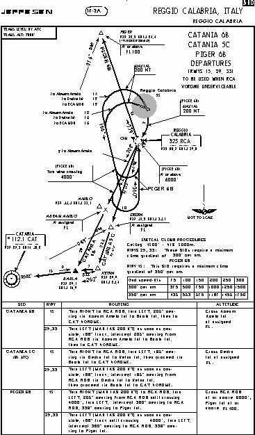
| CATANIA 6B 5C - PIGER 6B.gif | 04.11.06 | 12.47 kB |
| Star | 04.12.06 | 0 B |
| Arrival Procedure.gif | 04.11.06 | 9.49 kB |
| TREVISO SANT'ANGELO | 04.12.06 | 0 B |
| Aeroporto | 04.12.06 | 0 B |
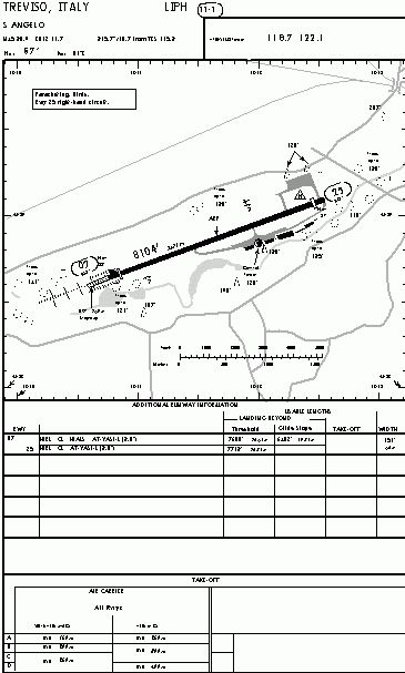
| LIPH.gif | 03.15.06 | 9.67 kB |
| Thumbs.db | 04.12.06 | 5.00 kB |
| TREVISO SANT'ANGELO.txt | 04.09.06 | 293 B |
| Approach | 04.12.06 | 0 B |
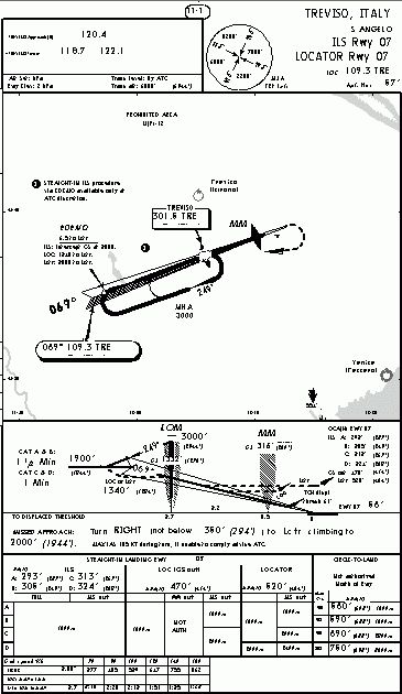
| ILS RWY 07.gif | 03.15.06 | 11.00 kB |
| Thumbs.db | 04.08.06 | 5.00 kB |
| LIPH_Agent.txt | 04.12.06 | 0 B |
| Sid | 04.12.06 | 0 B |
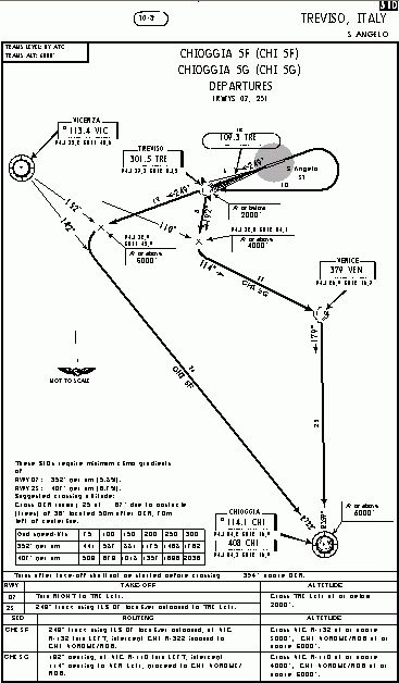
| CHIOGGIA 5F 5G.gif | 03.15.06 | 10.06 kB |
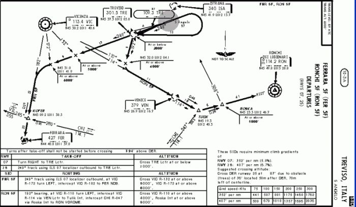
| FERRARA 5F RONCHI 5F.gif | 03.15.06 | 69.26 kB |
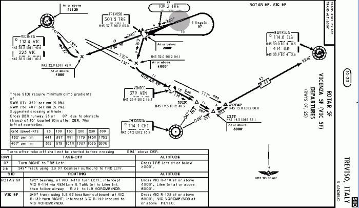
| ROTAR 5F VICENZA 5F.gif | 03.15.06 | 53.58 kB |
| Thumbs.db | 04.08.06 | 6.50 kB |
| Star | 04.12.06 | 0 B |
| ARRIVAL PROCEDURES RWY 07.gif | 03.15.06 | 8.27 kB |
| Thumbs.db | 04.08.06 | 5.00 kB |
| Thumbs.db | 03.18.06 | 22.00 kB |
| archivio.mdb | 04.13.06 | 84.00 kB |
| ChartMap.exe | 04.13.06 | 604.00 kB |
| English.lng | 04.12.06 | 4.21 kB |
| Italiano.lng | 04.12.06 | 4.57 kB |
| LangSetting.ini | 04.12.06 | 38 B |
| language.ini | 03.25.06 | 2.69 kB |
| MultiLangSupp.ini | 03.22.06 | 1.08 kB |
| Readme.txt | 04.12.06 | 2.45 kB |
| Tutorial.htm | 04.12.06 | 42.99 kB |
| Tutorial_file | 04.11.06 | 0 B |
| image001.jpg | 04.11.06 | 133.24 kB |
| image002.jpg | 04.11.06 | 121.92 kB |
| image003.jpg | 04.11.06 | 38.64 kB |
| image004.jpg | 04.11.06 | 106.96 kB |
| image005.jpg | 04.11.06 | 161.91 kB |
| image006.jpg | 04.11.06 | 125.38 kB |
| image007.jpg | 04.11.06 | 82.93 kB |
| image008.jpg | 04.11.06 | 149.13 kB |
| Thumbs.db | 04.11.06 | 37.50 kB |
| ChartMap_3.0 | 04.12.06 | 0 B |
| flyawaysimulation.txt | 10.29.13 | 959 B |
| Go to Fly Away Simulation.url | 01.22.16 | 52 B |
Installation Instructions
Most of the freeware add-on aircraft and scenery packages in our file library come with easy installation instructions which you can read above in the file description. For further installation help, please see our Flight School for our full range of tutorials or view the README file contained within the download. If in doubt, you may also ask a question or view existing answers in our dedicated Q&A forum.


0 comments
Leave a Response