50 North Simulations Release Boeing 737-300/400/500 Model Pack
50 North Simulations introduces intricately devised Boeing 737-300/400/500 variants, engineered with Gmax for precise modeling and smooth…

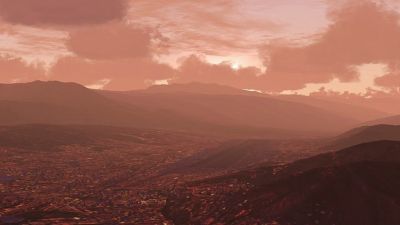
 Now available from designer Afredo Mendiola Loyola is Scenery Peru North & Lima for FS2004. It includes mesh terrain at LOD9, detailed airports, phototerrain scenery, static planes and AI traffic. For more information, click on Read More.
The Scenery Peru for Flight Simulator 2004 offers to virtual pilots the possibility of flying through "25 airports" and "55 aerodromes", exploring the tourist and geographic marvels of Peru.
The Scenery is virtual, in other words, is a copy of the Peruvian territory. The Scenery includes the cities and towns of Peru. To find the airports and Aerodromes visually, you can locate those following the course of the more important rivers and highways such as the "Panamericana" among others.
The Scenery Peru North and Lima v2.63 is NOT compatible with previous Flight Simulator versions due to the scenery uses the new Fs2004 scenery codes and FS2004 programming techniques.
The scenery uses Exclude that are included in the BGL scenery file, that serve to delete the default FS2004 scenery under the Scenery Peru North & Lima area, to avoid the duplication of Runways, buildings and 3D objects.
The scenery incorporates more than 146 Flatten Swith into the scenery files BGL, making unnecessary the modification of the FS2004 SCENERY.CFG file, these Flatten Switches serve to flatten small areas under Airports, cities and towns.
All the 3D objects and buildings uses the FS2004 nightlighting techniques, making the scenery more realistic.
The scenery is on top of the Peru North and Lima Mesh Terrain (Digital elevation Model DEM - SRTM), making more realistic the scenery.
The Airports and Aerodromes were designed with Peruvian Aeronautic Diagrams, that have the latest updates like runway extensions and improvements in some Airports and Aerodromes.
I have respected the geographic coordintates and elevations of the Navaids and runways. The true coordinates, heading, lenghts and elevations of the runways are officials and the landing approachs are the same that are included on the JEPPESEN and AIP charts. Some FS2004 airports aren't placed on the true geographic coordinates nor the true runway headings.
The roads, rivers, lakes, cities and towns, are over the Mesh Terrain, in other words the roads climb and descend the mesh terrain contour, the rivers descend by the valleys, the lakes, lagoons, cities and towns are on top of mountains. The coast lines are more accurate and smooth than the FS2004 coastlines.
The airport terminals and the building use the FS2004 styles, the buildings have several kind of textures, windows, roof styles and various shapes.
The Collique aerodrome is located in the real position, the north zone of the Lima city now have the real height due to the Peru North & Lima Mesh Terrain files.
The scenery includes more than 100 buildings in the Lima area with the FS2004 styles.
The scenery roads have different designs according to the peruvian geographic area, in the coast the roads have asphalt with center lines, in the andes and jungle the roads have concrete with center lines, and in some cases the roads have dirt.
The scenery roads show from 2 lanes to 10 lanes in the express ways, furthermore have the true width due to the FS2004 default roads have 30 meters of with.
The rivers have the true width and colors, due to the FS2004 rivers have 10 meters of width and some have dirt colors.
All the default FS2004 airports and Aerodromes have been replaced by the Scenery Peru North & Lima v2.63 to assure the higher accuracy in the geographic coordinates, heading and elevation in the Airports and Aerodromes, which now have more illumination and are updated with the latest Aeronautical information.
The SRTM Mesh terrain corrects the elevations of the entire Peru North & Lima scenery from Lat: 2* 0' 0" S to Lat: 13* 0' 00" S by the south.
The scenery uses pictures on BMP format with 16 bits to give more realism to the terrain and 3D objects.
The Scenery Includes:
Upgrade Microsoft Flight Simulator, FSX, P3D & X-Plane in minutes with our curated file library packed with aircraft, scenery, liveries, and utilities.
Ready to upgrade your hangar?
Browse the free file library
Ian Stephens is a flight simulation industry expert with over 20 years of experience and also has a keen interest in aviation and technology. Ian spends a lot of his time experimenting with various simulator packages but has a love for Microsoft Flight Simulator X because of the huge selection of add-ons available. However, Ian also has copies of Prepar3D and X-Plane installed.
Ian has been writing for Fly Away Simulation for over 9 years. Should you wish, you can contact Ian via email at ian.stephens@flyawaysimulation.com.
50 North Simulations introduces intricately devised Boeing 737-300/400/500 variants, engineered with Gmax for precise modeling and smooth…
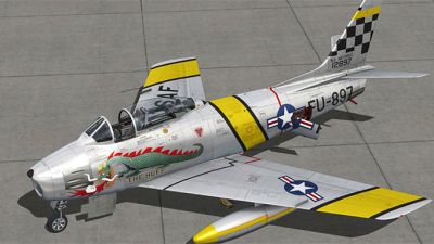
Flight simulation enthusiasts can now experience Milviz’s updated North American F-86F-30 Sabre, a legendary MiG adversary rebuilt for…
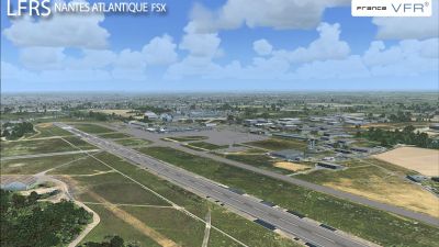
France VFR’s newest Nantes Atlantique International scenery for FSX and FS2004 offers high-resolution ground imagery, a 45 km² photoreal…
LatinVFR’s new scenery showcases Cuzco (Cusco) in Peru for FS2004/FSX with stunning photoreal textures, precise topography, and faithful…
FsDreamTeam’s newly unveiled Zurich 1.3 for FSX and FS2004 refines the airport environment with repositioned fire brigade training areas,…
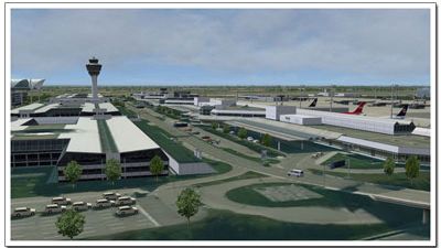
This meticulously crafted FSX and FS2004 scenery add-on brings Munich’s Franz Josef Strauss Airport to life with aerial imagery for crisp…