 FSX Scenery
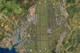
Honduras
Honduras. Airfields of Honduras: Nuevo Ocotepeque, Archaga, Amapala, Brus Lag…
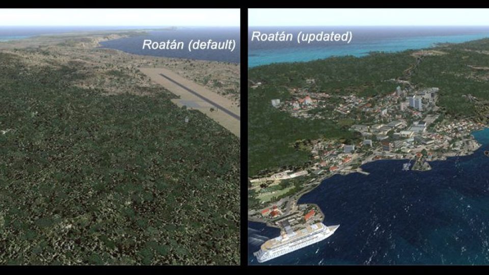
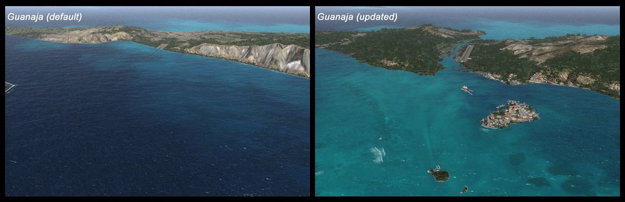
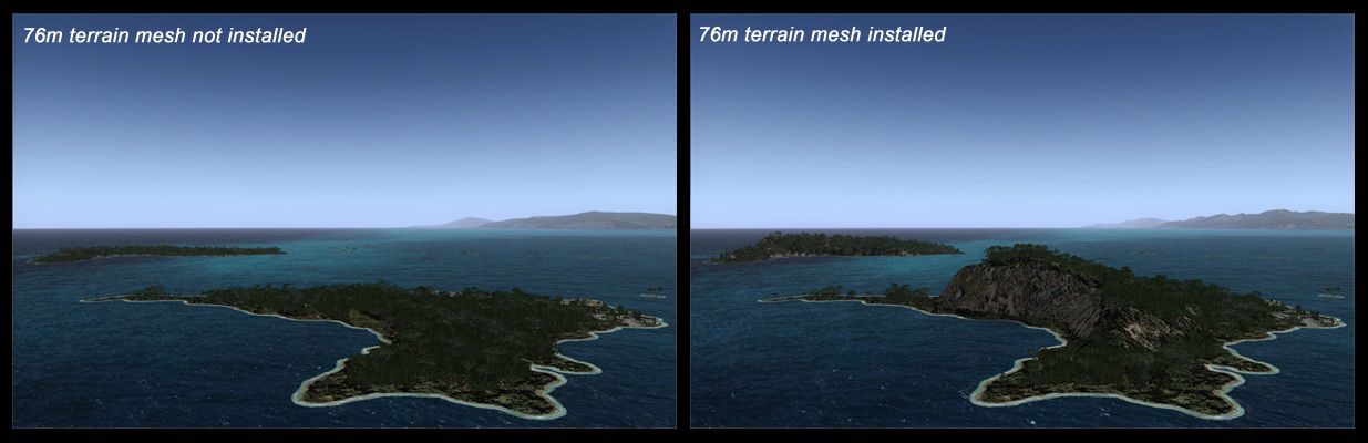
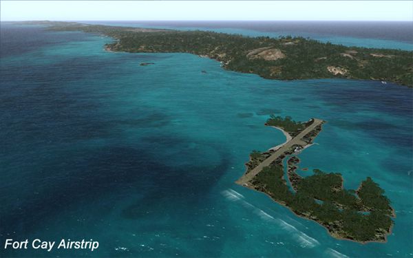
Honduras Bay Islands scenery refreshes Roatan, Barbareta, Guanaja, Utila, Cayos Cochinos, and surrounding cays with satellite-aligned coastlines, roads, rivers, lakes, and corrected landclass for FSX. It overhauls MHRO and GJAJ/MHNJ, adds AI-ready fields at MHUT, MHFC, and MHCP, tunes MHLC and MHPL, and includes GA flight plans that require Ultimate Traffic 2.
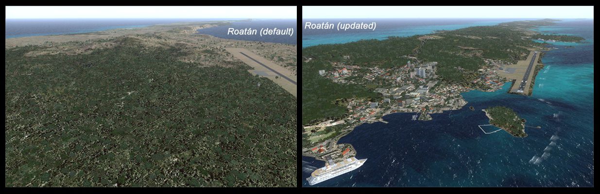
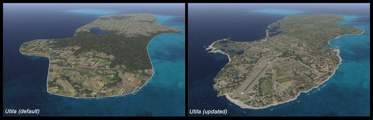
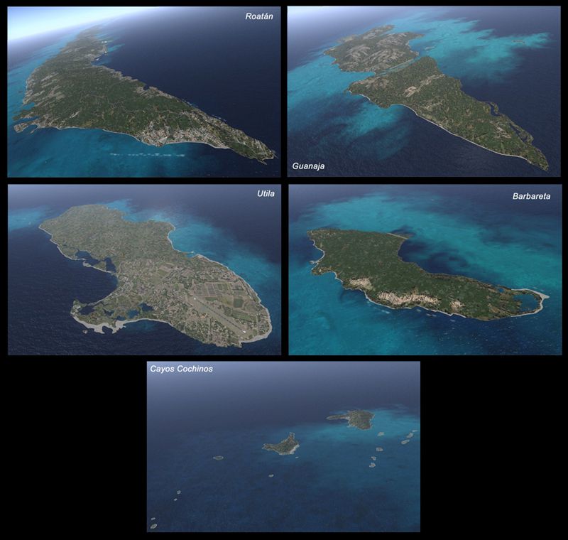
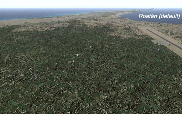
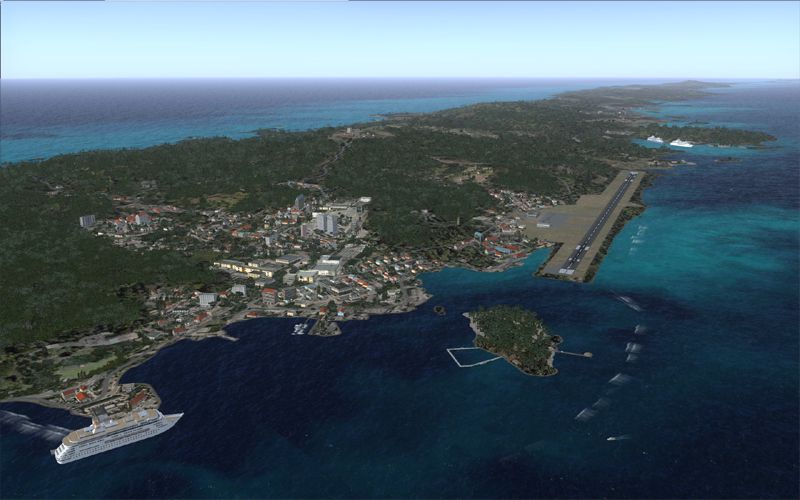
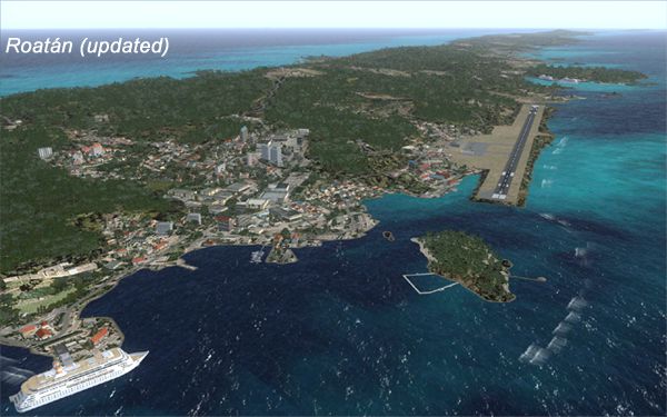
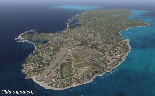
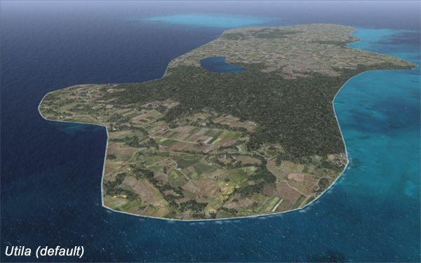
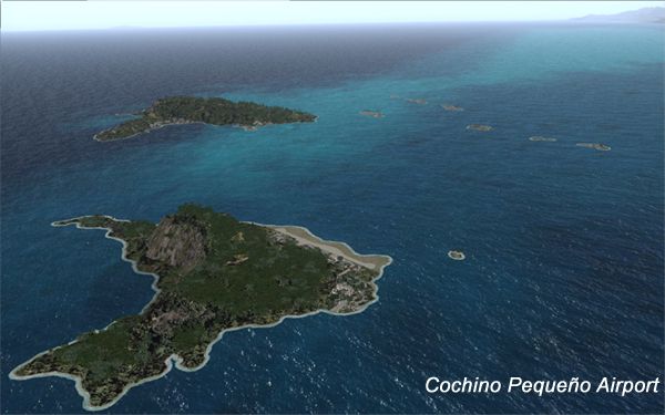
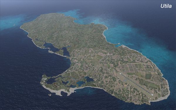
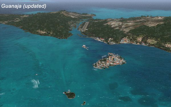
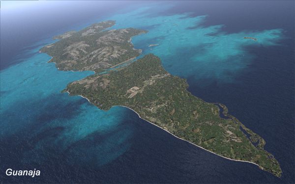
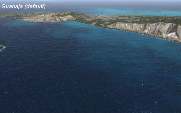
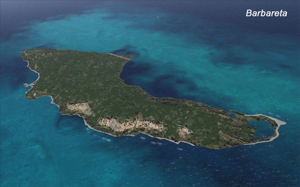
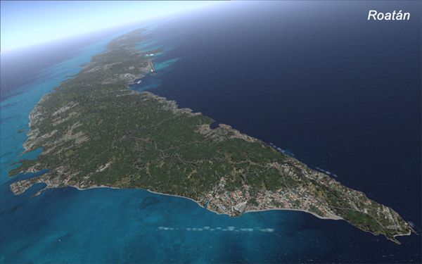
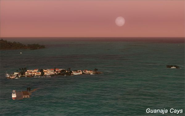

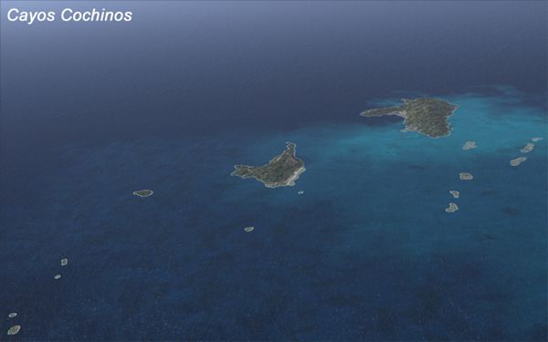
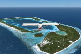
This project rebuilds the islands of Roatan, Barbareta, Guanaja, and Utila, and adds Cayos Cochinos and the numerous cays associated with the "Islas de la Bahia" (Islands of the Bay).
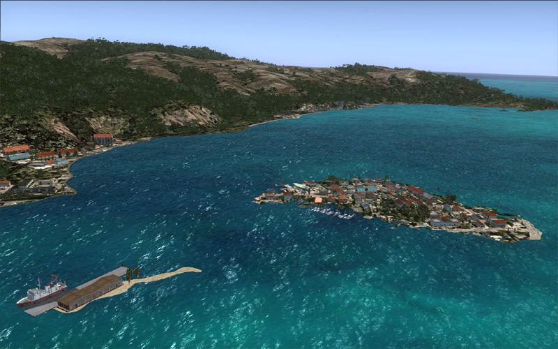
Aerial view of Honduras Islands scenery.
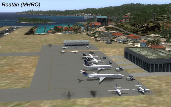
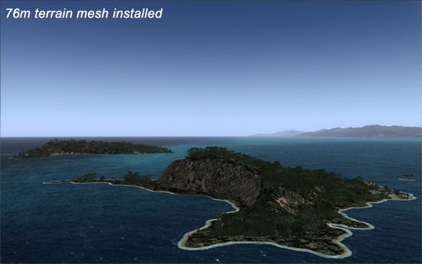
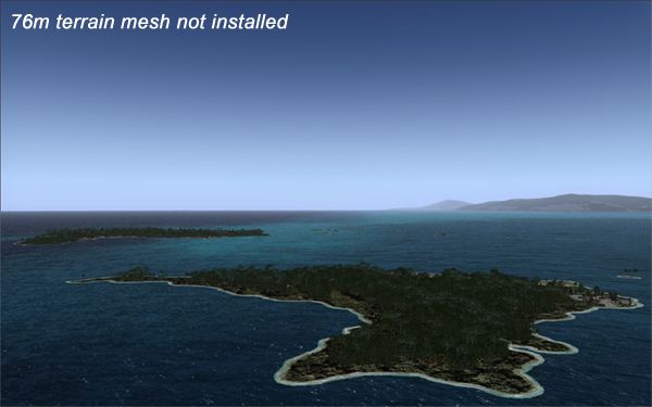
Both the Roatan (MHRO) and Guanaja (GJAJ/MHNJ) airports are completely overhauled and positioning is corrected. New and fully functioning AI airports are added for Utila (MHUT), Fort Cay (MHFC) and Cochino Pequeno (MHCP) of the Cayos Cochinos chain, and La Ceiba (MHLC) and Puerto Lempira (MHPL) are modified to accommodate AI traffic. Accurate coastlines, lakes, road and river data, as well as corrected landclass are provided based on the latest available satellite imagery. GA flight plans are provided to add or enhance service to the smaller islands. Updates were created or rebuilt in a manner which carefully aligned airport data with current satellite imagery, when available. Scenery was created using Airport Design Editor X v1.47.07, SBuilderX 3.13, and the FSX Object Placement Tool. Scenery objects were added and modified from stock FSX scenery to resemble as closely as possible the actual airports. By Carlyle Sharpe.
Simply import the "DBI" file with UT2 Power Pack, and install in UT2, OR you can place the "DB" file directly in "C:\Users\Your Name\AppData\Roaming\Flight One Software\Ultimate Traffic 2\Databases"
Remember to assign a Cessna light aircraft (CNA) in UT2 after the import is complete.
Free for all simmers · 8.09 MB · Scanned clean Jul 2026
Download speed: Free tier is capped at 0.5 Mbps (this file takes approximately 2 mins at the cap). PRO members download at full line speed.
FSX\Addon Scenery\ containing scenery and texture sub-folders.readme.txt or README file. It tells you exactly where files go, what dependencies are needed, and any quirks specific to this add-on.Use these coordinates to fly directly to this location once the mod is installed.
16.31680000,-86.52300000
Launch FSX or Prepar3D and use Flights → Load to open the downloaded .pln file. Your aircraft will be positioned at this location.
The archive honduras_islands.zip has 123 files and directories contained within it.
This list displays the first 500 files in the package. If the package has more, you will need to download it to view them.
| Filename/Directory | File Date | File Size |
|---|---|---|
| Flightsim_thumbnail.gif | 07.22.12 | 15.86 kB |
| Honduras AI Traffic | 07.22.12 | 0 B |
| Ttools format | 07.22.12 | 0 B |
| Daily | 07.22.12 | 0 B |
| Aircraft_Honduras_Islands.txt | 07.24.11 | 32 B |
| Airports_Honduras_Islands.txt | 07.25.11 | 780.17 kB |
| Flightplans_Honduras_Islands.txt | 02.06.12 | 2.16 kB |
| UT2 | 07.22.12 | 0 B |
| Readme.txt | 07.22.12 | 287 B |
| UT2Daily_Honduras_Islands.db | 07.29.11 | 192.00 kB |
| UT2Daily_honduras_islands.dbi | 02.07.12 | 192.00 kB |
| Place in Documents-Flight Simulator X Files | 07.22.12 | 0 B |
| Honduras Islands - Barbareta (MHBA).FLT | 07.22.12 | 9.38 kB |
| Honduras Islands - Barbareta (MHBA).FSSAVE | 07.22.12 | 195.38 kB |
| Honduras Islands - Barbareta (MHBA).WX | 07.22.12 | 84.90 kB |
| Honduras Islands - Cayos Cochinos.FLT | 07.22.12 | 9.39 kB |
| Honduras Islands - Cayos Cochinos.FSSAVE | 07.22.12 | 195.17 kB |
| Honduras Islands - Cayos Cochinos.WX | 07.22.12 | 3.28 MB |
| Honduras Islands - Cochino Pequeno (MHCP).FLT | 07.22.12 | 9.56 kB |
| Honduras Islands - Cochino Pequeno (MHCP).FSSAVE | 07.22.12 | 163.21 kB |
| Honduras Islands - Cochino Pequeno (MHCP).WX | 07.22.12 | 84.80 kB |
| Honduras Islands - Cruise Ships at Mahogany Bay.FLT | 07.21.12 | 9.41 kB |
| Honduras Islands - Cruise Ships at Mahogany Bay.FSSAVE | 07.21.12 | 189.77 kB |
| Honduras Islands - Cruise Ships at Mahogany Bay.WX | 07.21.12 | 84.90 kB |
| Honduras Islands - Dolphins at Maya Cay.FLT | 07.21.12 | 9.42 kB |
| Honduras Islands - Dolphins at Maya Cay.FSSAVE | 07.21.12 | 235.27 kB |
| Honduras Islands - Dolphins at Maya Cay.WX | 07.21.12 | 84.80 kB |
| Honduras Islands - Fort Cay (MHFC).FLT | 07.22.12 | 9.39 kB |
| Honduras Islands - Fort Cay (MHFC).FSSAVE | 07.22.12 | 188.14 kB |
| Honduras Islands - Fort Cay (MHFC).WX | 07.22.12 | 84.90 kB |
| Honduras Islands - Guanaja (GJAJ).FLT | 07.21.12 | 9.33 kB |
| Honduras Islands - Guanaja (GJAJ).FSSAVE | 07.21.12 | 174.00 kB |
| Honduras Islands - Guanaja (GJAJ).WX | 07.21.12 | 84.80 kB |
| Honduras Islands - Moonrise over Guanaja.FLT | 07.22.12 | 9.40 kB |
| Honduras Islands - Moonrise over Guanaja.FSSAVE | 07.22.12 | 113.13 kB |
| Honduras Islands - Moonrise over Guanaja.WX | 07.22.12 | 84.71 kB |
| Honduras Islands - Roatan (MHRO).FLT | 07.21.12 | 9.49 kB |
| Honduras Islands - Roatan (MHRO).FSSAVE | 07.21.12 | 212.88 kB |
| Honduras Islands - Roatan (MHRO).WX | 07.21.12 | 84.80 kB |
| Honduras Islands - Roatan to Guanaja flight.FLT | 07.22.12 | 9.49 kB |
| Honduras Islands - Roatan to Guanaja flight.FSSAVE | 07.22.12 | 136.87 kB |
| Honduras Islands - Roatan to Guanaja flight.WX | 07.22.12 | 84.90 kB |
| Honduras Islands - Utila (MHUT).FLT | 07.21.12 | 9.35 kB |
| Honduras Islands - Utila (MHUT).FSSAVE | 07.21.12 | 150.02 kB |
| Honduras Islands - Utila (MHUT).WX | 07.21.12 | 84.80 kB |
| Readme | 07.22.12 | 0 B |
| Readme.htm | 07.22.12 | 12.22 kB |
| Readme.txt | 07.22.12 | 324 B |
| Add.jpg | 07.21.12 | 53.47 kB |
| HI_1.jpg | 07.20.12 | 324.21 kB |
| HI_2.jpg | 07.20.12 | 377.55 kB |
| HI_after-76m.jpg | 07.21.12 | 138.98 kB |
| HI_Barbareta_600.jpg | 07.21.12 | 187.39 kB |
| HI_before-76m.jpg | 07.21.12 | 134.01 kB |
| HI_before-after-76m.jpg | 07.21.12 | 115.84 kB |
| HI_before-after-Guanaja.jpg | 07.21.12 | 146.60 kB |
| HI_before-after-Roatan.jpg | 07.21.12 | 217.24 kB |
| HI_before-after-Utila.jpg | 07.21.12 | 169.53 kB |
| HI_Cayos Cochinos_600.jpg | 07.21.12 | 135.36 kB |
| HI_Cochino Pequeno Airport.jpg | 07.21.12 | 186.45 kB |
| HI_Composite_800.jpg | 07.21.12 | 356.57 kB |
| HI_Fort Cay Airstrip.jpg | 07.21.12 | 182.82 kB |
| HI_Guanaja Cays.jpg | 07.22.12 | 141.09 kB |
| HI_Guanaja-after.jpg | 07.21.12 | 195.41 kB |
| HI_Guanaja-before.jpg | 07.21.12 | 178.05 kB |
| HI_Guanaja_600.jpg | 07.21.12 | 189.70 kB |
| HI_Roatan (MHRO).jpg | 07.21.12 | 200.24 kB |
| HI_Roatan-after.jpg | 07.21.12 | 229.69 kB |
| HI_Roatan-before.jpg | 07.21.12 | 262.70 kB |
| HI_Roatan_600.jpg | 07.21.12 | 180.45 kB |
| HI_thumbnail.gif | 07.22.12 | 15.86 kB |
| HI_thumbnail_large.jpg | 07.22.12 | 123.91 kB |
| HI_Utila-after.jpg | 07.21.12 | 211.06 kB |
| HI_Utila-before.jpg | 07.21.12 | 200.37 kB |
| HI_Utila_600.jpg | 07.21.12 | 194.60 kB |
| Thumbs.db | 08.04.10 | 69.00 kB |
| scenery | 07.22.12 | 0 B |
| 0_CVX_000_Honduras_Islands_terrain_exc.BGL | 07.20.11 | 1.81 kB |
| 1_CVX_001_Honduras_Islands_water_Cayos_Cochinos.BGL | 07.28.11 | 10.41 kB |
| 1_CVX_1_Honduras_Islands_Landclass_Holes_Cayos_Cochinos.BGL | 07.28.11 | 1.40 kB |
| 1_CVX_2_Honduras_Islands_Landclass_Filler_Cayos_Cochinos.BGL | 07.22.12 | 938 B |
| 2_CVX_001_Honduras_Islands_water_Guanaja.BGL | 07.21.12 | 28.89 kB |
| 2_CVX_1_Honduras_Islands_Landclass_Holes_Guanaja_v3.BGL | 07.20.12 | 39.56 kB |
| 2_CVX_2_Honduras_Islands_Landclass_Filler_Guanaja_v3.BGL | 07.17.12 | 41.60 kB |
| 3_CVX_001_Honduras_Islands_water_Roatan.BGL | 07.20.12 | 95.86 kB |
| 3_CVX_1_Honduras_Islands_Landclass_Holes_Roatan.BGL | 07.18.12 | 96.26 kB |
| 3_CVX_2_Honduras_Islands_Landclass_Filler_Roatan.BGL | 07.20.12 | 61.18 kB |
| 3_Honduras_Islands_Landclass_Filler_Roatan_EXT.BGL | 07.20.12 | 920 B |
| 4_CVX_001_Honduras_Islands_water_Utila.BGL | 07.10.12 | 25.08 kB |
| 4_CVX_1_Honduras_Islands_Landclass_Holes_Utila.BGL | 07.15.12 | 8.71 kB |
| 4_CVX_2_Honduras_Islands_Landclass_Filler_Utila.BGL | 07.14.12 | 4.42 kB |
| 4_Honduras_Islands_Landclass_Holes_Utila_EXT.BGL | 06.27.12 | 292 B |
| GJAJ_ADEX_CS.BGL | 07.22.12 | 2.74 kB |
| GJAJ_ADEX_CS_CVX.bgl | 07.22.12 | 379 B |
| GJA_ADEX_CS_ignore.BGL | 07.22.12 | 417 B |
| MHBA_ADEX_CS.BGL | 07.20.12 | 1.10 kB |
| MHBA_ADEX_CS_CVX.bgl | 07.20.12 | 264 B |
| MHCP_ADEX_CS.BGL | 06.28.12 | 3.32 kB |
| MHCP_ADEX_CS_CVX.bgl | 07.25.11 | 277 B |
| MHFC_ADEX_CS.BGL | 07.20.12 | 1.10 kB |
| MHFC_ADEX_CS_CVX.bgl | 07.20.12 | 287 B |
| MHLC_ADEX_CS.BGL | 07.22.12 | 7.91 kB |
| MHPL_ADEX_CS.BGL | 07.25.11 | 975 B |
| MHPL_ADEX_CS_CVX.bgl | 07.25.11 | 464 B |
| MHRO_ADEX_CS.BGL | 07.22.12 | 7.40 kB |
| MHRO_ADEX_CS_CVX.bgl | 07.22.12 | 326 B |
| MHUT_ADEX_CS.BGL | 07.21.12 | 1.78 kB |
| MHUT_ADEX_CS_CVX.bgl | 07.21.12 | 408 B |
| Objects_Barbareta.BGL | 07.20.12 | 412 B |
| Objects_Cayos_Cochinos.BGL | 07.22.12 | 7.92 kB |
| Objects_Fort_Cay.BGL | 07.22.12 | 2.09 kB |
| Objects_Guanaja.BGL | 07.20.12 | 4.34 kB |
| Objects_Roatan.BGL | 07.22.12 | 8.01 kB |
| Objects_Utila.BGL | 07.20.12 | 4.11 kB |
| WC_2426.bgl | 07.19.11 | 507 B |
| WC_2426a.bgl | 07.20.12 | 310 B |
| WC_2526.bgl | 07.19.11 | 520 B |
| YouTube comparisons | 07.22.12 | 0 B |
| GǬGuanaja Island, Boat Taxi from Airport to Hotel Alexander, HondurasGǼGÇÅ - YouTube.website | 07.22.12 | 849 B |
| GǬHD, Boat taxi from Guanaja Airport to Hotel Alexander on Bonacca CayGǼGÇÅ - YouTube.website | 07.22.12 | 836 B |
| GǬHD, Flying from Roatan to Guanaja, Bay Islands, HondurasGǼGÇÅ - YouTube.url | 06.23.12 | 261 B |
| flyawaysimulation.txt | 10.29.13 | 959 B |
| Go to Fly Away Simulation.url | 01.22.16 | 52 B |
Only PRO members can place votes.
More FSX & P3D add-ons hand-picked based on this download.
FSX Scenery
Honduras. Airfields of Honduras: Nuevo Ocotepeque, Archaga, Amapala, Brus Lag…
 FSX Scenery
Scenery Greek Islands. This pack contains LGHI Chios, LGKO Kos, LGMK Mikonos,…
FSX Scenery
Scenery Greek Islands Vol. 2. This pack contains LGKR Kerkyra, LGKF Kefalloni…
 FSX Scenery
Kadena AB And Okinawa Islands airstrips, southern Japan. This package contain…
FSX Scenery
Midway Atoll (Midway Islands) Photoreal Scenery. Midway Atoll - or Midway Isl…
 FSX Scenery
The Northern Cook Islands are a group of six islands and atolls in the South …
 FSX Scenery
Three airports included: SEST, SEGS and SEII. The Galapagos is a very interes…
 FSX Scenery
This is a small update for the Galapagos scenery (GALAPAGOS_FSX.ZIP). It adds…
Be the first to leave a comment on this download.
Be the first to share your thoughts on this download.