FSX Eastern Sierra Regional Airport Scenery
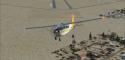
Eastern Sierra Regional Airport (KBIH) for Microsoft Flight Simulator X refreshes Bishop, California with corrected runway and taxiway alignment, refined aprons, and terrain-aware placement based on satellite references. Repositioned buildings and thoughtfully added default library objects create a convincing high-desert airfield environment while preserving smooth, reliable performance.
 United States of America
 - File: kbih_sce.zip
- Size:323.27 KB
- Scan:
Clean (23d)

- Access:Freeware
- Content:Everyone
Discover a precise recreation of Eastern Sierra Regional Airport (KBIH), ideally suited for pilots who want accurate runway alignment and detailed terrain placement in Microsoft Flight Simulator X. This update adjusts airport elements to match real-world positions and introduces multiple default library objects, ensuring a more immersive flying environment. Developed by Phillip Coyle, this freeware package leverages carefully compiled design data and real satellite references.
Refined Layout and Surface Adjustments
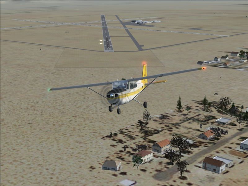
In this comprehensive enhancement, all taxiways, runways, and aprons have been realigned to align with their real-world markings. The airport’s configuration fits the factual geometry of the region, reflecting the natural layout of Bishop, California. This careful adjustment helps users enjoy a more authentic approach and departure, especially when operating general aviation flights in the nearby high-desert environment.

Eastern Sierra Regional Airport Scenery.
Object Placement and Buildings
All buildings have been carefully relocated and adjusted to maintain their correct orientation. Using accurate satellite imagery from Google Earth, the scenery update positions hangars, terminals, and supporting structures where they should be, creating a faithful representation of the airport’s physical layout. Additionally, default objects taken from standard FSX scenery libraries add another layer of realism to every part of the airfield.
Compiled with Airport Design Tools
The included BGL files were created using Airport Design Editor, which grants precise control over airport features. This professional-grade software was used to compile the updated scenery data, ensuring that runway headings, taxiway routes, and terrain elements follow consistent standards.
Performance Settings Recommended
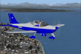
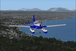
To view the majority of the placed objects, it is advisable to keep scenery settings at least on NORMAL. This allows the native objects, placed by default FSX libraries, to be fully rendered. With higher detail levels, the result is an even more engaging backdrop, reflecting the characteristic environment of Owens Valley and the backdrop of the Sierra Nevada range.
Step-by-Step Installation
- Locate the two BGL files (KBIH_ADE.BGL and KBIH_ADE_CVX.BGL) in the downloaded scenery folder.
- Copy both of these files into your main “Flight Simulator X / Addon Scenery / Scenery” directory.
- Launch Microsoft Flight Simulator X, and the corrected airport features will be active upon loading the region.
Quick Removal Instructions
- Delete or move the BGL files mentioned above from the “Flight Simulator X / Addon Scenery / Scenery” folder.
- Start the simulator, and the original default configuration will be restored.
Credits and Disclaimer
This scenery is freely provided by Phillip Coyle. While it has been thoroughly tested, it is supplied with the understanding that you assume all risks upon installation. The creator cannot be held liable for any potential impact on your system. No additional help or technical support is offered for these files.
Images & Screenshots

Finding the Scenery
- FSX/Prepar3D Coordinates:
-
37.37305600,-118.36388900
Use the downloaded flight plan file by launching FSX/P3D, selecting "Load Flight Plan" in the flight planner, and choosing the .pln file. Your aircraft will be positioned directly at the add-on’s location. - Decimal Degrees (DD):
-
Latitude: 37.373056°
Longitude: -118.363889° - Degrees, Minutes, Seconds (DMS):
-
Latitude: 37° 22' 23.002" N
Longitude: 118° 21' 50.000" W
Map Location
The archive kbih_sce.zip has 6 files and directories contained within it.
File Contents
This list displays the first 500 files in the package. If the package has more, you will need to download it to view them.
| Filename/Directory | File Date | File Size |
|---|---|---|
| KBIH_ADE.BGL | 12.18.08 | 11.53 kB |
| KBIH_ADE_CVX.bgl | 12.18.08 | 738 B |
| KBIH_Scenery.jpg | 12.17.08 | 315.36 kB |
| Readme.txt | 12.17.08 | 4.29 kB |
| flyawaysimulation.txt | 10.29.13 | 959 B |
| Go to Fly Away Simulation.url | 01.22.16 | 52 B |
Installation Instructions
Most of the freeware add-on aircraft and scenery packages in our file library come with easy installation instructions which you can read above in the file description. For further installation help, please see our Flight School for our full range of tutorials or view the README file contained within the download. If in doubt, you may also ask a question or view existing answers in our dedicated Q&A forum.


0 comments
Leave a Response