 FSX Scenery
Mesh In LOD 10 (30m) Of West Indies Arc
Mesh In LOD 10 (30m) Of West Indies Arc, Caribbean. By Valladier Jean-Louis. …
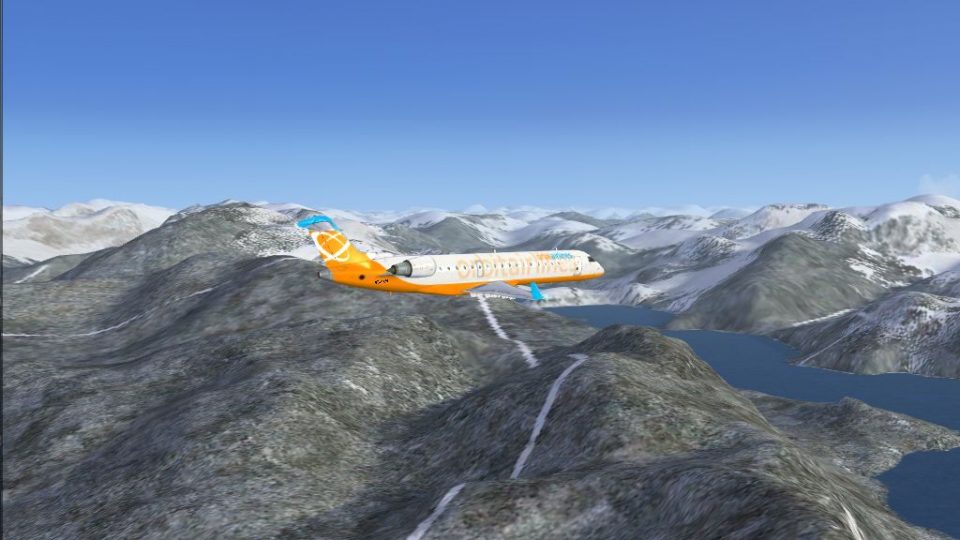
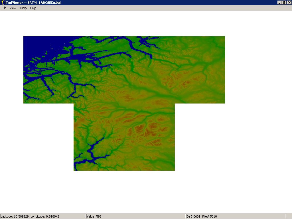
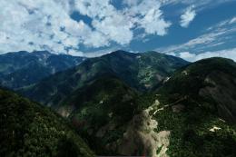
Ålesund and Norway’s west-coast terrain gains sharper relief with a near 10-meter elevation mesh that enhances ridgelines, valleys, and coastal contours for more convincing low-level VFR flying. Designed for Microsoft Flight Simulator X, coverage spans roughly 7–9°E and 61–62°N in a T-shaped area around Ålesund.
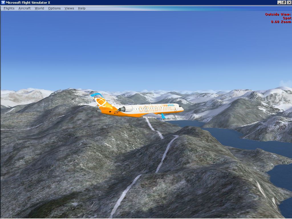

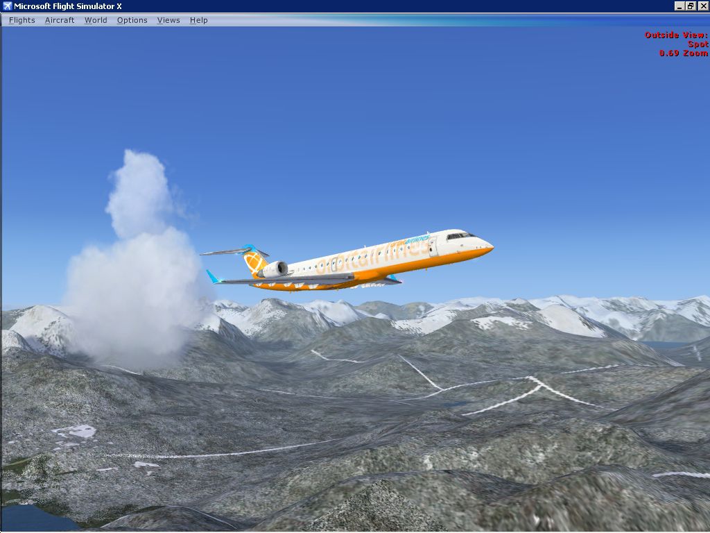
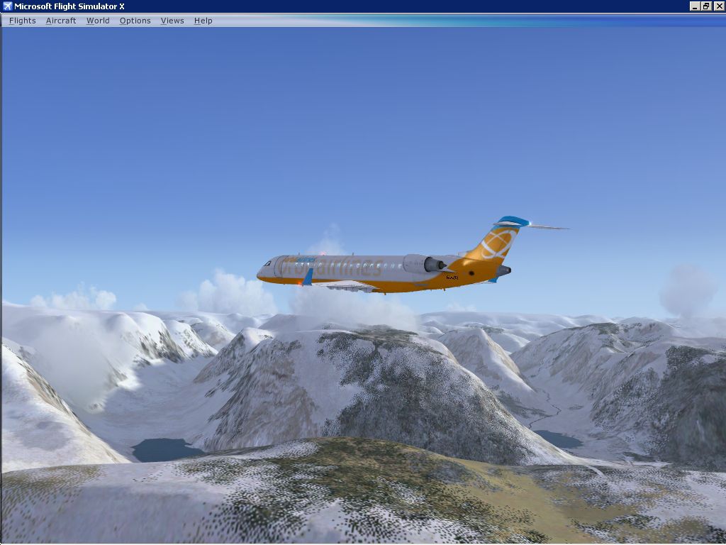
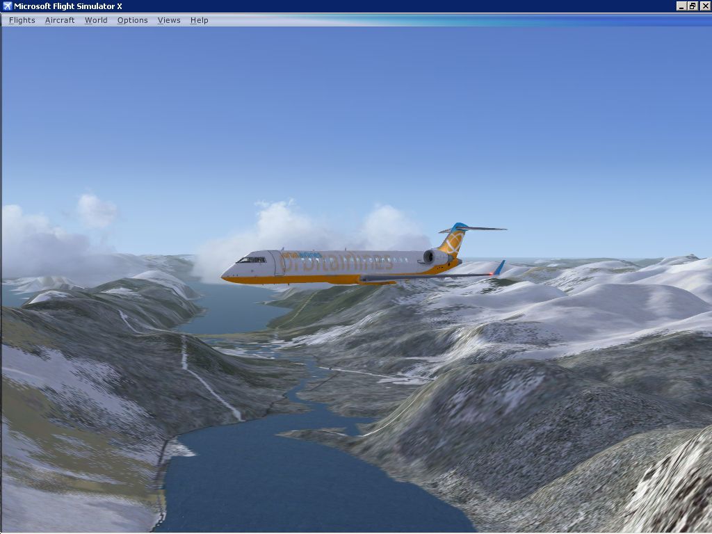
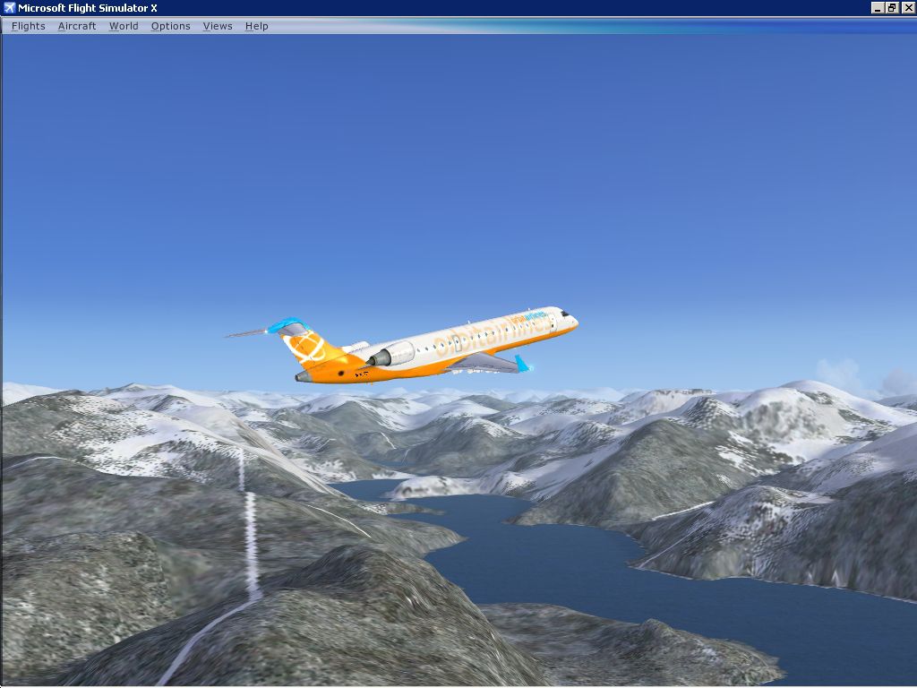
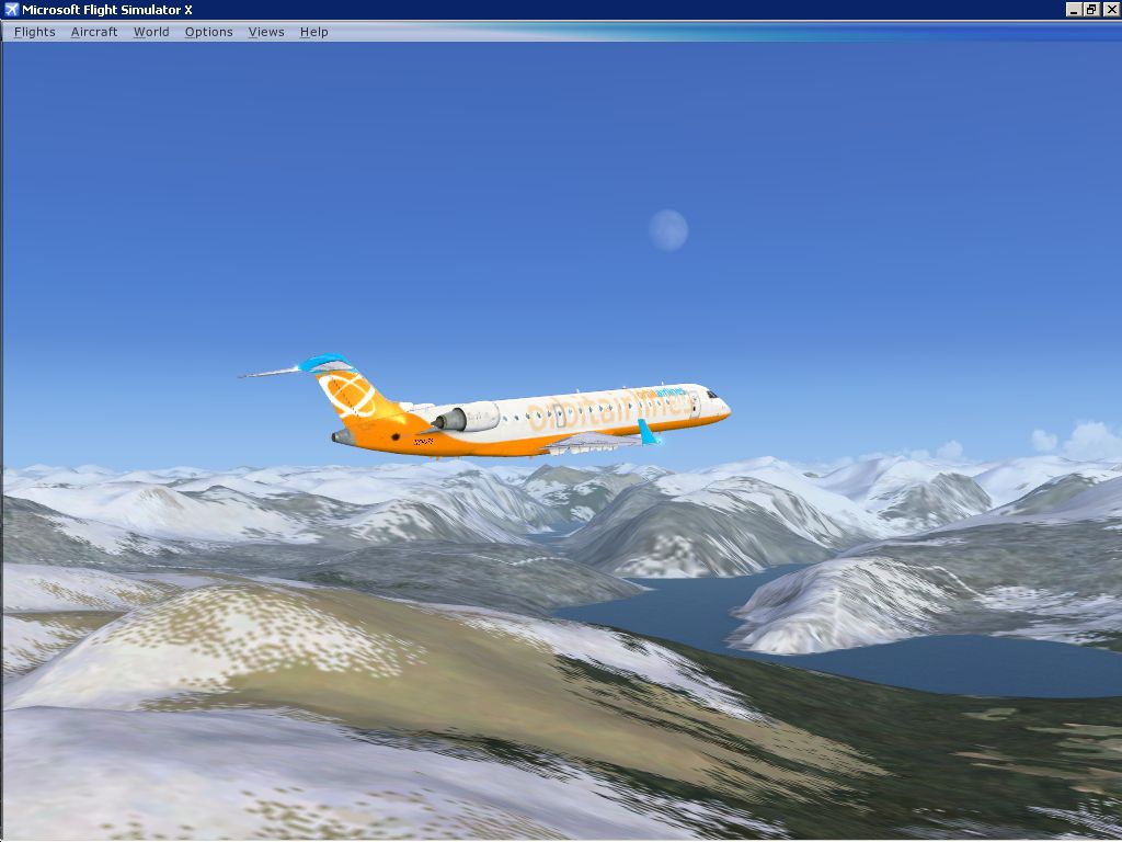
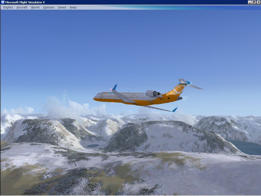
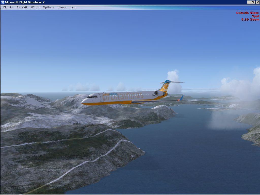
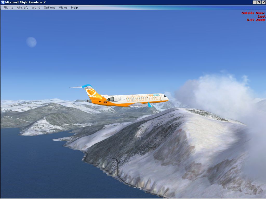
Alesund 10 Meter Mesh. Alesund is found on the west coast of Norway. By Wayne Evans.
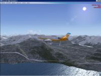
Alesund 10 Meter Mesh Scenery.
Alesund 10 metre mesh for FSX only.
Alesund is found on the West coast of Norway. (The same as most other populated places in Norway!)
This is near 10m mesh, which Jonathan de Ferranti of: http://www.viewfinderpanoramas.org/ has kindly allowed me to turn into a BGL for use in Microsoft FSX.
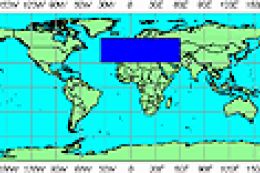
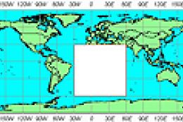
The coverage isn't all that large: From 007 East Longitude to 009 East Longitude, 61 North Latitude to 62 North Latitude. (Points on SW corner of each Lat/Long box) Area is in the shape of a 'T'.
See jpg for visual coverage.
Does make that area of Norway look nice though.
Wayne Evans UK
To install:
Unzip: "Alesund 10m Mesh" So you find that named folder wherever you download/unzip files to/from. Move/copy/Paste this folder into: (if you installed FSX into the default path folder) C:Microsoft Games/FSX/Addon Scenery folder. Start up FSX. Click on 'Settings' at the left hand side of the display - Click on 'Scenery Library' at right hand side of display, 'SETTINGS - SCENERY LIBRARY' window appears, click on 'Add Area' - a Browser window appears - browse to/Open folder: 'AddonScenery' - Left click on 'Alesund 10m mesh'found in that folder (so it is highlighted in blue), click 'OK' on Browser window. The 'Alesund 10m mesh' entry should now be showing at the top of the list of scenery in the: 'SETTINGS - SCENERY LIBRARY' display/window. Click on 'OK' FSX will now scan/read this folder into its Scenery library. (Animated scanning bar should appear) (You don't need to restart the program to go flying over Alesund - FSX is different to fs9). Go flying!

Alesund 10 Meter Mesh Scenery.
Free for all simmers · 62.49 MB · Scanned clean
Download speed: Free tier is capped at 0.5 Mbps (this file takes approximately 17 mins at the cap). PRO members download at full line speed.
FSX\Addon Scenery\ containing scenery and texture sub-folders.readme.txt or README file. It tells you exactly where files go, what dependencies are needed, and any quirks specific to this add-on.Use these coordinates to fly directly to this location once the mod is installed.
62.47200000,6.15490000
Launch FSX or Prepar3D and use Flights → Load to open the downloaded .pln file. Your aircraft will be positioned at this location.
The archive ales10m.zip has 19 files and directories contained within it.
This list displays the first 500 files in the package. If the package has more, you will need to download it to view them.
| Filename/Directory | File Date | File Size |
|---|---|---|
| Alesund_coverage.jpg | 03.08.09 | 265.56 kB |
| Read-me_Alesund_10m_mesh.txt | 03.10.09 | 1.59 kB |
| scenery | 03.10.09 | 0 B |
| Ale_Nor-10m.bgl | 03.08.09 | 59.28 MB |
| ScreenShot10.jpg | 03.08.09 | 415.85 kB |
| ScreenShot11.jpg | 03.08.09 | 370.51 kB |
| ScreenShot12.jpg | 03.08.09 | 372.81 kB |
| ScreenShot13.jpg | 03.08.09 | 409.98 kB |
| ScreenShot3.jpg | 03.08.09 | 460.18 kB |
| ScreenShot4.jpg | 03.08.09 | 476.04 kB |
| ScreenShot5.jpg | 03.08.09 | 387.05 kB |
| ScreenShot6.jpg | 03.08.09 | 363.08 kB |
| ScreenShot7.jpg | 03.08.09 | 420.59 kB |
| ScreenShot9.jpg | 03.08.09 | 351.15 kB |
| texture | 03.10.09 | 0 B |
| Thumbs.db | 03.10.09 | 34.50 kB |
| Alesund_10m_mesh | 03.10.09 | 0 B |
| flyawaysimulation.txt | 10.29.13 | 959 B |
| Go to Fly Away Simulation.url | 01.22.16 | 52 B |
More FSX & P3D add-ons hand-picked based on this download.
FSX Scenery
Mesh In LOD 10 (30m) Of West Indies Arc, Caribbean. By Valladier Jean-Louis. …
 FSX Scenery
For users of Flight Simulator X (and FSX: Steam Edition) and/or Prepar3D, ter…
 FSX Scenery
FSX World Wide Coverage SRTM 3, version 2, mesh of Europe. Includes the compl…
 FSX Scenery
Alaska 38 Terrain Mesh Part 1 & 2. FSX Alaska 38 Terrain Mesh Replacement ter…
 FSX Scenery
FSX World Wide Coverage SRTM 3, version 2, mesh of Africa. Includes the compl…
 FSX Scenery
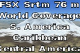
FSX SRTM 76 m South America, Central America and the Caribbean. Designed with…
 FSX Scenery
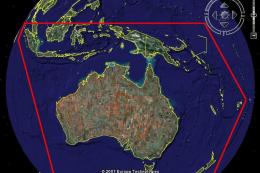
STRM Mesh For Australia, New Zealand and PNG. This SRTM mesh will update your…
 FSX Scenery
Madagascar Multi-LOD Mesh for SP1. To improve performance, FSX updated with S…
Be the first to leave a comment on this download.
Be the first to share your thoughts on this download.