 FSX Scenery
Amazonia Air Part 1
"Amazonia Air" Part I. Flights and scenery--Amazonia Air was founded only fou…
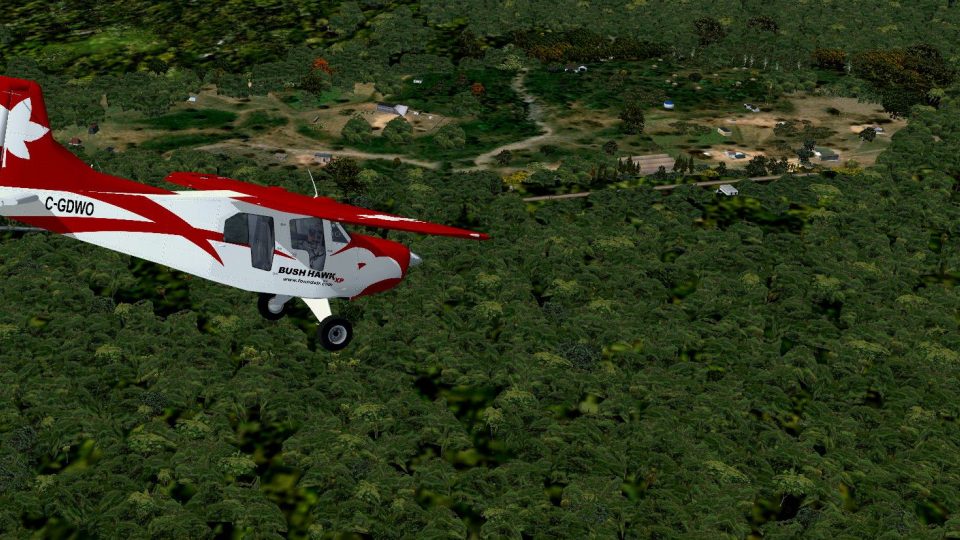
Amazonia Air II “Small Jungle Villages” brings four photoreal Peruvian Amazon settlements to life, tailored for low-and-slow bush flying with a mix of tiny airstrips and improvised grass clearings along remote tributaries. Designed for FSX, it enhances backcountry navigation and short-field technique with compact, carefully sited landing areas.
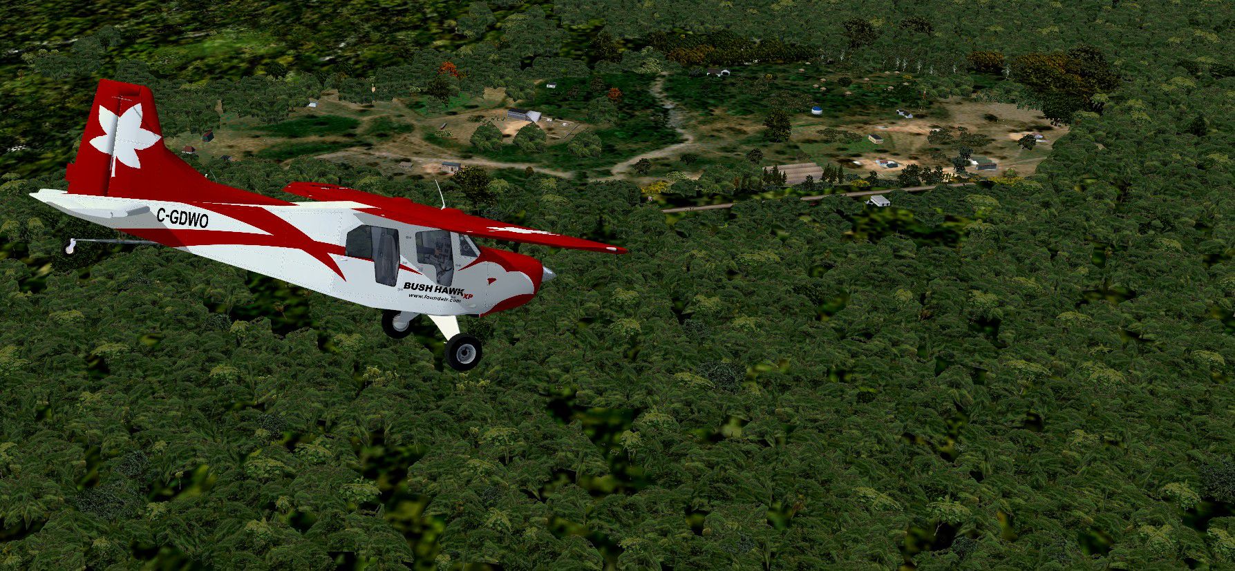
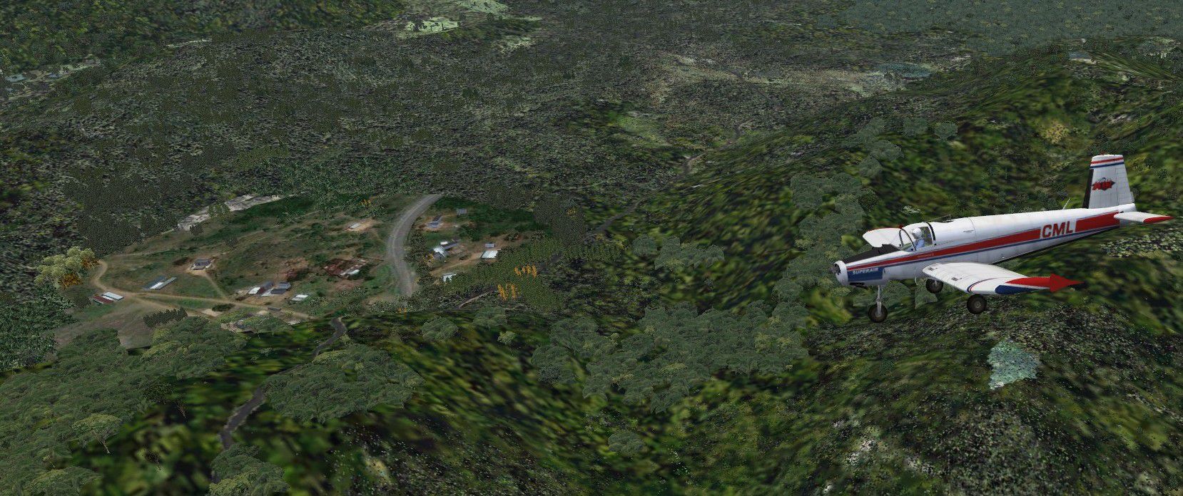
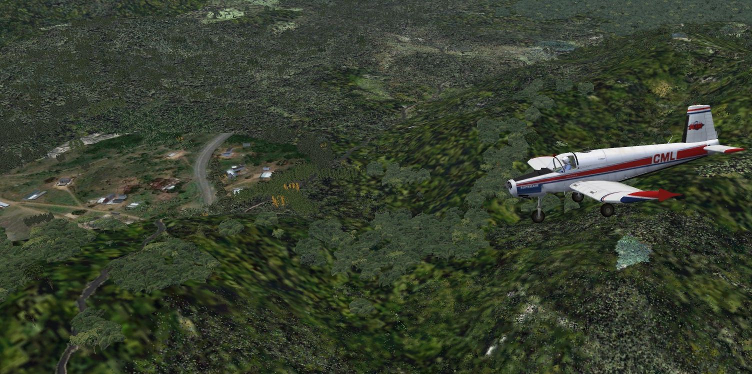
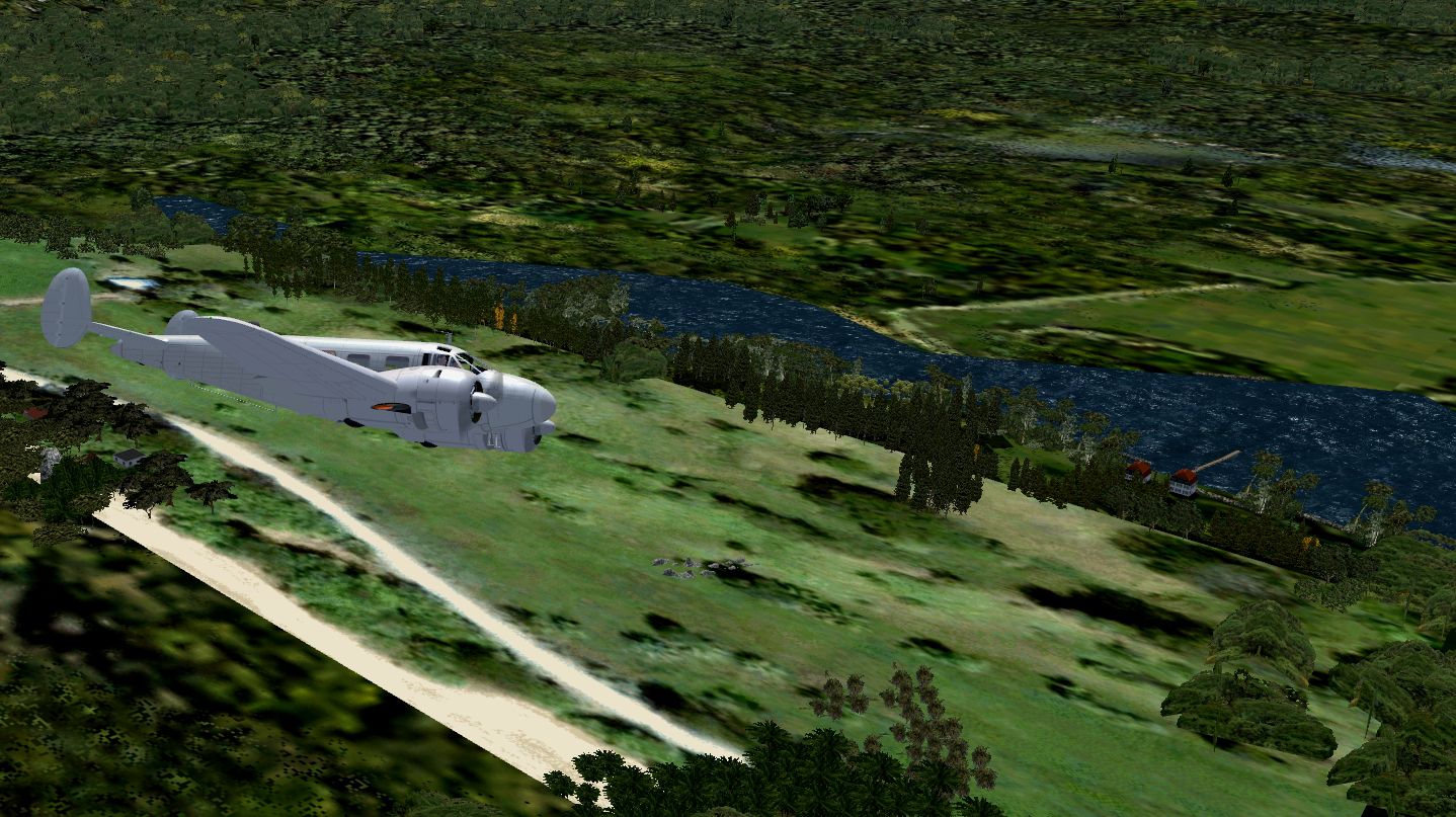
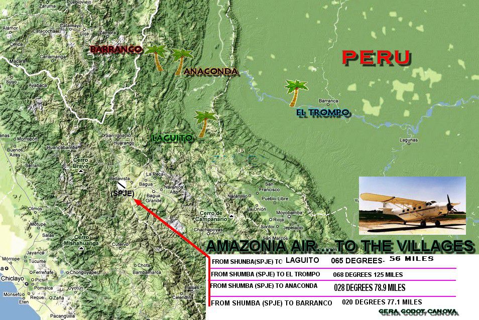
Scenery Amazonia Air II "Small Jungle Villages". The Peruvian Amazon is filled with many small Peru villages along the tributaries of the mighty river. This scenery depicts four photoreal villages to fly to in your slow bush plane. Some have a small airfields and others just deep grass areas improvised for the coming supplies planes. Pilots should overfly the landing area one or two times and plan the landing carefully at these small and constricted fields. By Gera Godoy Canova.
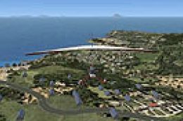
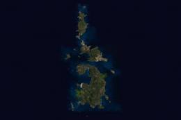
Aerial view of "Amazonia Air" Scenery.
AMAZONIA AIR PART II
“ Small Jungle Villages”
1) place the .bgl and LC files FOUND IN THE ENCLOSED "SCENERY" directory in your FSX/ADDON SCENERY/SCENERY Directory.
2) Place the .BMP files FOUND IN THE ENCLOSED " TEXTURE" directory in your FSX/ADDON SCENERY/TEXTURE Directory.
Activate the files by starting FSX.
Gera Godoy Canova
THIS IS FREEWARE AND MAY NOT BE USED IN ANY COMMERCIAL PRODUCT WHATSOEVER.

Aerial view of "Amazonia Air" Scenery.
Free for all simmers · 5.5 MB · Scanned clean
Download speed: Free tier is capped at 0.5 Mbps (this file takes approximately 2 mins at the cap). PRO members download at full line speed.
FSX\Addon Scenery\ containing scenery and texture sub-folders.readme.txt or README file. It tells you exactly where files go, what dependencies are needed, and any quirks specific to this add-on.Use these coordinates to fly directly to this location once the mod is installed.
-3.75000000,-73.25000000
Launch FSX or Prepar3D and use Flights → Load to open the downloaded .pln file. Your aircraft will be positioned at this location.
The archive am_air2.zip has 29 files and directories contained within it.
This list displays the first 500 files in the package. If the package has more, you will need to download it to view them.
| Filename/Directory | File Date | File Size |
|---|---|---|
| READ ME FIRST.txt | 10.25.10 | 509 B |
| file_id.diz | 10.25.10 | 137 B |
| elpueblo44.jpg | 10.24.10 | 569.04 kB |
| ROUTES MAP.jpg | 10.24.10 | 296.08 kB |
| CVX_FOTPARCHE333.BGL | 10.23.10 | 239 B |
| CVX_PRIMERO.BGL | 10.23.10 | 254 B |
| CVX_PROJECT.BGL | 10.23.10 | 228 B |
| CVX_PUEBLO333.BGL | 10.23.10 | 416 B |
| CVX_pueblo4-final.BGL | 10.24.10 | 236 B |
| FOTOPARCHE002.bgl | 10.23.10 | 4.52 kB |
| FOTOPARCHE01.bgl | 10.22.10 | 16.33 kB |
| FOTOPARCHE333.bgl | 10.23.10 | 15.71 kB |
| FOTOPARCHE555.bgl | 10.24.10 | 9.54 kB |
| FOTOPERU.bgl | 10.24.10 | 65.78 kB |
| LC_2733.bgl | 10.23.10 | 335 B |
| LC_tercerpueblo.bgl | 10.24.10 | 335 B |
| PARCHE9999.bgl | 10.24.10 | 6.06 kB |
| PUEBLO444.bgl | 10.23.10 | 6.86 kB |
| cuadro02.bmp | 10.22.10 | 513.05 kB |
| CUADRO33.bmp | 10.23.10 | 1.50 MB |
| PUEBLO002.bmp | 10.23.10 | 257.05 kB |
| PUEBLO333.bmp | 10.23.10 | 1.00 MB |
| PUEBLORECNS888.bmp | 10.24.10 | 129.05 kB |
| AMAZONIA AIR PART II Instructions.pdf | 10.26.10 | 77.15 kB |
| FOTO333.jpg | 10.23.10 | 1.04 MB |
| PUEBLO-111.jpg | 10.23.10 | 991.38 kB |
| fotodelpublw1.jpg | 10.24.10 | 414.36 kB |
| flyawaysimulation.txt | 10.29.13 | 959 B |
| Go to Fly Away Simulation.url | 01.22.16 | 52 B |
More FSX & P3D add-ons hand-picked based on this download.
FSX Scenery
"Amazonia Air" Part I. Flights and scenery--Amazonia Air was founded only fou…
 FSX Scenery
Villages Of Italy. This file adds into FSX all Italian villages of less than …
 FSX Scenery
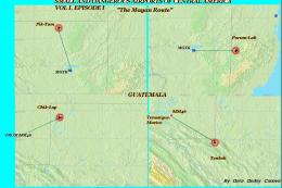
Small And Dangerous Airfields In Central America Part I (with a touch of salt…
 FSX Scenery
Small German Airfields EDAJ plus EDOT. AFCAD scenery for two smaler fields in…
 FSX Scenery
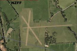
Christchurch Small Airfields. This adds NZWL, NZFF and updates NZRT which are…
 FSX Scenery
Costa Blanca Small Airfields; final release. These are updated files and incl…
FSX Scenery
Set of 51 small airfields located from north to south of Portugal, the vast m…
 FSX Scenery
Chi-Chi Jima. Susacki Airfield is presented in detail. Three water runways ar…
Be the first to leave a comment on this download.
Be the first to share your thoughts on this download.