FSX EGJJ Jersey UK Scenery
EGJJ Jersey Airport scenery refresh sharpens approaches and ground operations with improved vectors, richer apron detail, hand-placed buildings, perimeter roads, and accurately positioned PAPI lights in Microsoft Flight Simulator X. Custom runway touchdown zone bars and UK-style distance markers appear when the optional FSX Runway Numbers And Markings library is installed, enhancing Runway 09/27 realism.

 United Kingdom
 - File: jerseyadefsx.zip
- Size:1.01 MB
- Scan:
Clean (29d)

- Access:Freeware
- Content:Everyone
Discover this freeware scenery upgrade for EGJJ Jersey Airport in the Channel Islands, designed to add more realism and nuance to your flights in Microsoft Flight Simulator X. Created by John Ball, it refines the default layout with added vector elements, increased ground detail, and precise runway touchdown markers. This version incorporates scenery objects, hand-placed structures, and perimeter roads for a more immersive takeoff and landing experience, especially with the optional FSX Runway Numbers And Markings library by Lance Tucker.
Significant Airport Updates
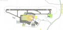
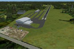
The default representation of Jersey Airport (IATA: JER) in Microsoft Flight Simulator X is simple. This add-on addresses that by enhancing local architecture, vegetation, and vehicle paths around the terminals and aprons. The runway environment also benefits from custom markings, reflecting the real-world alignment of Runway 09/27. Jersey Airport, a busy link in the Channel Islands, typically sees a high volume of flights to and from mainland UK, so these new details are particularly helpful for those who prioritize accuracy. Although it is not designed to be an exact replica, the layout remains faithful to real-world operations.
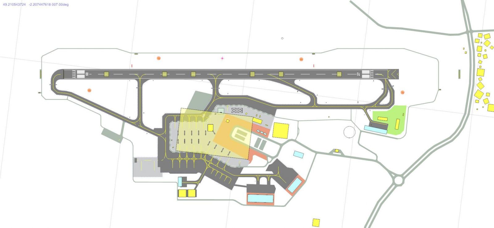
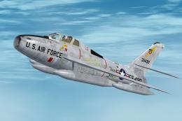
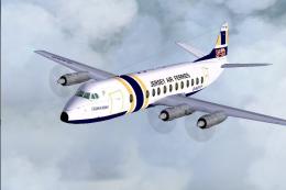
Enhanced scenery surrounding EGJJ Jersey Airport.
Runway Touchdown Zone Markings
Runway 09/27 at Jersey Airport measures 5,600 feet in total, with displaced thresholds bringing the actual usable distance for touchdown to around 5,100 feet. Under default simulator constraints, full touchdown zone (TDZ) markings are not supported for runways under 6,000 feet. To circumvent that, custom visuals have been inserted through the optional FSX Runway Numbers And Markings freeware (file name: rwy_mark.zip) by Lance Tucker. If this additional library is present, you will see accurately spaced bars: 500-foot markings, 1,000-foot brackets in UK style, plus 1,500- and 2,000-foot indicators.
Without the extra library, the scenery still functions normally, just minus the extra runway painting. The PAPI units have been carefully positioned about 1,000 feet from each runway threshold, reflecting the usual approach aids in this region.
Additional Structures and Ground Elements
Beyond the runway itself, this mod adds a wider array of buildings, fences, static objects, and road networks around the airfield. The fidelity is thoughtfully improved to capture essential airport landmarks, yet the improvement remains performance-friendly. This fictional enhancement respects the original airfield boundaries and general appearance, while integrating subtle details like airport service roads and local navaid placements.
Technical Guidance and Compatibility
According to the developer, John Ball, this scenery pack is built for the default Microsoft Flight Simulator X environment and has not been evaluated with other comprehensive add-ons or mesh products. Compatibility with vanilla FSX is tested extensively, so results in custom setups may vary. Nonetheless, installation procedures remain straightforward.
Installation Steps
- Move all four EGJJ_ADEX files into your main FSX\Addon Scenery\Scenery directory.
- Download and install rwy_mark.zip by Lance Tucker to enable the optional touchdown zone (TDZ) markings. Follow the instructions included in that separate package.
- Run Microsoft Flight Simulator X, select EGJJ under United Kingdom (Jersey), and explore the upgraded airport layout.
It should operate smoothly on most systems when placed correctly. If you notice any omissions, ensure the files mentioned are in the correct locations. Enjoy your flights around the Channel Islands with this freeware scenery enhancement by John Ball.
Images & Screenshots

Finding the Scenery
- FSX/Prepar3D Coordinates:
-
49.20770000,-2.19550000
Use the downloaded flight plan file by launching FSX/P3D, selecting "Load Flight Plan" in the flight planner, and choosing the .pln file. Your aircraft will be positioned directly at the add-on’s location. - Decimal Degrees (DD):
-
Latitude: 49.207700°
Longitude: -2.195500° - Degrees, Minutes, Seconds (DMS):
-
Latitude: 49° 12' 27.720" N
Longitude: 2° 11' 43.800" W
Map Location
The archive jerseyadefsx.zip has 9 files and directories contained within it.
File Contents
This list displays the first 500 files in the package. If the package has more, you will need to download it to view them.
| Filename/Directory | File Date | File Size |
|---|---|---|
| EGJJ 34.jpg | 01.29.11 | 115.87 kB |
| Jersey Readme.txt | 01.29.11 | 2.42 kB |
| EGJJ_ADEX_JB_CVX.bgl | 01.07.11 | 666 B |
| EGJJ_ADEX_JB.ad2.ad2 | 01.07.11 | 621.24 kB |
| EGJJ_ADEX_JB.ad2.ad2.bak | 12.30.10 | 284.28 kB |
| EGJJ_ADEX_JB.BGL | 01.07.11 | 36.53 kB |
| EGJJ_ADEX_JB.xml | 01.07.11 | 298.02 kB |
| flyawaysimulation.txt | 10.29.13 | 959 B |
| Go to Fly Away Simulation.url | 01.22.16 | 52 B |
Installation Instructions
Most of the freeware add-on aircraft and scenery packages in our file library come with easy installation instructions which you can read above in the file description. For further installation help, please see our Flight School for our full range of tutorials or view the README file contained within the download. If in doubt, you may also ask a question or view existing answers in our dedicated Q&A forum.


0 comments
Leave a Response