 FSX Scenery
Ghost Airports Collection - Pennsylvania
Update 5 presents Clarion, PA Rhea Airport. This update also places refuellin…
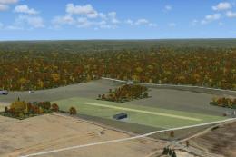
Pennsylvania’s Ghost Airport Collection recreates 41 long-closed airfields for FSX, restoring grass strips, early paved runways, and period layouts drawn from 1940 sectional references and historic aerial imagery. Each site places forgotten airports back on the map—now malls, campuses, parks, or farmland—complete with tailored identifiers and scenery objects for nostalgic cross-country flying.

Ghost Airport Collection - Pennsylvania. Here is a collection of forty-one Pennsylvania (PA) ghost airports, airports that are closed and most have been obliterated by progress. Most of the airports were found on a March 1940 Cleveland Sectional chart. Only airports that are fully closed and not used in any form or portion as an airport are included in this collection. Use FSX and this collection to fly back into history. By Richard O. Finley. (See also GHOST_AIRPORTS_COLLECTION_PENNSYLVANIA_UPDATE_1.ZIP and GHOST_AIRPORTS_COLLECTION_PENNSYLVANIA_UPDATE_2.ZIP).
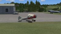
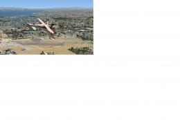
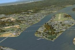
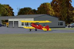
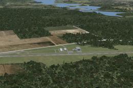
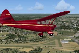
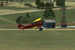
Screenshot of Pennsylvania Scenery.
The Ghost Airport Collection is a collection of forty-one Pennsylvania airports for FSX that used to exist but now are gone or virtually gone. These airports are now malls or shopping centers, industrial complexes, housing developments, parks, schools/universities, farm land, etc, etc. In some cases the airport is still recognizable but unused or partially used for another purpose.
All the airports in this collection fit that criteria. Many airports that comprise this collection came from a March 1940 Cleveland sectional chart I inherited from my father. There are airports that existed in 1940 and still exist as an airport in one form or another today. Those airports still in existence are not a ghost airport.
Signs of their existence are still there today like at the former location of Bettis airport near Pittsburgh (now the Southland Shopping Center) that has a nearby street named, “Luscombe Lane”. I bet that many residents of that street who lack an aviation background do not realize the significance of that name. In one case an airport became a housing development and the runway became the main road in the development. To preserve the heritage of the land, they named the main road, “Runway Avenue”. Oil City's Splane Memorial Airport still exists in whole but is used as the city's composting facility.
These airports have been built in FSX using aerial photographs from Penn Pilot (pennpilot.psu.edu) and with great deal of aid from Google Earth. A web site called “Abandoned & Little-Known Airfields” was also exceptionally helpful. I used stock library buildings that come with Airport Design Editor.
These airports were built using Airport Design Editor v1.40.07. In the era of the representative airport here, the average runway was a two thousand foot grass strip. Even the paved fields average length was around two thousand feet. Some of these airports were built by the government for use by the air mail pilots. In most cases they obtained the use of some farm field/pasture land and kept it somewhat mowed (not over knee-high). They used the flying field concept where pilots landed whatever way they had enough length and was mostly into the wind. Designate an official runway?---Naw! The runways were often laid out over mildly rolling hills.
Rolling hills is a function where Flight Simulator has a bit of a handicap. You can leave the natural (digitized) lay of the land in place but it tends to be pointy and uneven making for some bumpy landings. Where the polygons intersect, the transition is not always smooth and a wheel or the landing gear may disappear onto the ground. As a result, in most cases, I have opted to flatten the terrain. This results in both positive and negative embankments at the edge of the airport. While these cases do not represent the actual airport appearance, they work better than the unflattened version.
I have tried to find the original identifiers for these airports. I have only found Oil City's identifier (KOIL) so far. I contacted the office of Penndot that licenses airports but they said they archive records that old in a warehouse making them virtually unavailable. They are not even sure they used identifiers for all airports of that era. Flight Simulator requires an identifier so I just made up identifiers for most of these airports. If anybody has information on any of these identifiers, please let me know.
Installation:
This is very simple. Just unzip the downloaded file and put all resulting files in ~~microsoft flight simulator X\addon scenery\scenery. If you have my original version of KOIL installed, you will need to decide whether overwrite those files or keep the old files.
Here is a list of the airports in this collection:
Aliquippa Hopewell:
This airport, located about five northwest of Greater Pittsburgh, on a hill top catty-corner across the valley intersection from the hillside where USAir flight 427 crashed. Originally, Aliquippa Hopewell had two grass runways. Later they went to a single paved fifteen hundred foot north/south runway that lined up with the access notch they had in the Greater Pittsburgh control zone. The airport boasted a factory where they produced the Volaire 100, This design was eventually sold to Rockwell and produced as the Aero Commander 100 The AC100 evolved into the Darter Commander and later the more powerful Lark Commander.
Altoona:
Located outside of Altoona near a little village called Duncansville, this typical little airport boasted some fancy artwork on the surface of the field that included the airport symbol with a Keystone in it and the airport name.
Mayer:
Located at Bridgeville, PA, this was Pittsburgh's first airport. It was built and owned by a local brickmaker named Mayer who had a great interest in aviation. It was your basic flying field configuration designed to accommodate the biplanes of the day. It eventually had two designated runways the longest of which measured sixteen hundred feet.
Bettis:
This was Pittsburgh's second airport. It served during the 1920's and 1930's. Its two thousand foot runways restricted its practical use to that period. Choosing a runway configuration to model was not simple. The airport evolved over the years and when they did pave runways, they did not pave the entire extent of the grass runways. I chose the apparent longest grass configuration. Bettis was replaced by the largest airport in the nation (at that time), Allegheny County Airport which was built only a mile away. Bettis continued to serve aviation as the home of Pittsburgh Institute of Aeronautics for years after the airport closed. An interesting aside to this story is the 1938 aerial photo of Allegheny County Airport shows four intersecting runways. The eight runway ends were not identified according to magnetic heading. They were simply numbered 1 through 8.
Dubois:
This airport was close to the town of Dubois and was eventually replaced by the Dubois Jefferson airport (DUJ) that was built in a less congested area.
Grove City:
This privately owned paved airport served Grove City for years. In the 1970's it appeared on the charts as a restricted airport. It eventually closed and Grove City built the new Grove City airport (29D).
Harri-Emery:
This early airport served Bradford, PA from the 1920's to the 1970's. This airport was the home of the Taylor brothers airplane manufacturing facility where the early Taylor Cubs were produced. In 1931 the Taylor brothers were forced into bankruptcy due to a slump in sales and the Piper Cub was born. This airport continued to serve Bradford until it closed in 1971. Some fliers continued to use the field after it was officially closed. By 1977 it was part of the University of Pittsburgh at Bradford campus. The original hangar still exists and houses the student union.
Mercer:
This was one of the federally funded airports established to support the U.S. Air mail system. It had an airway beacon light on the field and a low-frequency range station nearby. When government support dried up, local support just was not there and this airport faded into history. In the ensuing years someone built a narrow private strip across the road from the site of the Mercer airport. The cut through the woods for that airport can still be seen on Google Earth. I never knew that airport to be licensed.
Splane Memorial:
This airport near Oil City, PA served as the focus of aviation for most of Venango county in the 1930's and 1940's. It began as a function of the Oil City Aero Club and benefited from the generosity of a local donor whose son had died in WWI hence the name Splane Memorial. The Oil City Aero Club wanted to get the airport set up as a municipal function so it could qualify for WPA funding. The funding was obtained and WPA built a single two thousand foot paved runway and a hangar. When it opened, KOIL had the only paved runway between Pittsburgh and Buffalo. After the big hangar burned down and the county decided to throw its support behind an airport site near Franklin (the county seat), the fate of KOIL was sealed. The airport managed to remain in existence until 1971. The city of Oil City now uses the site as its composting facility. The form of the airport can clearly be seen on Google Earth. My original version was built from details available from Google Earth. The newer version represents KOIL as it appeared in the 1938 aerial photograph from Penn Pilot.
Punx-Brae:
This airport served Punxsutawney, PA for several years. I have no information about this field. It closed and was replaced by the current Punxsutawney airport.
Kearsarge:
This airport was built in the 1950's to serve the Erie, PA area as an alternative to the larger, more commercial, Erie airport. The airport closed in the 1960's and the land sold to a developer. It is the location of the original part of the Millcreek Mall.
Scranton Municipal:
This airport was opened as the Schultzville Airport. In 1928 it became Port Scranton Airport. Eventually it was renamed Scranton Municipal. It was replaced in function by the Wilkes Barre Scranton Airport (AVP) and eventually fully closed in 1979.
Col. Drake:
This is the old Titusville airport. I have not found much information about this field. It was named for Edwin Drake the man who developed the method of extracting petroleum from the earth. This happened in Titusville in 1859 and gave birth to the oil industry. In order to give Drake more stature in Titusville while he was conducting his initial experiments, the principles of the company he worked for back in New York and Connecticut addressed his mail to Col. Edwin Drake. In reality, his greatest achievement up until that time was becoming a conductor on the New Haven Railroad, a position he was unable to keep.
Warren:
This airport looks like it may have been one of those “land any way you want” airports initially. In 1938 it consisted of two grass runways which is the way I modeled it. Eventually WPA came in and built a single two thousand foot paved runway and a hangar. They also built a dike around the airport to protect it from flooding.
Waynesboro:
Originally Worley Field, this airport became Waynesboro Municipal airport after an infusion of WPA funding and funding from several local sponsors built hangars, offices and two paved runways. It lasted less than fifteen years after its makeover. When the government canceled GI Bill flight training, the airport closed within a year. The FSX version of this airport looks a little weird because a nearby airport (5PN5) was licensed with an incorrect field elevation. The listed field elevation is 240'. Google Earth shows it should be about 500' higher. This means, for Flight Simulator users, 5PN5 causes Flight Simulator to create a five hundred foot deep crater in the surrounding terrain with a gentle enough slope to the sides that it looks pretty natural. Waynesboro airport is on that slope that is created so it has a tremendous embankment that looks really strange. I have included an unfinished version of this airport with the field elevation set to 500' so you can see the scope of the problem. You can imagine the cliff if it was set to the correct altitude (over 700'). Ironically, the offending airport now appears on Google Earth to be a Wal Mart Supercenter.
Peterson Memorial:
This airport is located at Tipton, PA, near Bellwood, PA which is just up the valley from Altoona. This airport was originally Stultz Field. Paul Peterson bought it but sold the land to a company that wanted to build a factory. Mr. Peterson took his money and bought an old racetrack next door and built a new airport there. I did not want to build two airports side by side so I modeled the newer airport because it is larger therefore more functional. Peterson Memorial is named for Paul Peterson Jr. who was killed when he slipped on some ice while hand propping a UPF-7 at the original airport. If you had time to listen to his stories, you would find Paul Peterson Sr. was a very interesting man. He was one of this nation's first airline pilots and seemed to know everybody who was anybody in early aviation.
State College:
While it is listed on the sectional chart as just State College, old timers around there say it was the original State College Air Depot. During its life the airport went through several changes in size and layout. It appears as land or access to land was acquired or lost, runways were added or closed. When that airport closed just after WWII, the owner set up shop at another location southwest of State College. I have that airport modeled also.
Taylorville:
This airport was located near a small village named Taylorville but has an Ashland zip code. I do not know for certain what its name was. I found it by doing a search for Airport Road in Penn Pilot. For the purpose of the naming convention used in Flight Simulator, I used the nearby village as the airport name and the nearest town with a post office as the city location.
Benninger:
This airport was built behind a restaurant with an aviation theme. It had a PT-19 on the roof which you can see in the 1958 aerial photo of the area.
Erie County:
This is the old Erie County and not related to the new Erie County Airport (3G1). It was located in Fairview southwest of Erie.
Keystone:
This somewhat narrow triangular airport served Emporium, PA. I am not sure how long it was there. It appeared on the 1938 aerial photos. Then the nearby creek crossed under the road leading out of town and passed north of the highway and airfield. The runway was near the road with the hangars farther in on the field. The 1958 aerial photo shows the creek had been diverted south of the airport and the bridge on the main highway eliminated. The hangars were now closer to the highway and the runway was farther in on the airfield next to the creek. That is the version I modeled. Sitting on the ground at this field, everything seemed like it was above you. The 1968 aerial photo shows an industrial facility at the site.
Leechburg:
This airport served the Leechburg area for many years. If you search for Cantor Lane, Leechburg, PA with Google Earth you can still see the checkerboard roof of the old hangar.
Blain:
I do not know anything about this little airport west of Harrisburg. I found it searching for “Airport Road”.
Seneca Airpark:
Located in Seneca, a suburb of Oil City, this airport primarily served the Oil City area It was opened in the late 1940's as a two grass runway commercial airport with a FBO. It closed during the fifties. It was reborn in the 1970's when the owner sold part of the east/west runway for a housing development, paved the north/south runway and reopened it as an aircraft home base with no FBO. In the late eighties or early nineties, it was closed again but the runway is still there.
Patterson Heights:
This airport served the Beaver Falls area in the thirties and forties. It was eventually absorbed by the local golf course. I cannot find a definitive description of the life span of this airport. It is interesting to note the airport appears to be divided into two parts. A secondary portion of the field appears to be across the road from the primary field. It appears aircraft taxied across the road to use the secondary portion. That secondary portion seems to have quite a drop-off at its western extent. I could not reasonably use flattening on that portion so the western portion suffers from that pointy lumpiness. Here is an article from the Pittsburgh Press that mentions Patterson Heights Airport:
“Pittsburgh Press: December 1, 1941
100 BRAVE RAIN FOR AIR TOUR
Baden Youth Wins Trophy In Oil City Trip
Nearly 100 of Western Pennsylvania's citizen aviators braved rain squalls and "ceiling zero" visibility yesterday to participate in The Pittsburgh Press' first Air Tour Club Defense Flight to Oil City. Fog and rain clouds which closed in over the entire Tri-State section, disrupting airline service in many cities, grounded scores of pilots who had planned to participate in the Defense Tour. A 17-year old youth, Paul Moore, of 324 State St., Baden, copped first place and the silver trophy for accuracy in estimating his flight time in the Defense Efficiency Contest.
Flies Through Fog
Mr. Moore, forced to fly at times through fog and rain, landed at Splane memorial Airport only 11 seconds behind schedule. He flew alone from the Patterson Heights Airport, Beaver Falls. Second place went to Mr. and Mrs. Paul Wild, 645 Boggs St., Pittsburgh, who landed at the Oil City field only one minute and ten seconds late. Third place was captured by Ralph P. Anderson, 43 North Linwood St., Crafton, and his passenger, Miss Glenda Fitch, who made the difficult l00-mile flight only five minutes behind schedule. Second and third place winners flew from Mayer Field, Bridgeville. Speakers at the Air Tour Luncheon included Mayor John Payne, Oil City; Lee Gavin, Chamber of Commerce secretary; Frank Lucie, manager of Splane Memorial Airport; Harry V. Speigelman, secretary of the Oll City Aero Club; Dr. G. Pankratz, Franklin Aero Club, and Elmer Price of The Pittsburgh Press. Wilfred Rose, president of the Franklin Club, presided over the luncheon meeting.
Clubs Entertain
Members of the Oil City and Franklin aviation clubs had prepared to entertain the largest single mass flight of citizen pilots ever assembled in Western Pennsylvania. It was estimated that no less than 250 fliers and from 100 to 150 airplanes would have convened at Oil City if weather had proved more favorable. A large percentage of pilots found their home airports closed in by fog early Sunday while many others started the flight only to be turned back midway."
Bellefonte:
This is the old Bellefonte airport. It had a low frequency range station nearby. It was part of the early airmail support system the government maintained in the early years of the airmail experiment.
Emlenton:
This airport was built to serve the aviation needs of Emlenton sometime after WWII and closed sometime in the 1970's I believe.
Conneaut Lake:
This airport served Conneaut Lake from the 1950's until the 1980's. There is a reason the cutout for runway 5-23 looks crooked. It is because that is the way it was. I do not know why. Maybe the surveyor had a few too many beers that day!
Kylertown/Ames:
From the March 1940 Sectional chart, this airport(s) is actually shown as two adjacent airports. My best guess is that the government wanted a support field there for the airmail system but Ames field with its 1500' runway did not meet their needs. For whatever reason, they chose to set up a completely new airport next door to Ames. The new field had no hangars or terminal building. It had no obvious parking areas. It just had runways. The Ames airport had all those support features that Kylertown airport lacked. The two airports did not appear to be separated by a fence or any other kind of barrier. Once again, this field in the middle of Pennsylvania's nowhere, had a low frequency range station, a NDB, a rotating beacon and an airway beacon light.
New Holland:
I found this airport by searching for "Airport Road". It is located northeast of Lancaster, PA. The airport is now a housing development with two roads, one which appears to have the same centerline as the old runway is named "Runway Avenue" and the other named "Windsock Way".
Pittsburgh Greensburg:
When this early airport got hemmed in by development, local aviation interests moved down the road a little way to provide a less obstructed home base eventually for Arnold Palmer at the next town down the road called Latrobe. This airport has some nice graphics.
Clearfield:
The old Clearfield airport was there in 1938 when they did the aerial photos now available on Penn Pilot. It lasted into the 1970's. It was replaced by Clearfield-Lawrence Airport.
Brookville:
This was an airport built and maintained for the airmail service. It once had two NDBs, was located right along a LF Range airway. Brookville had a fan marker and was a mandatory reporting point. It had a Flight Service Station and was an important part of the early air traffic control system. The locals, however, did not support the field. When airmail went to the big airports and the LF Range went the way of the buggy whips, CAA moved their FSS to the new Dubois (DUJ) airport and the Brookville airport withered and died. It is now back to being farmland. A detailed story of this airport just appeared on the website: Abandoned & Little-Known Airfields.
Roulette:
This small airport existed just outside Roulette, PA. When you take off to the southeast, you will see another airport southeast of the field just as soon as you clear the trees. According to Google Earth, this field (Ranch Aero) does not appear to be active at the present time.
Penn Mead:
This airport seemed to be an alternate airport for Meadville, PA. In 1940, it coexisted with Port Meadville. It still looked pretty much intact in the May 1969 aerial photo available on Penn Pilot.
Buckstown:
Not to be confused with Bucktown, this airport is right across the road (Rt. 30) from Indian Lake Airport. It is not far from the Flight 93 crash site at Shanksville, PA.
Pierce Auxiliary:
I am not sure exactly what the designation “Auxiliary” meant in 1940 but this airport was one of them. It was three runways with no buildings, no facilities and no airport markings.
Hamilton:
This airport served Indiana, PA. It is probably the Indiana airport Jimmy Stewart remembered. It was replaced by what is now known as Indiana Jimmy Stewart Airport built not far from the site of the Hamilton Airport.
State College Air Depot:
This airport served State College, PA from 1946 until 1987 and was a replacement for the original State College Air Depot.
Matamoras:
Located in the easternmost corner of Pennsylvania where Pennsylvania, New York and New Jersey come together, this airport served the Matamoras area since about 1929. Originally named the Merrill-Ronne Airport, it became the Matamoras airport in 1938. It was renamed Deverend Airport in 1976. It was closed around 1980. Why they only paved about half the runway length is not known.
Vandergrift:
This airport, not far from the Leechburg airport, served Vandergrift area for an undetermined period. I found it on the March 1940 Sectional chart. It was a little obstructed on several sides especially east through southeast.
Kane Auxiliary:
Another auxiliary field, this one in the heartland of small town Pennsylvania away from any city.
If you count, there is actually forty-two airports here. I consider Waynesboro a throwaway since it is unfinished, at the wrong elevation and generally not reproducible given the terrain problem in the native FSX database. I would personally recommend, once you have seen the mess this little licensing error caused, removing the two filenames containing KWYB from the ~~microsoft flight simulator X\addon scenery\scenery folder.
This package should give the nostalgia buffs something to work with. Go forth and have fun.
If anybody has any information about these fields (like identifiers), please let me know.
This scenery is released as Freeware.
Richard O. Finley
Free for all simmers · 15.5 MB · Scanned clean
Download speed: Free tier is capped at 0.5 Mbps (this file takes approximately 4 mins at the cap). PRO members download at full line speed.
This add-on may require the following files to function properly. If this is a repaint, the dependency below is likely the base aircraft package.
FSX\Addon Scenery\ containing scenery and texture sub-folders.readme.txt or README file. It tells you exactly where files go, what dependencies are needed, and any quirks specific to this add-on.Use these coordinates to fly directly to this location once the mod is installed.
40.27320000,-76.88670000
Launch FSX or Prepar3D and use Flights → Load to open the downloaded .pln file. Your aircraft will be positioned at this location.
The archive ghost_airport_collection_pennsylvania.zip has 6 files and directories contained within it.
This list displays the first 500 files in the package. If the package has more, you will need to download it to view them.
| Filename/Directory | File Date | File Size |
|---|---|---|
| Ghost Airport - Pennsylvania.zip | 02.04.11 | 137.73 kB |
| Readme - Ghost Airports.txt | 02.04.11 | 24.51 kB |
| Readme - Ghost Airports with Pictures.doc | 02.04.11 | 15.50 MB |
| Ghost Airports - Pennsylvania.jpg | 02.04.11 | 245.97 kB |
| flyawaysimulation.txt | 10.29.13 | 959 B |
| Go to Fly Away Simulation.url | 01.22.16 | 52 B |
More FSX & P3D add-ons hand-picked based on this download.
FSX Scenery
Update 5 presents Clarion, PA Rhea Airport. This update also places refuellin…
 FSX Scenery
Ghost Airports - Pennsylvania Update 4. Ghost Airports Collection - Pennsylva…
 FSX Scenery
Ghost Airport Collection California (CA). Southeast of Los Angeles, past Long…
 FSX Scenery
Fantasy Island, Pennsylvania. This is a complimentary scenery file to the Sel…
 FSX Scenery
Scenery Ghost Airport, Splane Memorial, Oil City, Pennsylvania (PA). Splane M…
 FSX Scenery
Ghost Airports Youngstown Exec, Ohio. Youngstown Executive Airport was opened…
 FSX Scenery
Ghost Airports PA - Update 2. This update for Ghost Airports Collection - Pen…
 FSX Scenery
Ghost Airports PA - Update 1. Update #1 for Ghost Airports Collection - Penns…
Read what other simmers think, or add your own.
Do you have any info on the "Smilin Jack" airport? Douglassville, PA. Was located at Pa Rt 422 and Airport Road.
Grew up at KERI in the 50's. Have a lot of memories from those days as dad and I learned to fly with Mc Mllan and I still have the farm 7PA8 at Cochranton. Moved to Cleveland in the early 60's and worked in aviation until retirement in 2007. Still flying at the small airports. Like to touch bases. pete
I would like to thank Mr. Underwood for his historical insight into the lifespan of Kearsarge Airport. When I wrote the description, I only had the aerial photograph available on the PennPilot web site. In the April 1939 picture, it is difficult to tell if it was being used as an airport. There is not a single airplane visible. The land layout could be either farmland or a runway layout so I decided to err on the safe side and go for an origin date in the 50's. In the 1958 picture, it looks more airport like and some of the objects near the large building could be construed as airplanes. I can remember seeing airplanes there when traveling to Erie with my parents in the latter half or the 50's.
Again, thank you for your insight.
Richard O. Finley
Gents, your brief description of the Kearsarge Airport is incorrect in that it dates from the 1930s. I know, because I lived nearby and became aware of the place c. 1938 when a flock of Cubs taxied downhill into town for an aviation expo on the old fairgrounds near the intersection of Peach St. and Cherry St., where we then lived.
After the show they all took off from the circus grounds. The airport was run by a lady pilot whose name began with a K. I'd have to dig into my files to find it and a list I have of all the planes that were based there in 1946. There were a lot of war surplus trainers from Canada. Ms. K. was one of the first women to fly helicopters commercially, as I recall.
We left Erie in 1948 and I believe Kearsarge Airport was closed at that time, although there may have been a few airplanes based there, according to what my friends have told me. We moved to California, where I learned to fly while still in high school. I flew for over 50 years and still get a turn at the controls from time to time. John Underwood