FSX Lake Toba Regional Airport Scenery
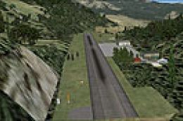
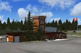
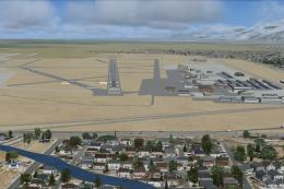
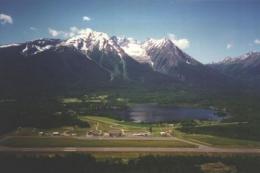
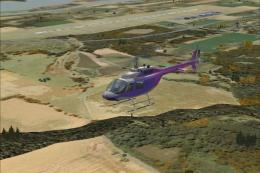
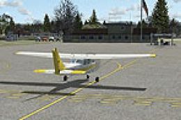
Lake Toba Regional Airport (WIDT) brings Indonesia’s iconic caldera lake region to life in FSX with a detailed airfield environment that supports believable regional flights and scenic approaches. The scenery enhances runway and apron presentation, adds airport-side structures, and improves the overall sense of place around Lake Toba.
 Indonesia
 - File: widt.zip
- Size:7.76 KB
- Scan:
Clean (9d)

- Access:Freeware
- Content:Everyone

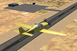
Lake Toba Regional Airport (WIDT). Lake Toba is the largest lake in Indonesia. By Ikhsan Ramadhan Ritonga.

Finding the Scenery
- FSX/Prepar3D Coordinates:
-
2.68880000,98.87540000
Use the downloaded flight plan file by launching FSX/P3D, selecting "Load Flight Plan" in the flight planner, and choosing the .pln file. Your aircraft will be positioned directly at the add-on’s location. - Decimal Degrees (DD):
-
Latitude: 2.688800°
Longitude: 98.875400° - Degrees, Minutes, Seconds (DMS):
-
Latitude: 2° 41' 19.680" N
Longitude: 98° 52' 31.440" E
Map Location
The archive widt.zip has 5 files and directories contained within it.
File Contents
This list displays the first 500 files in the package. If the package has more, you will need to download it to view them.
| Filename/Directory | File Date | File Size |
|---|---|---|
| WIDT_ADEX_IXAN.BGL | 04.06.11 | 19.81 kB |
| WIDT_ADEX_IXAN_CVX.bgl | 04.06.11 | 213 B |
| Readme.txt | 04.10.11 | 142 B |
| flyawaysimulation.txt | 10.29.13 | 959 B |
| Go to Fly Away Simulation.url | 01.22.16 | 52 B |
Installation Instructions
Most of the freeware add-on aircraft and scenery packages in our file library come with easy installation instructions which you can read above in the file description. For further installation help, please see our Flight School for our full range of tutorials or view the README file contained within the download. If in doubt, you may also ask a question or view existing answers in our dedicated Q&A forum.


0 comments
Leave a Response