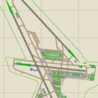
AFX For LSZH
Tailored for Microsoft Flight Simulator X, this AFX / AFCAD rebuild brings Zurich-Kloten LSZH up to date with a new instrument landing system on runway 28, accurate parking stand coding across aprons B, D, G and T, plus corrected west-side stands replacing out-of-service gates, ensuring orderly AI traffic behaviour.

- 49.96 KB

- 354

- 1