 FS2004 Scenery
UK Landclass for Southern England
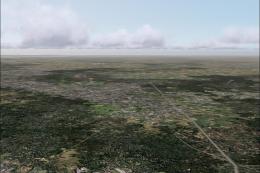
Realistic, pleasing and recognisable ground scenery over Hampshire and neighb…
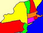
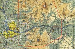
New York and New England terrain mesh sharpens mountains, valleys, and coastlines across the northeastern United States, bringing more convincing elevation detail to flights in FS2004. Built from USGS and NASA Shuttle Radar Topography Mission 1-arc second data and resampled to LOD 10, it covers New York, New England, and large surrounding areas into southern Ontario.
Free for all simmers · 161.57 MB · Scanned clean Jul 2026
Download speed: Free tier is capped at 0.5 Mbps (this file takes approximately 45 mins at the cap). PRO members download at full line speed.
FS9\Aircraft\, FS9\Addon Scenery\, FS9\Gauges\, or FS9\Effects\.readme.txt or README file. It tells you exactly where files go, what dependencies are needed, and any quirks specific to this add-on.The archive nynemesh.zip has 9 files and directories contained within it.
This list displays the first 500 files in the package. If the package has more, you will need to download it to view them.
| Filename/Directory | File Date | File Size |
|---|---|---|
| scenery | 01.16.04 | 0 B |
| ny_ne_1arc_lod10.bgl | 01.16.04 | 163.27 MB |
| texture | 12.01.03 | 0 B |
| Addon Scenery | 12.01.03 | 0 B |
| file_id.diz | 01.16.04 | 755 B |
| nyne_scenery.gif | 01.16.04 | 5.64 kB |
| readme.txt | 01.16.04 | 3.16 kB |
| flyawaysimulation.txt | 10.29.13 | 959 B |
| Go to Fly Away Simulation.url | 01.22.16 | 52 B |
Only PRO members can place votes.
More FS2004 add-ons hand-picked based on this download.
FS2004 Scenery
Realistic, pleasing and recognisable ground scenery over Hampshire and neighb…
 FS2004 Scenery
(N49-53, W112-116). All lake elevations are adjusted for best fit with the me…
 FS2004 Scenery
(N49-53, W116-120). All lake elevations are adjusted for best fit with the me…
 FS2004 Scenery
This comprehensive terrain mesh package provides an enhanced representation o…
 FS2004 Scenery
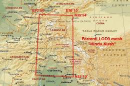
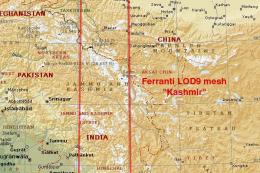
This freeware add-on provides an enhanced terrain mesh focused on coordinates…
 FS2004 Scenery
Scenery for the Trinidad and Tobago main airport Piarco (TTPG) is a small zip…
 FS2004 Scenery
Made only for FS2004 and will not work in previous versions. These files add …
 FS2004 Scenery
FS2004 Columbia River Gorge And Volcanoes. Complete replacement of the defaul…
Be the first to leave a comment on this download.
Be the first to share your thoughts on this download.