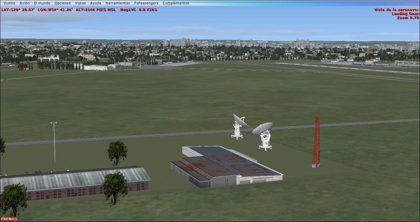
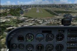
FSX Campo Grande International Airport Scenery
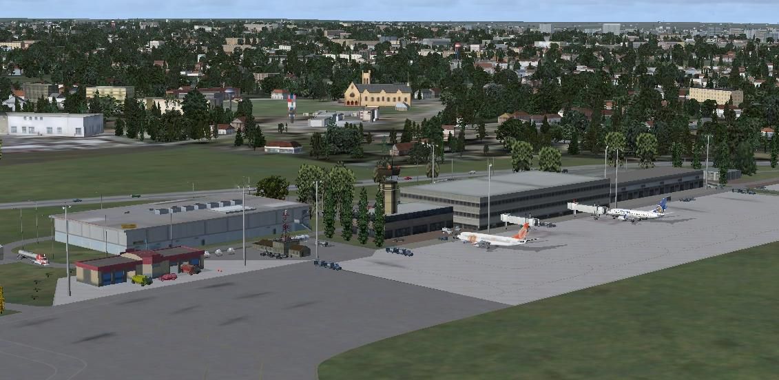
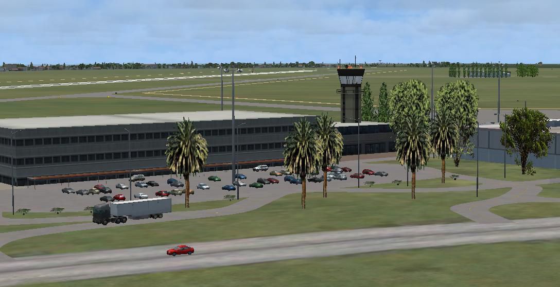
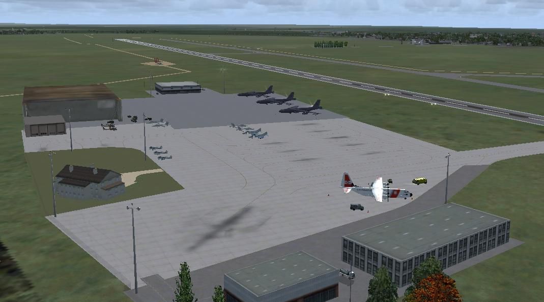
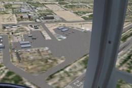
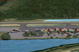
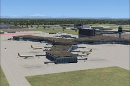
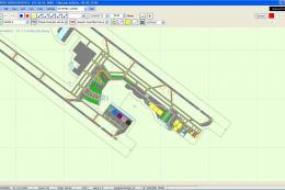
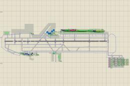
Campo Grande International Airport (SBCG) brings Mato Grosso do Sul, Brazil to life with a detailed terminal area and airfield layout built largely from native assets. Designed for FSX, it requires the Acceleration pack libraries and includes an extra radar object, delivering a cohesive, performance-friendly airport environment for regional and domestic operations.

 Brazil
 - File: sbcg.zip
- Size:5.72 MB
- Scan:
Clean (22d)

- Access:Freeware
- Content:Everyone
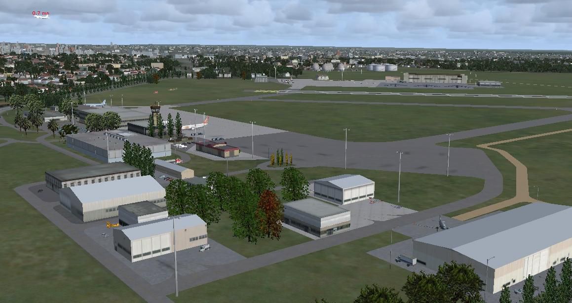
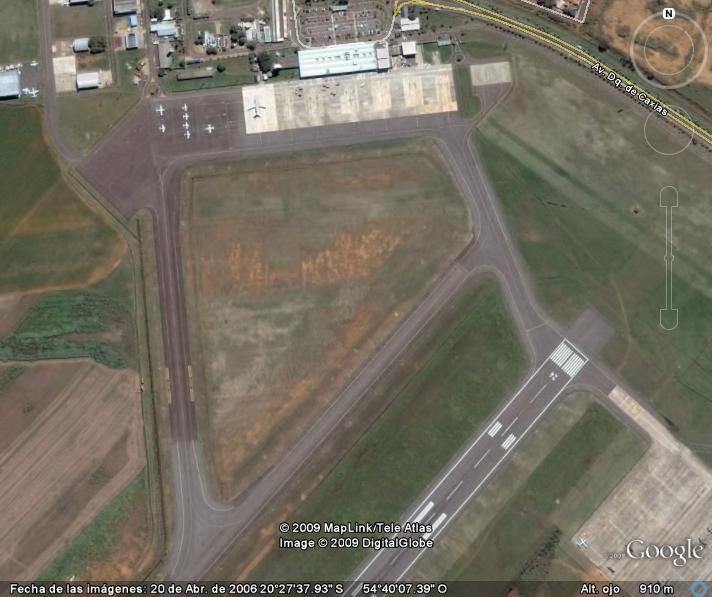
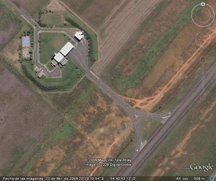
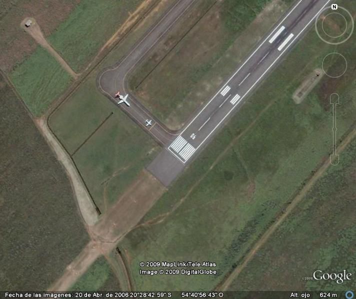
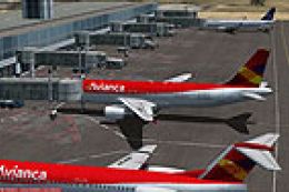
Campo Grande International Airport, Mato Grosso de Sul, Brazil (SBCG). By Cristobal Laje.
Campo Grande International Airport Scenery.
Requirements for use and you'll enjoy the scenery:
The scenario was made with default objects for Flight Simulator X (R) Acceleration (R) pack. It has not been tested with others versions of FSX! All items except the radar that is attached to this folder, belong to the libraries of fsx acceleration pack.
INSTALATION:
1) Copy the SBCG folder into your ADDON SCENERY of FSX.
2) Open the Settings/Scenery Library and "add Area".
3) Select the SBCG folder and click "OK" for adds the new area.
Enjoy!
Campo Grande International Airport Scenery.
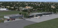
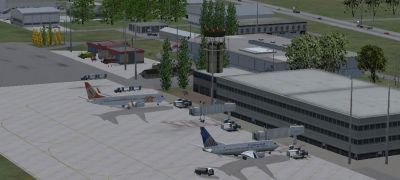
Images & Screenshots


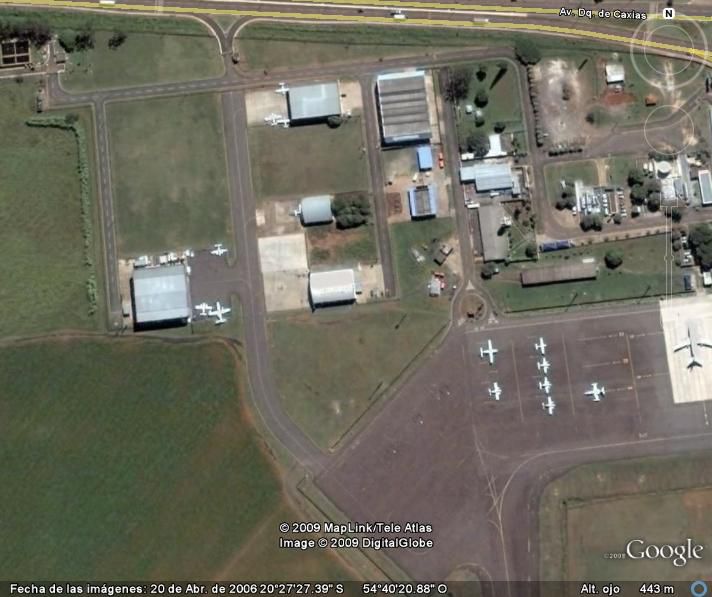


Finding the Scenery
- FSX/Prepar3D Coordinates:
-
-20.46860000,-54.67260000
Use the downloaded flight plan file by launching FSX/P3D, selecting "Load Flight Plan" in the flight planner, and choosing the .pln file. Your aircraft will be positioned directly at the add-on’s location. - Decimal Degrees (DD):
-
Latitude: -20.468600°
Longitude: -54.672600° - Degrees, Minutes, Seconds (DMS):
-
Latitude: 20° 28' 06.960" S
Longitude: 54° 40' 21.360" W
Map Location
The archive sbcg.zip has 75 files and directories contained within it.
File Contents
This list displays the first 500 files in the package. If the package has more, you will need to download it to view them.
| Filename/Directory | File Date | File Size |
|---|---|---|
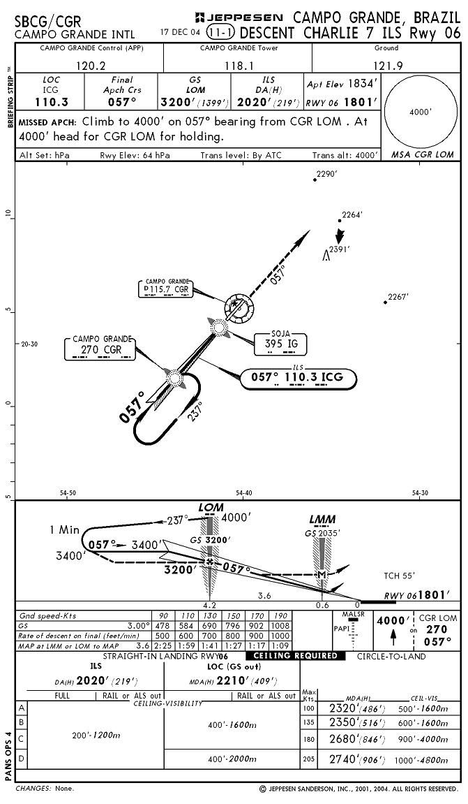
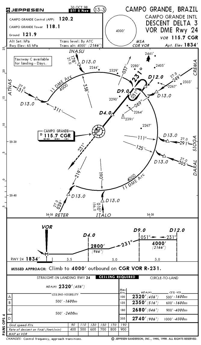
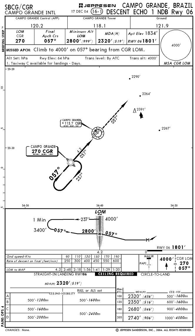
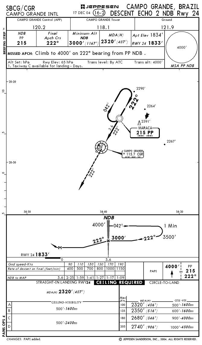
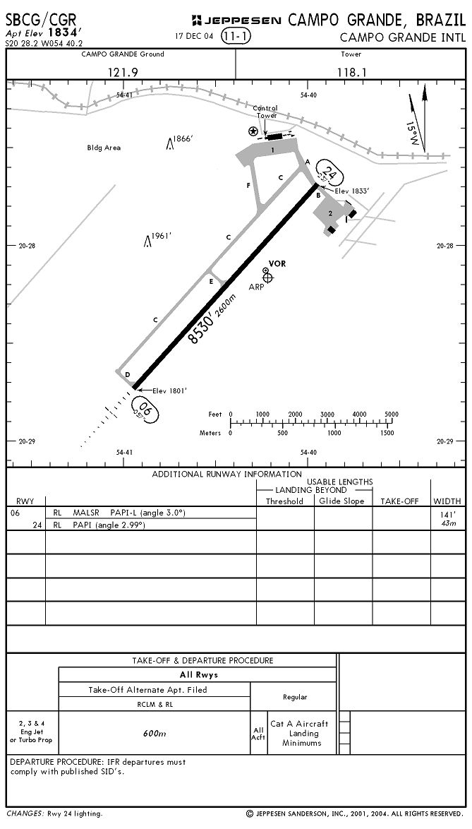
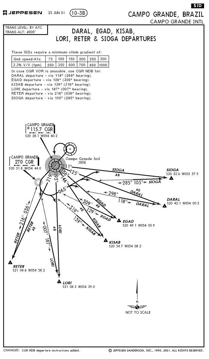
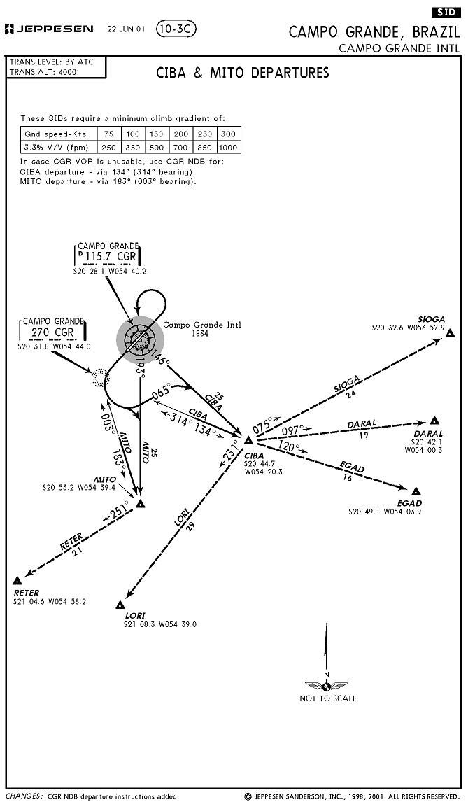
| Charts | 11.07.09 | 0 B |
| 10-3.JPG | 11.07.09 | 91.15 kB |
| 10-3A.JPG | 11.07.09 | 79.27 kB |
| 10-3B.JPG | 11.07.09 | 102.24 kB |
| 10-3C.JPG | 11.07.09 | 86.74 kB |
| 10-4.JPG | 11.07.09 | 163.79 kB |
| 11-1.JPG | 11.07.09 | 130.02 kB |
| 11-2.JPG | 11.07.09 | 138.68 kB |
| 11-3.JPG | 11.07.09 | 138.18 kB |
| 11-5.JPG | 11.07.09 | 157.71 kB |
| 11-6.JPG | 11.07.09 | 137.55 kB |
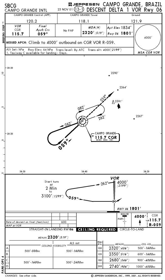
| 13-1.JPG | 11.07.09 | 111.82 kB |
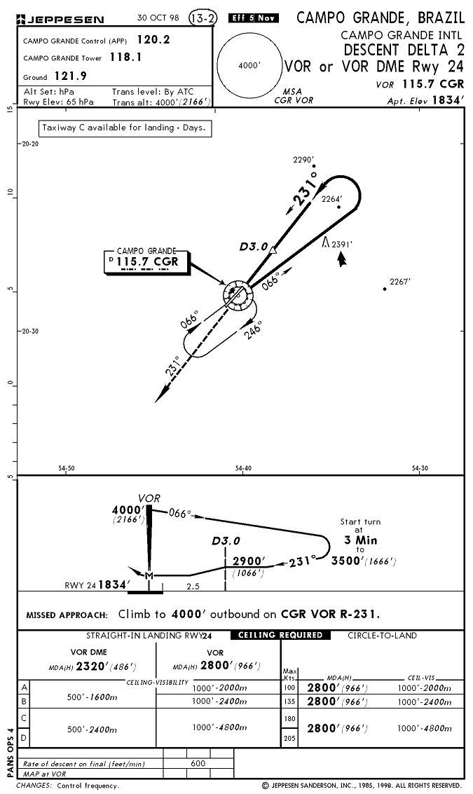
| 13-2.JPG | 11.07.09 | 105.39 kB |
| 13-3.JPG | 11.07.09 | 128.23 kB |
| 16-1.JPG | 11.07.09 | 118.10 kB |
| 16-2.JPG | 11.07.09 | 112.02 kB |
| Airport.JPG | 11.07.09 | 241.56 kB |
| Thumbs.db | 11.07.09 | 75.50 kB |
| INFO.txt | 11.07.09 | 2.00 kB |
| Install.txt | 11.07.09 | 1.21 kB |
| RADAR.txt | 10.29.08 | 118 B |
| Radar_readme.txt | 11.07.09 | 963 B |
| Readme_lights.txt | 11.06.08 | 2.51 kB |
| readme_lights_credits.txt | 11.06.08 | 2.51 kB |
| SBCG_PICS | 11.07.09 | 0 B |
| Civil_1.JPG | 11.07.09 | 109.56 kB |
| Civil_2.JPG | 11.07.09 | 99.14 kB |
| Civil_3.JPG | 11.07.09 | 104.99 kB |
| Civil_4.JPG | 11.07.09 | 50.61 kB |
| Civil_5.JPG | 11.07.09 | 65.71 kB |
| Front.JPG | 11.07.09 | 81.74 kB |
| Mil_1.JPG | 11.07.09 | 67.85 kB |
| Radar.JPG | 11.07.09 | 580.13 kB |
| Thumbs.db | 11.07.09 | 59.00 kB |
| SBCG_SATELLITE | 11.07.09 | 0 B |
| CABECERA SUR.jpg | 10.31.09 | 57.19 kB |
| MEDIO.jpg | 10.31.09 | 58.97 kB |
| Mil.jpg | 10.31.09 | 69.05 kB |
| TERMINAL_1.jpg | 10.31.09 | 59.47 kB |
| Terminal_2.jpg | 10.31.09 | 61.51 kB |
| Thumbs.db | 11.07.09 | 40.50 kB |
| TOTAL.jpg | 10.31.09 | 75.24 kB |
| Scenery | 11.07.09 | 0 B |
| C130 Coast Guard USA Library.bgl | 08.12.09 | 679.70 kB |
| C130 Coast Guard USA Library.xml | 08.12.09 | 251 B |
| F4 Hellenic library.bgl | 07.16.09 | 549.82 kB |
| F4 hellenic Library.xml | 07.16.09 | 247 B |
| Gazelle Helicopter Library.bgl | 10.18.09 | 1.15 MB |
| Gazelle Helicopter Library.xml | 10.18.09 | 365 B |
| Gloster Meteor.bgl | 09.17.09 | 1.43 MB |
| Gloster Meteor.xml | 09.17.09 | 364 B |
| lightobj.bgl | 11.06.08 | 643.63 kB |
| lightobj.txt | 11.06.08 | 547 B |
| RADAR.bgl | 10.29.08 | 524.90 kB |
| SBCG.BGL | 11.07.09 | 72.41 kB |
| SBCG_CVX.bgl | 11.07.09 | 1.69 kB |
| Statics_Aircrafts_credits.txt | 11.07.09 | 455 B |
| Texture | 11.07.09 | 0 B |
| almwht.dds | 10.16.08 | 64.12 kB |
| asr9.dds | 10.29.08 | 128.12 kB |
| C130 USA Coast Guard 1.bmp | 08.12.09 | 512.07 kB |
| F4 Hellenic Fuselage 2.bmp | 07.16.09 | 128.07 kB |
| F4 hellenic Intake_R.bmp | 07.16.09 | 32.07 kB |
| F4 Hellenic Tail.bmp | 07.16.09 | 128.07 kB |
| F4 Hellenic Untitled-2.bmp | 07.16.09 | 128.07 kB |
| F4 Hellenic Wings.bmp | 07.16.09 | 512.07 kB |
| Gazelle Texture France Camouflage.bmp | 10.18.09 | 512.07 kB |
| lights1.dds | 11.06.08 | 32.12 kB |
| Meteor texture Netherlands.bmp | 09.17.09 | 512.07 kB |
| Meteor texture UK.bmp | 09.17.09 | 512.07 kB |
| RADAR.txt | 10.29.08 | 118 B |
| Thumbs.db | 11.07.09 | 31.00 kB |
| SBCG | 11.07.09 | 0 B |
| flyawaysimulation.txt | 10.29.13 | 959 B |
| Go to Fly Away Simulation.url | 01.22.16 | 52 B |
Installation Instructions
Most of the freeware add-on aircraft and scenery packages in our file library come with easy installation instructions which you can read above in the file description. For further installation help, please see our Flight School for our full range of tutorials or view the README file contained within the download. If in doubt, you may also ask a question or view existing answers in our dedicated Q&A forum.


0 comments
Leave a Response