FSX Williamson County Regional Airport Scenery
Williamson County Regional Airport (KMWA) in Marion, Illinois comes to life with upgraded terminal structures, refined runway and apron textures, custom lighting for confident night taxiing, and detail-rich object placement that improves ground flow and approaches. Built for Microsoft Flight Simulator X, it also aligns signage, layout elements, and local landmarks for authentic southern Illinois context.


 United States of America
 - File: kmwa_marionil.zip
- Size:475.28 KB
- Scan:
Clean (4d)

- Access:Freeware
- Content:Everyone
This freeware rendition of Williamson County Regional Airport (KMWA), located in Marion, Illinois (IL), USA, integrates carefully enhanced terminal structures, custom lighting arrays, and detail-rich object placements. Created by Jimmy R. Martin, this scenery package optimizes the airfield’s immersion for those utilizing Microsoft Flight Simulator X. Subtle yet significant changes refine the visual environment and correct various layout elements, making approaches and ground activity more realistic.
Enhanced Airfield Components
- Primary and Secondary Runways: Upgraded textures ensure smooth transitions between runway, taxiway, and apron surfaces.
- Apron Configurations: Additional static objects enrich the atmosphere, replicating the local feel of Marion, Illinois.
- Optimized Lighting: Custom illuminations modernize night flying operations and enable clearer taxi guidance.
- Scenery Integration: Placement of region-specific landmarks contextualizes the airport within southern Illinois.
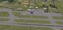
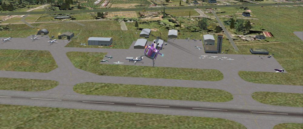
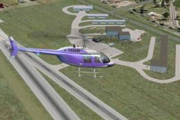
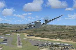
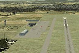
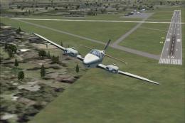
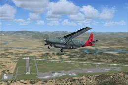
Screenshot of Williamson County Regional Airport during the day.
A Personal Anecdote from the Developer
Back in 1964, while I served as Minister of Music and Education for Pleasant Ridge Baptist Church, our Sunday School materials were delayed in shipment. I volunteered to accompany the pastor’s son, Charlie Dollar, in a Cessna 172 flight to Nashville to pick up the supplies. On the return leg, the aircraft began to backfire severely. We attempted to contact KMWA’s tower but received no initial response.
Switching to the emergency frequency on 121.5 connected us with KCGI, who then informed us that KMWA’s tower radio had been disabled by a lightning strike and suggested using their ground channel. Upon touchdown, we allowed the engine to cool fully, and following a successful test run, we took off again. The mechanics on site had some reservations, but I assured them of my familiarity with field landings.
We eventually arrived at Greenville, Illinois, where a mechanic greeted us in a rather heated manner. He hopped into the cockpit to verify the plane’s condition and nearly lost control upon takeoff. After landing with a somewhat pale expression, he decided to ferry the aircraft back to St. Louis and reevaluate his recent overhaul work.
— Jimmy R. Martin
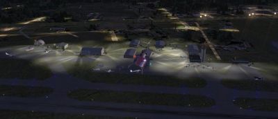
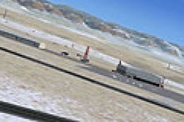
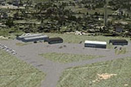
Screenshot of Williamson County Regional Airport at night.
Further Technical Improvements
- Taxiway Signage Adjustments: Ensures correct routing and minimizes confusion near the airport’s main ramp.
- Ground Frequency Updates: Reflects an accurate communication setup, consistent with modern FAA conventions.
- Regional Context: Incorporates subtle farmland and small-town scenery elements that characterize Williamson County’s environment.
Images & Screenshots

Finding the Scenery
- FSX/Prepar3D Coordinates:
-
37.75000000,-88.77000000
Use the downloaded flight plan file by launching FSX/P3D, selecting "Load Flight Plan" in the flight planner, and choosing the .pln file. Your aircraft will be positioned directly at the add-on’s location. - Decimal Degrees (DD):
-
Latitude: 37.750000°
Longitude: -88.770000° - Degrees, Minutes, Seconds (DMS):
-
Latitude: 37° 45' 00.000" N
Longitude: 88° 46' 12.000" W
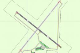
Map Location
The archive kmwa_marionil.zip has 19 files and directories contained within it.
File Contents
This list displays the first 500 files in the package. If the package has more, you will need to download it to view them.
| Filename/Directory | File Date | File Size |
|---|---|---|
| AirNav KMWA - Williamson County Regional Airport.url | 03.16.11 | 123 B |
| file_id.diz | 03.18.11 | 128 B |
| KMWA.txt | 03.16.11 | 128 B |
| PS0127.jpg | 03.18.11 | 56.88 kB |
| PS0128.jpg | 03.18.11 | 91.80 kB |
| ramp lights.txt | 01.25.11 | 458 B |
| README.txt | 03.16.11 | 1.84 kB |
| scenery | 03.18.11 | 0 B |
| KMWA_ADEX_JTM.ad2.ad2 | 03.16.11 | 150.42 kB |
| KMWA_ADEX_JTM.BGL | 03.16.11 | 10.29 kB |
| KMWA_jRm_IS.bgl | 03.18.11 | 4.40 kB |
| RampLight_Library.bgl | 01.11.05 | 30.63 kB |
| Thumbs.db | 05.14.06 | 208.50 kB |
| texture | 03.18.11 | 0 B |
| ESDG_ramp.BMP | 01.09.05 | 32.07 kB |
| ESDG_ramp_lm.BMP | 01.09.05 | 32.07 kB |
| KMWA_Marion IL | 03.18.11 | 0 B |
| flyawaysimulation.txt | 10.29.13 | 959 B |
| Go to Fly Away Simulation.url | 01.22.16 | 52 B |
Installation Instructions
Most of the freeware add-on aircraft and scenery packages in our file library come with easy installation instructions which you can read above in the file description. For further installation help, please see our Flight School for our full range of tutorials or view the README file contained within the download. If in doubt, you may also ask a question or view existing answers in our dedicated Q&A forum.

0 comments
Leave a Response