FSX Governors Harbour Airport Scenery
Governors Harbour Airport (MYEM) on Eleuthera gets a sharper, satellite-referenced layout with corrected runway placement near the shoreline, upgraded ramps and signage, custom hangars, and realistic night lighting with ramp lamps. Includes static GA aircraft, local clutter and ground activity for a lived-in feel in Microsoft Flight Simulator X, and requires the FSX Acceleration Pack.

 Bahamas
 - File: myem.zip
- Size:1.02 MB
- Scan:
Clean (26d)

- Access:Freeware
- Content:Everyone
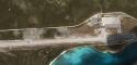
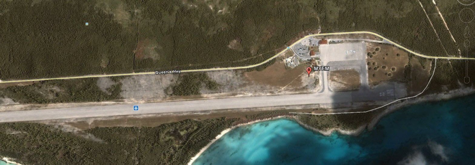
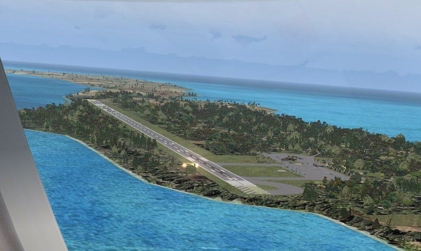
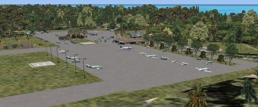
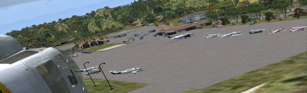
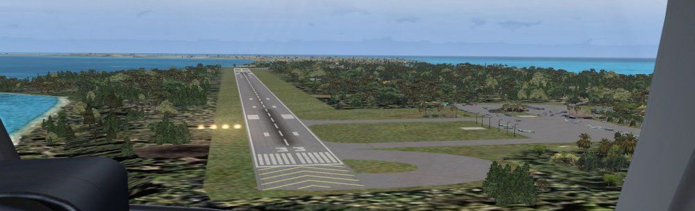
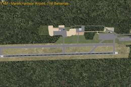
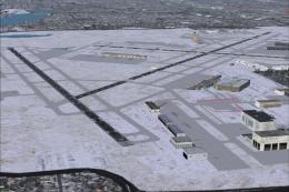
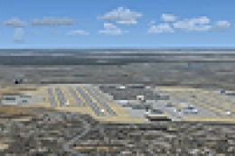
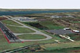
Experience a refined depiction of Governors Harbour Airport, located on Eleuthera in the Bahamas, through this freeware scenery package by Jimmy R. Martin. It requires the FSX Acceleration Pack and presents an immersive environment complete with precision runway positioning, detailed hangars, and realistic lighting. Designers used satellite data from Google Earth to replicate the airport’s true layout, resulting in an authentic coastal approach.
Detailed Rendering of Airport Features
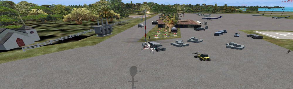
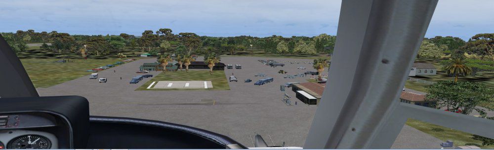
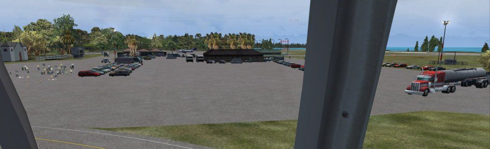
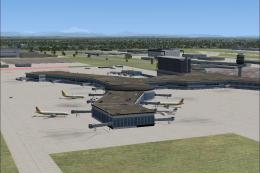
This custom scenery integrates static general aviation aircraft (provided by gaplane1.zip), airborne traffic, and meticulously placed structures. The package upgrades ramps, signage, and local ground traffic, creating a richer atmosphere for Microsoft Flight Simulator X enthusiasts who want a more authentic region to explore.

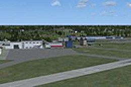
Above: Governors Harbour Airport with enhanced ground textures and static models.
Required Components and Installation Steps
- FSX Acceleration Pack must be installed beforehand.
- Search for gaplane1.zip and install it to enable additional aircraft objects.
- Locate any existing MYEM files in your add-on scenery folders and remove them to avoid conflicts.
- This add-on is not compatible with certain Bahamas Sea Plane tour packages.
- Ensure you place both provided folders into your primary add-on scenery directory before loading Microsoft Flight Simulator X.
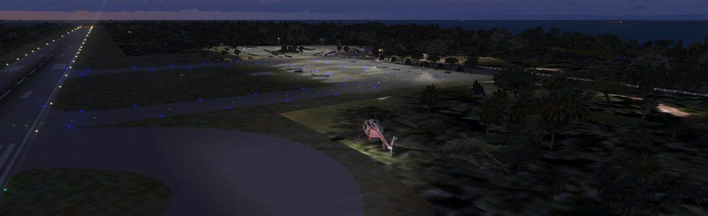
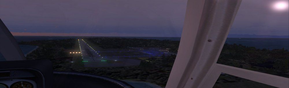
Enhanced Lighting and Coastal Placement
The runway lighting system has been tailored for nighttime operations and features individual ramp lights to improve visibility. Because of real-world positioning, the entire airport was shifted slightly west, closer to the shoreline, improving approach realism and relevancy to the actual Bahamas environment.
Above: Detailed ramp and shore-facing runway in the Governors Harbour area.
Notable Technical Enhancements
- Objects and People
- Scattered around the apron to simulate local ground crews and travelers, improving immersion.
- Photo-Referenced Layout
- Runway and taxiways are oriented using satellite imagery, reducing discrepancies between in-sim visuals and real-world data.
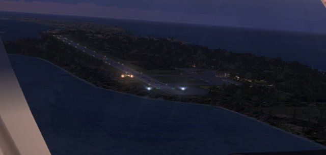
- Improved Shoreline Accuracy
- Optimized to mirror the proximity of the runway to the Atlantic coast, providing a scenic departure over the turquoise waters.
All these details combined deliver a faithful interpretation of Governors Harbour Airport while maintaining smooth performance in Microsoft Flight Simulator X. This scenery is presented by Jimmy R. Martin, whose goal was to recreate the airport’s unique charm and offer simmers an engaging Bahamian destination for GA flights and beyond.
Images & Screenshots

Finding the Scenery
- FSX/Prepar3D Coordinates:
-
25.28470000,-76.33100000
Use the downloaded flight plan file by launching FSX/P3D, selecting "Load Flight Plan" in the flight planner, and choosing the .pln file. Your aircraft will be positioned directly at the add-on’s location. - Decimal Degrees (DD):
-
Latitude: 25.284700°
Longitude: -76.331000° - Degrees, Minutes, Seconds (DMS):
-
Latitude: 25° 17' 04.920" N
Longitude: 76° 19' 51.600" W
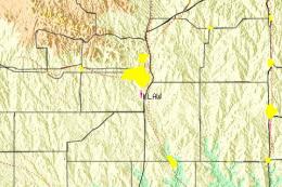
Map Location
The archive myem.zip has 29 files and directories contained within it.
File Contents
This list displays the first 500 files in the package. If the package has more, you will need to download it to view them.
| Filename/Directory | File Date | File Size |
|---|---|---|
| AirNav MYEM - Governors Harbour Airport.url | 03.29.11 | 180 B |
| fiel_id.diz | 03.29.11 | 216 B |
| PS0195.jpg | 03.28.11 | 178.12 kB |
| PS0196.jpg | 03.29.11 | 18.29 kB |
| PS0197.jpg | 03.29.11 | 83.74 kB |
| PS0198.jpg | 03.29.11 | 56.08 kB |
| PS0199.jpg | 03.29.11 | 27.71 kB |
| PS0200.jpg | 03.29.11 | 36.32 kB |
| PS0201.jpg | 03.29.11 | 86.78 kB |
| PS0202.jpg | 03.29.11 | 66.08 kB |
| PS0203.jpg | 03.29.11 | 52.27 kB |
| PS0204.jpg | 03.29.11 | 50.23 kB |
| PS0205.jpg | 03.29.11 | 69.12 kB |
| pspbrwse.jbf | 03.29.11 | 4.67 kB |
| ramp lights.txt | 01.25.11 | 458 B |
| README.txt | 03.29.11 | 1.08 kB |
| scenery | 03.29.11 | 0 B |
| MYEM_ADEX_JTM.ad2.ad2 | 03.29.11 | 146.13 kB |
| MYEM_ADEX_JTM.BGL | 03.29.11 | 6.87 kB |
| MYEM_ADEX_JTM_CVX.bgl | 03.29.11 | 814 B |
| MYEM_FSXP.bgl | 03.29.11 | 9.17 kB |
| RampLight_Library.bgl | 01.11.05 | 30.63 kB |
| Thumbs.db | 05.14.06 | 208.50 kB |
| texture | 03.29.11 | 0 B |
| ESDG_ramp.BMP | 01.09.05 | 32.07 kB |
| ESDG_ramp_lm.BMP | 01.09.05 | 32.07 kB |
| MYEM | 03.29.11 | 0 B |
| flyawaysimulation.txt | 10.29.13 | 959 B |
| Go to Fly Away Simulation.url | 01.22.16 | 52 B |
Installation Instructions
Most of the freeware add-on aircraft and scenery packages in our file library come with easy installation instructions which you can read above in the file description. For further installation help, please see our Flight School for our full range of tutorials or view the README file contained within the download. If in doubt, you may also ask a question or view existing answers in our dedicated Q&A forum.

0 comments
Leave a Response