FSX Canyonlands Field/Moab Airport
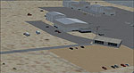
Canyonlands Field/Moab Airport (KCNY) for Microsoft Flight Simulator X refreshes the default field with taxiways and ramp layout aligned to satellite imagery and FAA data. It adds hangars, terminal, Redtail Aviation FBO, GA and helipad parking, fuel services, static aircraft, and detailed ground clutter for a livelier southeast Utah hub.
 United States of America
 - File: kcny_canyonlands_moab_airport_ut.zip
- Size:3.04 MB
- Scan:
Clean (8d)

- Access:Freeware
- Content:Everyone

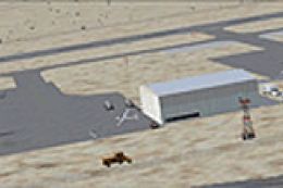
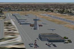
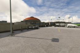
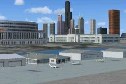
Canyonlands Field/Moab Airport, Utah (UT), USA. AFCAD for default/stock FSX airport. Made with ADE 9X. Canyonlands Field is located in Southeast Utah and is currently served by Great Lakes Airlines with daily flights to Denver. This updates the airport according to Google satellite imagery and the latest FAA data. Revises all the taxiways, ramp, adds all the hangars, the terminal, Redtail Aviation FBO, and more. See the readme for more details. By Matthew Hollcraft.
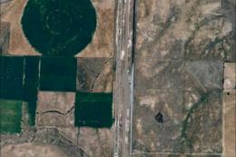
Aerial view of Canyonlands Field/Moab Airport.
Files:
KCNY_ADEX_MH: AFCAD
KCNY_ADEX_MH_CVX: Removes autogen
Installation:
Take the two BGL files (KCNY_ADEX_MH and KCNY_ADEX_MH_CVX) and place them in your Flight Simulator X/Addon Scenery/scenery folder.
This AFCAD updates all the taxiways using Google satellite imagery. Extends and updates the ramp, adds the terminal with 1 gate, a fuel truck, GA parking, Redtail Aviation FBO, helipads, static aircraft, a parking lot, and other "eye candy" around the field.

Finding the Scenery
- FSX/Prepar3D Coordinates:
-
38.76000000,-109.75000000
Use the downloaded flight plan file by launching FSX/P3D, selecting "Load Flight Plan" in the flight planner, and choosing the .pln file. Your aircraft will be positioned directly at the add-on’s location. - Decimal Degrees (DD):
-
Latitude: 38.760000°
Longitude: -109.750000° - Degrees, Minutes, Seconds (DMS):
-
Latitude: 38° 45' 36.000" N
Longitude: 109° 45' 00.000" W
Map Location
The archive kcny_canyonlands_moab_airport_ut.zip has 7 files and directories contained within it.
File Contents
This list displays the first 500 files in the package. If the package has more, you will need to download it to view them.
| Filename/Directory | File Date | File Size |
|---|---|---|
| 1.BMP | 12.08.12 | 3.89 MB |
| 2.BMP | 12.08.12 | 3.89 MB |
| KCNY_ADEX_MH.BGL | 12.08.12 | 10.08 kB |
| KCNY_ADEX_MH_CVX.bgl | 12.08.12 | 258 B |
| Readme.txt | 12.08.12 | 2.65 kB |
| flyawaysimulation.txt | 10.29.13 | 959 B |
| Go to Fly Away Simulation.url | 01.22.16 | 52 B |
Installation Instructions
Most of the freeware add-on aircraft and scenery packages in our file library come with easy installation instructions which you can read above in the file description. For further installation help, please see our Flight School for our full range of tutorials or view the README file contained within the download. If in doubt, you may also ask a question or view existing answers in our dedicated Q&A forum.

0 comments
Leave a Response