FS2004 Aviation Weather Information System
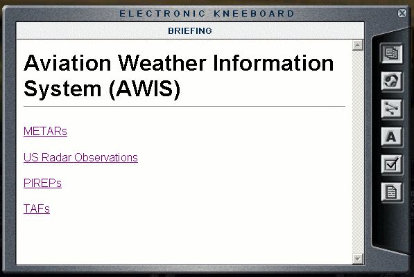
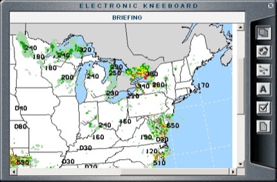
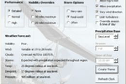
Aviation Weather Information System (AWIS) brings real-world weather briefings into the FS2004 kneeboard using clear, graphic HTML pages sourced from NOAA’s aviationweather.gov. Check METARs, national radar with cloud-top heights, PIREPs for icing and turbulence, plus decoded and raw TAF lookups for faster, better-informed route planning.

 5/5
(1)
1.2K downloads
FS2004
5/5
(1)
1.2K downloads
FS2004
- File: awis.zip
- Size:200.36 KB
- Scan:
Clean (25d)

- Access:Freeware
- Content:Everyone
Aviation Weather Information System (AWIS) v 1.0
This is a collection of HTML pages that can be viewed in the kneeboard giving the sim pilot fingertip access to up-to-date real-wold weather information in qick-to-digest graphic formats.
All content is courtesey of aviationweather.gov (NOAA).
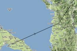
- NOAA METAR Applet
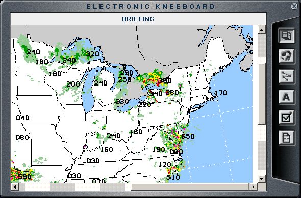
- US National Radar w/ cloud top heights
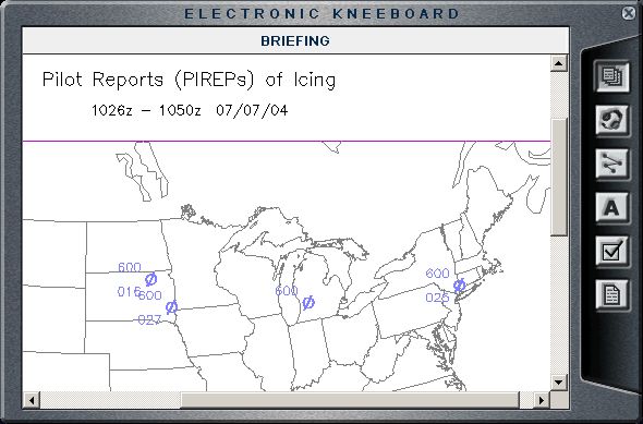
- PIREPs of icing, turbulence and sky condition
- Decoded an raw TAF lookup tool
To uninstall, nuke the AWIS directory and restore the backup of nobrief.htm
I can make way more advanced functionality for the kneeboard (I do ASP.Net apps for a living), but I'm lacking in ideas for it. Got any?
Nick Ruisi
NickRuisi@softhome.net
Images & Screenshots
The archive awis.zip has 13 files and directories contained within it.
File Contents
This list displays the first 500 files in the package. If the package has more, you will need to download it to view them.
| Filename/Directory | File Date | File Size |
|---|---|---|
| README.txt | 07.07.04 | 1.19 kB |
| grab1.gif | 07.07.04 | 55.86 kB |
| grab2.gif | 07.07.04 | 50.70 kB |
| grab3.gif | 07.07.04 | 41.59 kB |
| grab4.gif | 07.07.04 | 41.59 kB |
| nat_radar.htm | 07.04.04 | 147 B |
| itw.htm | 07.05.04 | 971 B |
| metars.htm | 07.04.04 | 4.27 kB |
| index.htm | 07.04.04 | 700 B |
| taf.htm | 07.04.04 | 833 B |
| gpl.txt | 07.07.04 | 17.92 kB |
| flyawaysimulation.txt | 10.29.13 | 959 B |
| Go to Fly Away Simulation.url | 01.22.16 | 52 B |
Installation Instructions
Most of the freeware add-on aircraft and scenery packages in our file library come with easy installation instructions which you can read above in the file description. For further installation help, please see our Flight School for our full range of tutorials or view the README file contained within the download. If in doubt, you may also ask a question or view existing answers in our dedicated Q&A forum.


0 comments
Leave a Response