 FSX Missions
Land of Giants-A French Expedition Mission
Land of Giants-A French Expedition. FSadventureSky FSX Flight. French East Co…
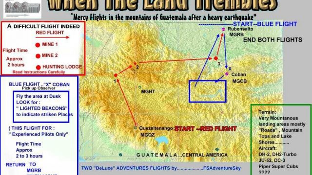
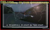
When the Land Trembles delivers a tense Guatemala earthquake SAR scenario for FSX, with two optional routes: a Red evacuation flight to extract wounded miners from a damaged western mine, or a Blue reconnaissance run to assess lake-area impacts and deliver radio gear. Requires included QUETZAL and HRAIN scenery BGLs.
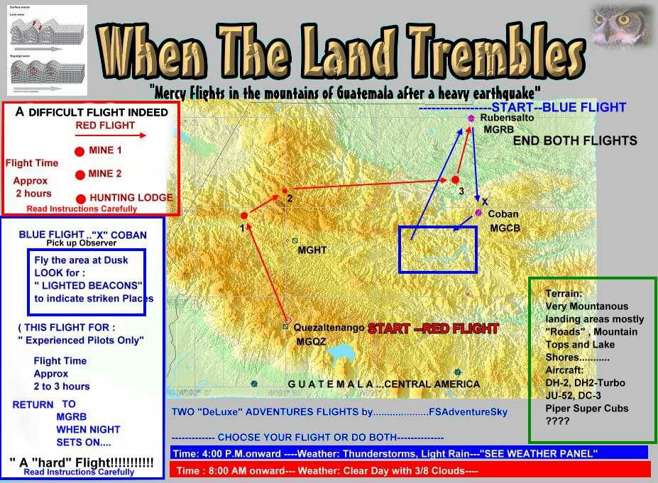

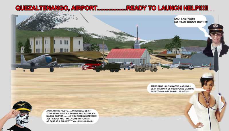
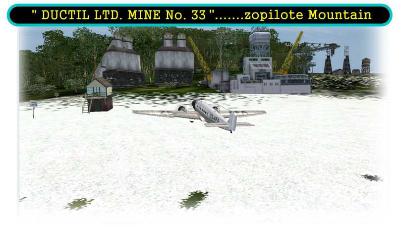
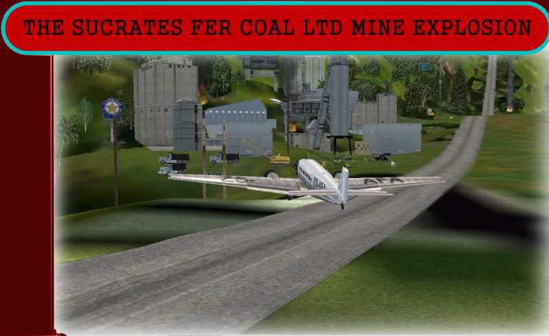
When The Land Trembles. At 8:46 a.m. a 6.2 Earthquake hit the western mountains of Guatemala, Central America. Two flight routes have been set up by the Civil Defense and SAR authorities. They use two airports to reconnoiter their respective areas. It has been reported that two mines in the western Pine Mountains have been heavily hit and in Mine 1 (Socrates Fer Coal Ltd.) there are some wounded miners who must be picked up. You can choose Red flight, where you will use a fair transport since you must pick up the wounded or Blue flight which is a "reconnaissance" flight out to a lake area and access the damage as well as land and bring radio communications equipment to the communities. Either way, this is dangerous stuff. By Gera Godoy C.
When The Land Trembles Mission.
1) Place the..QUETZAL and HRAIN bgl files in your FSX/addon scenery/scenery directory and "activate" them.
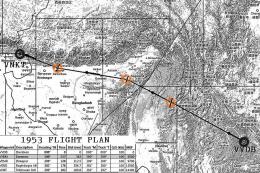
2) Print the Flight Plans jpg for your reference while flying. (Check locations against your MAP in FSX)
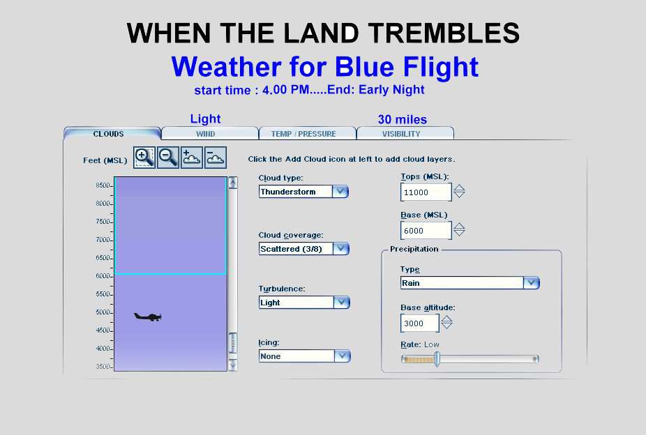
3) Check the Weather for Blue Flight jpg and adjust the weather settings of FSX
That´s it ........You are now ready to start either of the flights.
Enjoy,
Gera.
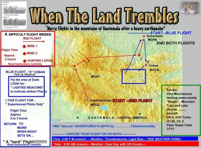
When The Land Trembles Mission flight plans.
Free for all simmers · 460.17 KB · Scanned clean
Download speed: Free tier is capped at 0.5 Mbps. PRO members download at full line speed.
FSX\Missions\ as a sub-folder. The folder must contain an XML file describing the mission.readme.txt or README file. It tells you exactly where files go, what dependencies are needed, and any quirks specific to this add-on.The archive quake.zip has 15 files and directories contained within it.
This list displays the first 500 files in the package. If the package has more, you will need to download it to view them.
| Filename/Directory | File Date | File Size |
|---|---|---|
| mina 2 zopilote.jpg | 10.16.07 | 50.04 kB |
| PORTADA1.jpg | 10.16.07 | 42.60 kB |
| QUETZAL.bgl | 10.18.07 | 4.59 kB |
| QUETZAL-AIRPORT.jpg | 10.18.07 | 50.87 kB |
| weather-blue-flight.jpg | 10.16.07 | 48.22 kB |
| portada.jpg | 10.13.07 | 52.27 kB |
| HRAIN.bgl | 10.14.07 | 6.40 kB |
| FileID.diz | 10.19.07 | 1.37 kB |
| FLIGHT INSTRUCTIONS--TREMBLE.txt | 10.19.07 | 5.21 kB |
| FLIGHT PLANS.jpg | 10.19.07 | 175.32 kB |
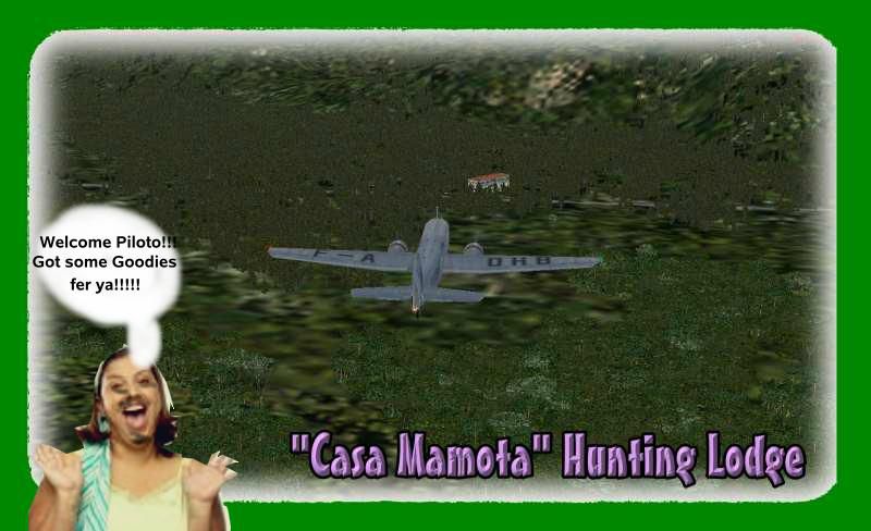
| hunting lodge.jpg | 10.19.07 | 56.26 kB |
| READ ME FIRST.txt | 10.19.07 | 794 B |
| bolita2.GIF | 10.19.07 | 10.24 kB |
| flyawaysimulation.txt | 10.29.13 | 959 B |
| Go to Fly Away Simulation.url | 01.22.16 | 52 B |
More FSX & P3D add-ons hand-picked based on this download.
FSX Missions
Land of Giants-A French Expedition. FSadventureSky FSX Flight. French East Co…
 FSX Missions
Land At The Fly-In. Everyone is waiting and watching for our arrival. Land th…
 FSX Missions
Land The Space Shuttle at NASA's Shuttle Landing Facility in Titusville. Flig…
 FSX Missions
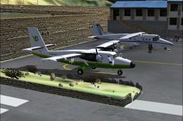
Madagascar Mission. The Madagascarian Military pays you for a transport fligh…
 FSX Missions
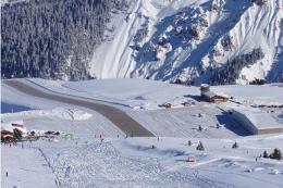
Experience a daring alpine approach with this immersive mission set amid the …
 FSX Missions
Discover a daring and immersive freeware add-on that challenges your landing …
 FSX Missions
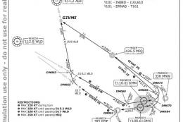
The Most Dangerous Airports: Lukla. The next in The Most Dangerous Airport Mi…
 FSX Missions
Hurricane Landing. Your task is to fly an Airbus A320 from Munich to Hamburg …
Be the first to leave a comment on this download.
Be the first to share your thoughts on this download.