FSX Misaka Japan Real Scenery
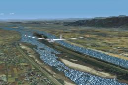
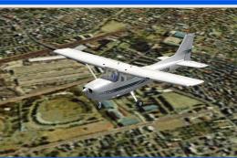
Misaka Japan Real Scenery recreates the Mt. Ena region with detailed terrain and landmark coverage around Magome, Tsumago, and Nakatsugawa City, ideal for low-level sightseeing and approach practice near RJNG Gifu. Built for Microsoft Flight Simulator X, it delivers a cohesive slice of rural Gifu with a natural sense of place.
 Japan
Japan - File: misaka.zip
- Size:50.58 MB
- Scan:
Clean (3d)

- Access:Freeware
- Content:Everyone

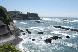
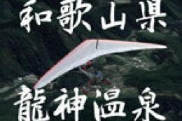
Misaka Japan Real Scenery v1.0. Includes Mt.Ena Magome Tumago Nakatugawa-City Gifu Fly RJNG (Gifu). Scenery by Kenichi Ochiai.

Misaka Japan Real Scenery.

Finding the Scenery
- FSX/Prepar3D Coordinates:
-
35.35970000,136.86760000
Use the downloaded flight plan file by launching FSX/P3D, selecting "Load Flight Plan" in the flight planner, and choosing the .pln file. Your aircraft will be positioned directly at the add-on’s location. - Decimal Degrees (DD):
-
Latitude: 35.359700°
Longitude: 136.867600° - Degrees, Minutes, Seconds (DMS):
-
Latitude: 35° 21' 34.920" N
Longitude: 136° 52' 03.360" E
Map Location
The archive misaka.zip has 7 files and directories contained within it.
File Contents
This list displays the first 500 files in the package. If the package has more, you will need to download it to view them.
| Filename/Directory | File Date | File Size |
|---|---|---|
| misaka | 08.25.08 | 0 B |
| FILE_ID.DIZ | 08.25.08 | 181 B |
| misaka.gif | 08.25.08 | 16.10 kB |
| ochi_masaka.FLT | 08.25.08 | 8.66 kB |
| Ochi_Misaka_FSX.cab | 08.25.08 | 50.55 MB |
| flyawaysimulation.txt | 10.29.13 | 959 B |
| Go to Fly Away Simulation.url | 01.22.16 | 52 B |
Installation Instructions
Most of the freeware add-on aircraft and scenery packages in our file library come with easy installation instructions which you can read above in the file description. For further installation help, please see our Flight School for our full range of tutorials or view the README file contained within the download. If in doubt, you may also ask a question or view existing answers in our dedicated Q&A forum.

0 comments
Leave a Response