FSX Lee Stocking Island Scenery
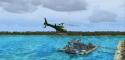
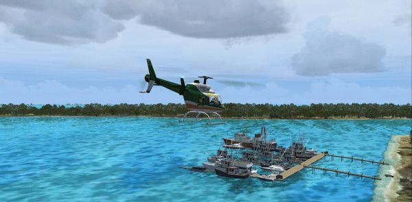
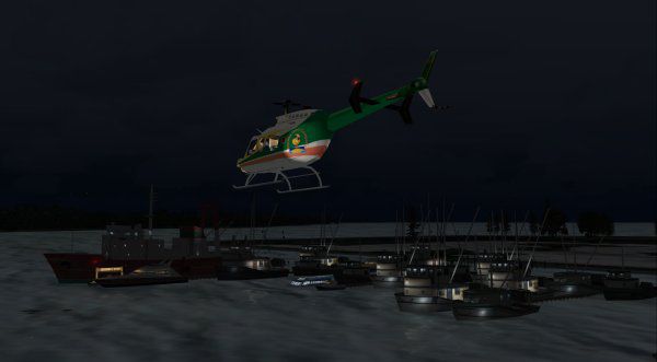
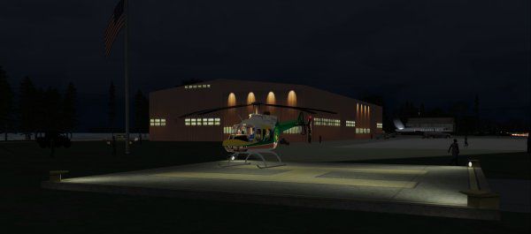
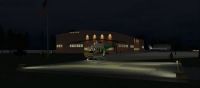
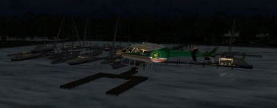
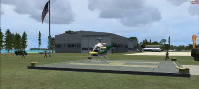
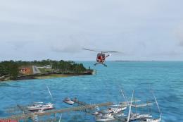
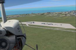
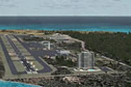
Lee Stocking Island’s Bahamas Research Center comes to life with detailed docks, lively marina ambience, and MS library objects throughout, including playful dolphin animations near the waterfront. Built for FSX, the scenery adds approach lighting guidance and an ILS-equipped main runway for confident day or night arrivals.

 Bahamas
 - File: myxe_jrm.zip
- Size:789.68 KB
- Scan:
Clean (16d)

- Access:Freeware
- Content:Everyone
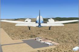
Lee Stocking Island, The Bahamas Research Center. Definitely not photoreal but real nice. Uses all MS library objects. Watch for the dolphins playing around the docks! By Jimmy R. Martin.
Lee Stocking Island Scenery.
ONLY...WILL NOT WORK IN FS9.
Settings set to "normal" to display all features of this addon.
All the scenery files go into your "FSX/addon scenery/scenery" folder.
Approach lighting uses the "ball": blinking white...to high///steady white...on glidepath...red...to low.
I have added ILS to the main runway. FSX night lighting stinks!!!
Screenshots include:
Active Sky Advanced
All FSX scenery sliders to max
American Systems Print Screen Delux
Computer:
Gigabite 64 bit MB
SATA drives
Intel Quad 2.83GHz Processor
4GB DDR2 RAM
64-Bit Operating System
Windows 7 Ultimate 64 Bit
GeForce 275 video card
CH Flight Sim Yoke
Saitek Rudder Peddles
FS Genesis Terrain Mesh
Ultimate Terrain X USA
Tree X (FREEWARE-extremely accurate trees visuals)
Airport Design Editor ADE
FSceneFSX FS9
My Traffic X
FS Realtime
is on my C drive. FS9 is on my D drive. Active Sky Advanced is on my D Drive.
Jimmy R Martin
Lee Stocking Island Scenery.
Images & Screenshots

Finding the Scenery
- FSX/Prepar3D Coordinates:
-
23.77000000,-76.10000000
Use the downloaded flight plan file by launching FSX/P3D, selecting "Load Flight Plan" in the flight planner, and choosing the .pln file. Your aircraft will be positioned directly at the add-on’s location. - Decimal Degrees (DD):
-
Latitude: 23.770000°
Longitude: -76.100000° - Degrees, Minutes, Seconds (DMS):
-
Latitude: 23° 46' 12.000" N
Longitude: 76° 05' 60.000" W
Map Location
The archive myxe_jrm.zip has 17 files and directories contained within it.
File Contents
This list displays the first 500 files in the package. If the package has more, you will need to download it to view them.
| Filename/Directory | File Date | File Size |
|---|---|---|
| 1.gif | 07.12.09 | 90.56 kB |
| 2.bmp | 07.12.09 | 472.90 kB |
| 3.jpg | 07.12.09 | 14.12 kB |
| 4.jpg | 07.12.09 | 15.74 kB |
| 6.jpg | 07.12.09 | 17.47 kB |
| file_id.diz | 07.12.09 | 229 B |
| pspbrwse.jbf | 07.12.09 | 8.74 kB |
| readme.txt | 07.12.09 | 1.09 kB |
| scenery | 07.12.09 | 0 B |
| MYXE_ADE_ADE.BGL | 07.09.09 | 8.03 kB |
| MYXE_ADE_ADE_CVX.bgl | 07.09.09 | 234 B |
| MYXE_ADE_XXX.ade | 07.09.09 | 1018.48 kB |
| MYXE_ADE_XXX.ade.bak | 07.09.09 | 804.46 kB |
| web.gif | 07.12.09 | 38.93 kB |
| MYXE_jRm | 07.12.09 | 0 B |
| flyawaysimulation.txt | 10.29.13 | 959 B |
| Go to Fly Away Simulation.url | 01.22.16 | 52 B |
Installation Instructions
Most of the freeware add-on aircraft and scenery packages in our file library come with easy installation instructions which you can read above in the file description. For further installation help, please see our Flight School for our full range of tutorials or view the README file contained within the download. If in doubt, you may also ask a question or view existing answers in our dedicated Q&A forum.

0 comments
Leave a Response