 FSX Scenery
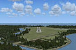
Tarn Farm And Paty's Farm
Tarn Farm And Paty's Farm, UK Tarn Farm and Patty's Farm grass strips; compan…
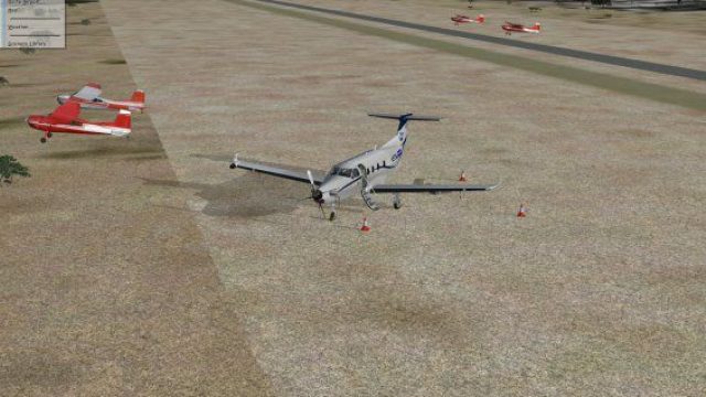
Hay Fever Farm (CO59) refreshes the small airstrip near Galeton, Colorado with sharper placement of farm details and improved surroundings for low-and-slow flying in FSX. It requires the free RWY12 EZ-Scenery object library, and pairs well with Ultimate Terrain USA landclass for more convincing roads, rivers, and terrain context.
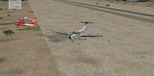
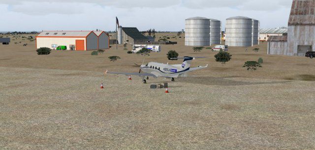
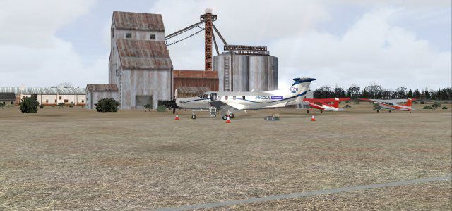
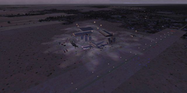
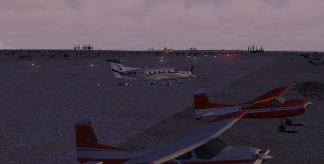

Hay Fever Farm (CO59) update, Galeton, Colorado (CO). Requires free library of Rwy12 - EZ Scenery objects. Ultimate Terrain USA for detailed landclass. By Jimmy R. Martin.
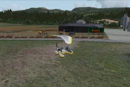
Screenshot of Hay Fever Farm Scenery.
This scenery requires FREE library of RWY12 - EZ scenery objects available on FlightSim.com or AVSIM. I also use FS Scene ground textures & Ultimate Terrain X USA* for landclass and FS Genesis terrain elevation. Either way you can get use of this scenery. Place the folder in your addon scenery and activate.
*Ultimate Terrain US/Canada/UK brings your flight sim experience to life with accurace placement of every road, railroad, river, coastline with tiny islands and other features based on current satellite data.
Screenshot of Hay Fever Farm Scenery.
Free for all simmers · 308.71 KB · Scanned clean Jul 2026
Download speed: Free tier is capped at 0.5 Mbps. PRO members download at full line speed.
FSX\Addon Scenery\ containing scenery and texture sub-folders.readme.txt or README file. It tells you exactly where files go, what dependencies are needed, and any quirks specific to this add-on.Use these coordinates to fly directly to this location once the mod is installed.
40.57000000,-104.57000000
Launch FSX or Prepar3D and use Flights → Load to open the downloaded .pln file. Your aircraft will be positioned at this location.
The archive jrm_co59-1.zip has 21 files and directories contained within it.
This list displays the first 500 files in the package. If the package has more, you will need to download it to view them.
| Filename/Directory | File Date | File Size |
|---|---|---|
| file_id.diz | 11.20.10 | 257 B |
| jrm_CO59 | 11.20.10 | 0 B |
| scenery | 11.20.10 | 0 B |
| CO59_ADEX_JRM.ad2 | 11.20.10 | 72.97 kB |
| CO59_ADEX_JRM.BGL | 11.20.10 | 665 B |
| CO59_obj_jRm.bgl | 11.20.10 | 3.79 kB |
| jrm_CO59_abacus.bgl | 06.06.06 | 1.59 kB |
| Thumbs.db | 05.27.08 | 6.50 kB |
| PS0078.jpg | 11.20.10 | 46.41 kB |
| PS0079.jpg | 11.20.10 | 44.37 kB |
| PS0080.jpg | 11.20.10 | 49.32 kB |
| PS0081.jpg | 11.20.10 | 24.35 kB |
| PS0082.jpg | 11.20.10 | 22.63 kB |
| PS0084.jpg | 11.20.10 | 25.32 kB |
| pspbrwse.jbf | 11.20.10 | 9.03 kB |
| readme.txt | 11.20.10 | 653 B |
| web description.txt | 11.20.10 | 257 B |
| web3.gif | 06.06.06 | 7.55 kB |
| jrm_CO59 | 11.20.10 | 0 B |
| flyawaysimulation.txt | 10.29.13 | 959 B |
| Go to Fly Away Simulation.url | 01.22.16 | 52 B |
Only PRO members can place votes.
More FSX & P3D add-ons hand-picked based on this download.
FSX Scenery
Tarn Farm And Paty's Farm, UK Tarn Farm and Patty's Farm grass strips; compan…
 FSX Scenery
This scenery is of the Hay River (CYHY) NT, Canada airport located on the sou…
 FSX Scenery
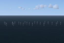
Llandudno Wind Farm, North Wales, UK. Situated approximately 8 km off the coa…
 FSX Scenery
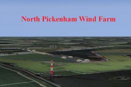
North Pickenham Wind Farm for Neil's Microlights. Situated near Swaffham in N…
 FSX Scenery
Clipgate And Pent Farm Grass Strips. Clipgate and Pent Farm Grass Strips, com…
 FSX Scenery
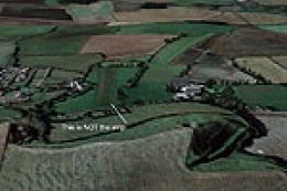
East-Lochlane-Farm, Crieff, Scotland, UK. A farm strip taken from Bryan Locky…
 FSX Scenery
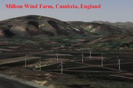
Millom Wind Farm for Neil's Microlights UK. This wind farm is located just no…
 FSX Scenery
A Day On The Farm Total Plus 2 More. Complete add-on farm strips scenery comp…
Be the first to leave a comment on this download.
Be the first to share your thoughts on this download.