 FSX Scenery
Corrected File For VAPO
Corrected Scenery File For VAPO Pune VOR/DME (PUN), for use with PUNEFSX.ZIP.…
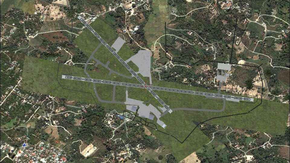
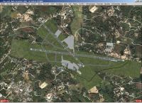
Pune International Airport and Lohegaon Airbase (VAPO/PNQ) gets a Google Earth-based layout, updated AFCAD, and an added ILS for runway 28 (109.70/276) in FSX, improving parking and AI operations. Animated details such as windsock and hangars appear when installed, and some features require Abacus EZ-Scenery, Rwy12, and select FS2004 object libraries.
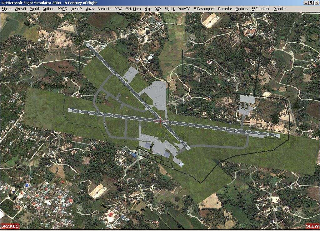


VAPO Pune Airport Scenery. Google earth based scenery and AFCAD update for Pune International airport/Lohegaon Airbase for FSX. Utilizes FS2004 standard library objects and additional library objects described in the readme.txt file. Modified for FSX, new ILS runway 28 added. Refer earlier ecenery for further information. By Rick Marcinko. (See also PUNEFSX_CORRECTED.ZIP).
Overview of VAPO Pune Airport Scenery.
Google Earth based scenery for Pune, an Airforce Base/ International airport located in Pune, 165 kilometers from Mumbai (Bombay). Pune is a fast-expanding city in the Maharashtra state in the Western Ghats located on the eastern edge of the Deccan peninsula and is known as the "Oxford Of the East" in view of the large number of centres of higher education here.
Pune International Airport (IATA: PNQ, ICAO: VAPO) is located approximately 10 km (6.2 mi) north-east of Pune in the state of Maharashtra, India. The airport, operated by the Airports Authority of India, shares its runway with Lohegaon Air Base. Air India has begun operating direct flights from Pune to Dubai, as also Indian Airlines with flights to Singapore thus giving it international status.[1] Pune Airport also serves Indian Airlines, Jet Lite and Jet Airways, that run domestic flights connecting Pune to major Indian cities such as Delhi, Mumbai, Bangalore and Hyderabad, as well as budget carriers like SpiceJet and Deccan.
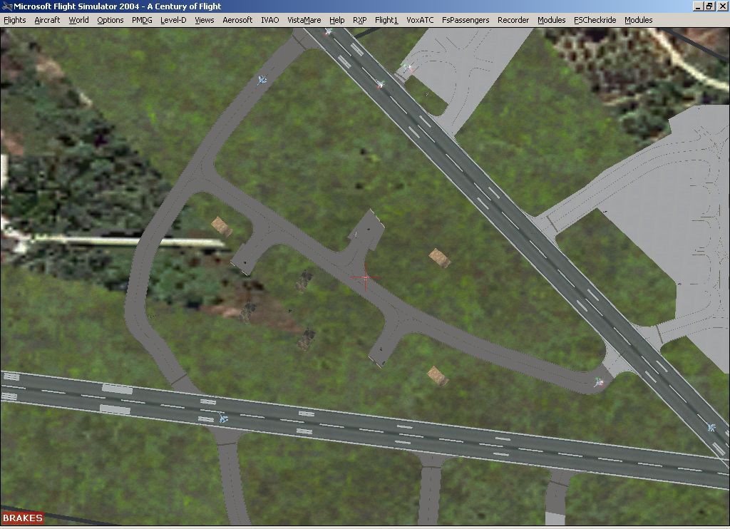
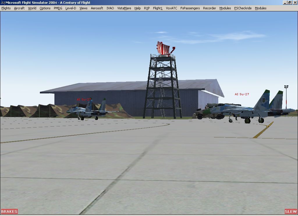
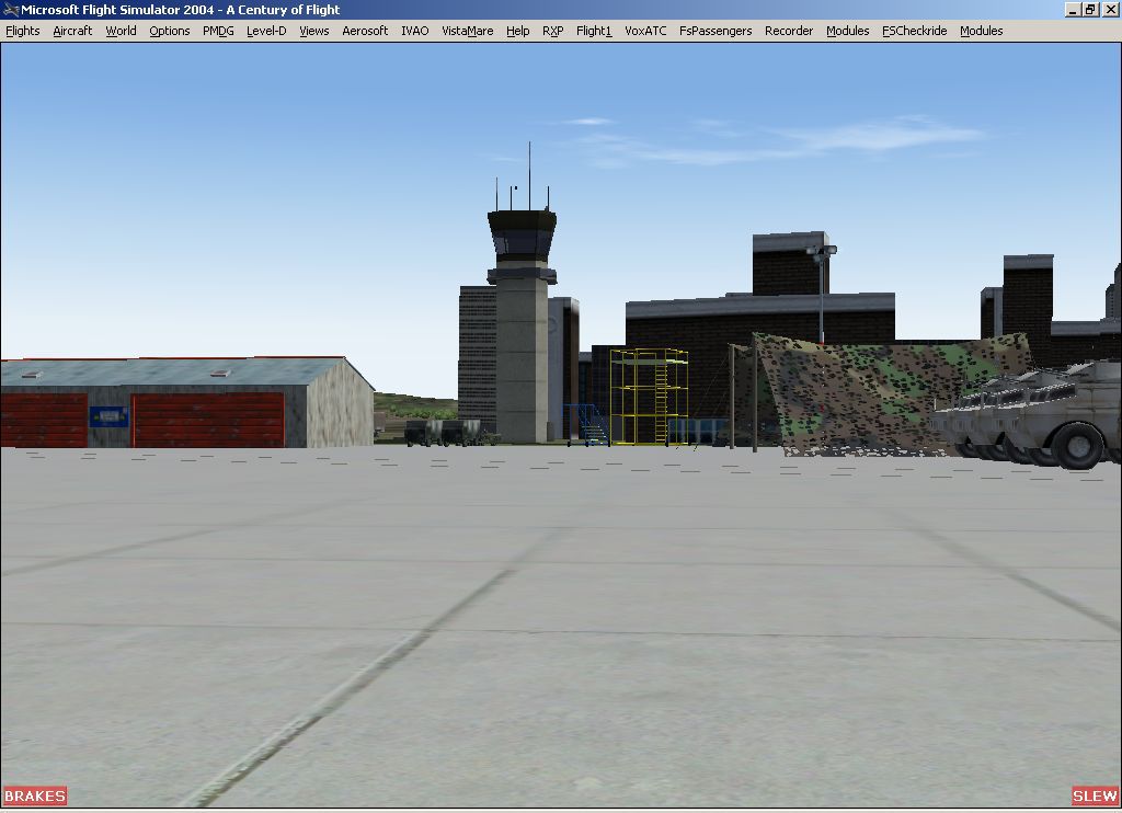
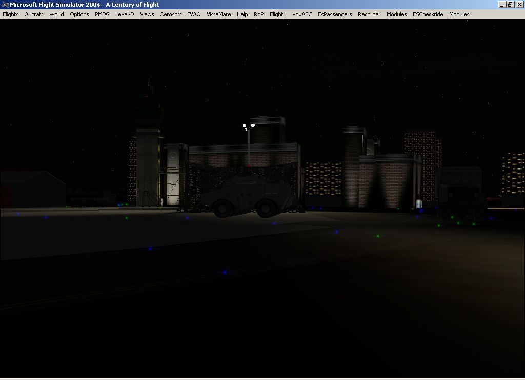
Flight Simulator X has only provided 2 runways, a generic apron and an ATC tower at this airport and this scenery seeks to redress the situation so that you and your "AI" traffic can use the airport.This scenery also features animated scenery such as an animated windsock, and hangars that requires the download of animated sceneries from the Abacus sources listed below.The animated hangars open by setting the appropriate NAV2 frequencies as listed on front of the hangar doors.
The scenery does not purport to be ultra-accurate. Based on high quality satellite imagery from Google Earth, the layout is proportionally correct but the added airport features, such as buildings, are built from default Microsoft objects and add-on libraries so will not look exactly like the real thing.
You are not obliged to download and install any additional scenery libraries, but to enjoy this scenery in its entirety, it is recommened to download the specific additional libraries listed below for full functionality of the animated scenery.
Jan 2012 - The FS2004 scenery i released in 2009 has been furthur modified for FSX. Some users had complained of trees which i have excluded and tested on this version. Also due to several requests i have included an ILS (with Glideslope) for Rwy 28, although the current approach into VAPO Rwy 28 is visual. Installation of an ILS has been delayed for several years due to co ordination problems with the military authorities which control the airfield.
ILS Rwy 28 (course 276 Freq 109.70). New BGL file :VAPO_ADEX_AA.bgl. I've also included approach procedure for VAPO. Dowloaded from the airindiaops website.
INSTALLATION OPTIONS:
i. Basic installation - some airport objects, such as buildings, will display as they use default Flights Simulator objects.
ii. Standard libraries - I recommend downloading and installing the Abacus EZ-Scenery and Rwy12 standard libraries as these will be effective in many other sceneries too.
Abacus EZ-Scenery EZ-Libraries
Rwy12 Library 1 (Seev Kahn & Israel Roth)
Rwy12 Library 2 (Seev Kahn & Israel Roth)
Rwy12 Library 3 (Seev Kahn & Israel Roth)
iii. Additional libraries - some of the features in this scenery use the following additional scenery object libraries.
1)FS2004 Len's EZ Animated Objects
2)FS2004 Modern Military Objects And Scenery
3)FS2004 Military Ground Service Equipment
4)FS2004 RAF Ground Support Equipment
5)EZhangers for Abacus EZ-Scenery (Dennis Waggoner)
INSTALLATION
Just put the various *.bgl files in your Flight Simulator's Addon Scenery\scenery folder and the enhanced airport will be activated next time you start Flight Simulator 2004.
Alternatively, you can create a separate folder for individual airports or all of my AFCAD and scenery files together, placing the files into a sub-folder named 'scenery'. Then add the folder to the Flight Simulator Scenery Library and the enhanced airport layout(s) will be activated next time you start Flight Simulator 2004.
To remove the scenery, just delete the same files (and remove from the Scenery Library list if appropriate) and restart.
CREDITS
I am grateful to Lee Swordy for his free AFCAD software, a major contribution to Flight Simulator, without which this airport simulation could not have been developed. His work has now been ported into commercial software and developed further.
The above-mentioned creators of scenery libraries are thanked for making their work available to all.
Google must be thanked for making the satellite data so easily accessible.
For geographical information I use many books and internet references to supplement my own knowledge. Wikipedia is an excellent source for many of these locations.
If I have failed to mention anybody else, it is definitely not intentional.
I would also like to thank Mr. John Hinson, who created the VAOZ, Nasik/Ozar scenery , which i used as a source to teach myself the nuances of AFCAD.Thanks John!
Enjoy!
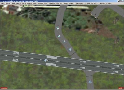
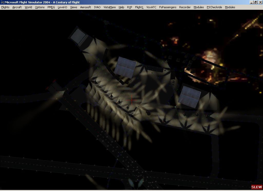
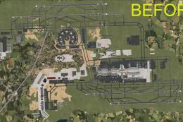
Top down view showing AI Aircraft on runway at Pune Airport.
Free for all simmers · 7.23 MB · Scanned clean Aug 2026
Download speed: Free tier is capped at 0.5 Mbps (this file takes approximately 2 mins at the cap). PRO members download at full line speed.
This add-on may require the following files to function properly. If this is a repaint, the dependency below is likely the base aircraft package.
FSX\Addon Scenery\ containing scenery and texture sub-folders.readme.txt or README file. It tells you exactly where files go, what dependencies are needed, and any quirks specific to this add-on.Use these coordinates to fly directly to this location once the mod is installed.
18.58280000,73.91960000
Launch FSX or Prepar3D and use Flights → Load to open the downloaded .pln file. Your aircraft will be positioned at this location.
The archive punefsx.zip has 19 files and directories contained within it.
This list displays the first 500 files in the package. If the package has more, you will need to download it to view them.
| Filename/Directory | File Date | File Size |
|---|---|---|
| puneFSX | 01.17.12 | 0 B |
| Pune VAPO | 05.19.09 | 0 B |
| airdefense.jpg | 05.19.09 | 118.83 kB |
| airport_VAPO.jpg | 05.19.09 | 228.36 kB |
| ai_aircraft.jpg | 05.19.09 | 109.42 kB |
| animated_radar&hangars.jpg | 05.19.09 | 78.88 kB |
| Apron.jpg | 05.19.09 | 70.93 kB |
| ATC.jpg | 05.19.09 | 77.32 kB |
| FILE_ID.DIZ | 01.17.12 | 276 B |
| night.jpg | 05.19.09 | 55.13 kB |
| night_hangar.jpg | 05.19.09 | 42.33 kB |
| readme.txt | 01.17.12 | 6.39 kB |
| scenery | 01.17.12 | 0 B |
| Animated_windsock.BGL | 05.16.09 | 138 B |
| VAPO_ADEX_AA.BGL | 01.17.12 | 17.70 kB |
| VAPO_Fs9.bgl | 05.18.09 | 7.87 kB |
| VAPO Approach.pdf | 01.17.12 | 7.08 MB |
| flyawaysimulation.txt | 10.29.13 | 959 B |
| Go to Fly Away Simulation.url | 01.22.16 | 52 B |
Only PRO members can place votes.
More FSX & P3D add-ons hand-picked based on this download.
FSX Scenery
Corrected Scenery File For VAPO Pune VOR/DME (PUN), for use with PUNEFSX.ZIP.…
 FSX Scenery
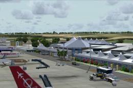
Princess Juliana International Airport (TNCM) in Saint Marteen, Netherlands A…
 FSX Scenery
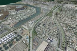
Los Angeles Airport Scenery v3, California (CA). This photoreal scenery is a …
 FSX Scenery
Barbados International Airport (TBPB). Grantley Adams International Airport f…
 FSX Scenery
Paris Charles de Gaulle Airport (CDG, LFPG), France. The entire airport has b…
 FSX Scenery
John F. Kennedy Airport (KJFK), New York, NYU. This is a photoreal scenery re…
 FSX Scenery
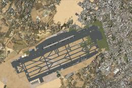
Dubai International Airport (OMDB), Dubai. Includes a new passenger terminal …
 FSX Scenery
Soekarno-Hatta International Airport (WIII), Jakarta, Indonesia. An update to…
Be the first to leave a comment on this download.
Be the first to share your thoughts on this download.