Page 28
Searches the whole library — filter by sim & category on the results page
LTBQ Izmit, Turkey, hosts a configuration that includes one cargo space, ten combat spaces, two fuel spaces, and nine helicopter landing pads compliant with Heli Traffic 2009. The LTBQ_ADEX_DM_ALT.…
 Turkey
Holzdorf AB lies in eastern Germany and is depicted as a Luftwaffe site with an updated stock representation; ADE X 1.50 handles placement with stock objects, while German shelters and a hangar by …
 Germany
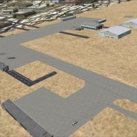
Yoff Airport (GOOF) upgrade serves Dakar, Senegal, adding airport buildings and objects while using stock FSX assets, with cargo on the ramp and expanded parking near Accra Airport. Lee Marrow auth…
 Senegal
FAGG, located in the Western Cape of South Africa, anchors a project by Reben Niemand. He uses Sketchup, ADE and Sbuilderx to prepare the photos for reference, forming a visual record of FAGG at th…
 South Africa
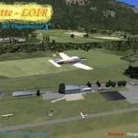
Reutte airfield LOIR in Tyrol presents v1.02 with a runway, a helipad, windsock and wind tee that change with the wind, and AI compatible taxiways supporting AI traffic. Detail 3D objects feature p…
 Austria
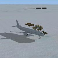
Two BGLs, YWKS.BGL and YWKS_CVX.BGL, define Wilkins Aerodrome (YWKS) in Antarctica. The altitude is set at 2600 feet, while real life sits between 2300 and 2550 feet, due to ground elevation differ…
 Antarctica
An offshore staging near Okinawa places a small U.S. battlegroup alongside the Japanese Self Defense Force, with several vessels anchored at Isa Bay. All ships are landable, and the setup uses a BG…
 Japan
Japan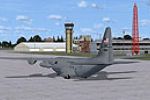
Two BGL files, AFX_KLRF_JC.bgl and KLRF_JC.bgl, adjust the Little Rock air base (KLRF) near Jacksonville, Arkansas, adding parking spaces, a fire station with trucks, extra buildings, static fuel t…
 United States of America
Walker Grant provides a Beale AFB enhancement that adds more objects drawn from the default libraries, including parking lots, emergency vehicles, personnel, and civilian tech reps in hangars. The …
United States of America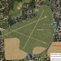
Named by Alf Denham, the enhancement covers Priory Farm X3PF, Walney Island EGNL, and White Waltham EGLM with custom objects and refined layouts reflecting rural and coastal settings. It uses Googl…
 United Kingdom
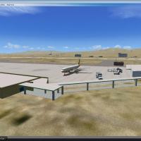
Development spans nine months as Laughlin area improvements center on Bullhead City's KIFP and nearby Laughlin, NV, introducing a redesigned terminal and new models by Josephs Jasper. Scott Peterso…
United States of AmericaDallas/Fort Worth International Airport extends four runways to 13,401 feet, covering 18L-36R, 18R-36L, 17C-35C, and 17R-35L, while other runways remain at their correct lengths; two BGL files acco…
United States of America
A four-country mesh spans Ethiopia, Erythrea, Djibouti and Somalia, assembled as a Horn region project with LOD 0 to 9. Creator credit goes to Marcel Wislet, and the assembly covers the four nation…
 Global (World)
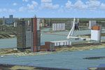
Aimed at enriching Dutch airspace visuals, this update adds three-dimensional urban architecture, bridges and overpasses, wind turbines, and ships and vessels across the Netherlands. The v4.0.32 in…
 Netherlands
Freeware offering enhances visual references across Switzerland for visual flight, drawing on OpenStreetMap data to depict land use, leisure areas, waterways, and rail lines. Created by Markus Frey…
 Switzerland
KLAX.BGL modifies the default layout at the airport serving the city of Los Angeles in California, adding a center taxiway between 25L and 25R and correcting taxiways E17, AA and V along with updat…
United States of America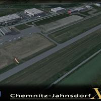
Beta development for EDCJ Chemnitz Jahnsdorf by Sierra.Foxtrot-Design introduces licensed 40cm per-pixel ground surfaces with night and seasonal variants and a lighting overhaul realized with 3D ob…
Germany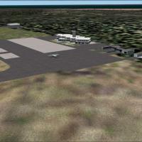
Macapá 2005, identified as SBMQ, presents a freeware variant that faithfully mirrors the airport layout with updated taxiway signage and improved runway markings. By Gustavo Luna, it adds enhanced …
 Brazil
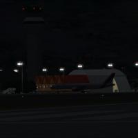
By Antoine Calleja, a second fix for VNKT, Nepal, addresses missing aprons and a strip of asphalt in front of hangars at Khatmandu Tribhuvan Airport, and also corrects light poles at the field to i…
 Nepal
NepalThe airport lies in Aswidnik, 15 kilometers from Lublin's main town, a location within Poland that places it near Lublin; the first commercial landing and takeoff occur on 17 December 2012, credite…
 Poland