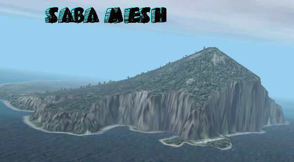
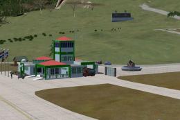
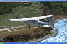
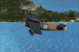
FS2002 Saba Island High Resolution Mesh
Saba Island’s rugged Caribbean terrain comes alive with a high-resolution mesh that sharpens ridgelines, cliffs, and coastal contours for more believable approaches and sightseeing. Designed for FS2002, this detailed elevation data enhances the island’s distinctive topography across the entire scenery area with crisp shaping and natural relief.
- File: sabamesh.zip
- Size:39.32 KB
- Scan:
Clean (0d)

- Access:Freeware
- Content:Everyone
Images & Screenshots
The archive sabamesh.zip has 7 files and directories contained within it.
File Contents
This list displays the first 500 files in the package. If the package has more, you will need to download it to view them.
| Filename/Directory | File Date | File Size |
|---|---|---|
| N18_W64.bgl | 11.07.01 | 9.88 kB |
| saba.gif | 11.07.01 | 16.84 kB |
| saba.jpg | 11.07.01 | 15.24 kB |
| FILE_ID.DIZ | 11.07.01 | 193 B |
| saba.txt | 11.07.01 | 1.26 kB |
| flyawaysimulation.txt | 10.29.13 | 959 B |
| Go to Fly Away Simulation.url | 01.22.16 | 52 B |
Installation Instructions
Most of the freeware add-on aircraft and scenery packages in our file library come with easy installation instructions which you can read above in the file description. For further installation help, please see our Flight School for our full range of tutorials or view the README file contained within the download. If in doubt, you may also ask a question or view existing answers in our dedicated Q&A forum.


0 comments
Leave a Response