 FSX AFCAD Files
AFCAD File For LPPT
Elevate Microsoft Flight Simulator X with a refined rendition of Lisbon Inter…
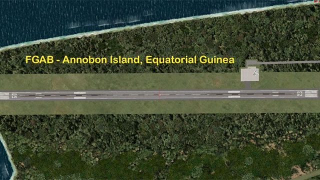
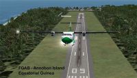
Annobon Airport (FGAB) brings San Antonio de Pale, Equatorial Guinea into FSX with a new runway 05/23, revised apron layout, background polygon, parking, and local landclass touches for town and industry. Built for smooth AI operations, it adds an FSS frequency and practical low runway lighting for daylight VFR flying.
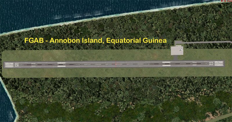


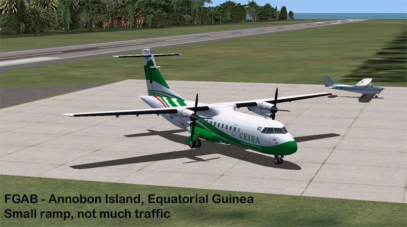
Annobon Airport, San Antonio de Pale, Equatorial Guinea. Updates the airport serving this offshore island for AI traffic - specifically the World of AI packages. There is no default FSX airport on this island. Airport update by Reggie Fields.
Plane taking off from of Annobon Airport.
Overview - This is a NEW airport for FSX. The real airport apparently does not have an ICAO code - but the code FGAB is used by AI flight plan writers.
These files add the airport to your FSX world and setup the airport for AI traffic - specifically the World of AI packages.
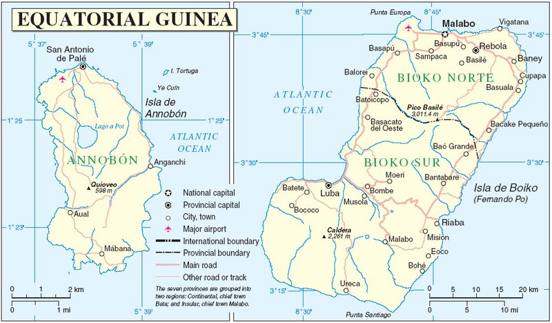
Location - FGAB/ Annobon Island is located about 220 nm west of the coast of Africa, and about 110 miles southwest of Sao Tome Island. The island is only about 4 miles by 2 miles. The island population is about 5,000.
The airport has minimal air traffic - often only one to three flights per week.
The default FSX mesh for this island is flat as a pancake. The shortline is blocky and not very well done. the link below has a photo which shows the island with the airport, the main town of San Antonio de Pale and the volcanic crater lake - Lago A Pot. The island's main extinct volcano rises to an elevation of 598M / 1,961 ft at the peak named Quioveo.
Creating a more exact island shortline and the mesh is a much more complex project for another day.
Airport Information - Google Earth imagery is Apr 26, 2006
This is a daylight, VFR only airport. I have set the runway lights to Low.
Parking Codes:
No parking codes are used for this airport. At this time the maximum airline traffic is one ATR-42 aircraft from Ceiba Intercontinental.
There is apparently some government / military traffic occasionally - a few months ago a flight by an AN-26 crashed just off shore on approach to the airport/ island.
The main parking spot is 21.3M in size RAMP_GA. This is sufficiently large for the ATR and any other probably aircraft such as An-12 An-26, C-160 or C-130.
There are 2 GA Small (7.3M) and 1 GA Medium (9.3M) parking spots on the apron.
There are no taxi lines drawn on the apron.
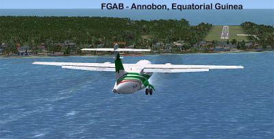
Plane approaching Annobon Airport.
Free for all simmers · 1016.6 KB · Scanned clean Jul 2026
Download speed: Free tier is capped at 0.5 Mbps. PRO members download at full line speed.
AF2_*.bgl or AFX_*.bgl) go into FSX\Addon Scenery\Scenery\ or a dedicated AFCAD folder you create.readme.txt or README file. It tells you exactly where files go, what dependencies are needed, and any quirks specific to this add-on.Use these coordinates to fly directly to this location once the mod is installed.
-1.40750000,5.62160000
Launch FSX or Prepar3D and use Flights → Load to open the downloaded .pln file. Your aircraft will be positioned at this location.
The archive fgab_ade_rjf_v1.zip has 14 files and directories contained within it.
This list displays the first 500 files in the package. If the package has more, you will need to download it to view them.
| Filename/Directory | File Date | File Size |
|---|---|---|
| FGAB-1.jpg | 11.13.09 | 177.33 kB |
| FGAB-2.jpg | 11.13.09 | 153.24 kB |
| FGAB-3.jpg | 11.13.09 | 134.05 kB |
| FGAB-4.jpg | 11.13.09 | 190.65 kB |
| FGAB_ADEX_New_RJF_V1.BGL | 11.13.09 | 3.75 kB |
| FGAB_ADEX_New_RJF_V1_CVX.bgl | 11.13.09 | 2.18 kB |
| FGAB_ADEX_RJF_V1.gif | 11.13.09 | 12.60 kB |
| file_id.diz | 11.13.09 | 333 B |
| Map_Area.jpg | 11.13.09 | 90.20 kB |
| Map_Islands.PNG | 11.13.09 | 255.77 kB |
| ReadMe.txt | 11.13.09 | 4.77 kB |
| FGAB_ADE_RJF_v1 | 11.13.09 | 0 B |
| flyawaysimulation.txt | 10.29.13 | 959 B |
| Go to Fly Away Simulation.url | 01.22.16 | 52 B |
Only PRO members can place votes.
More FSX & P3D add-ons hand-picked based on this download.
FSX AFCAD Files
Elevate Microsoft Flight Simulator X with a refined rendition of Lisbon Inter…
 FSX AFCAD Files
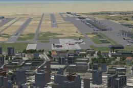
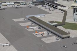
John F. Kennedy International Airport, New York, NY, USA, v2. This airport up…
 FSX AFCAD Files
Dubai International Airport, United Arab Emirates (UAE). This airport update …
 FSX AFCAD Files
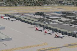
Los Angeles International Airport (LAX), California (CA), USA. This airport u…
 FSX AFCAD Files
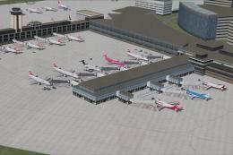
This freeware package modernizes Zurich International Airport (LSZH) in Micro…
 FSX AFCAD Files
Lic Benito Juarez International Airport, Mexico City, Mexico. This airport up…
 FSX AFCAD Files
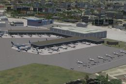
Enhance Kastrup Airport (EKCH) in Copenhagen, Denmark with this freeware upgr…
 FSX AFCAD Files
This enhanced update for Schiphol (EHAM) in Amsterdam focuses on reconstructi…
Be the first to leave a comment on this download.
Be the first to share your thoughts on this download.