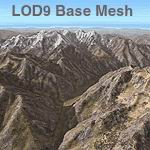
FS2004 Himalayas LOD9 Base Mesh - Hindu Kush
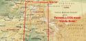
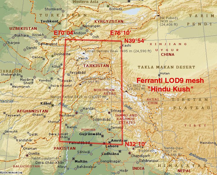
High-resolution LOD9 terrain mesh reshapes the Hindu Kush between N32°–40° and E70°–76°, blending Shuttle Radar Topography Mission data with refined elevations from topographic mapping to eliminate voids and sharpen ridgelines, passes, and valleys. Built for Microsoft Flight Simulator 2004, it also supports FS2002 for more faithful mountain flying and planning.
- File: fs_him_b5.zip
- Size:85.72 MB
- Scan:
Clean (9d)

- Access:Freeware
- Content:Everyone
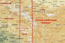
This comprehensive terrain mesh package provides an enhanced representation of the Hindu Kush range, focusing on the coordinates N32°-40°, E70°-76°. Featuring carefully integrated Shuttle Radar (SRTM) data and supplementary elevation details from topographic maps (compiled by Jonathan de Ferranti), it offers an especially intricate landscape for simmers who prioritize accuracy within Microsoft Flight Simulator 2004. Additionally, it maintains full compatibility with FS2002 and is distributed free of charge.
Elevated Fidelity Across the Hindu Kush
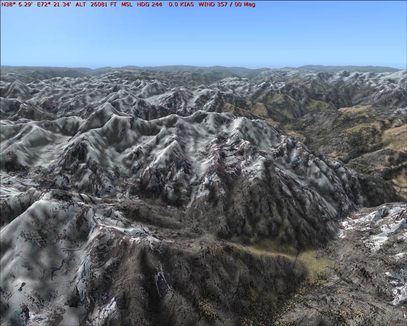
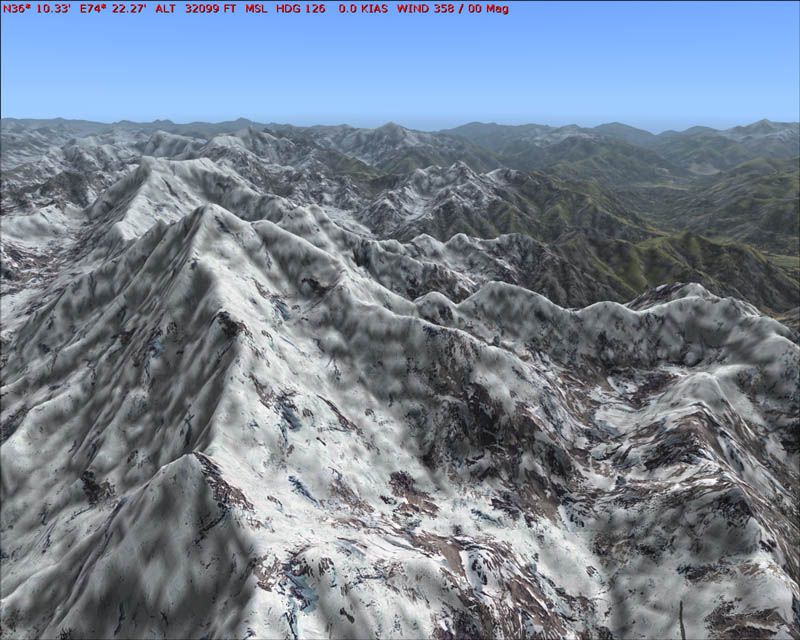
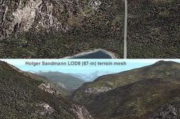
This add-on is part of a broader set of “LOD9 base mesh” releases, which depict the vast Himalayan region with impressive resolution. Numerous mountain passes and remote valleys gain definition from the seamless blending of void-free data, ensuring features far beyond default scenery clarity. With the mesh precisely compiled by Holger Sandmann, expect remarkable detail that preserves essential terrain characteristics—including rugged ridgelines and abrupt elevation shifts—essential for those who crave enhanced realism.
Data Integration Achievements
The primary dataset from SRTM surveys is enriched where necessary by carefully processed map-based height curves. This meticulous substitution method corrects data gaps common with raw radar acquisitions. As a result, sim pilots experience topography that aligns more closely with real altitude variations, making route planning across the Hindu Kush peaks and valleys substantially more immersive.
Option for Greater Detail
Beyond this core “LOD9 base mesh” collection, an optional “LOD10 Himalayan Peaks” layer is also available, which highlights particularly commanding summits and ridges. Installing this secondary enhancement augments overall authenticity while preserving performance for long-haul flights or complex approach procedures within mountainous terrain.
Smoother Flight Experiences
By refining contours and smoothing transitions, this mesh lets users enjoy more believable approaches and departures in these challenging highland regions. No more abrupt cliffs or cartoonish slopes—every contour is carefully resolved to aid both visual flight and instrument operations.
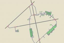
Visual Preview
Key Takeaways for Advanced Simmers
- Accurate Regional Coverage
- Targets the region spanning N32°-40°, E70°-76°, covering critical segments of the Hindu Kush and adjacent areas.
- Meticulous Data Assistance
- Fills SRTM voids with elevation models generated by Jonathan de Ferranti, ensuring minimal gaps.
- Compiled for Flight Simulation
- Holger Sandmann assembled these files specifically for Microsoft Flight Simulator 2004, while retaining FS2002 compatibility.
- Enhanced Terrain Realism
- Eliminates major terrain irregularities, enabling precise navigation experiences at the higher elevations of South and Central Asia.
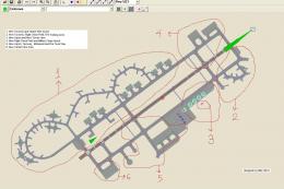
Images & Screenshots
The archive fs_him_b5.zip has 15 files and directories contained within it.
File Contents
This list displays the first 500 files in the package. If the package has more, you will need to download it to view them.
| Filename/Directory | File Date | File Size |
|---|---|---|
| fs_him_b5 | 02.21.06 | 0 B |
| File_id.diz | 02.21.06 | 456 B |
| fs_him_b5.gif | 02.11.06 | 14.16 kB |
| Himalayan Base Mesh 5 - Hindu Kush | 02.21.06 | 0 B |
| Himalayas - Karakoram - Rakaposhi.jpg | 01.29.06 | 110.81 kB |
| Himalayas - Pamir - Batang Valley.jpg | 01.29.06 | 111.52 kB |
| map Himalayas base mesh - Hindu Kush.jpg | 02.06.06 | 253.10 kB |
| mesh Himalayas by Ferranti & Sandmann | 02.07.06 | 0 B |
| scenery | 02.21.06 | 0 B |
| mesh_Himalayas_base_Hindu_Kush_LOD7.bgl | 02.21.06 | 5.34 MB |
| mesh_Himalayas_base_Hindu_Kush_LOD8.bgl | 02.21.06 | 18.41 MB |
| mesh_Himalayas_base_Hindu_Kush_LOD9.bgl | 02.21.06 | 65.70 MB |
| readme fs_him_b5.txt | 02.21.06 | 8.92 kB |
| flyawaysimulation.txt | 10.29.13 | 959 B |
| Go to Fly Away Simulation.url | 01.22.16 | 52 B |
Installation Instructions
Most of the freeware add-on aircraft and scenery packages in our file library come with easy installation instructions which you can read above in the file description. For further installation help, please see our Flight School for our full range of tutorials or view the README file contained within the download. If in doubt, you may also ask a question or view existing answers in our dedicated Q&A forum.


0 comments
Leave a Response