 FSX Scenery
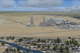
Salt Lake City International Airport 2020
KSLC - Salt Lake City Intl Airport 2020, Utah, USA by Ray Smith I have been a…
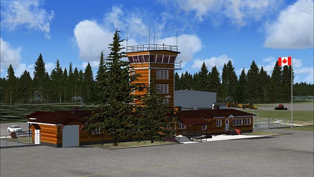
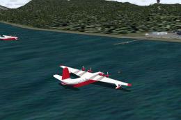
Watson Lake Airport (CYQH) scenery brings Yukon’s key Northern stopover to life with updated airfield layout, refined ground textures, and detailed buildings tailored for bush and regional operations. Designed for Microsoft Flight Simulator X Acceleration, v2.00 enhances approaches and ramp immersion across the surrounding Canadian landscape.

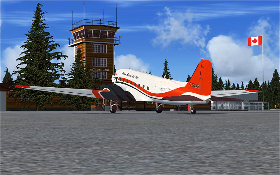
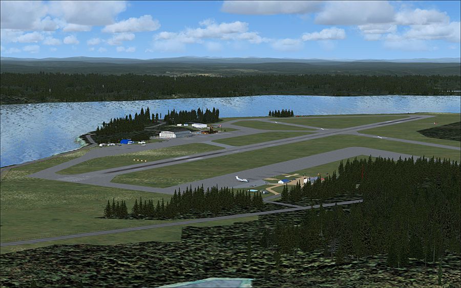
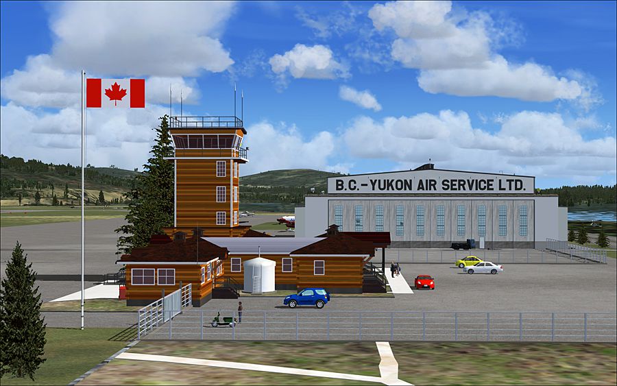
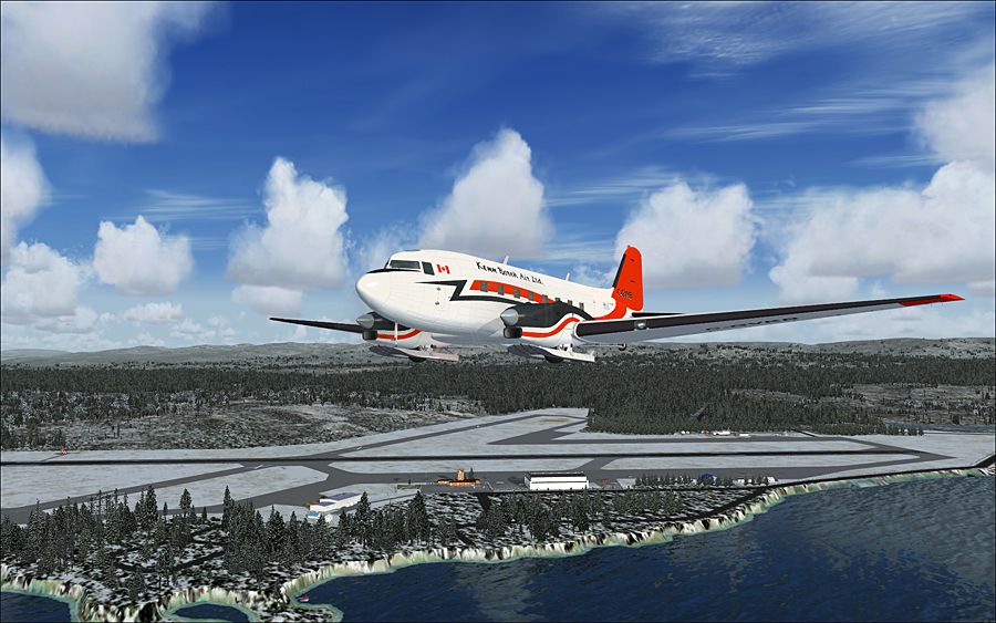
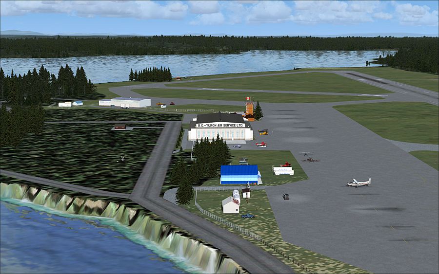
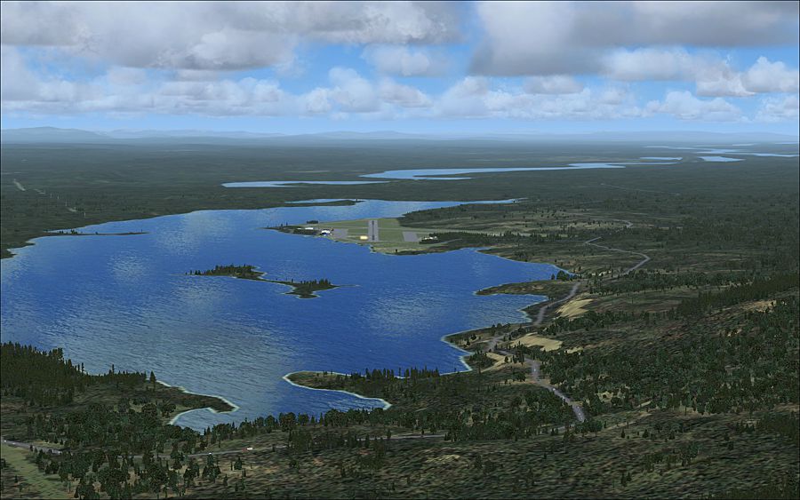
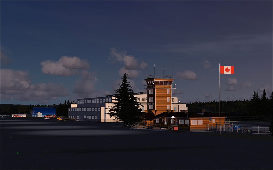
(CYQH), Yukon, Canada, v2.00, for FSX Acceleration. By Lets Fly Association / Shigeru Tomino (TONO).

Screenshot of Watson Lake Airport scenery.
Free for all simmers · 13.48 MB · Scanned clean Jul 2026
Download speed: Free tier is capped at 0.5 Mbps (this file takes approximately 4 mins at the cap). PRO members download at full line speed.
FSX\Addon Scenery\ containing scenery and texture sub-folders.readme.txt or README file. It tells you exactly where files go, what dependencies are needed, and any quirks specific to this add-on.Use these coordinates to fly directly to this location once the mod is installed.
60.11640000,-128.82100000
Launch FSX or Prepar3D and use Flights → Load to open the downloaded .pln file. Your aircraft will be positioned at this location.
The archive fsx_cyqh_v200.zip has 17 files and directories contained within it.
This list displays the first 500 files in the package. If the package has more, you will need to download it to view them.
| Filename/Directory | File Date | File Size |
|---|---|---|
| CYQH_V2_Readme_E.pdf | 09.09.12 | 1.59 MB |
| CYQH_V2_Readme_J.pdf | 09.09.12 | 3.53 MB |
| fsx_cyqh_v2-0.gif | 09.15.12 | 10.80 kB |
| fsx_cyqh_v2-1.jpg | 09.03.12 | 476.95 kB |
| fsx_cyqh_v2-2.jpg | 09.03.12 | 485.85 kB |
| fsx_cyqh_v2-3.jpg | 09.03.12 | 523.75 kB |
| fsx_cyqh_v2-4.jpg | 09.03.12 | 493.59 kB |
| fsx_cyqh_v2-5.jpg | 09.03.12 | 533.17 kB |
| fsx_cyqh_v2-6.jpg | 09.03.12 | 475.64 kB |
| fsx_cyqh_v2-7.jpg | 09.03.12 | 260.64 kB |
| fsx_cyqh_v2-8.jpg | 09.04.12 | 455.79 kB |
| FSX_CYQH_Watson_Lake_V200_US.msi | 09.09.12 | 5.49 MB |
| Option_Tree | 09.15.12 | 0 B |
| FSX_CYQH_V2F_Tree.BGL | 08.30.12 | 10.92 kB |
| FSX_CYQH_V2F_Tree_Winter.BGL | 08.30.12 | 10.92 kB |
| flyawaysimulation.txt | 10.29.13 | 959 B |
| Go to Fly Away Simulation.url | 01.22.16 | 52 B |
Only PRO members can place votes.
More FSX & P3D add-ons hand-picked based on this download.
FSX Scenery
KSLC - Salt Lake City Intl Airport 2020, Utah, USA by Ray Smith I have been a…
 FSX Scenery
Lake Toba Regional Airport (WIDT). Lake Toba is the largest lake in Indonesia…
 FSX Scenery
Rock Lake Airport (Upper) Scenery. Rock Lake Airport is a fictional bush pilo…
 FSX Scenery
This enhanced environment brings Idaho’s Henry’s Lake region (airport code U5…
 FSX Scenery
Lake Grace Airport (YLGC), a small airport in Western Australia. By Frank Sal…
 FSX Scenery
Sproat Lake Mars Water Bomber Base including AI. These files are a freeware g…
 FSX Scenery
Scenery KWYS Yellowstone And Lake Area. Complete objects library included. By…
 FSX Scenery
FSX Lake Hood (PALH), Alaska (AK). Includes added hangars, animated floatplan…
Read what other simmers think, or add your own.