FSX Terrain Design
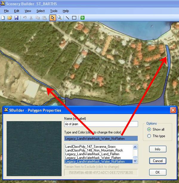
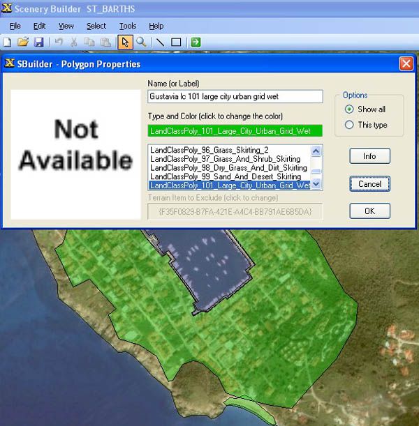
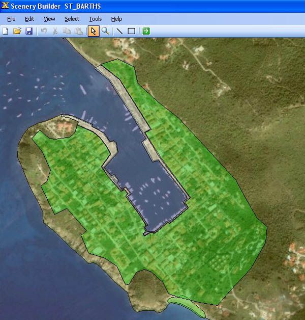
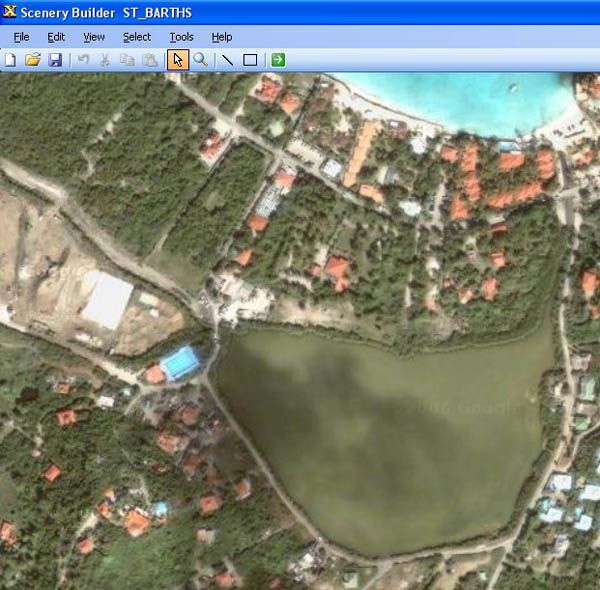
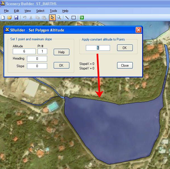
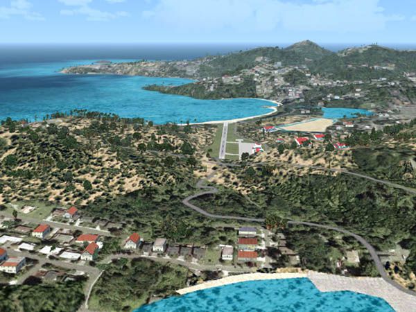
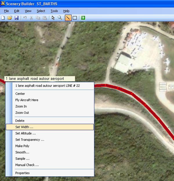
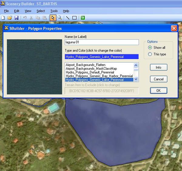
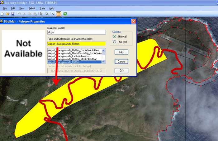
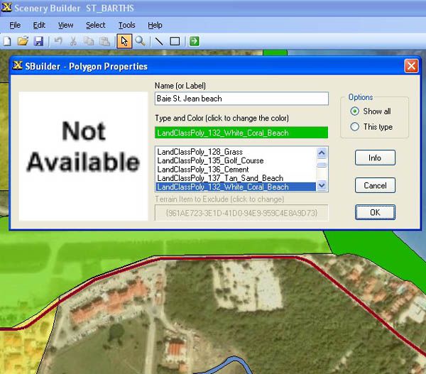
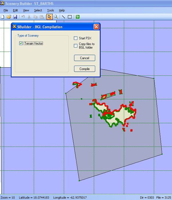
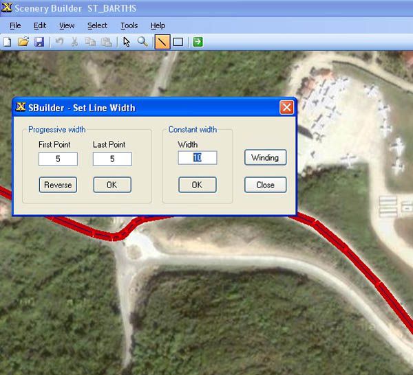
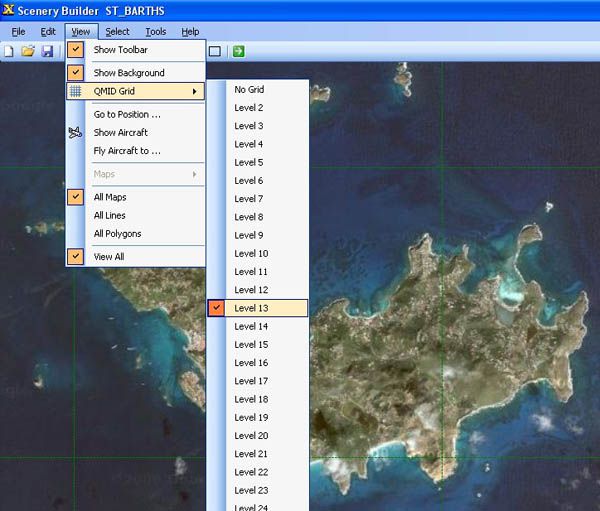
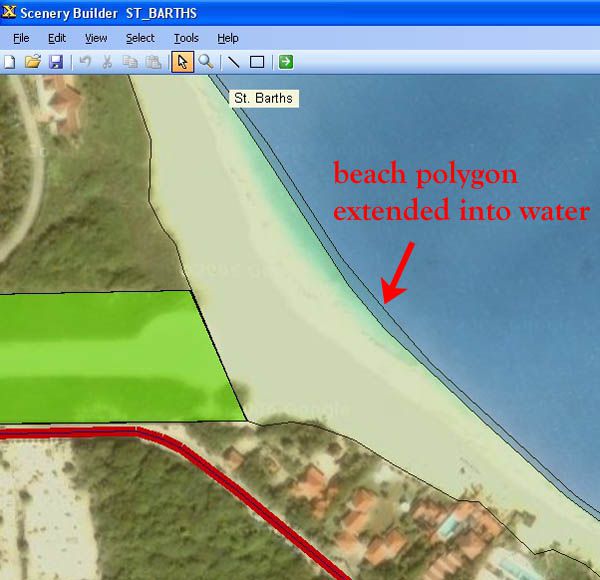
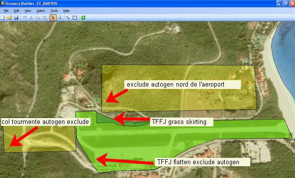
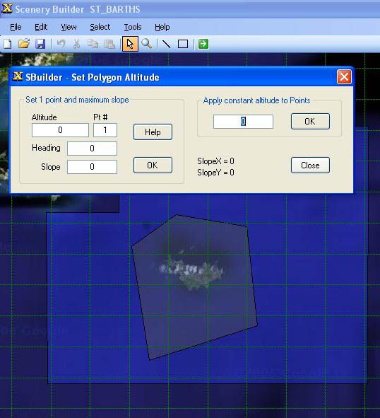
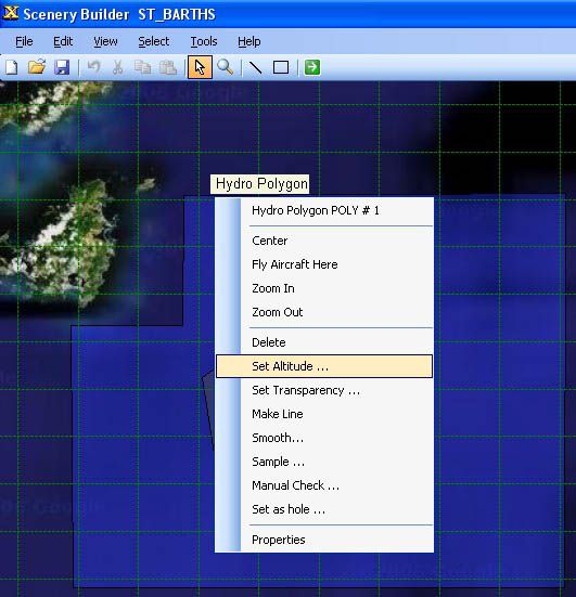
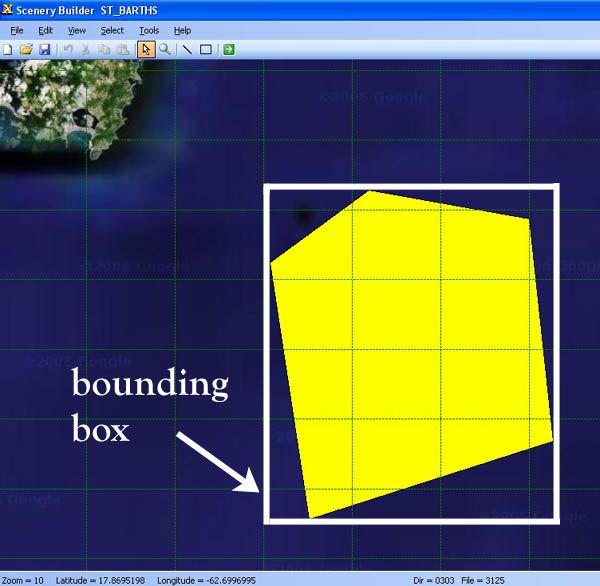
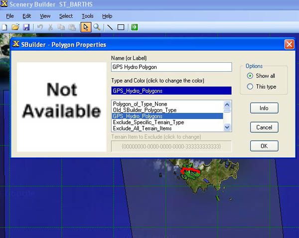
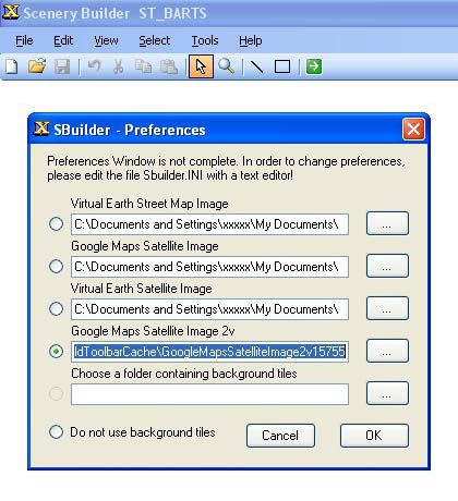
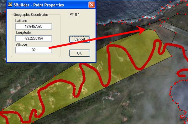
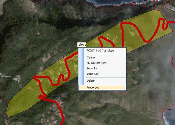
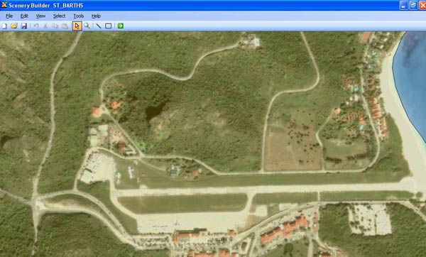
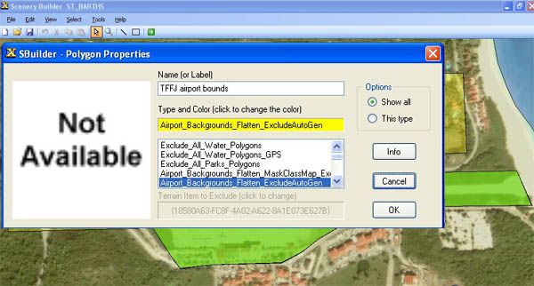
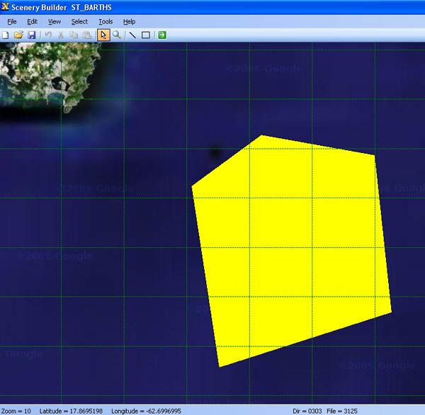
FSX Terrain Design is an illustrated guide to Flight Simulator X terrain fundamentals, showing how to edit scenery with SBuilder for FSX and build believable environments fast. It covers creating water bodies, roads and vehicle traffic, shaping airport flattens, removing autogen, and adding finer terrain detail with clear, practical examples.
 Prepar3D
- File: terdsnfs.zip
- Size:3.55 MB
- Scan:
Clean (9d)
- Access:Freeware
- Content:Everyone
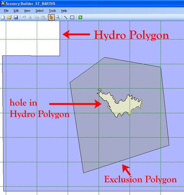
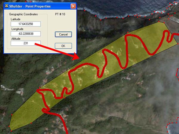
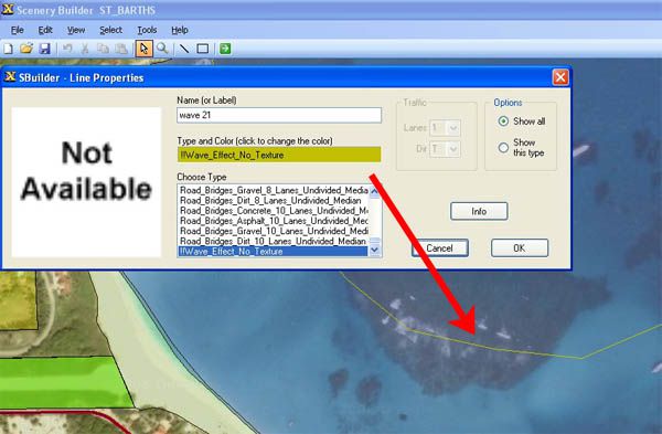
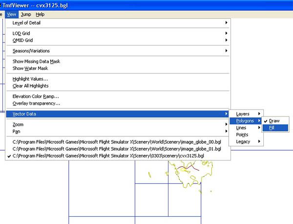
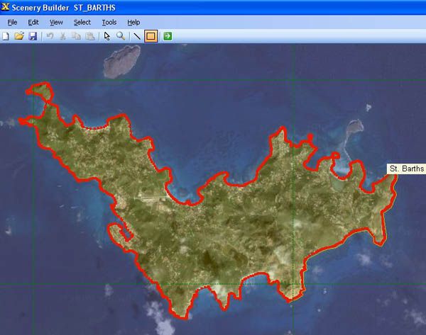
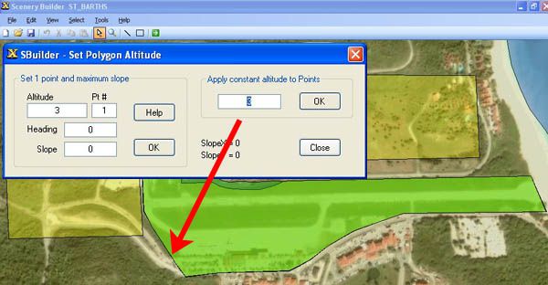
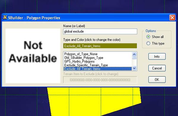
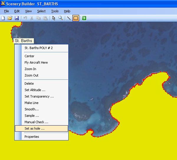
This simple illustrated document explains the basic concepts in Flight Simulator X terrain, and how to change them using SBuilder for FSX. Make new water bodies, roads, vehicle traffic, airport flattens, remove autogen, add more detail - anybody can do it easily and quickly.
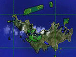
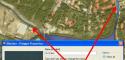
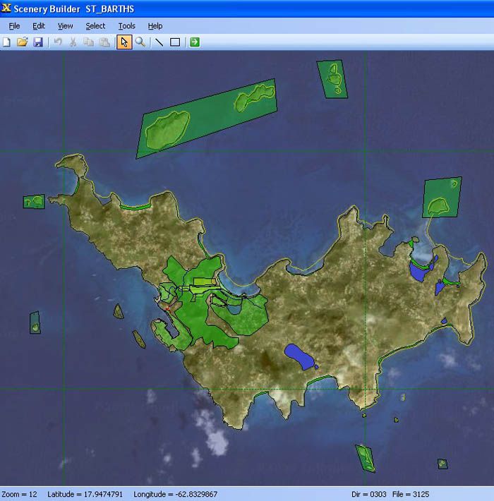
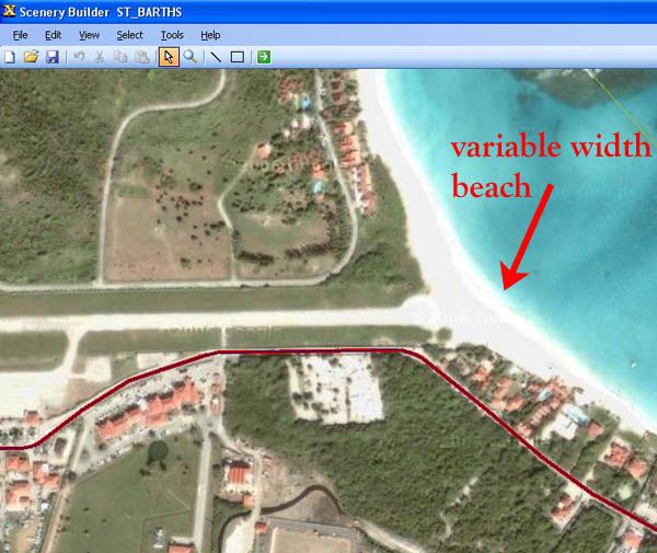
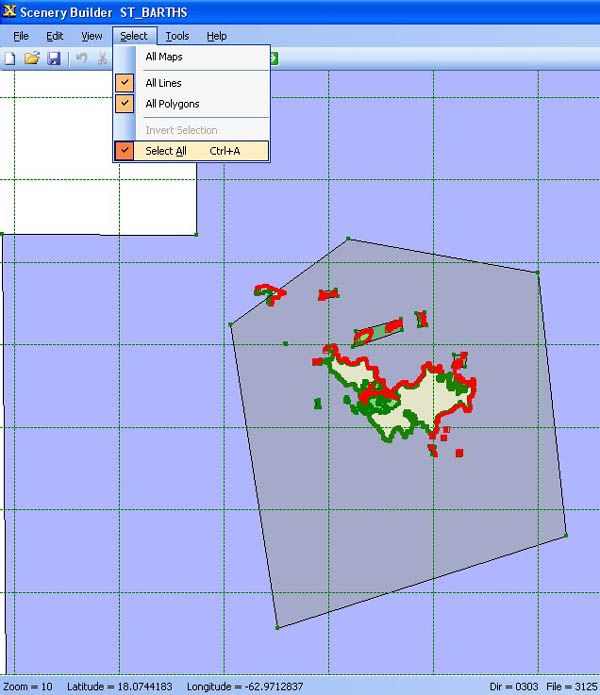
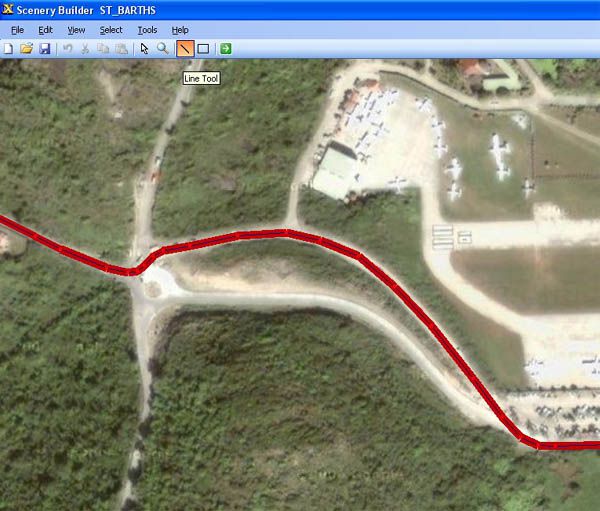
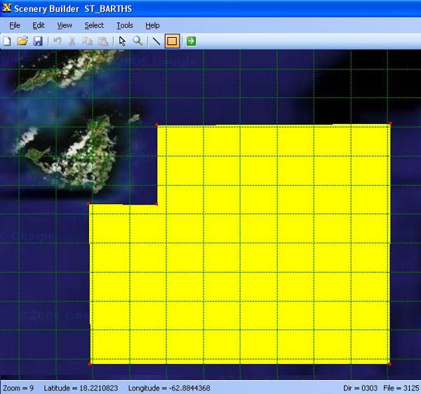
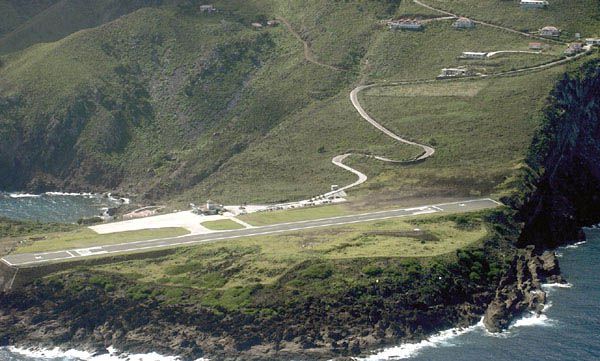
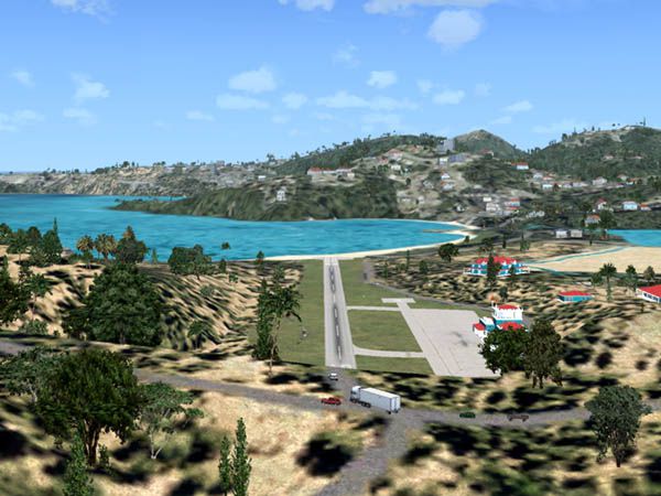
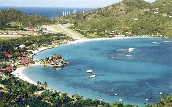
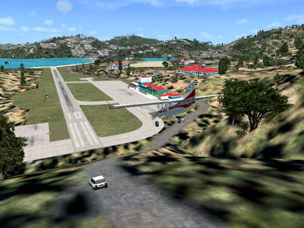
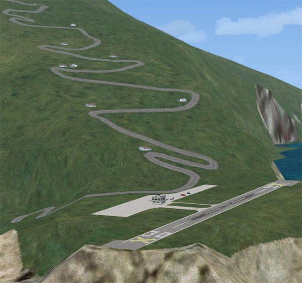
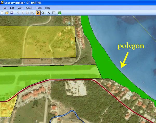
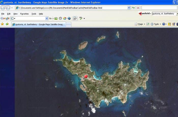
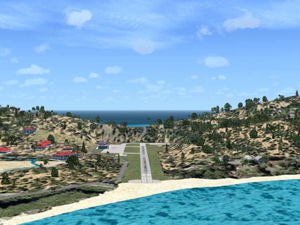
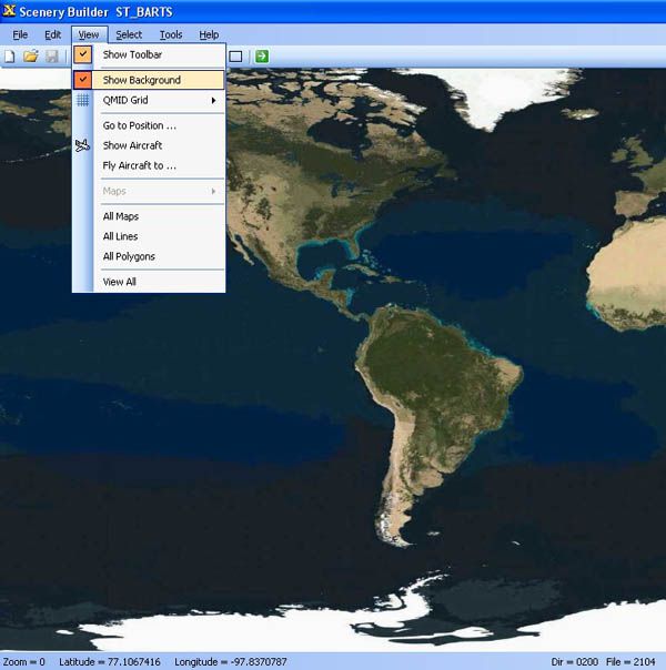
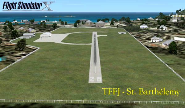
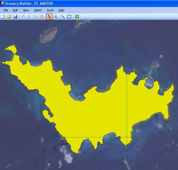
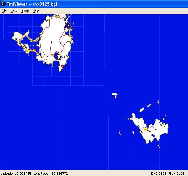
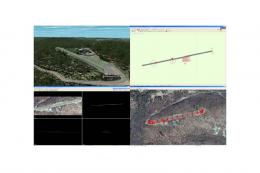
Overview of island terrain.
Images & Screenshots


The archive terdsnfs.zip has 81 files and directories contained within it.
File Contents
This list displays the first 500 files in the package. If the package has more, you will need to download it to view them.
| Filename/Directory | File Date | File Size |
|---|---|---|
| Additional_documents | 03.28.07 | 0 B |
| Airport_ground_mask.xls | 03.28.07 | 30.50 kB |
| Gradient_Map.xls | 03.28.07 | 62.50 kB |
| images | 04.07.07 | 0 B |
| 01.JPG | 03.25.07 | 64.01 kB |
| 02.JPG | 03.25.07 | 49.87 kB |
| 03.JPG | 03.19.07 | 40.89 kB |
| 04.JPG | 03.19.07 | 40.54 kB |
| 05.jpg | 03.21.07 | 44.75 kB |
| 06.JPG | 03.21.07 | 42.74 kB |
| 07.JPG | 03.25.07 | 26.27 kB |
| 08.JPG | 03.25.07 | 31.14 kB |
| 09.JPG | 02.16.07 | 56.69 kB |
| 10.JPG | 04.07.07 | 53.21 kB |
| 11.JPG | 03.25.07 | 37.27 kB |
| 12.JPG | 03.25.07 | 33.78 kB |
| 13.JPG | 03.25.07 | 43.50 kB |
| 14.JPG | 03.25.07 | 18.59 kB |
| 15.JPG | 03.25.07 | 54.31 kB |
| 16.JPG | 03.25.07 | 52.31 kB |
| 17.JPG | 03.25.07 | 56.29 kB |
| 18.JPG | 03.26.07 | 40.25 kB |
| 19.JPG | 03.26.07 | 47.82 kB |
| 20.JPG | 03.26.07 | 55.20 kB |
| 21.JPG | 03.26.07 | 43.70 kB |
| 22.JPG | 03.26.07 | 33.86 kB |
| 23.JPG | 03.26.07 | 32.73 kB |
| 24.JPG | 03.28.07 | 69.86 kB |
| 25.JPG | 03.28.07 | 72.97 kB |
| 26.JPG | 03.28.07 | 58.08 kB |
| 27.JPG | 03.28.07 | 57.99 kB |
| 28.JPG | 03.28.07 | 74.16 kB |
| 29.JPG | 03.28.07 | 72.65 kB |
| 30.JPG | 03.28.07 | 74.75 kB |
| 31.JPG | 03.28.07 | 89.04 kB |
| 32.JPG | 03.28.07 | 44.10 kB |
| 33.JPG | 03.28.07 | 44.34 kB |
| 34.JPG | 03.28.07 | 35.53 kB |
| 35.JPG | 03.28.07 | 46.76 kB |
| 36.JPG | 04.05.07 | 64.31 kB |
| 37.JPG | 03.30.07 | 46.12 kB |
| 38.JPG | 03.30.07 | 47.69 kB |
| 39.JPG | 03.30.07 | 54.36 kB |
| 40.JPG | 03.30.07 | 43.36 kB |
| 41.JPG | 03.30.07 | 78.00 kB |
| 42.JPG | 03.30.07 | 84.42 kB |
| 43.JPG | 04.05.07 | 63.56 kB |
| 44.JPG | 04.05.07 | 66.16 kB |
| 45.JPG | 04.05.07 | 71.92 kB |
| 46.JPG | 04.05.07 | 67.43 kB |
| 47.JPG | 04.05.07 | 57.88 kB |
| 48.JPG | 04.05.07 | 67.11 kB |
| 49.JPG | 04.05.07 | 57.27 kB |
| 50.JPG | 04.05.07 | 72.17 kB |
| 51.JPG | 04.06.07 | 59.15 kB |
| 52.JPG | 04.06.07 | 58.64 kB |
| 53.JPG | 04.06.07 | 45.89 kB |
| 54.JPG | 04.06.07 | 54.44 kB |
| 55.JPG | 04.06.07 | 63.27 kB |
| 56.JPG | 04.06.07 | 51.50 kB |
| 57.JPG | 04.06.07 | 72.12 kB |
| 58.JPG | 04.06.07 | 49.17 kB |
| 59.JPG | 04.06.07 | 56.49 kB |
| 60.JPG | 04.06.07 | 54.44 kB |
| 61.JPG | 04.06.07 | 52.38 kB |
| 62.JPG | 04.06.07 | 75.52 kB |
| 63.JPG | 04.06.07 | 66.93 kB |
| 64.JPG | 04.06.07 | 67.37 kB |
| 65.JPG | 04.06.07 | 69.44 kB |
| 66.JPG | 04.06.07 | 73.93 kB |
| 67.JPG | 04.06.07 | 53.91 kB |
| 68.JPG | 04.06.07 | 65.14 kB |
| 69.JPG | 04.06.07 | 60.60 kB |
| 70.JPG | 04.06.07 | 43.23 kB |
| background.jpg | 10.29.06 | 2.70 kB |
| banner_top.JPG | 03.20.07 | 12.87 kB |
| Notes.txt | 04.07.07 | 747 B |
| Terrain_Design_for_Flight_Simulator_X.html | 04.07.07 | 102.59 kB |
| Terrain_Design_for_Flight_Simulator_X | 04.07.07 | 0 B |
| flyawaysimulation.txt | 10.29.13 | 959 B |
| Go to Fly Away Simulation.url | 01.22.16 | 52 B |
Installation Instructions
Most of the freeware add-on aircraft and scenery packages in our file library come with easy installation instructions which you can read above in the file description. For further installation help, please see our Flight School for our full range of tutorials or view the README file contained within the download. If in doubt, you may also ask a question or view existing answers in our dedicated Q&A forum.


0 comments
Leave a Response