FSX Flight Plans For The US Terrirories
Nine low-altitude training flight plans over Guam and Puerto Rico bring IFR, VFR, and slow-speed navigation challenges to Microsoft Flight Simulator X, ideal for military-style profiles or any aircraft. Included TFR and Pave Tack gauges improve terrain following and targeting, and optional mini panel v2.1 streamlines tactical instrumentation.
 Prepar3D
- File: us_territories.zip
- Size:1.56 MB
- Scan:
Clean (7d)
- Access:Freeware
- Content:Everyone
This comprehensive freeware package offers a set of precise low-altitude training routes for Microsoft Flight Simulator X, focusing on the U.S. territories of Guam and Puerto Rico. It contains nine distinct plans featuring IFR (Instrument Flight Rules), VFR (Visual Flight Rules), and slow-speed navigational paths. Enthusiasts of strategic bombers, fighter jets, or any other military-style craft will find this add-on particularly valuable. Created by Bill McClellan, it includes specialized gauges by Karol Chlebowski that enhance Terrain Following Radar (TFR) functionality and introduce advanced targeting capabilities via the Pave Tack system.
Immersive Low-Altitude Paths Across Pacific and Caribbean Locations
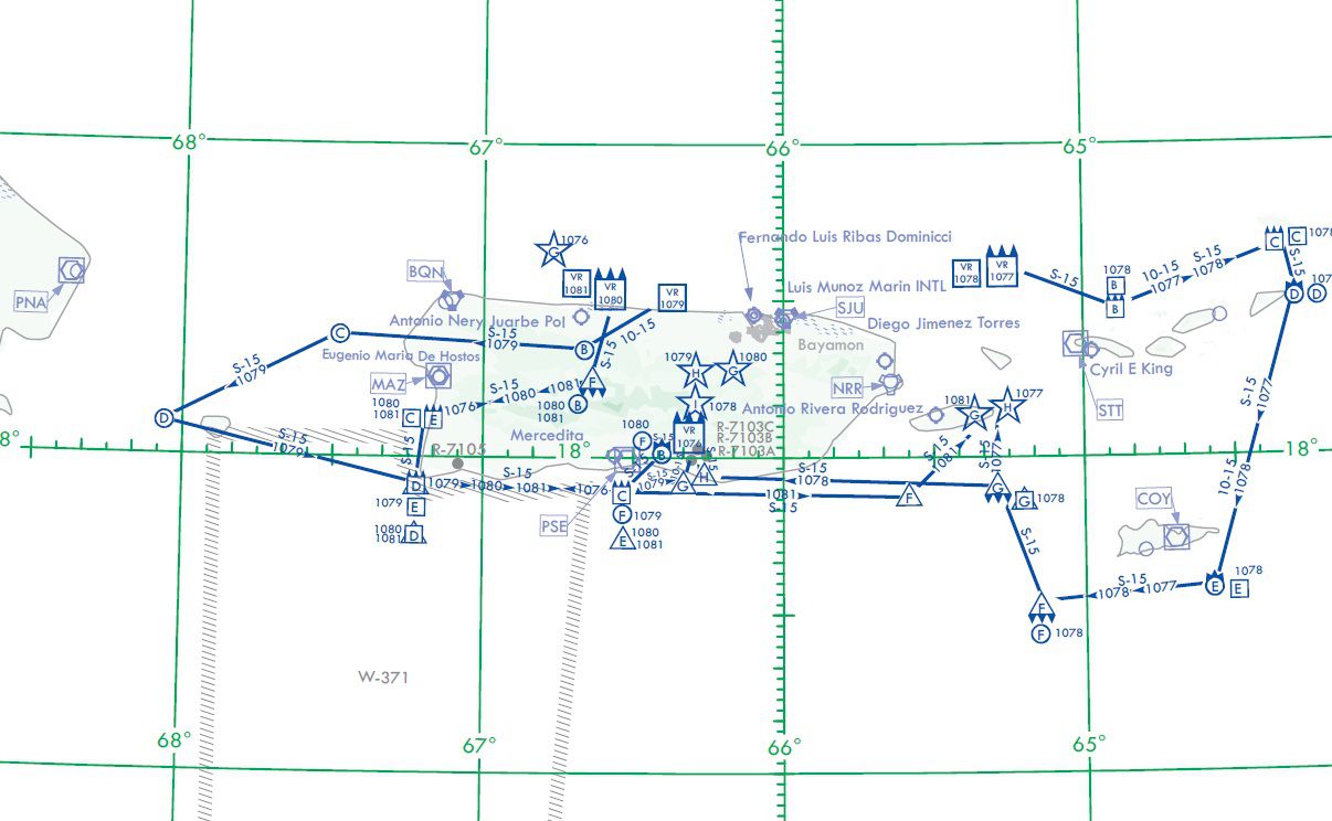
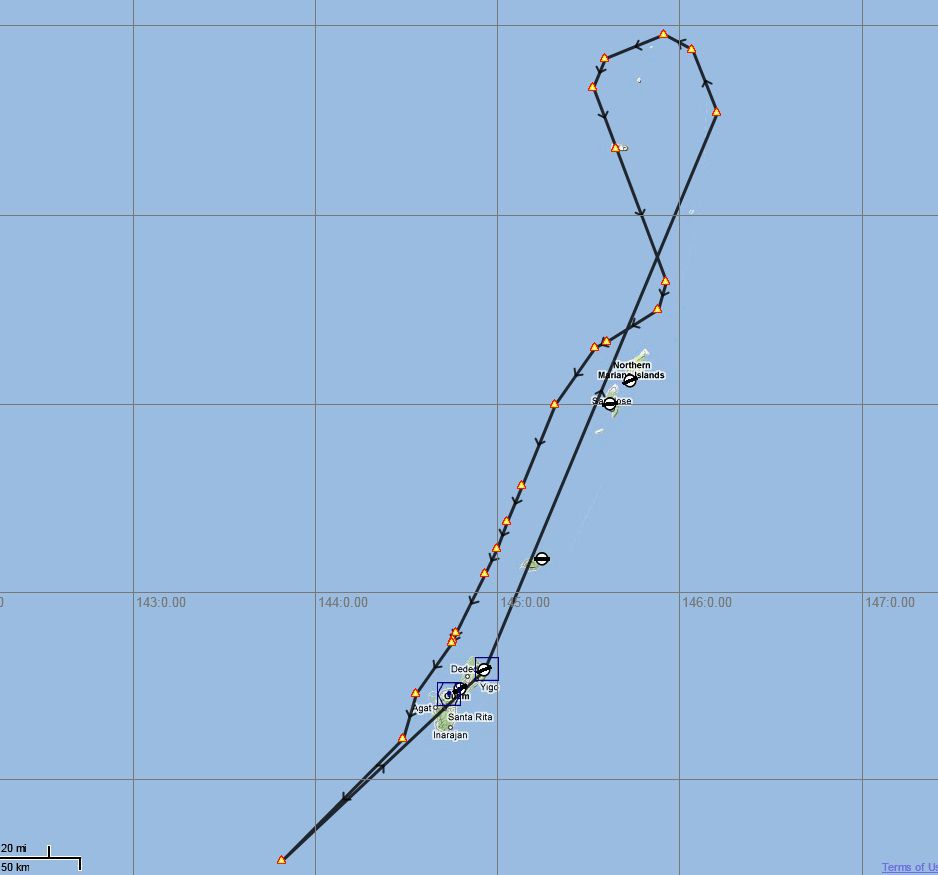
In this pack, you will discover multiple flight paths tailored to the exacting conditions of Guam and Puerto Rico. These two territories offer diverse topographies, making them ideal for extended low-level runs. Pilots can engage in realistic maneuvers that replicate genuine military training exercises, which are customarily performed by bombers like the B-52 Stratofortress, swing-wing aircraft such as the F-111, and even the sleek B-2 Spirit. Nonetheless, any aircraft can be used to practice the same navigating procedures across these challenging routes.
Routes Catered to IFR, VFR, and Slow-Speed Scenarios
The package includes nine separate paths, each categorized by the nature of the flight environment. Some routes emphasize low-speed approaches for smaller jets, while others are designed for intricate instrument approaches typical of IFR flights. There are also VFR lines that focus on visibility-based navigation. This variety ensures that all types of aircrews—ranging from casual explorers to advanced simulation pilots—obtain a wide spectrum of training opportunities.
Expanded Gauge Functionality with TFR and Pave Tack Systems
A key highlight of this release is the inclusion of two gauges—both authored by Karol Chlebowski. First is the TFR (Terrain Following Radar) gauge, which assists in maintaining steady altitudes over uneven terrain. Additionally, the Pave Tack integration provides advanced targeting, reconnaissance, and navigational functionalities typically encountered in modern fighter and bomber operations. By combining these tools with the built-in features of the simulator, you get a system that closely emulates the avionics you'd expect in dedicated combat aircraft.
Optional Mini Panel v2.1 Integration
For those seeking even more cohesive instrumentation, Bill McClellan also recommends the optional mini panel v2.1. This enhanced panel brings together TFR, Pave Tack, and several other tactical overlays into a single interface, streamlining access to critical data during intense phases of flight. Although not required to enjoy the nine routes, this panel significantly raises the realism when conducting high-speed maneuvers at low altitudes.
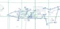
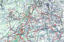
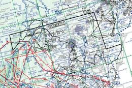
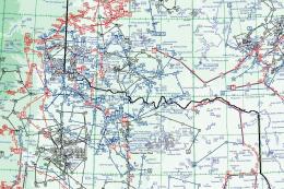
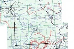
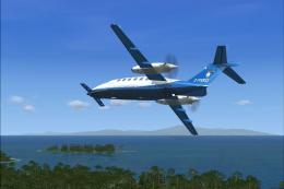
Illustration showing one of the planned routes.
Ideal Missions for a Range of Combat and Civilian Aircraft
Though designed with high-performance bombers and interceptors in mind, the routes can be adapted to any aircraft type, offering desired freedom for civil aviation fans as well. Pilots who prefer historical bombers like the British Avro Vulcan or modern multirole jets will discover routes that test speed, agility, and flight management skills over oceanic expanses and tropical landscapes. In every scenario, the combination of realistic terrain contours and carefully plotted waypoints delivers immersion suitable for extended mission operations.
Developers and Acknowledgments
This freeware add-on is authored by Bill McClellan, with two essential gauges provided by Karol Chlebowski. Their work ensures that this expansion feels natural within Microsoft Flight Simulator X while preserving the challenging elements intrinsic to low-altitude practice runs. Because of their dedication, virtual pilots can refine bombing runs, simulate reconnaissance missions, and sharpen general flight techniques over remote territories that offer unique geographical variety.
Images & Screenshots
The archive us_territories.zip has 21 files and directories contained within it.
File Contents
This list displays the first 500 files in the package. If the package has more, you will need to download it to view them.
| Filename/Directory | File Date | File Size |
|---|---|---|
| Instruction Manual.pdf | 09.14.11 | 1.19 MB |
| Pave Tack Notes.pdf | 09.14.11 | 190.52 kB |
| Pave Tack.cab | 07.05.11 | 633.89 kB |
| Puerto Rico.jpg | 09.11.11 | 175.59 kB |
| Readme.txt | 09.15.11 | 2.12 kB |
| TFR.cab | 07.02.11 | 9.88 kB |
| FlightPlans | 09.15.11 | 0 B |
| IR-026 (SAN JUAN PR).pln | 09.06.11 | 2.27 kB |
| IR-027 (SAN JUAN PR).pln | 09.01.11 | 1.88 kB |
| IR-983 (GUAM ISLAND) .PLN | 09.02.11 | 5.57 kB |
| VR-1076 (SAN JUAN PR).PLN | 09.06.11 | 2.84 kB |
| VR-1077 (SAN JUAN PR).PLN | 09.06.11 | 3.03 kB |
| VR-1078 (SAN JUAN PR).PLN | 09.06.11 | 3.23 kB |
| VR-1079 (SAN JUAN PR).PLN | 09.06.11 | 3.03 kB |
| VR-1080 (SAN JUAN PR).PLN | 09.06.11 | 2.84 kB |
| VR-1081 (SAN JUAN PR).PLN | 09.06.11 | 2.84 kB |
| Maps | 09.15.11 | 0 B |
| Guam.jpg | 09.11.11 | 69.78 kB |
| Puerto Rico.jpg | 09.11.11 | 175.59 kB |
| flyawaysimulation.txt | 10.29.13 | 959 B |
| Go to Fly Away Simulation.url | 01.22.16 | 52 B |
Installation Instructions
Most of the freeware add-on aircraft and scenery packages in our file library come with easy installation instructions which you can read above in the file description. For further installation help, please see our Flight School for our full range of tutorials or view the README file contained within the download. If in doubt, you may also ask a question or view existing answers in our dedicated Q&A forum.
Related Add-ons
Some mods you may like


0 comments
Leave a Response