 FSX Misc
Flight Plans For The Southwestern US
Embark on a low-altitude cross-country journey through the southwestern Unite…
Northeastern US low-level flight plans deliver 196 carefully built IFR, VFR, and slow-speed routes for realistic terrain-hugging training, valley runs, and checkpoint timing in Microsoft Flight Simulator X. Optional terrain-following radar and Pave Tack-style gauges add cockpit guidance for reconnaissance and strike practice, supporting everything from heavy bombers to fast jets and general aviation.
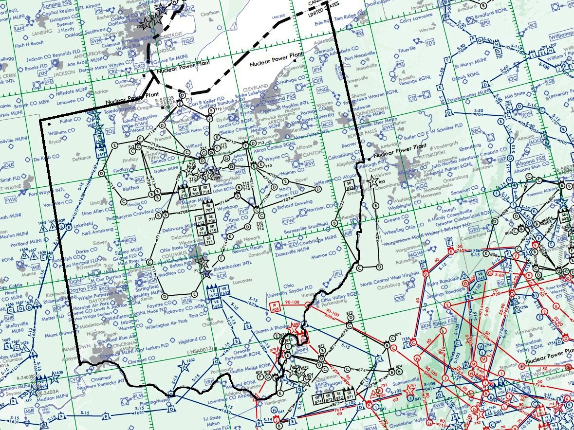
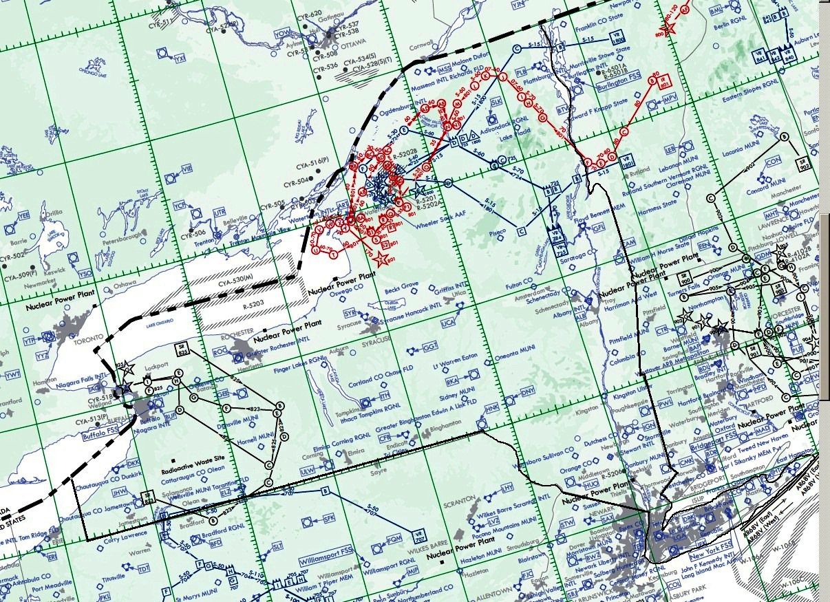
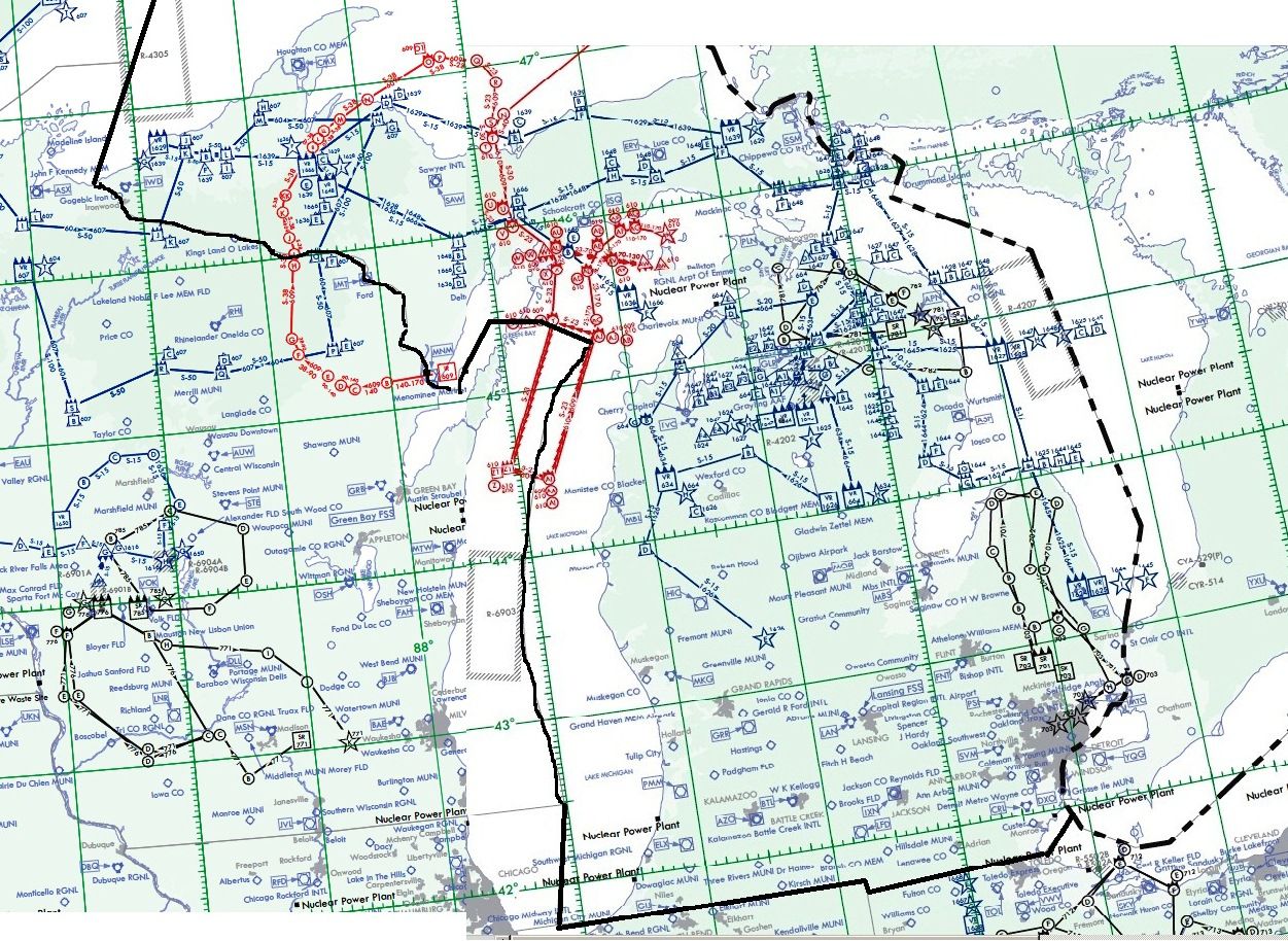
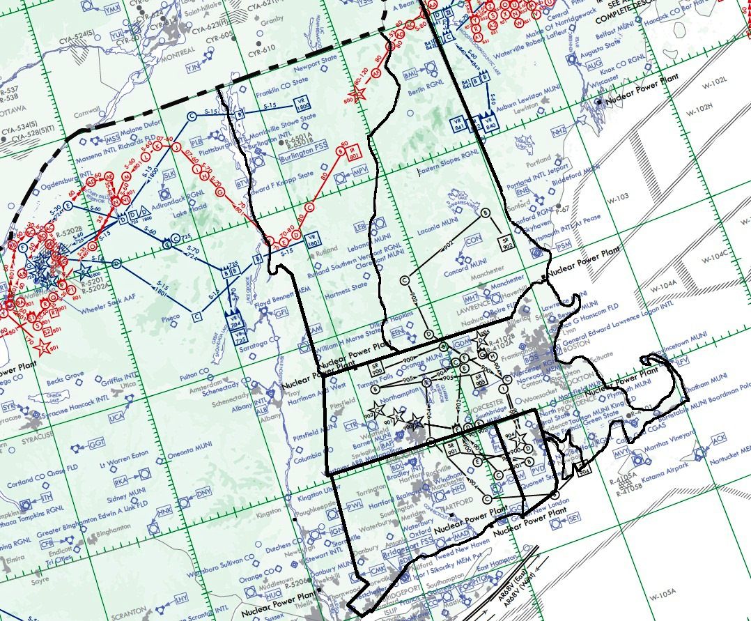
Experience an extensive set of low-level routes across the Northeastern United States, meticulously crafted for Microsoft Flight Simulator X enthusiasts seeking both IFR and VFR flight corridors. This all-inclusive bundle encompasses 196 routes—covering IFR, VFR, and slow-speed profiles—to accommodate a wide range of aircraft. It also integrates specialized gauges by Karol Chlebowski that streamline terrain-following flight and reconnaissance operations, ensuring an engaging journey on each route. Developed by Bill McClellan, the package offers a unique military training dimension for fans of B-52, F-111, B-1B, B-2, A6, A4, Vulcan, or any other combat airplane you prefer.
Each route in this set is designed for realistic low-altitude exploration within Northeastern airspace. Pilots can navigate valleys, river basins, and rolling hills as they refine their formation procedures or perfect high-speed maneuvers. These carefully laid-out tracks re-create authentic regional training lanes used by various tactical air wings. Moreover, they offer flexible altitude profiles, so pilots can replicate the adrenaline-fueled rides typical of fighter and bomber missions.
The package includes a detailed assortment of instrument flight rules (IFR) plans for precision flying, as well as visual flight rules (VFR) paths for those wanting an authentic out-the-window experience. Users can also opt for slower-speed routes, which grant additional time to analyze terrain and master advanced navigation procedures. With these expansive routes, you can fine-tune everything from low-level navigation to timing checkpoints across changing weather conditions in the Northeastern region.
Two optional gauges developed by Karol Chlebowski—one focusing on terrain-following radar (TFR) and another called Pave Tack—significantly enhance your low-level sorties. The TFR gauge helps in maintaining consistent terrain clearance, even in rapidly shifting topography. Meanwhile, Pave Tack offers navigation and reconnaissance capabilities, including simulated bombing functionalities, that align closely with real-world mission demands. For those seeking an even broader range of tools, v2.1 of the mini-panel (also provided by the author) combines these capabilities in a single interface.
Although the routes cater to military-grade jets and bombers, you are free to engage them with any aircraft, whether it’s a light fixed-wing or a civilian airliner. The variety of flight strategies in IFR, VFR, and slow-speed configurations allows you to sharpen diverse piloting methods, making each trip in Microsoft Flight Simulator X both riveting and credible.
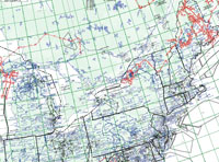
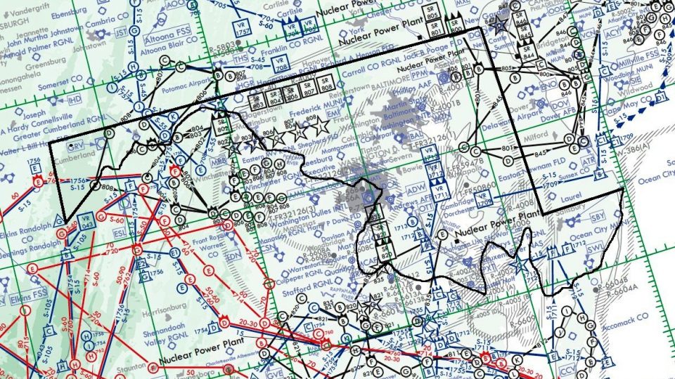
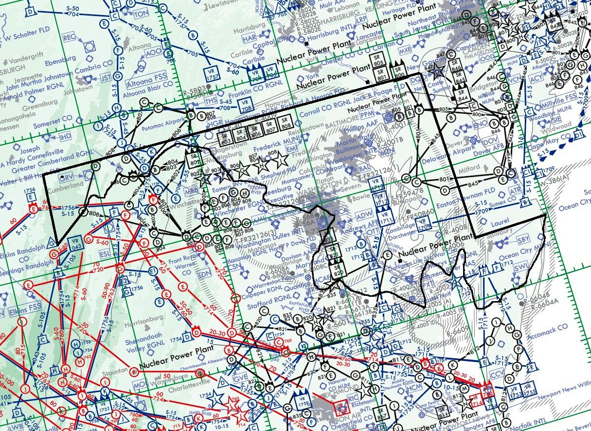
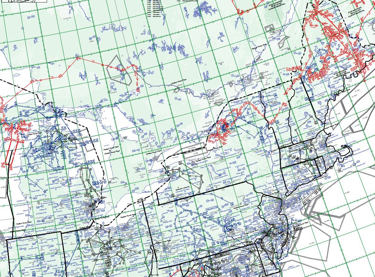
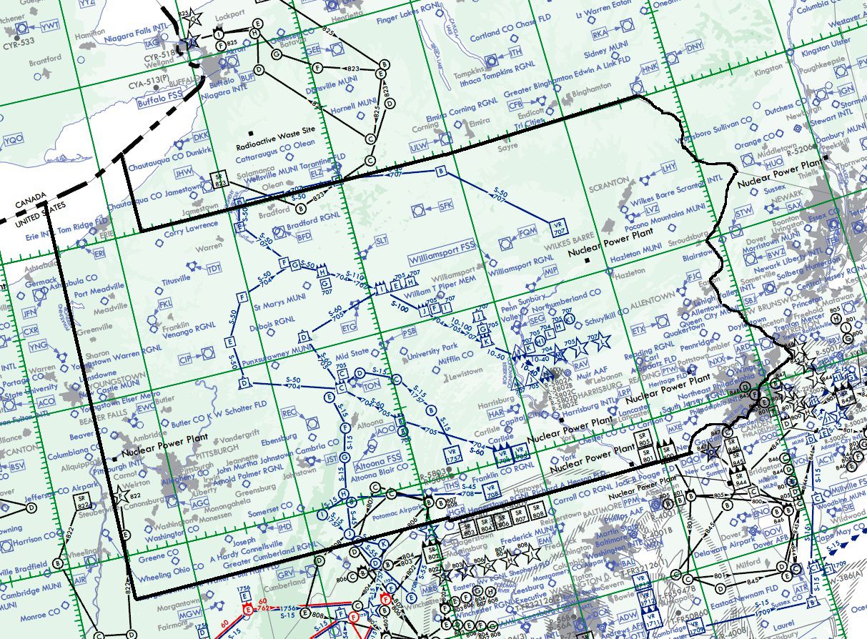
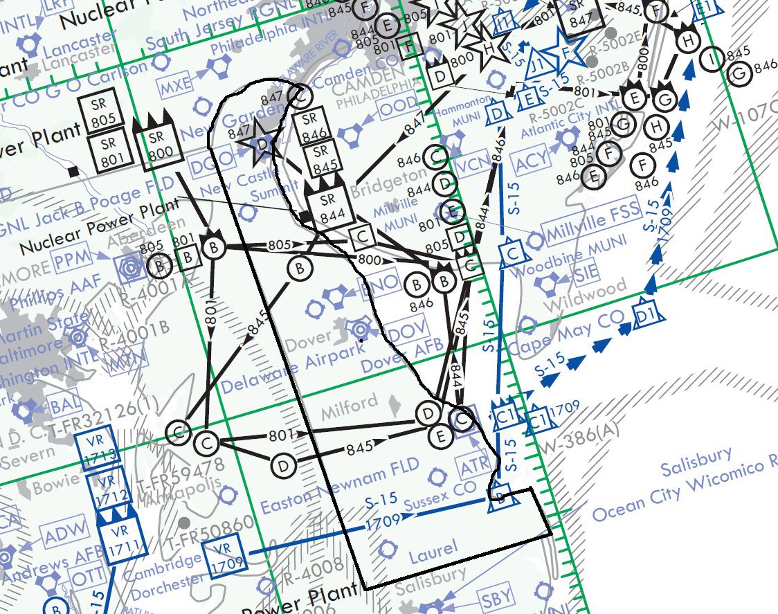
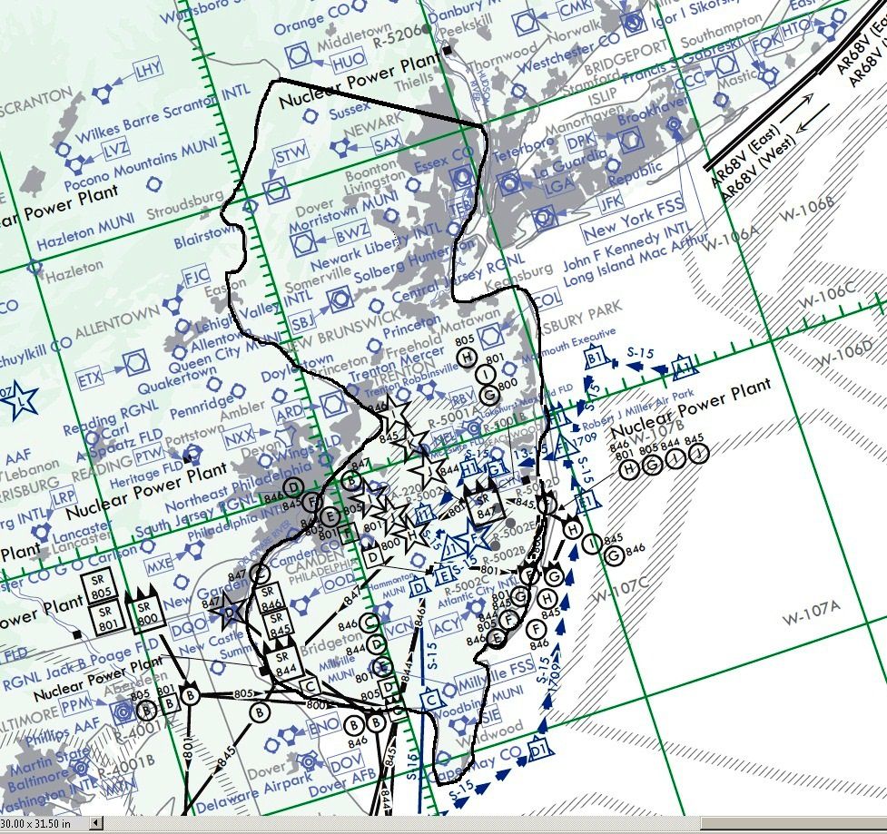
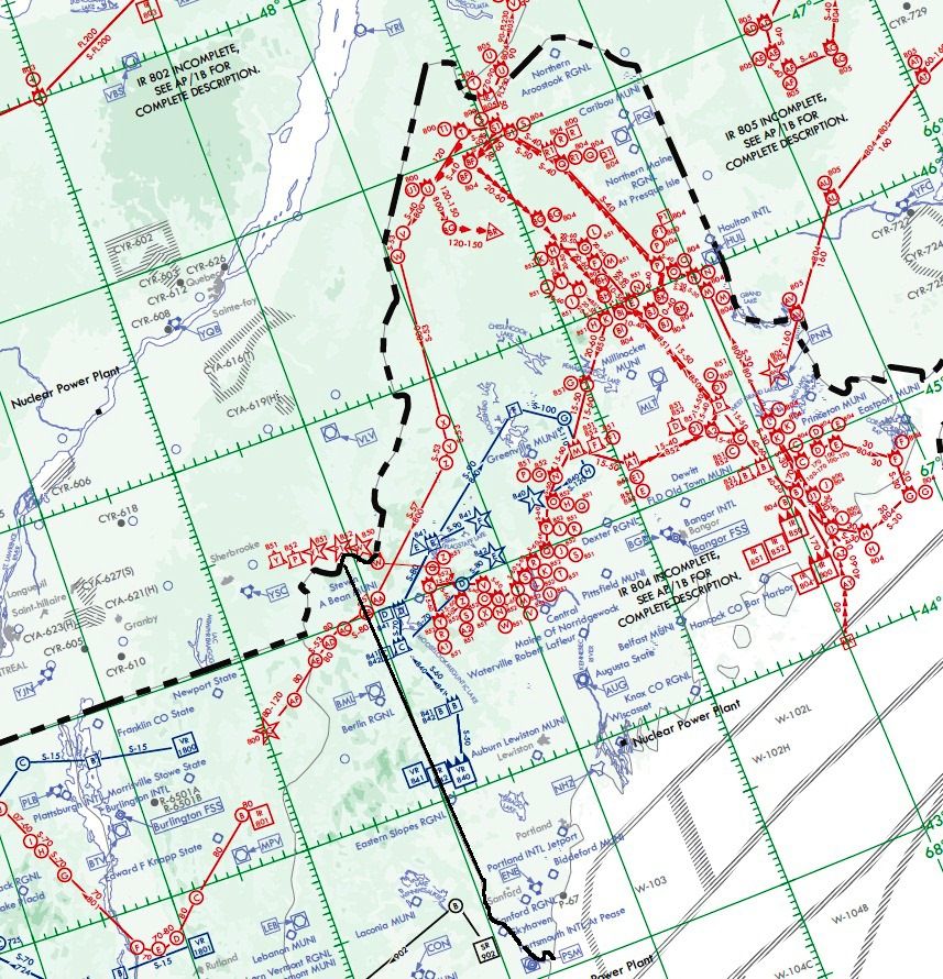
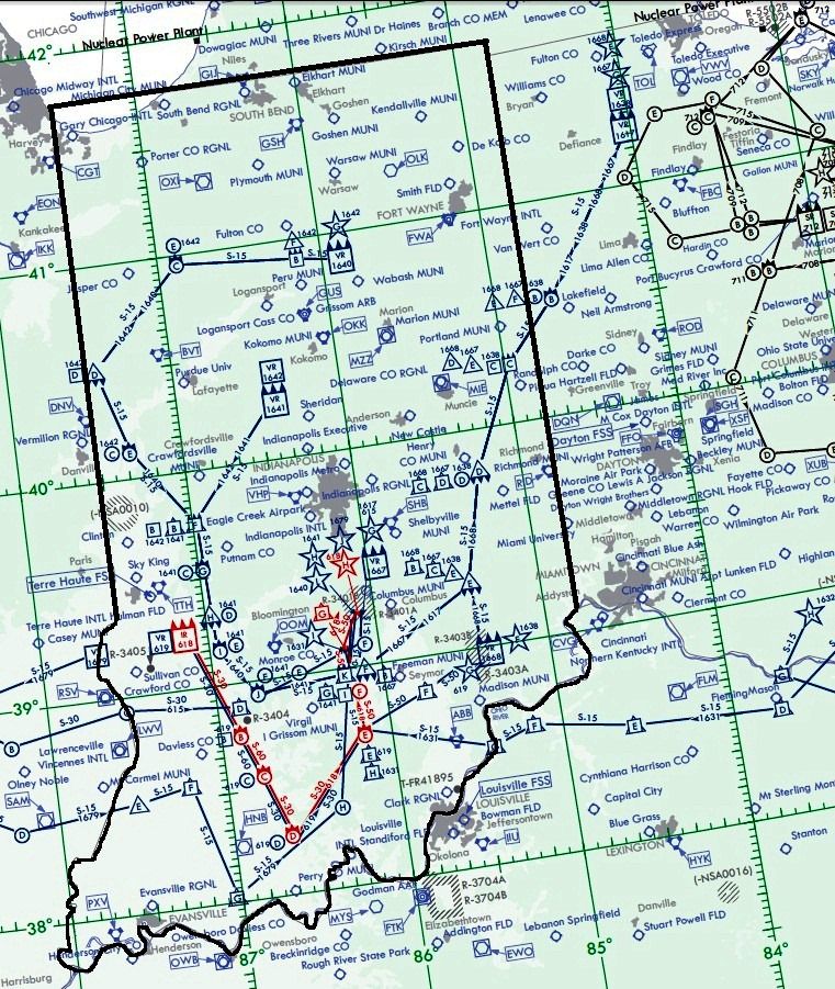
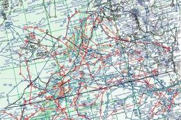
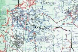
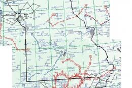
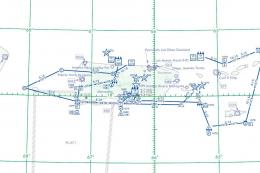
Illustration of flight plan coverage in the Northeastern U.S.
Alongside these flight plans, the companion gauges will help you simulate military-level tactics with more precision. This entire package is brought to you by Bill McClellan, integrating authentic routes, innovative cockpit enhancements, and robust operational freedom for military-inspired or civilian flights alike.
Free for all simmers · 7.18 MB · Scanned clean Jul 2026
Download speed: Free tier is capped at 0.5 Mbps (this file takes approximately 2 mins at the cap). PRO members download at full line speed.
SimObjects\Airplanes\, Addon Scenery\, Effects\, or Gauges\.readme.txt or README file. It tells you exactly where files go, what dependencies are needed, and any quirks specific to this add-on.The archive northeast_us_flightplans.zip has 120 files and directories contained within it.
This list displays the first 500 files in the package. If the package has more, you will need to download it to view them.
| Filename/Directory | File Date | File Size |
|---|---|---|
| Northeastern US.jpg | 09.12.11 | 701.60 kB |
| Pave Tack Notes.pdf | 09.14.11 | 190.52 kB |
| Pave Tack.cab | 07.05.11 | 633.89 kB |
| Readme.txt | 09.14.11 | 2.09 kB |
| TFR.cab | 07.02.11 | 9.88 kB |
| FlightPlans | 09.13.11 | 0 B |
| IR-079 (BRISTOL TN).PLN | 09.07.11 | 6.94 kB |
| IR-608 (ROANOKE VA).PLN | 09.07.11 | 3.03 kB |
| IR-609 (MARQUETTE MI).PLN | 09.07.11 | 8.27 kB |
| IR-610 (SAULT STE MARIE MI).PLN | 09.06.11 | 8.40 kB |
| IR-618 (INDIANAPOLIS IN).PLN | 09.07.11 | 3.04 kB |
| IR-723 (CHARLESTON WV).PLN | 09.06.11 | 3.41 kB |
| IR-762 (MORGANTOWN WV).PLN | 09.06.11 | 2.64 kB |
| IR-800 (BANGOR ME).PLN | 09.06.11 | 7.87 kB |
| IR-800A (BURLINGTON VT).PLN | 09.06.11 | 12.39 kB |
| IR-801 (FORT DRUM NY).PLN | 09.06.11 | 9.83 kB |
| IR-804 (PRESQUE ISLE ME).PLN | 09.06.11 | 12.95 kB |
| IR-850 (BANGOR ME).PLN | 09.06.11 | 6.51 kB |
| IR-851 (BANGOR ME).PLN | 09.09.11 | 7.68 kB |
| IR-852 (BANGOR ME).PLN | 09.06.11 | 5.34 kB |
| SR-701 (DETRIOT MI).PLN | 09.06.11 | 3.02 kB |
| SR-702 (DETRIOT MI).PLN | 09.06.11 | 3.22 kB |
| SR-703 (DETRIOT MI).PLN | 09.06.11 | 2.44 kB |
| SR-707 (COLUMBUS OH).PLN | 09.06.11 | 3.03 kB |
| SR-708 (COLUMBUS OH).PLN | 09.06.11 | 3.03 kB |
| SR-709 (COLUMBUS OH).PLN | 09.07.11 | 2.45 kB |
| SR-710 (COLUMBUS OH).PLN | 09.06.11 | 3.03 kB |
| SR-711 (COLUMBUS OH).PLN | 09.07.11 | 2.64 kB |
| SR-712 (COLUMBUS OH).PLN | 09.06.11 | 2.84 kB |
| SR-713 (COLUMBUS OH).PLN | 09.06.11 | 2.84 kB |
| SR-714 (COLUMBUS OH).PLN | 09.06.11 | 2.84 kB |
| SR-715 (COLUMBUS OH).PLN | 09.06.11 | 3.03 kB |
| SR-730 (MINNEAPOLIS).PLN | 09.06.11 | 2.85 kB |
| SR-731 (MINNEAPOLIS).PLN | 09.06.11 | 2.46 kB |
| SR-781 (LANSING MI).PLN | 09.06.11 | 2.63 kB |
| SR-782 (LANSING MI).PLN | 09.06.11 | 2.82 kB |
| SR-800 (NORTH PHILADELPHIA PA).PLN | 09.06.11 | 3.02 kB |
| SR-801 (NORTH PHILADELPHIA PA).PLN | 09.06.11 | 3.41 kB |
| SR-802 (MARTINSBURG WV).PLN | 09.06.11 | 2.85 kB |
| SR-803 (MARTINSBURG WV).PLN | 09.06.11 | 2.65 kB |
| SR-804 (MARTINSBURG WV).PLN | 09.06.11 | 3.04 kB |
| SR-805 (NORTH PHILADELPHIA PA).PLN | 09.06.11 | 3.22 kB |
| SR-806 (MARTINSBURG WV).PLN | 09.06.11 | 2.85 kB |
| SR-807 (MARTINSBURG WV).PLN | 09.06.11 | 3.04 kB |
| SR-808 (MARTINSBURG WV).PLN | 09.06.11 | 3.24 kB |
| SR-820 (WASHINGTON DC).PLN | 09.06.11 | 3.02 kB |
| SR-821 (WASHINGTON DC).PLN | 09.06.11 | 2.83 kB |
| SR-822 (PITTSBURGH PA).PLN | 09.06.11 | 2.64 kB |
| SR-823 (BUFFALO NY).PLN | 09.06.11 | 3.41 kB |
| SR-825 (BUFFALO NY).PLN | 09.06.11 | 2.83 kB |
| SR-835 (WASHINGTON DC).PLN | 09.06.11 | 2.63 kB |
| SR-844 (MILLVILLE DE).PLN | 09.06.11 | 3.41 kB |
| SR-845 (MILLVILLE DE).PLN | 09.06.11 | 3.60 kB |
| SR-846 (MILLVILLE DE).PLN | 09.06.11 | 3.21 kB |
| SR-847 (MILLVILLE DE).PLN | 09.06.11 | 2.25 kB |
| SR-900 (BRIDGEPORT CT).PLN | 09.06.11 | 2.83 kB |
| SR-901 (BRIDGEPORT CT).PLN | 09.09.11 | 2.44 kB |
| SR-902 (BRIDGEPORT CT).PLN | 09.06.11 | 2.82 kB |
| SR-904 (BOSTON MA).PLN | 09.06.11 | 3.41 kB |
| SR-905 (BOSTON MA).PLN | 09.06.11 | 2.25 kB |
| VR-1617 (TOLEDO OH).PLN | 09.07.11 | 2.83 kB |
| VR-1624 (ALPENA MI).PLN | 09.05.11 | 3.21 kB |
| VR-1625 (ALPENA MI).PLN | 09.07.11 | 2.63 kB |
| VR-1626 (MOUNT PLESANT MI).PLN | 09.07.11 | 2.43 kB |
| VR-1627 (CHEBOYGAN MI).PLN | 09.07.11 | 3.02 kB |
| VR-1628 (SAULT STE MARIE MI).PLN | 09.07.11 | 3.41 kB |
| VR-1629 (MARQUETTE MI).PLN | 09.07.11 | 2.83 kB |
| VR-1631 (CINCINNATI OH).PLN | 09.07.11 | 3.22 kB |
| VR-1632 (COLUMBUS OH).PLN | 09.07.11 | 3.03 kB |
| VR-1633 (HUNTINGTON WV).PLN | 09.07.11 | 2.45 kB |
| VR-1636 (ESCANABA MI).PLN | 09.07.11 | 2.63 kB |
| VR-1638 (MUNCIE IN).PLN | 09.07.11 | 2.63 kB |
| VR-1639 (MARQUETTE MI).PLN | 09.07.11 | 2.82 kB |
| VR-1640 (FORT WAYNE IN).PLN | 09.07.11 | 3.80 kB |
| VR-1641 (FORT WAYNE IN).PLN | 09.02.11 | 3.02 kB |
| VR-1642 (INDIANAPOLIS IN).PLN | 09.07.11 | 2.83 kB |
| VR-1644 (ALPENA MI).PLN | 09.02.11 | 3.21 kB |
| VR-1645 (OSCODA MI).PLN | 09.07.11 | 2.63 kB |
| VR-1647 (ALPENA MI).PLN | 09.07.11 | 3.02 kB |
| VR-1648 (SAULT STE MARIE MI).PLN | 09.07.11 | 3.40 kB |
| VR-1666 (ESCANABA MI).PLN | 09.07.11 | 2.63 kB |
| VR-1667 (TOLEDO OH).PLN | 09.07.11 | 2.83 kB |
| VR-1668 (MUNCIE IN).PLN | 09.07.11 | 2.63 kB |
| VR-1679 (TERRE HAUTE IN).PLN | 09.07.11 | 3.43 kB |
| VR-1709 (ALANTIC CITY NJ).PLN | 09.02.11 | 2.64 kB |
| VR-1711 (WASHINGTON DC).PLN | 09.07.11 | 2.83 kB |
| VR-1712 (WASHINGTON DC).PLN | 09.07.11 | 2.83 kB |
| VR-1713 (RICHMOND VA).PLN | 09.07.11 | 3.02 kB |
| VR-1757 (ALTOONA PA).PLN | 09.07.11 | 3.79 kB |
| VR-1800 (BURLINGTON VT).PLN | 09.07.11 | 2.44 kB |
| VR-1801 (BURLINGTON VT).PLN | 09.07.11 | 2.44 kB |
| VR-604 (DULUTH MN).PLN | 09.06.11 | 5.35 kB |
| VR-607 (DULUTH MN).PLN | 09.06.11 | 5.35 kB |
| VR-615 (SPRINGFIELD IL).PLN | 09.07.11 | 2.84 kB |
| VR-619 (TERRE HAUTE IN).PLN | 09.06.11 | 2.85 kB |
| VR-634 (TRAVERSE CITY MI).PLN | 09.06.11 | 3.02 kB |
| VR-664 (TRAVERSE CITY MI).PLN | 09.06.11 | 3.02 kB |
| VR-704 (HARRISBURG PA).PLN | 09.06.11 | 3.99 kB |
| VR-705 (HARRISBURG PA).PLN | 09.06.11 | 3.22 kB |
| VR-707 (HARRISBURG PA).PLN | 09.06.11 | 3.80 kB |
| VR-708 (BALTIMORE MD).PLN | 09.06.11 | 2.63 kB |
| VR-724 (SYRACUSE NY).PLN | 09.06.11 | 3.03 kB |
| VR-725 (SYRACUSE NY).PLN | 09.06.11 | 2.64 kB |
| VR-840 (BANGOR ME).PLN | 09.06.11 | 3.21 kB |
| VR-841 (BANGOR ME).PLN | 09.06.11 | 2.63 kB |
| VR-842 (BANGOR ME).PLN | 09.06.11 | 2.43 kB |
| Maps | 09.13.11 | 0 B |
| CT RI MA VT NH.jpg | 08.31.11 | 492.55 kB |
| Delaware.jpg | 08.31.11 | 507.45 kB |
| Indiania.jpg | 09.04.11 | 362.65 kB |
| Maine.jpg | 09.04.11 | 387.38 kB |
| Maryland.jpg | 09.04.11 | 718.03 kB |
| Michigan.jpg | 09.13.11 | 568.72 kB |
| New Jersey.jpg | 09.13.11 | 495.09 kB |
| New York.jpg | 09.04.11 | 542.52 kB |
| Ohio.jpg | 09.04.11 | 617.86 kB |
| Pennsylvania.jpg | 09.13.11 | 692.94 kB |
| Instruction Manual.pdf | 09.14.11 | 1.19 MB |
| flyawaysimulation.txt | 10.29.13 | 959 B |
| Go to Fly Away Simulation.url | 01.22.16 | 52 B |
Only PRO members can place votes.
More FSX & P3D add-ons hand-picked based on this download.
FSX Misc
Embark on a low-altitude cross-country journey through the southwestern Unite…
 FSX Misc
This comprehensive freeware collection of 196 flight plans focuses on various…
 FSX Misc
Cover vast low-altitude corridors across the South Central U.S. with 179 meti…
 FSX Misc
This freeware package offers an extensive collection of low-level military tr…
 FSX Misc
This comprehensive freeware package offers a set of precise low-altitude trai…
 FSX Misc
Includes actual current flights. By Kevin R. Wynn. Screenshot of Emirates Air…
 FSX Misc
British Airways Airbus A318 Flight Plans for fall 2009. Data taken from Briti…
 FSX Misc
Includes actual flightplans up to September 2013. By Kevin R. Wynn. Thai Airw…
Be the first to leave a comment on this download.
Be the first to share your thoughts on this download.