FSX Flight Plans for the North Central US
Low-level military training comes alive with 77 north-central US routes covering IFR, VFR, and Slow Speed Route operations in Microsoft Flight Simulator X. Purpose-built flight plans pair with included Terrain Following Radar and Pave Tack gauges, plus an optional mini panel, to support realistic bomber and fighter-style navigation, terrain-hugging profiles, and tactical mission practice.

 Prepar3D
- File: north_central_us_flightplans.zip
- Size:5.13 MB
- Scan:
Clean (7d)
- Access:Freeware
- Content:Everyone
This freeware package offers an extensive collection of low-level military training routes spanning the north central region of the United States. Included are 77 detailed flight plans designed for IFR (Instrument Flight Rules), VFR (Visual Flight Rules), and SSR (Slow Speed Route) operations, which are ideal for anyone wanting to replicate bomber and fighter navigation procedures across varied terrains in Microsoft Flight Simulator X. Developed by Bill McClellan, with additional gauges by Karol Chlebowski, this set provides an authentic training environment and specialized systems to help simulate realistic tactical missions.
Wide-Ranging Training Paths Across Diverse Terrain
These routes traverse a patchwork of farmland and open plains, commonly used for strategic flight practice. Each plan is structured to challenge your altitude management and navigation skills during high-speed sessions or subsonic flights. The package caters not only to bomber-focused enthusiasts flying B-52, F-111, B-1B, B-2, or Vulcan aircraft, but also to pilots who prefer any other airframe. Whether you want to enact precise aeronautical routines or practice standard IFR procedures, these 77 flight plans ensure a substantial variety of configurations and destinations.
Specialized Gauges for Advanced Operations
Included are two functional gauges by Karol Chlebowski designed for TFR (Terrain Following Radar) flight and enhanced Pave Tack capabilities. The TFR gauge allows you to skirt ground features at safer altitudes, simulating specialized bomber ingress and low-altitude navigation. Meanwhile, Pave Tack introduces more refined targeting procedures for bombing runs and reconnaissance tasks, adding simulation depth for those interested in stealthy approaches or precision engagement techniques.
Additional Mini Panel Compatibility
For pilots seeking integrated functionality, there is an optional mini panel (version 2.1) that merges TFR flying and Pave Tack features into a single interface. This panel, created to complement the flight plans, consolidates numerous controls so you can coordinate navigation, autopilot adjustments, and targeting parameters efficiently—all from one concise display.
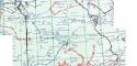
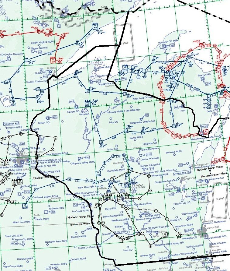
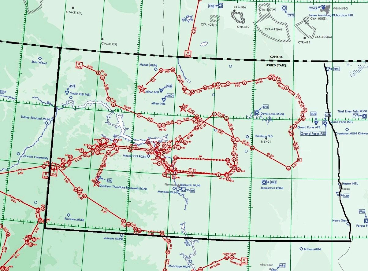
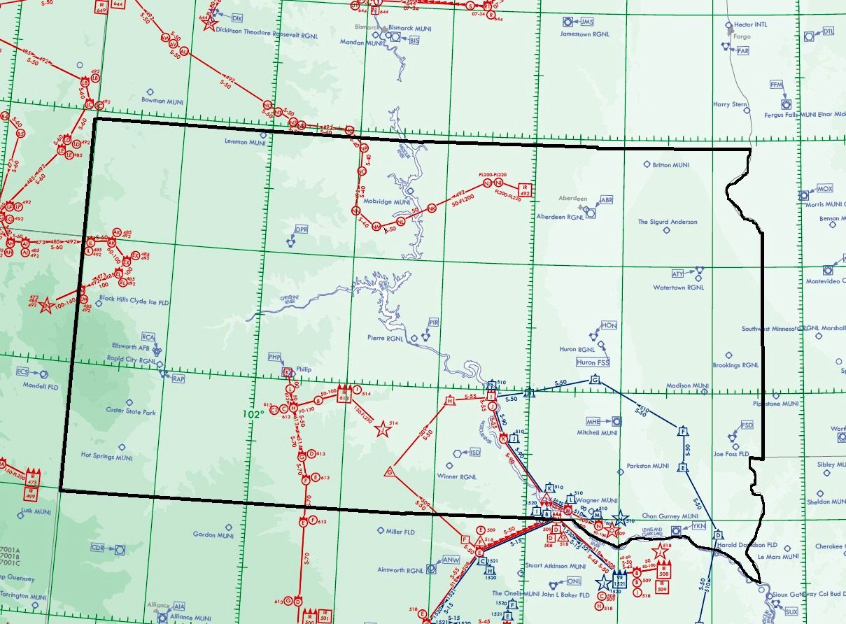
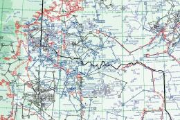
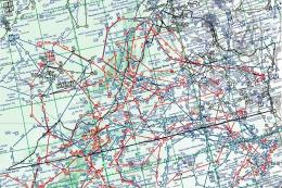
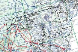
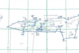
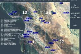
Visual Overview
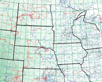
Snapshot showing the expansive network of routes featured in this package.
Key Technical Highlights
- IFR, VFR, and SSR: Multiple route types to practice both traditional and low-speed flight techniques.
- Terrain Following Radar: Crafted for low altitude flight, aiding pilots who want to hug the contours of the terrain during training runs.
- Pave Tack Capabilities: Offers precise navigation and targeting tools that enhance mission realism in bomber or reconnaissance operations.
- Flexible Aircraft Usage: Perfect for heavy bombers, fast jets, or any aircraft suited to low-level flight profiles.
- Optional Mini Panel: Version 2.1 provides an integrated approach for monitoring critical elements in a sleek interface.
Thanks to the meticulous efforts of Bill McClellan and the ingenious gauges from Karol Chlebowski, these flight plans can significantly enhance your simulated flight experience across the north central states. Whether you prefer supersonic routes in a modern fighter or methodical terrain-following maneuvers in a heavy bomber, this comprehensive package brings authentic military-style routing to your simulator skies.
Images & Screenshots
The archive north_central_us_flightplans.zip has 96 files and directories contained within it.
File Contents
This list displays the first 500 files in the package. If the package has more, you will need to download it to view them.
| Filename/Directory | File Date | File Size |
|---|---|---|
| Instruction Manual.pdf | 09.14.11 | 1.19 MB |
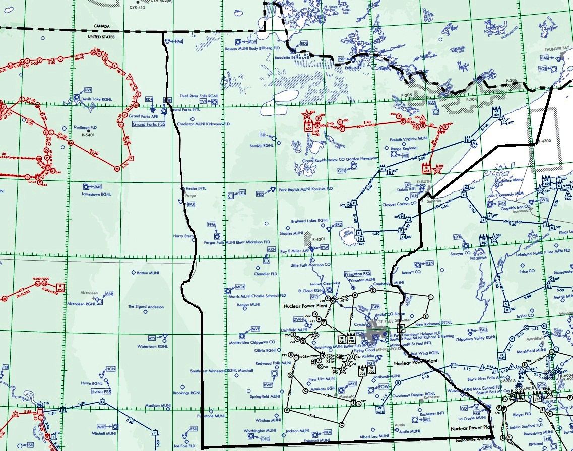
| North Central US States.jpg | 09.13.11 | 540.01 kB |
| Pave Tack Notes.pdf | 09.14.11 | 190.52 kB |
| Pave Tack.cab | 07.05.11 | 633.89 kB |
| Readme.txt | 09.15.11 | 2.10 kB |
| TFR.cab | 07.02.11 | 9.88 kB |
| FlightPlans | 09.15.11 | 0 B |
| IR-174 (LITTLE ROCK AR).PLN | 09.06.11 | 6.31 kB |
| IR-175 (ENID OK).PLN | 09.06.11 | 3.60 kB |
| IR-177 (LAMAR CO).PLN | 09.06.11 | 5.39 kB |
| IR-185 (CHEROKEE OK).PLN | 09.06.11 | 3.60 kB |
| IR-414 (LIMON CO).PLN | 09.06.11 | 2.05 kB |
| IR-424 (DENVER CO).PLN | 09.06.11 | 2.44 kB |
| IR-473 (BILLINGS MT).PLN | 09.07.11 | 9.88 kB |
| IR-485 STRC (RAPID CITY SD).PLN | 09.06.11 | 5.79 kB |
| IR-492 STRC (RAPID CITY SD).PLN | 09.06.11 | 8.13 kB |
| IR-499 STRC (WORLAND WY).PLN | 09.06.11 | 6.55 kB |
| IR-500 (NORTH PLATTE NE).PLN | 09.06.11 | 7.72 kB |
| IR-501 McCOOK NE.PLN | 09.06.11 | 6.14 kB |
| IR-503 (GARDEN CITY KS).PLN | 09.06.11 | 7.29 kB |
| IR-504 (TOPEKA KS).PLN | 09.06.11 | 7.49 kB |
| IR-505 (SALINA KS).PLN | 09.06.11 | 3.59 kB |
| IR-507 (GRAND ISLAND NE).PLN | 09.06.11 | 3.40 kB |
| IR-508 (AINSWORTH NE).PLN | 09.07.11 | 3.41 kB |
| IR-509 (YANKTON SD).PLN | 09.07.11 | 4.39 kB |
| IR-513 (GREAT BEND KS).PLN | 09.06.11 | 6.52 kB |
| IR-514 (NORTH PLATTE NE).PLN | 09.06.11 | 3.41 kB |
| IR-517 (HASTINGS NE).PLN | 09.06.11 | 3.59 kB |
| IR-518 (AINSWORTH NE).PLN | 09.06.11 | 3.39 kB |
| IR-524 (HASTINGD NE).PLN | 09.06.11 | 8.97 kB |
| IR-526 (DODGE CITY KS).PLN | 09.06.11 | 7.49 kB |
| IR-527 (SPRINGFIELD IL).PLN | 09.07.11 | 3.03 kB |
| IR-592 (BRANSON MO).PLN | 09.06.11 | 7.29 kB |
| IR-605 (DULUTH MN).PLN | 09.06.11 | 2.82 kB |
| IR-606 (DULUTH MN).PLN | 09.06.11 | 2.82 kB |
| IR-609 (MARQUETTE MI).PLN | 09.07.11 | 8.27 kB |
| IR-613 (PIERRE SD).PLN | 09.09.11 | 3.44 kB |
| IR-614 (SPRINGFIELD IL).PLN | 09.07.11 | 2.45 kB |
| IR-644 (BISMARCK ND).PLN | 09.06.11 | 8.87 kB |
| IR-649 (MINOT ND).PLN | 09.07.11 | 4.78 kB |
| IR-656 (SASKATOON SK).PLN | 09.07.11 | 4.39 kB |
| IR-678 (GRAND FORKS ND).PLN | 09.07.11 | 8.09 kB |
| SR-221 (LITTLE ROCK AR).PLN | 09.06.11 | 8.08 kB |
| SR-225 (LITTLE ROCK AR).PLN | 09.01.11 | 3.60 kB |
| SR-616 (KANSAS CITY MO).PLN | 09.06.11 | 2.83 kB |
| SR-617 (KANSAS CITY MO).PLN | 09.06.11 | 3.02 kB |
| SR-618 (KANSAS CITY MO).PLN | 09.06.11 | 2.63 kB |
| SR-619 (KANSAS CITY MO).PLN | 09.06.11 | 2.83 kB |
| SR-727 (MINNEAPOLIS MN).PLN | 09.06.11 | 3.23 kB |
| SR-728 (MINNEAPOLIS MN).PLN | 09.06.11 | 2.85 kB |
| SR-729 (MINNEAPOLIS MN).PLN | 09.06.11 | 2.85 kB |
| SR-730 (MINNEAPOLIS).PLN | 09.06.11 | 2.85 kB |
| SR-731 (MINNEAPOLIS).PLN | 09.06.11 | 2.46 kB |
| SR-771 (MILWAUKEE WI).PLN | 09.06.11 | 3.61 kB |
| SR-776 (LA CROSSE WI).PLN | 09.06.11 | 2.83 kB |
| SR-785 (LA CROSSE WI).PLN | 09.06.11 | 2.84 kB |
| VR-119 (WICHITA KS).PLN | 09.06.11 | 2.82 kB |
| VR-138 (HUTCHINSON KS).PLN | 09.06.11 | 3.60 kB |
| VR-152 (WICTHIA KS).PLN | 09.06.11 | 3.01 kB |
| VR-1520 (LINCOLN NE).PLN | 09.07.11 | 3.39 kB |
| VR-1521 (LINCOLN NE).PLN | 09.07.11 | 3.41 kB |
| VR-1525 (KANSAS CITY MO).PLN | 09.07.11 | 2.44 kB |
| VR-1546 (SPRINGFIELD MO).PLN | 09.07.11 | 2.82 kB |
| VR-1616 (ROCHESTER MN).PLN | 09.07.11 | 3.00 kB |
| VR-1635 (SPRINGFIELD IL).PLN | 09.07.11 | 2.45 kB |
| VR-1650 (WISCONSON RAPIDS WI).PLN | 09.07.11 | 2.81 kB |
| VR-1679 (TERRE HAUTE IN).PLN | 09.07.11 | 3.43 kB |
| VR-510 (SIOUX FALLS SD).PLN | 09.06.11 | 4.17 kB |
| VR-511 (MANHATTAN KS).PLN | 09.06.11 | 3.78 kB |
| VR-512 (MANHATTAN KS).PLN | 09.06.11 | 3.78 kB |
| VR-531 (SALINA KS).PLN | 09.06.11 | 2.82 kB |
| VR-532 (HAYS KS).PLN | 09.06.11 | 3.79 kB |
| VR-533 (EMPORIA KS).PLN | 09.06.11 | 3.21 kB |
| VR-534 (EL DORADO KS).PLN | 09.06.11 | 3.02 kB |
| VR-535 (EMPORIA KS).PLN | 09.06.11 | 3.40 kB |
| VR-536 (HAYS KS).PLN | 09.06.11 | 2.63 kB |
| VR-540 (OMAHA NE).PLN | 09.06.11 | 3.98 kB |
| VR-541 (OMAHA NE).PLN | 09.06.11 | 3.98 kB |
| VR-544 (SALINA KS).PLN | 09.06.11 | 3.21 kB |
| VR-545 (SALINA KS).PLN | 09.06.11 | 3.21 kB |
| VR-552 (WICHITA KS).PLN | 09.06.11 | 3.01 kB |
| VR-604 (DULUTH MN).PLN | 09.06.11 | 5.35 kB |
| VR-607 (DULUTH MN).PLN | 09.06.11 | 5.35 kB |
| VR-615 (SPRINGFIELD IL).PLN | 09.07.11 | 2.84 kB |
| Maps | 09.15.11 | 0 B |
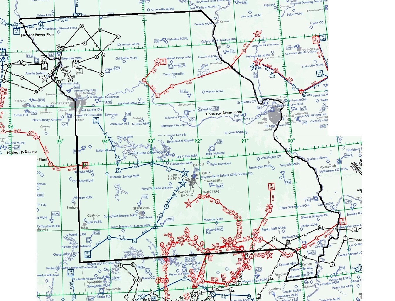
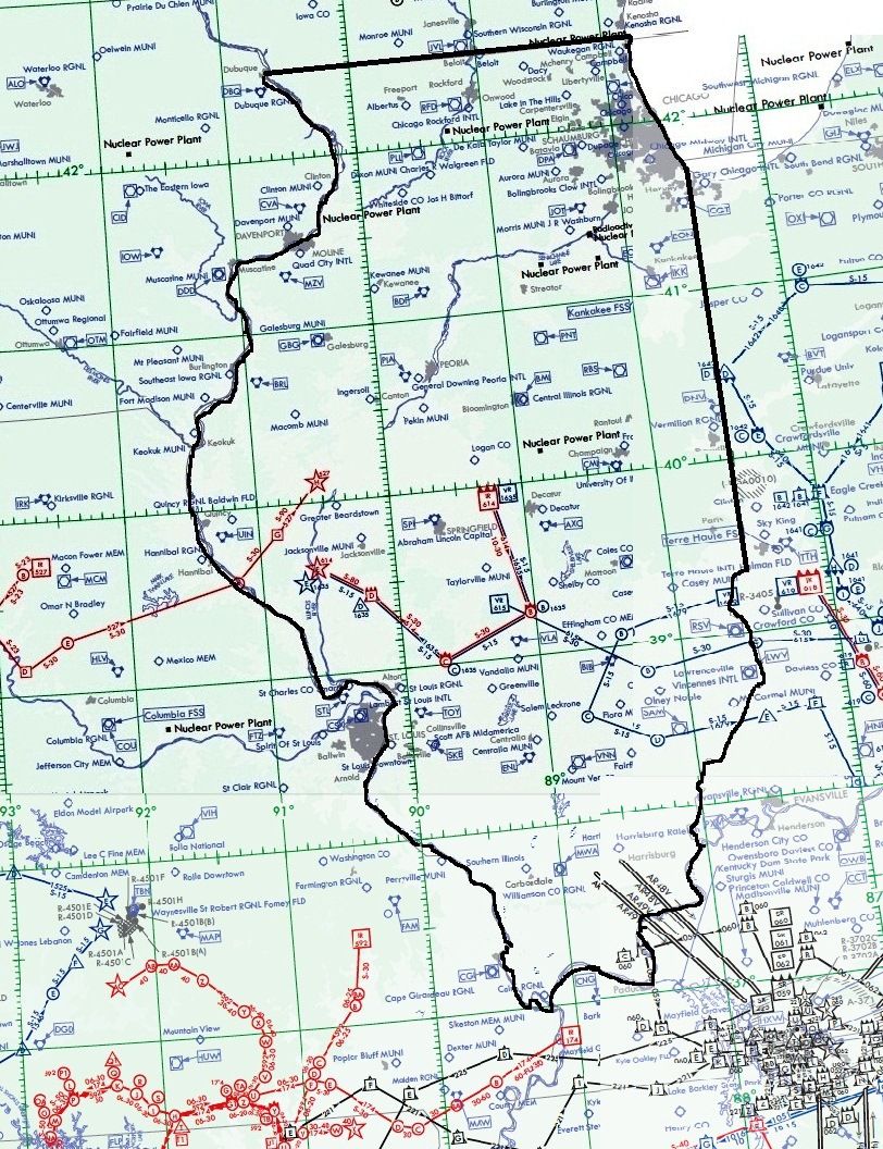
| Illinois.jpg | 09.13.11 | 439.66 kB |
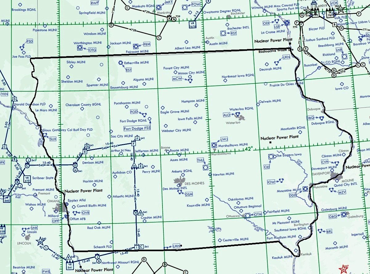
| Iowa.jpg | 09.04.11 | 362.92 kB |
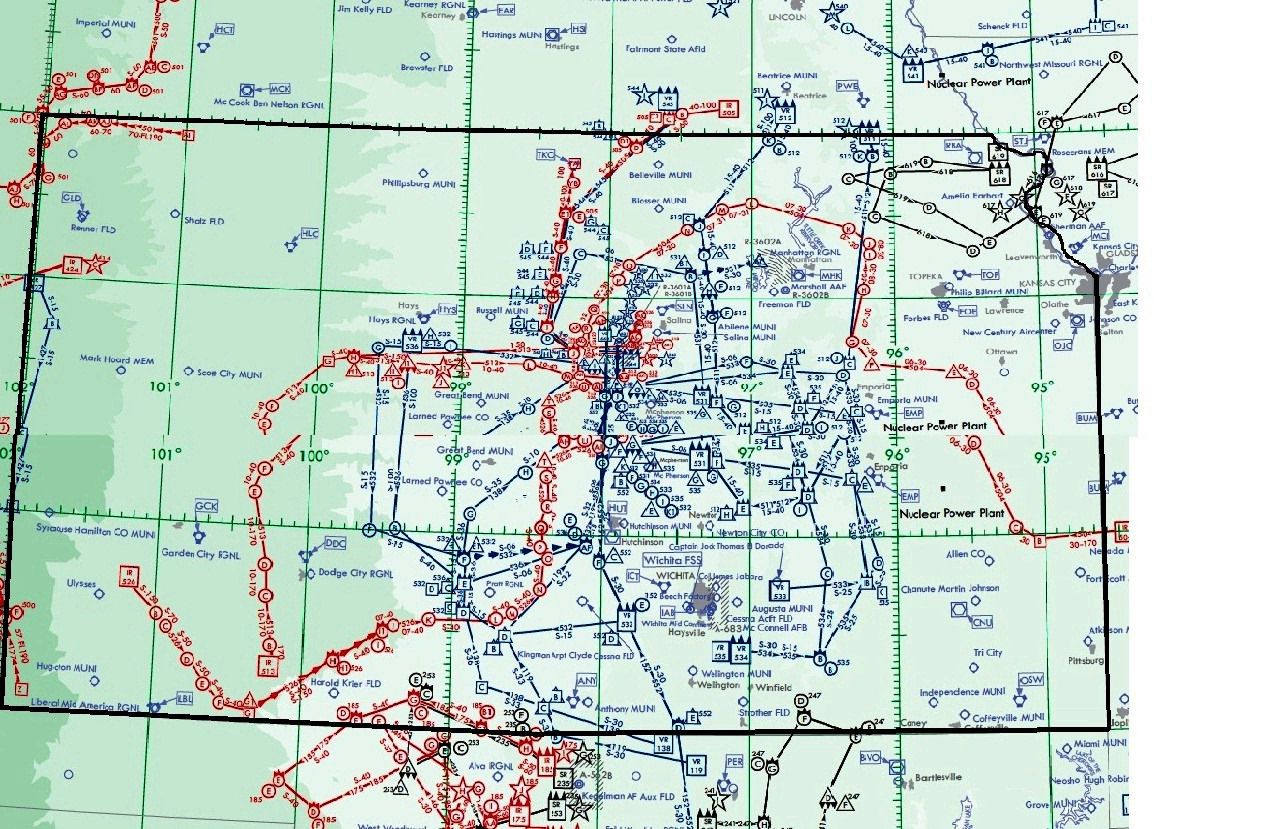
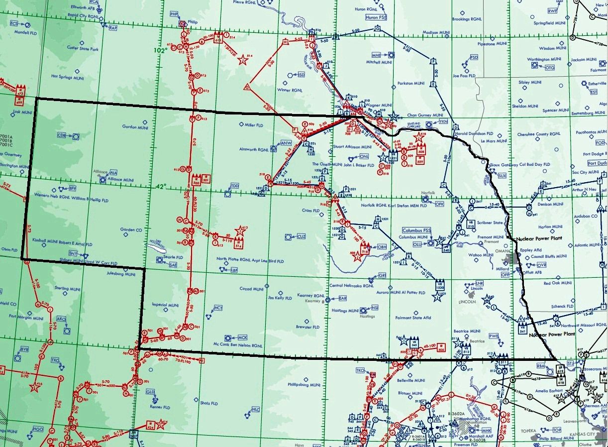
| Kansas.jpg | 09.04.11 | 412.72 kB |
| Minnesota.jpg | 09.04.11 | 402.41 kB |
| Missouri.jpg | 09.08.11 | 510.34 kB |
| Nebraska.jpg | 09.04.11 | 405.02 kB |
| North Dakota.jpg | 09.04.11 | 301.90 kB |
| South Dakota.jpg | 08.31.11 | 312.86 kB |
| Wisconson.jpg | 09.04.11 | 313.30 kB |
| flyawaysimulation.txt | 10.29.13 | 959 B |
| Go to Fly Away Simulation.url | 01.22.16 | 52 B |
Installation Instructions
Most of the freeware add-on aircraft and scenery packages in our file library come with easy installation instructions which you can read above in the file description. For further installation help, please see our Flight School for our full range of tutorials or view the README file contained within the download. If in doubt, you may also ask a question or view existing answers in our dedicated Q&A forum.
Related Add-ons
Some mods you may like


0 comments
Leave a Response