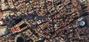
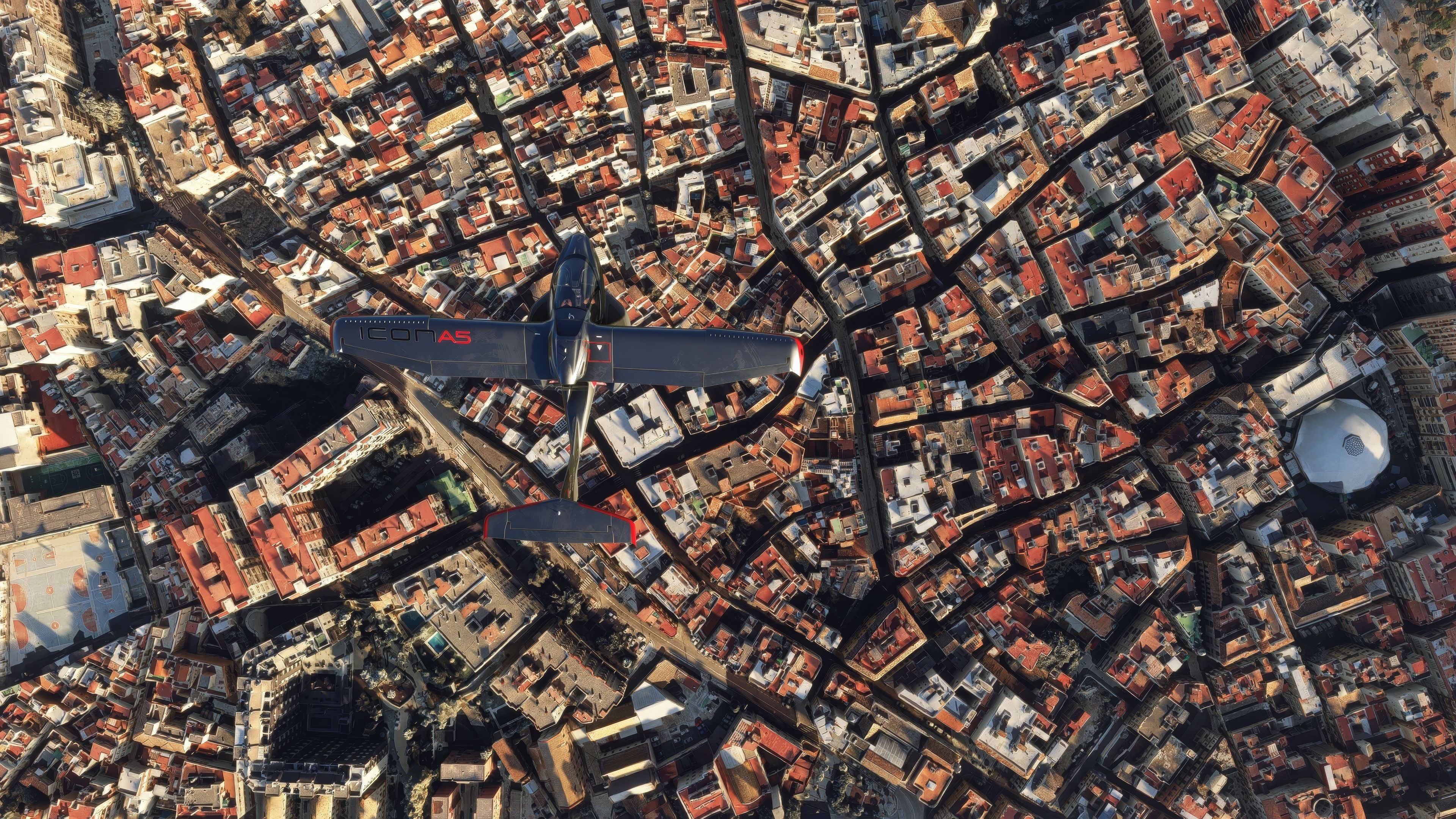
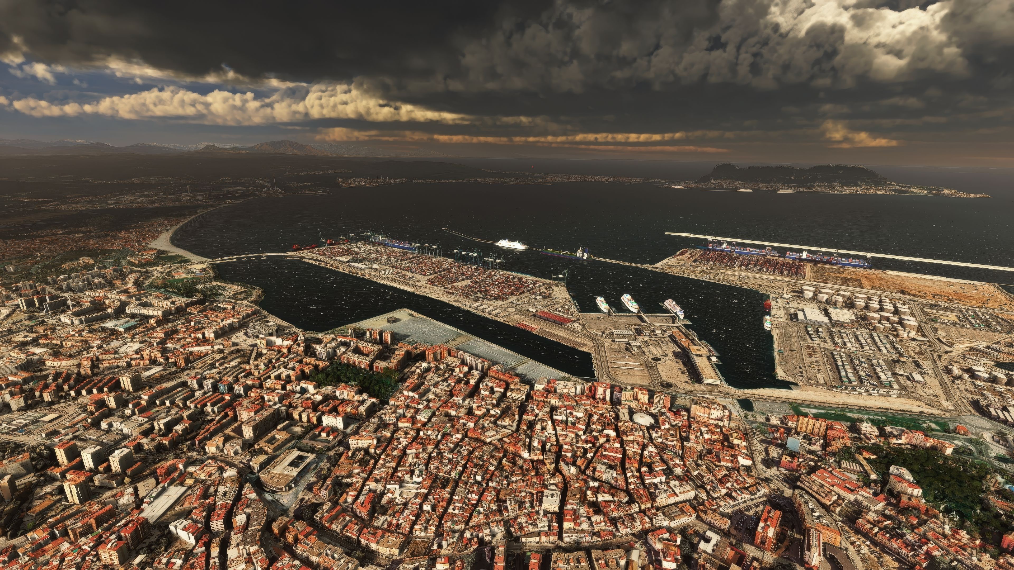
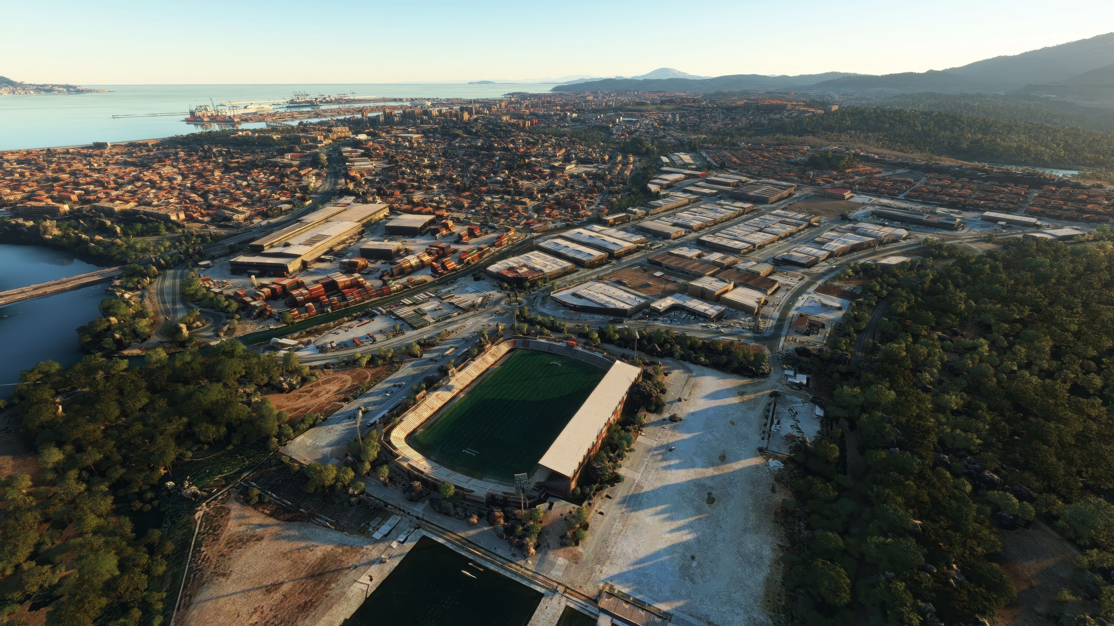
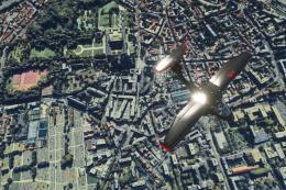
MSFS Algeciras Photogrammetry Scenery
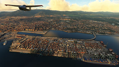
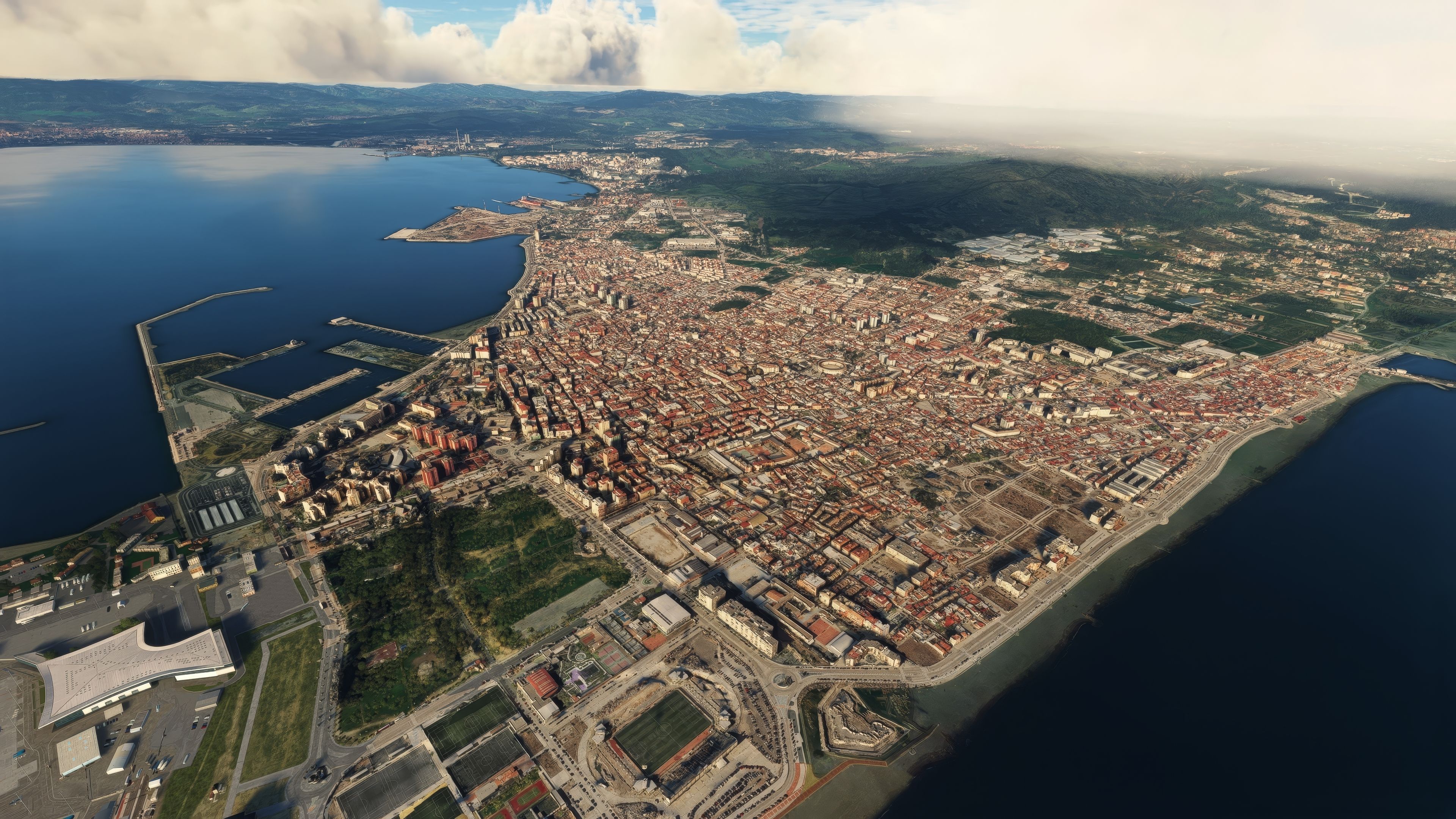
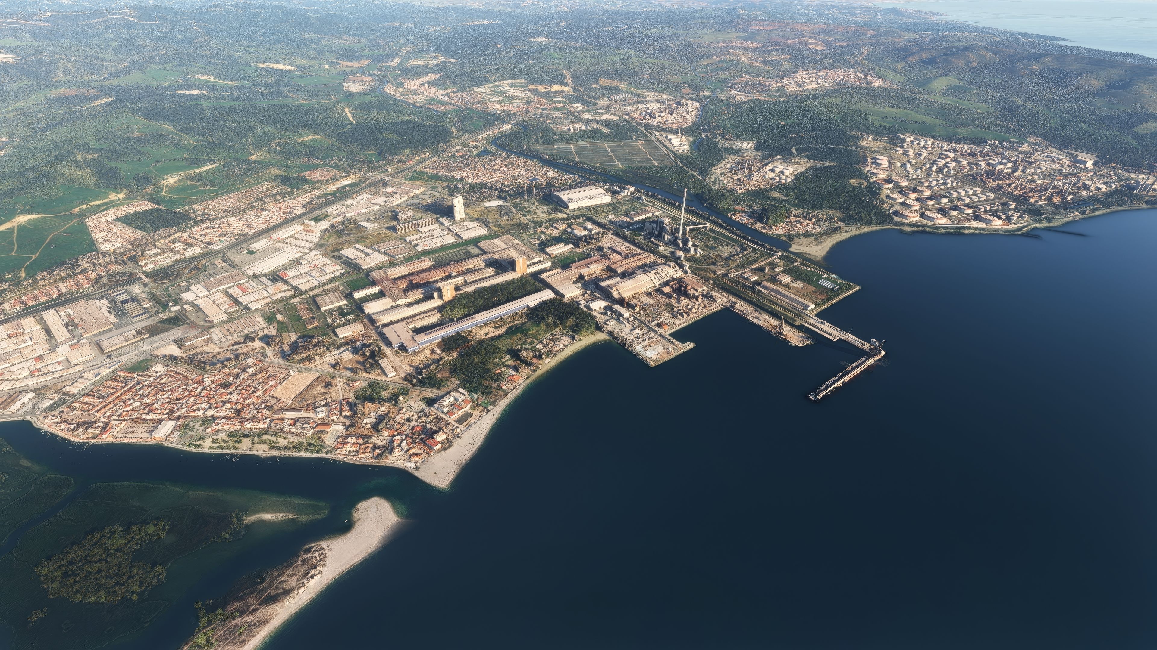
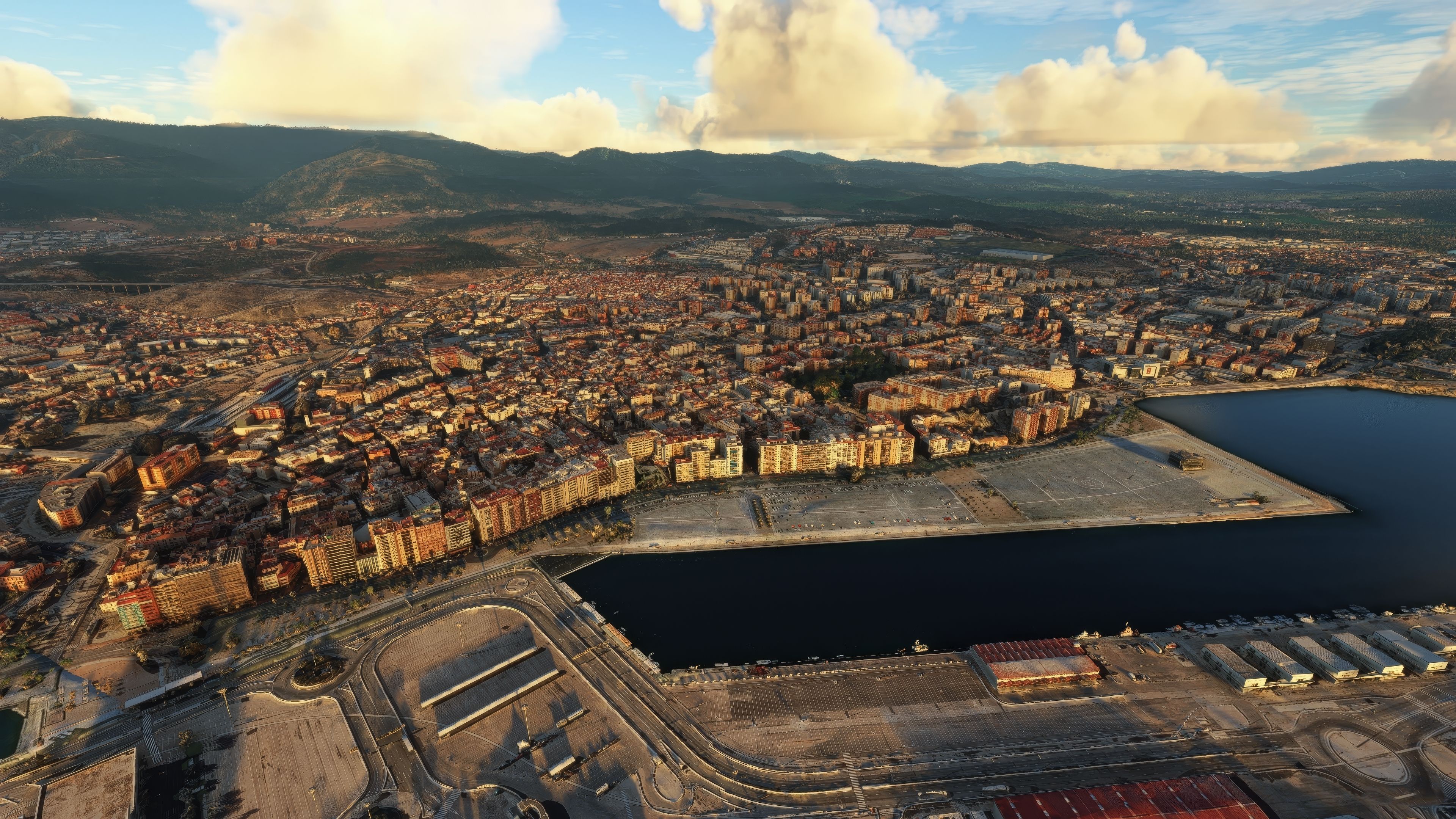
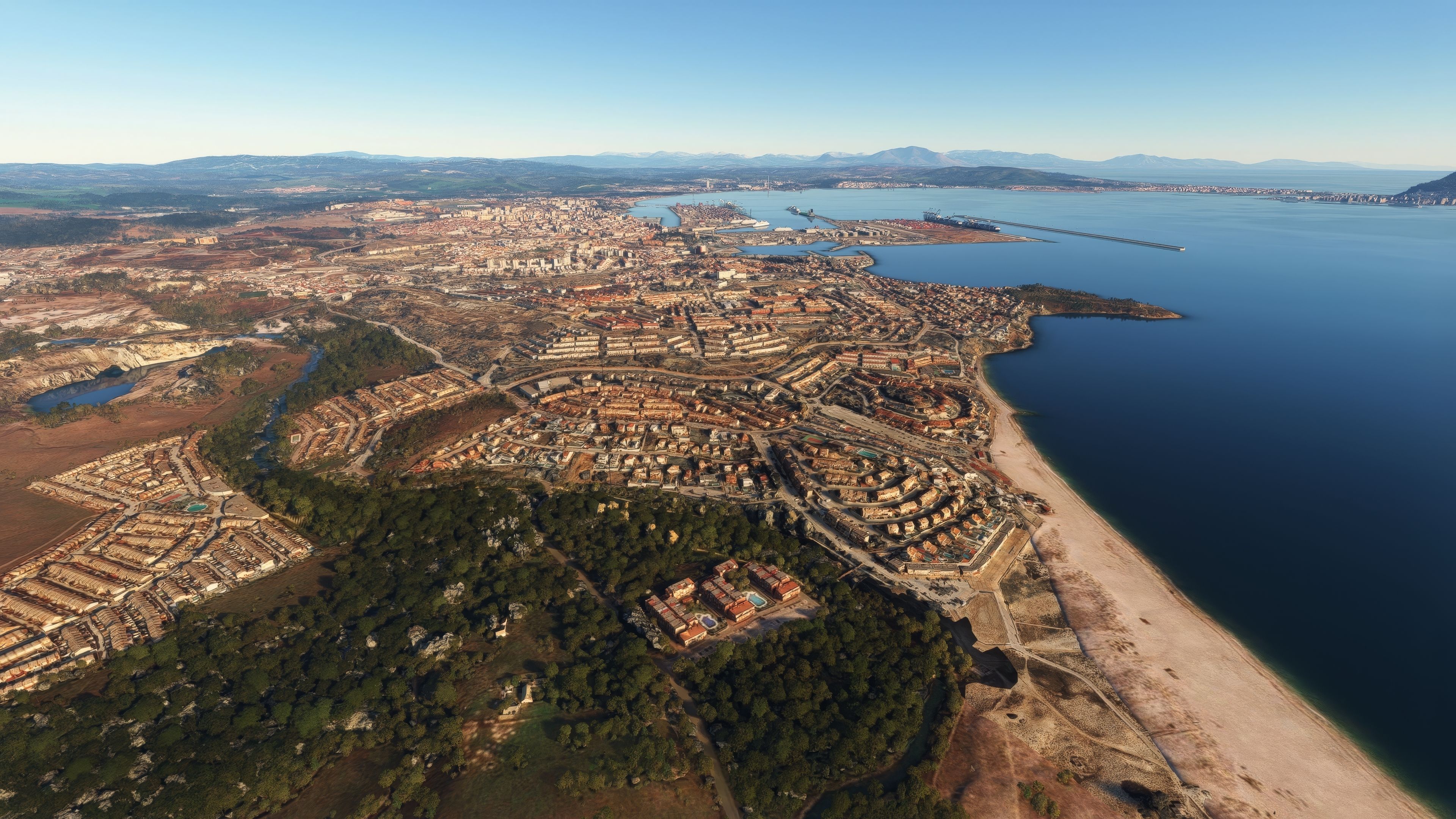
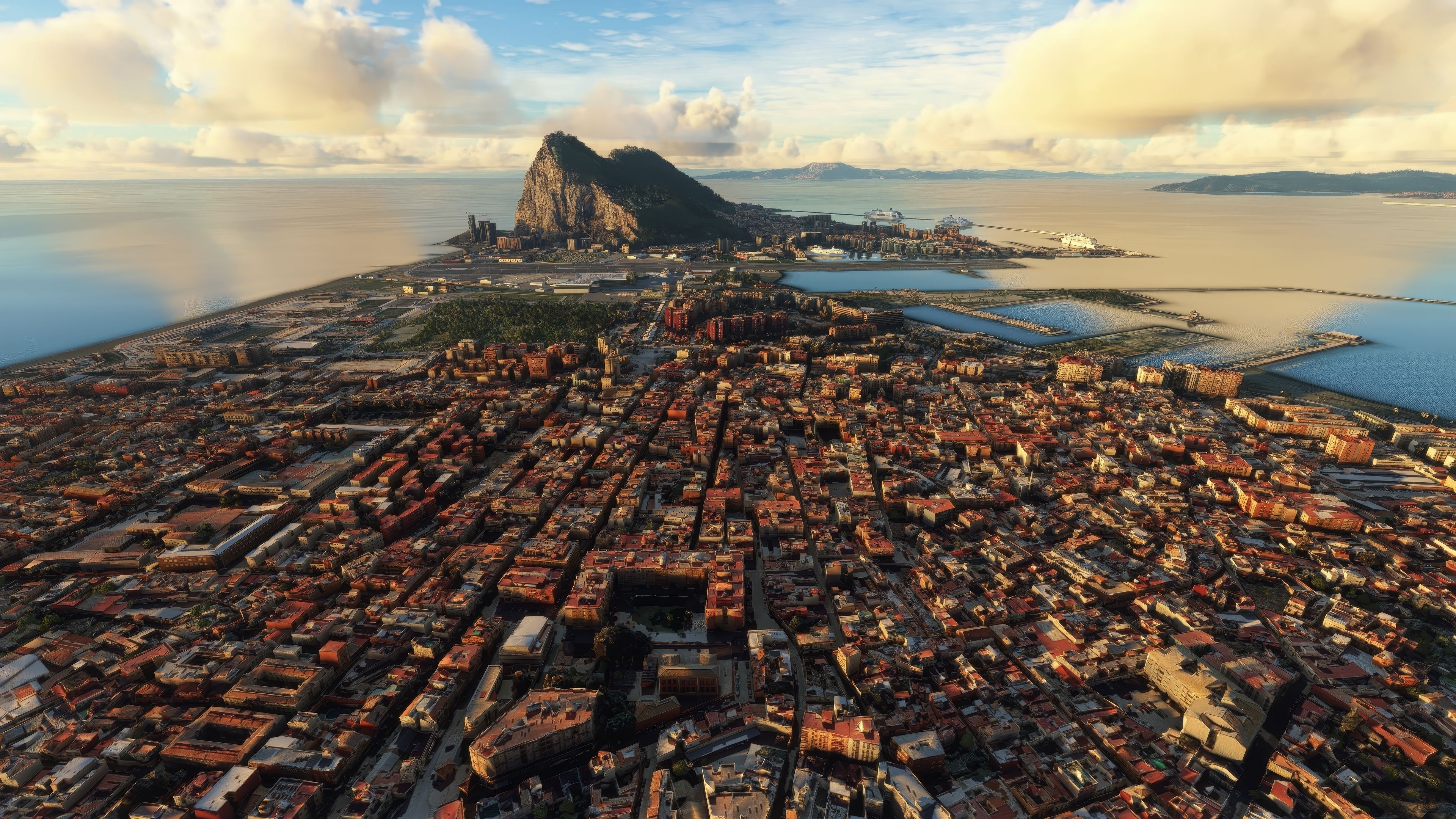
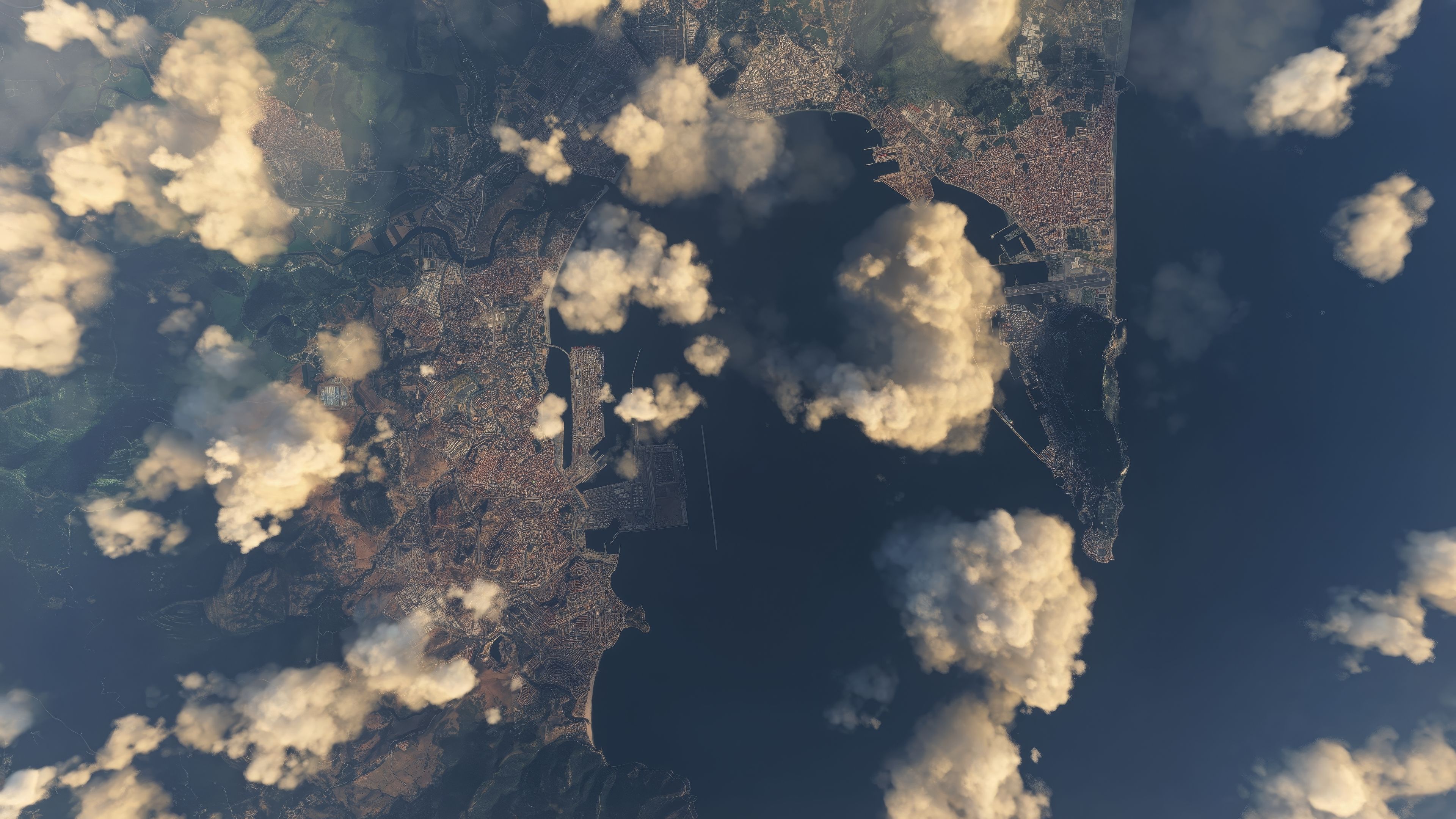
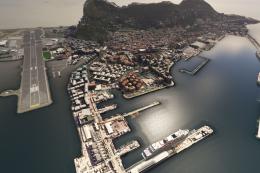
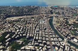
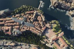
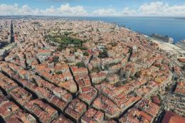
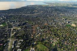
Algeciras, Spain comes alive with high-resolution photogrammetry that accurately shapes its streets, waterfront, and landmark skyline, including the vast Port of Algeciras and the Río de la Miel. Designed for Microsoft Flight Simulator, it blends smoothly with nearby Gibraltar coverage thanks to refined elevation adjustments for natural transitions.


 Spain
Spain - File: msfs-algeciras-photo.zip
- Size:2.38 GB
- Scan:
Clean (9d)

- Access:Freeware
- Content:Everyone

Expert Overview
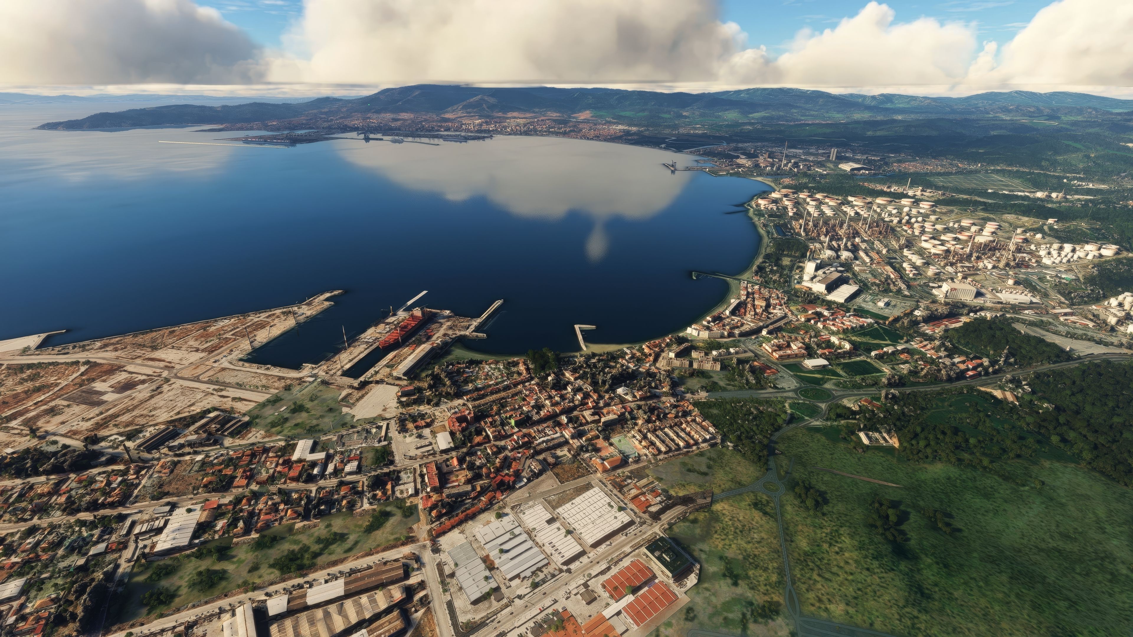
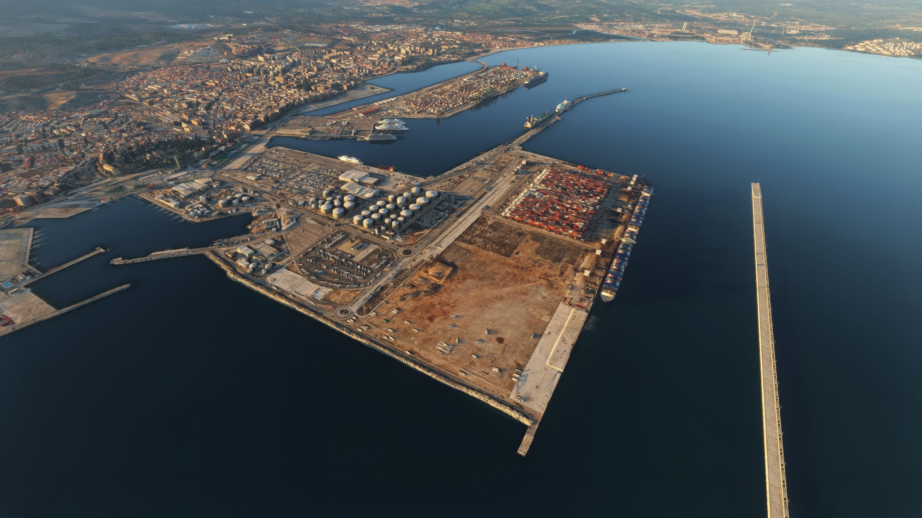
The MSFS Algeciras Photogrammetry Scenery brings the Spanish port city of Algeciras to life with advanced photogrammetry data, offering a high-fidelity urban rendition at the southern tip of the Iberian Peninsula. As someone who has tested this addon extensively, I admire how it captures the city’s intricate road networks, bustling dock zones, and surrounding terrain while ensuring a smooth blend with Gibraltar’s nearby photogrammetry scenery.
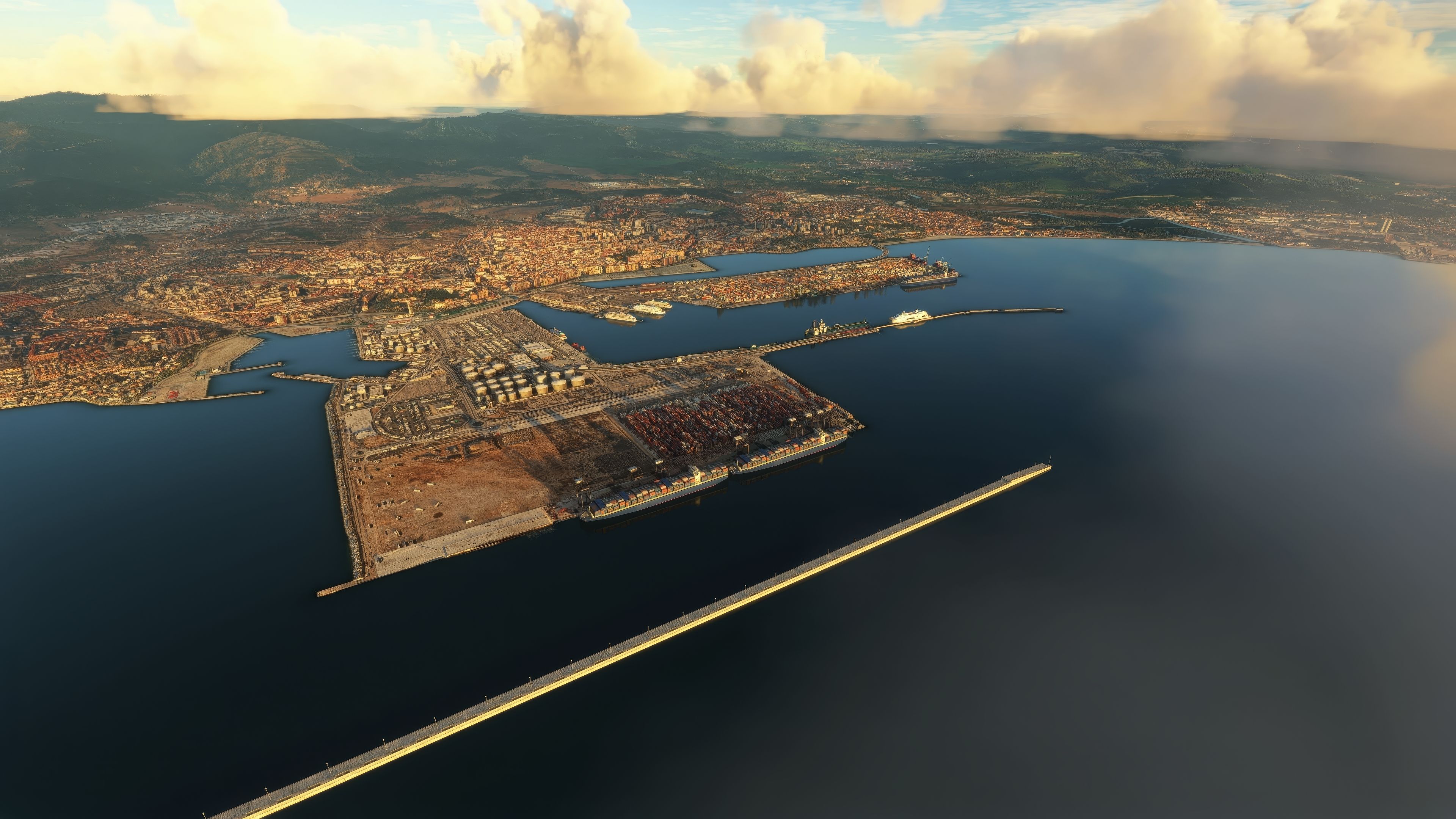
From realistic container terminals to the carefully mapped Río de la Miel, every detail enhances authenticity and immersion within Microsoft Flight Simulator. This comprehensive scenery shines in both visual and technical precision, highlighting one of Europe’s key maritime gateways. Flying around this busy coastal region feels seamless and natural, offering a standout experience for virtual pilots seeking an impressive expansion to their flight sim environment.
This mod was installed, tested and reviewed by Adam McEnroe for Fly Away Simulation. Adam is an FS mod expert. Read his bio here.
Enhance your virtual skies with the Algeciras Photogrammetry Scenery, a meticulously detailed representation of the vibrant area of Algeciras, Spain. Positioned at the southern tip of the Iberian Peninsula, this scenery brings to life the bustling urban landscape and its significant maritime gateway.
 Key Features
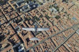
- High-resolution photogrammetry: Experience Algeciras in stunning realism as buildings, streets, and landmarks are rendered with precision using advanced photogrammetry technology. This technique captures photographic data and transforms it into 3D digital models, providing a lifelike simulation environment.
- Detailed port area: Explore one of Europe's largest ports. The Port of Algeciras is showcased in extensive detail, featuring its container, cargo, and transshipment activities.
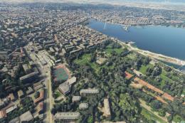
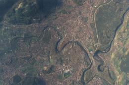
- Authentic urban layout: Fly over the Río de la Miel, the southernmost river of continental Europe, and observe the accurate urban sprawl of Algeciras, reflecting its real-world counterpart.
- Seamless integration: Version 1.1 includes elevation adjustments ensuring a seamless blend with the nearby Gibraltar Photogrammetry Scenery.
This scenery mod leverages data extracted from Google Maps and modeled using the Google Earth Decoder tool, promising a faithful reproduction of Algeciras and its surroundings.
Nearby Airports to Explore
Enhance your flight plans by taking off or landing at these nearby airports, perfectly complementing the Algeciras scenery:
- Gibraltar International Airport (LXGB): Located just around the bay, offers challenging approaches with its unique runway and proximity to the scenic Rock of Gibraltar.
- Jerez Airport (LEJR): Positioned northeast of Algeciras, serves as a gateway to Andalusia's rich cultural heritage and is ideal for extending your virtual journeys.
The MSFS Algeciras Photogrammetry Scenery adds not only visual depth but also a geographical richness that enhances the immersive experience of Microsoft Flight Simulator. Dive into the beauty of Algeciras and its strategic maritime portal to the Mediterranean.
Credits to Microsoft and Asobo for the continuously evolving MSFS platform that makes such intricate enhancements possible.
Installation
Simply extract the archive and copy the thalixte-algesiras folder into your MSFS community folder.
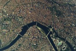
Images & Screenshots


Finding the Scenery
- MSFS Format:
-
36.13326000,-5.45051000
You can copy and paste these coordinates into Microsoft Flight Simulator's search bar when starting a flight or the Developer Mode "Teleport" window to navigate directly to the center of this scenery area, airport, or landmark after you have installed this addon. - Decimal Degrees (DD):
-
Latitude: 36.133260°
Longitude: -5.450510° - Degrees, Minutes, Seconds (DMS):
-
Latitude: 36° 07' 59.736" N
Longitude: 5° 27' 01.836" W
Map Location
Installation Instructions
Most of the freeware add-on aircraft and scenery packages in our file library come with easy installation instructions which you can read above in the file description. For further installation help, please see our Flight School for our full range of tutorials or view the README file contained within the download. If in doubt, you may also ask a question or view existing answers in our dedicated Q&A forum.
0 comments
Leave a Response