FSX Alf's UK Airfields Volume 6 Scenery
Alf’s UK Airfields Volume 6 refreshes Bembridge (EGHJ), Dunkeswell (EGTU), and Sywell/Northampton (EGBK) with corrected positioning, improved airport layouts, and carefully placed default objects for more believable small-field operations. Built for Microsoft Flight Simulator X, it uses real-world references to enhance hangars, parking, markers, and signage while keeping a clean, immersive look.
 United Kingdom
 - File: alfsukv6.zip
- Size:1.43 MB
- Scan:
Clean (10d)

- Access:Freeware
- Content:Everyone
This freeware package offers enhanced depictions of three smaller UK airfields in Microsoft Flight Simulator X. It refines default scenery by adding more detail and improving overall aesthetics, yet it remains grounded in standard FSX objects. Created by Alf Denham, this volume focuses on EGHJ Bembridge, EGTU Dunkeswell, and EGBK Sywell/Northampton. Each location is repositioned and populated according to data from real-world references, ensuring a practical and more immersive flying environment.
Alf's UK Airfields Volume 6 Scenery.
Key Airports and Customizations
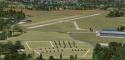
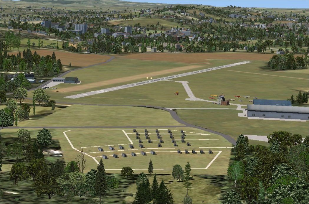
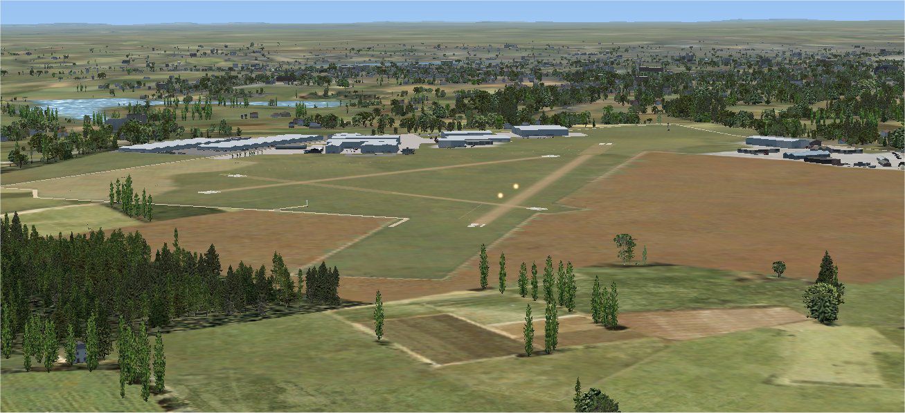
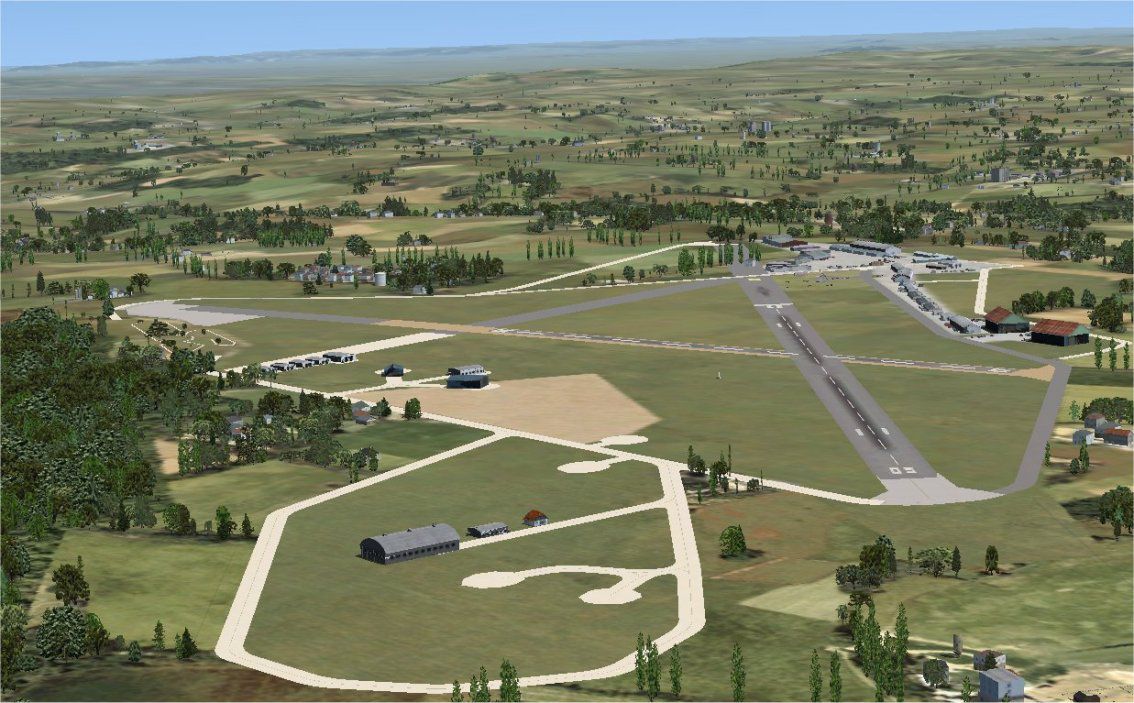
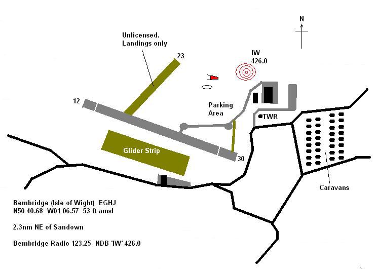
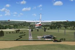
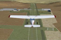
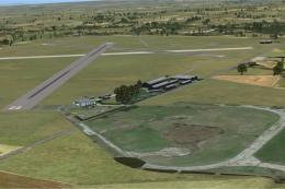
- Bembridge (EGHJ): Situated on the eastern end of the Isle of Wight, this general aviation strip has updated hangars, taxiway markers, and simplified structures to reflect public imagery while retaining default FSX elements.
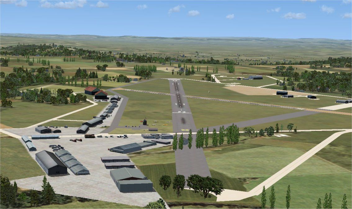
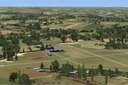
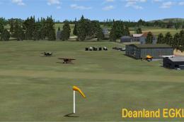
- Dunkeswell (EGTU): Located in Devon, this historic ex-RAF field features adjusted parking spots and additional building models for a more accurate small-airport feel, all derived from aerial mapping (such as Google Earth) and flight guidance materials.
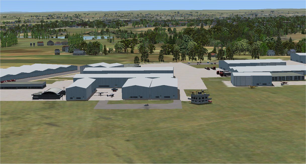
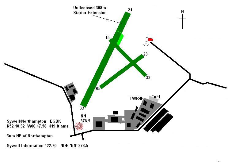
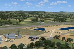
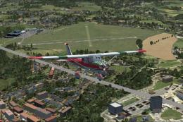
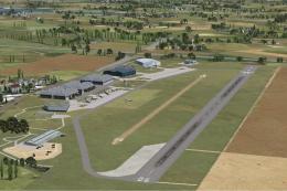
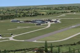
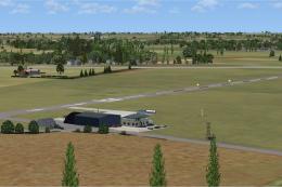
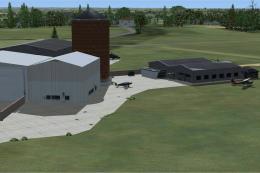
- Sywell/Northampton (EGBK): Known for grass runways and a classic layout, Sywell is upgraded with generic FSX library objects placed via the FSX SDK Object Placement Tool and Airport Design Editor. It has improved signage and modest 3D enhancements.
Development Resources Used
All modifications rely solely on standard FSX scenery data, meaning there are no custom 3D models beyond the platform’s default libraries. References include Google Earth, Pooley’s UK Flight Guide, and Airport Design Editor v1.26. The developer tested these fields exclusively within FSX SP2, so performance may differ if Service Pack 1 or SP2 are not fully installed.
Installation and Removal
The necessary steps for adding these revised airfields are documented within the included readme files. To remove the scenery at any time, delete the installed folder components from your simulator directory and restore any original files if needed.
Previous Volumes
- Volume 1
- EGSL Andrewsfield, EGSQ Clacton, EGWC Cosford, EGTR Elstree, EGMD Lydd, EGTZ Old Warden, EGHP Popham.
- Volume 2
- EGTD Dunsfold, EGET Lerwick/Tingwall, EGNF Netherthorpe.
- Volume 3
- EGKH Lashenden, EGSX North Weald, EGCJ Sherburn-in-Elmett, EGBS Shobdon.
- Volume 4
- EGTB Booker and an alternate BookerPlus version, EGST Elmsett.
- Volume 5
- EGSU Duxford, EGSR Earls Colne, EGFE Haverfordwest.
Designed for simmers who want richer small-field visuals, this collection bridges the gap between stock scenery and realistic UK aerodromes. The objective is not precise replication but rather a faithful upgrade using basic library assets. This release is authored by Alf Denham.
Images & Screenshots


Finding the Scenery
- FSX/Prepar3D Coordinates:
-
51.28090000,-1.71220000
Use the downloaded flight plan file by launching FSX/P3D, selecting "Load Flight Plan" in the flight planner, and choosing the .pln file. Your aircraft will be positioned directly at the add-on’s location. - Decimal Degrees (DD):
-
Latitude: 51.280900°
Longitude: -1.712200° - Degrees, Minutes, Seconds (DMS):
-
Latitude: 51° 16' 51.240" N
Longitude: 1° 42' 43.920" W
Map Location
The archive alfsukv6.zip has 33 files and directories contained within it.
File Contents
This list displays the first 500 files in the package. If the package has more, you will need to download it to view them.
| Filename/Directory | File Date | File Size |
|---|---|---|
| BembridgeEGHJ | 05.06.08 | 0 B |
| Bembridge#1.jpg | 05.04.08 | 146.01 kB |
| Bembridge#2.jpg | 05.06.08 | 190.50 kB |
| Bembridge#3.jpg | 05.04.08 | 162.01 kB |
| Bembridge_Map.JPG | 05.04.08 | 41.60 kB |
| Bembridge_ReadMe.txt | 05.08.08 | 1.21 kB |
| Scenery | 05.06.08 | 0 B |
| EGHJ_ADE_AED.BGL | 05.03.08 | 6.33 kB |
| EGHJ_ADE_AED_CVX.bgl | 05.03.08 | 866 B |
| EGHJ_extra.BGL | 05.03.08 | 4.36 kB |
| DunkeswellEGTU | 05.06.08 | 0 B |
| Dunkeswell#1.jpg | 05.06.08 | 153.82 kB |
| Dunkeswell#2.jpg | 05.06.08 | 180.23 kB |
| Dunkeswell_Map.JPG | 05.06.08 | 38.14 kB |
| Dunkeswell_ReadMe.txt | 05.06.08 | 869 B |
| Scenery | 05.06.08 | 0 B |
| EGTU_ADE_AED.BGL | 05.06.08 | 9.58 kB |
| EGTU_ADE_AED_CVX.bgl | 05.06.08 | 1.31 kB |
| EGTU_extra.BGL | 05.06.08 | 6.75 kB |
| License.txt | 03.23.08 | 631 B |
| READ_ME_FIRST.txt | 05.06.08 | 1.66 kB |
| SywellEGBK | 05.06.08 | 0 B |
| Scenery | 05.06.08 | 0 B |
| EGBK_ADE_AED.BGL | 05.04.08 | 10.43 kB |
| EGBK_ADE_AED_CVX.bgl | 05.04.08 | 1.35 kB |
| EGBK_extra.BGL | 05.04.08 | 6.00 kB |
| Sywell#1.jpg | 05.04.08 | 184.18 kB |
| Sywell#2.jpg | 05.04.08 | 166.98 kB |
| Sywell#3.jpg | 05.04.08 | 168.37 kB |
| Sywell_Map.JPG | 05.04.08 | 37.76 kB |
| Sywell_ReadMe.txt | 05.04.08 | 862 B |
| flyawaysimulation.txt | 10.29.13 | 959 B |
| Go to Fly Away Simulation.url | 01.22.16 | 52 B |
Installation Instructions
Most of the freeware add-on aircraft and scenery packages in our file library come with easy installation instructions which you can read above in the file description. For further installation help, please see our Flight School for our full range of tutorials or view the README file contained within the download. If in doubt, you may also ask a question or view existing answers in our dedicated Q&A forum.
0 comments
Leave a Response