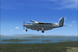
FSX South Africa, Robben Island Scenery
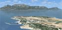
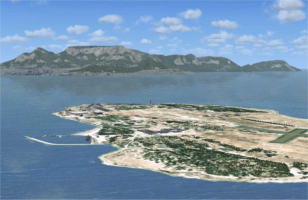
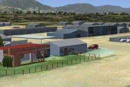
Robben Island scenery recreates the iconic Table Bay landmark with accurate coastline contours, detailed airstrip surfaces, and carefully placed cultural points of interest for low-level VFR exploration. Built for Microsoft Flight Simulator X, it also includes optional terrain mesh to sharpen elevations, cliffs, roads, and dams for a more lifelike approach from Cape Town.

 South Africa
 - File: fsxworx19.zip
- Size:4.69 MB
- Scan:
Clean (10d)

- Access:Freeware
- Content:Everyone
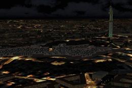
Immerse yourself in the rich coastal environment of Robben Island, located just off the shores of Cape Town in South Africa. This freeware enhancement, developed by Aeroworx and led by creators Hannes Steyn and Martin du Preez, brings a highly detailed rendition of the famous island to Microsoft Flight Simulator X. Pilots have long sought an authentic representation of this historically significant site, and now they can discover its distinctive scenery from the virtual cockpit.
Historical Notes on Robben Island
Robben Island, sometimes referred to as the “seal island” (from the Dutch “Robbeneiland”), rests about seven kilometers north of Cape Town in Table Bay. It is instantly recognizable for its oval shape and its role in global history—prominent figures, including Nelson Mandela and Kgalema Motlanthe, once served time here. During World War II, this island was strategically armed to defend the nearby city. That varied past, encompassing both political imprisonment and wartime preparedness, amplifies Robben Island’s enduring significance in South Africa.

Robben Island Scenery.
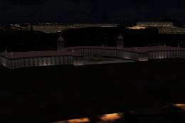
Scenery Highlights and Enhanced Terrain
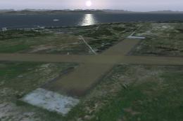
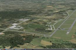
Within this scenery, the coastal outlines, airstrip surfaces, and numerous points of cultural interest have been thoroughly modeled to match real-world references. Accurate elevations and island contours benefit from an optional mesh (detailed terrain data that refines hills, cliffs, and coastlines) specifically optimized by the Aeroworx team. Numerous dams, roads, and vector elements are carefully positioned so users can appreciate an immersive approach over Table Bay.
Installation Procedures for Microsoft Flight Simulator X
- Unpack the “fsxWorx19.zip” file to a temporary location. It is recommended to establish a designated folder for storing Aeroworx FSX scenery downloads.
- Run the installer named “fsxWorx19.exe.” It will detect your main Microsoft Flight Simulator X folder automatically. Follow the on-screen prompts.
- Two new directories, “SASceneryFSX” and “AeroworxLC,” will appear in your Scenery folder. Future Aeroworx sceneries will be placed into these same directories.
- If you prefer a manual install, direct the extracted content to your preferred directories, but note that subsequent updates anticipate files in the default Aeroworx-installed locations.
- If you have not installed past Aeroworx packages, launch FSX, access the Scenery Library, and then add both “SASceneryFSX” and “AeroworxLC.” Restart FSX to activate the new scenery.
Performance Tweaks and Constraints
- Set your display to a 1m resolution for the best visual fidelity.
- Some roads may pass over water surfaces, especially where bridges have not been programmed.
- Occasional misalignment can occur where default runways intersect rivers or roads.
- At times, dams might appear slightly above or below their intended contours on 76m meshes, making 1m resolution particularly advisable.
Scenery Creation and Tools
This package leverages the official Microsoft Flight Simulator X SDK (Service Pack 2) for accurate file compilation. Additional development utilities include Scenery Builder by Luis Sá, Airport Design Editor by ScruffyDuck Software, Whisplacer 0.9, and various geo-referencing programs for detailed digitization.
Contributors:
By Hannes Steyn, Martin du Preez (Aeroworx), with additional support from Johan van Wyk (Aeroworx). All involved have meticulously refined terrain and structures to give simmers an authentic Robben Island experience.
Images & Screenshots

Finding the Scenery
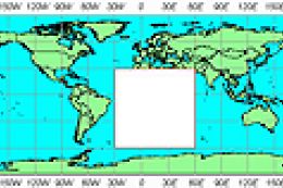
- FSX/Prepar3D Coordinates:
-
33.80630000,18.36670000
Use the downloaded flight plan file by launching FSX/P3D, selecting "Load Flight Plan" in the flight planner, and choosing the .pln file. Your aircraft will be positioned directly at the add-on’s location. - Decimal Degrees (DD):
-
Latitude: 33.806300°
Longitude: 18.366700° - Degrees, Minutes, Seconds (DMS):
-
Latitude: 33° 48' 22.680" N
Longitude: 18° 22' 00.120" E
Map Location
The archive fsxworx19.zip has 9 files and directories contained within it.
File Contents
This list displays the first 500 files in the package. If the package has more, you will need to download it to view them.
| Filename/Directory | File Date | File Size |
|---|---|---|
| Aeroworx_License_Agreement.PDF | 04.29.08 | 66.69 kB |
| FILE_ID.DIZ | 08.23.09 | 613 B |
| fsxWorx19.exe | 08.23.09 | 4.40 MB |
| fsxWorx19.jpg | 08.23.09 | 255.61 kB |
| license.txt | 04.04.09 | 7.38 kB |
| ReadmefsxWorx19.txt | 08.23.09 | 4.18 kB |
| fsxWorx19 | 08.23.09 | 0 B |
| flyawaysimulation.txt | 10.29.13 | 959 B |
| Go to Fly Away Simulation.url | 01.22.16 | 52 B |
Complementing Files & Dependencies
This add-on mentions the following files below in its description. It may be dependent on these files in order to function properly. It's possible that this is a repaint and the dependency below is the base package.
You may also need to download the following files:
Installation Instructions
Most of the freeware add-on aircraft and scenery packages in our file library come with easy installation instructions which you can read above in the file description. For further installation help, please see our Flight School for our full range of tutorials or view the README file contained within the download. If in doubt, you may also ask a question or view existing answers in our dedicated Q&A forum.


0 comments
Leave a Response