FSX Simara Airport Scenery
Simara Airport (VNSI) brings Nepal’s subtropical Terai gateway to life with an accurate runway, taxiway, and apron layout guided by satellite references, plus new hangars, apron clutter, static crews, and subtle bird animations for added atmosphere. Built for Microsoft Flight Simulator X, it requires ADE9X for the airport design foundation.

 Nepal
Nepal - File: fsx_vnsi.zip
- Size:108.52 KB
- Scan:
Clean (22d)

- Access:Freeware
- Content:Everyone
Immerse yourself in a detailed rendition of Nepal’s Simara Airport (VNSI) with this scenery add-on, carefully crafted by developer Antoine Calleja for Microsoft Flight Simulator X. This freeware package seamlessly integrates animated elements, precise ground layouts, and various structures that enhance overall realism.
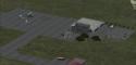
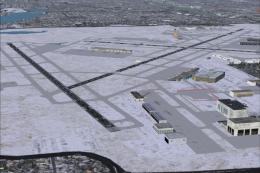
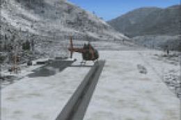
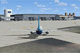
Elevated Look at Simara’s Airfield Environment
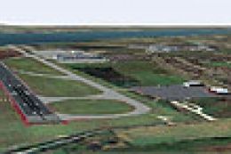
Simara Airport sits in the Bara District of southern Nepal and supports domestic operations, often serving as a gateway for regional flights. In this scenery, you will find an accurately placed runway layout based on satellite data. Because this geography lies near the Terai plains, the add-on provides an authentic feel of its unique subtropical setting.

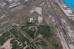
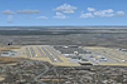
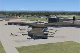
Tailored visualization of Simara Airport’s surroundings.
Key Technical Attributes
- ADE9X Integration: The airport layout is devised with ADE9X (Airport Design Editor), which allows for precise runway, taxiway, and apron positioning.
- Accurate References: Google satellite images inspired the overall airport placement, matching real-world geographic features.
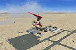
- Animated Inclusions: You will notice local fauna representations—such as flying birds—and various ground elements that create a more lifelike atmosphere.
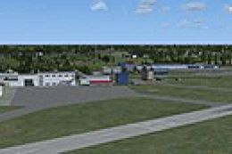
- Enriched Structures: New hangars, static ground crews, and other objects populate the apron, adding an operational feel finalizing the overall immersion.
Installation Guide
To install, copy the provided scenery files and paste them into your microsoftgames/Microsoft Flight Simulator X/Addon Scenery/Scenery folder. Afterward, activate this folder within your simulator’s scenery library for immediate integration.
Created by Antoine Calleja
Images & Screenshots

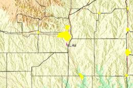
Finding the Scenery
- FSX/Prepar3D Coordinates:
-
27.15950000,84.98010000
Use the downloaded flight plan file by launching FSX/P3D, selecting "Load Flight Plan" in the flight planner, and choosing the .pln file. Your aircraft will be positioned directly at the add-on’s location. - Decimal Degrees (DD):
-
Latitude: 27.159500°
Longitude: 84.980100° - Degrees, Minutes, Seconds (DMS):
-
Latitude: 27° 09' 34.200" N
Longitude: 84° 58' 48.360" E
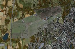
Map Location
The archive fsx_vnsi.zip has 7 files and directories contained within it.
File Contents
This list displays the first 500 files in the package. If the package has more, you will need to download it to view them.
| Filename/Directory | File Date | File Size |
|---|---|---|
| VNSI_ADEX_NEP.xml | 11.03.09 | 15.33 kB |
| VNSI_ADEX_NEP_CVX.bgl | 11.03.09 | 744 B |
| VNSI_ADEX_NEP.BGL | 11.03.09 | 2.17 kB |
| VNSI Read me.txt | 11.05.09 | 445 B |
| fsx 2009-11-03 18-44-18-26.jpg | 11.03.09 | 102.80 kB |
| flyawaysimulation.txt | 10.29.13 | 959 B |
| Go to Fly Away Simulation.url | 01.22.16 | 52 B |
Installation Instructions
Most of the freeware add-on aircraft and scenery packages in our file library come with easy installation instructions which you can read above in the file description. For further installation help, please see our Flight School for our full range of tutorials or view the README file contained within the download. If in doubt, you may also ask a question or view existing answers in our dedicated Q&A forum.
0 comments
Leave a Response