FSX MYEH Scenery
North Eleuthera Airport (MYEH) scenery refines this Bahamas gateway with corrected runway placement, updated apron layout, custom ramp lighting, and lively static objects that suit day or night operations in Microsoft Flight Simulator X. The package aligns the field to the shoreline using Google Earth references and requires GAPLANE1.ZIP for select GA static aircraft.

 Bahamas
 - File: myeh_fsxp.zip
- Size:491.05 KB
- Scan:
Clean (26d)

- Access:Freeware
- Content:Everyone
Elevate your virtual flights around North Eleutheria in the Bahamas with this thoroughly updated MYEH scenery package. It reflects a highly detailed depiction of the real-airport location, incorporating runway alignment, ramp lighting, and realistic static objects. Authored by Jimmy R. Martin, this add-on integrates custom resources based on Google Earth references, ensuring alignment with local terrain and near-shoreline positioning in Microsoft Flight Simulator X (Acceleration Pack required). While it is designed primarily for FSX, it also calls on references to Microsoft Flight Simulator 2004 objects for certain GA aircraft resources, so keep an eye on the compatibility essentials below.

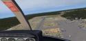
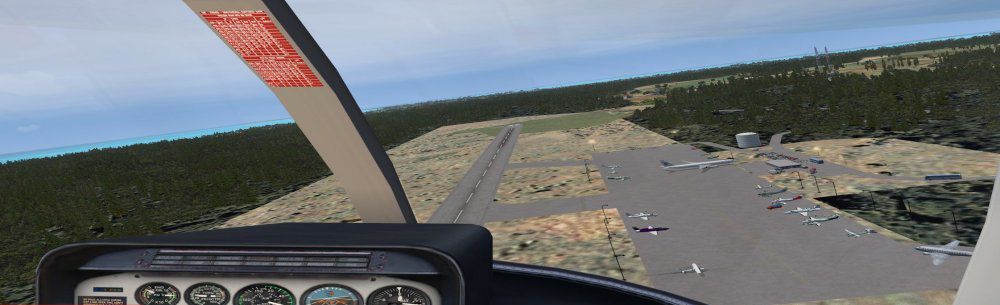
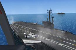
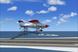
Screenshot of MYEH Scenery.
Technical Enhancements for MYEH
- Accurate Runway and Apron Layout: Drawn from Google Earth imagery to ensure faithful runway positioning and taxi areas.
- Immersive Objects and Persons Model: The inclusion of various 3D objects and human figures brings authenticity to the environment.
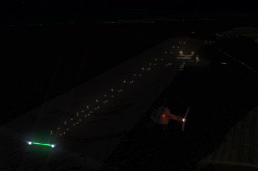
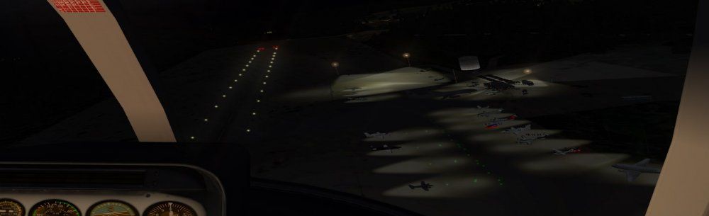
- Lighting Effects: Customized ramp lighting improves low-light visibility for night operations.
- GA Aircraft Compatibility: Some static GA planes require GAPLANE1.ZIP resources. Designed to integrate with EZ-Scenery elements.
Scenery Basics and Background
North Eleuthera Airport (MYEH) is positioned on the northern tip of Eleuthera Island. It often serves as a gateway to the stunning Out Islands and features a mix of domestic operations and commuter services. In the simulation, this add-on shifts the airport slightly west to align it more closely with its real-world shoreline location. While not photoreal, the ground textures and building placements aim to mirror local topography and architecture.
Installation and Configuration Steps
- Locate any existing MYEM or MYEH files in your addon scenery directory and remove them to prevent conflicts.
- Extract the two provided scenery folders directly into your addon scenery folder.
- Confirm that you have installed GAPLANE1.ZIP if you plan to utilize the additional GA plane models included in this package.
- Activate the new folders in your scenery library settings.
Note: This scenery may not be compatible with certain Bahamas Sea Plane tours due to layout conflicts. Ensure no overlapping sceneries are active.
FS2004 (ACOF) Scenery Objects
- FS2004 GA Planes 1 for EZ-Scenery
- File name: gaplane1.zip (required to see various custom GA aircraft models).

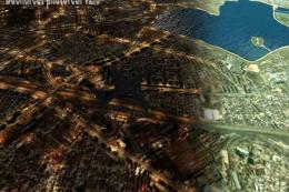
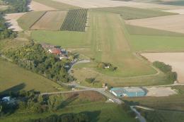
Screenshot of MYEH runway at night.
Additional Notes and Developer Credits
This rendition of North Eleuthera Airport relies on various FSX & FSXP libraries as well as enhanced lighting systems. It has been assembled without employing photoreal textures but remains as faithful as possible to real-world satellite imagery. Many thanks to Jimmy R. Martin for making this freeware upgrade available to enthusiasts. Enjoy exploring the region’s picturesque approaches, and be sure to adjust your flight plans to accommodate the updated positioning of this scenic island airport.
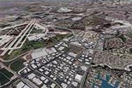
Images & Screenshots

Finding the Scenery
- FSX/Prepar3D Coordinates:
-
25.47570000,-76.68050000
Use the downloaded flight plan file by launching FSX/P3D, selecting "Load Flight Plan" in the flight planner, and choosing the .pln file. Your aircraft will be positioned directly at the add-on’s location. - Decimal Degrees (DD):
-
Latitude: 25.475700°
Longitude: -76.680500° - Degrees, Minutes, Seconds (DMS):
-
Latitude: 25° 28' 32.520" N
Longitude: 76° 40' 49.800" W
Map Location
The archive myeh_fsxp.zip has 23 files and directories contained within it.
File Contents
This list displays the first 500 files in the package. If the package has more, you will need to download it to view them.
| Filename/Directory | File Date | File Size |
|---|---|---|
| 31069.jpg | 03.29.11 | 8.56 kB |
| AirNav MYEH - North Eleuthera Airport.url | 03.29.11 | 123 B |
| fiel_id.diz | 03.29.11 | 221 B |
| PS0211.jpg | 04.01.11 | 26.62 kB |
| PS0212.jpg | 04.01.11 | 24.18 kB |
| PS0213.jpg | 04.01.11 | 57.07 kB |
| pspbrwse.jbf | 03.30.11 | 4.08 kB |
| ramp lights.txt | 01.25.11 | 458 B |
| README.txt | 03.29.11 | 1.08 kB |
| scenery | 04.02.11 | 0 B |
| MYEH_ADEX_JTM.ad2.ad2 | 04.01.11 | 101.54 kB |
| MYEH_ADEX_JTM.ad2.ad2.bak | 04.01.11 | 98.68 kB |
| MYEH_ADEX_JTM.BGL | 04.01.11 | 5.50 kB |
| MYEH_ADEX_JTM_CVX.bgl | 04.01.11 | 258 B |
| MYEH_FSXP.bgl | 03.31.11 | 3.21 kB |
| RampLight_Library.bgl | 01.11.05 | 30.63 kB |
| Thumbs.db | 05.14.06 | 208.50 kB |
| texture | 03.29.11 | 0 B |
| ESDG_ramp.BMP | 01.09.05 | 32.07 kB |
| ESDG_ramp_lm.BMP | 01.09.05 | 32.07 kB |
| MYEH_FSXP | 04.01.11 | 0 B |
| flyawaysimulation.txt | 10.29.13 | 959 B |
| Go to Fly Away Simulation.url | 01.22.16 | 52 B |
Installation Instructions
Most of the freeware add-on aircraft and scenery packages in our file library come with easy installation instructions which you can read above in the file description. For further installation help, please see our Flight School for our full range of tutorials or view the README file contained within the download. If in doubt, you may also ask a question or view existing answers in our dedicated Q&A forum.


0 comments
Leave a Response