FSX Saxony Airfields Scenery Part 1
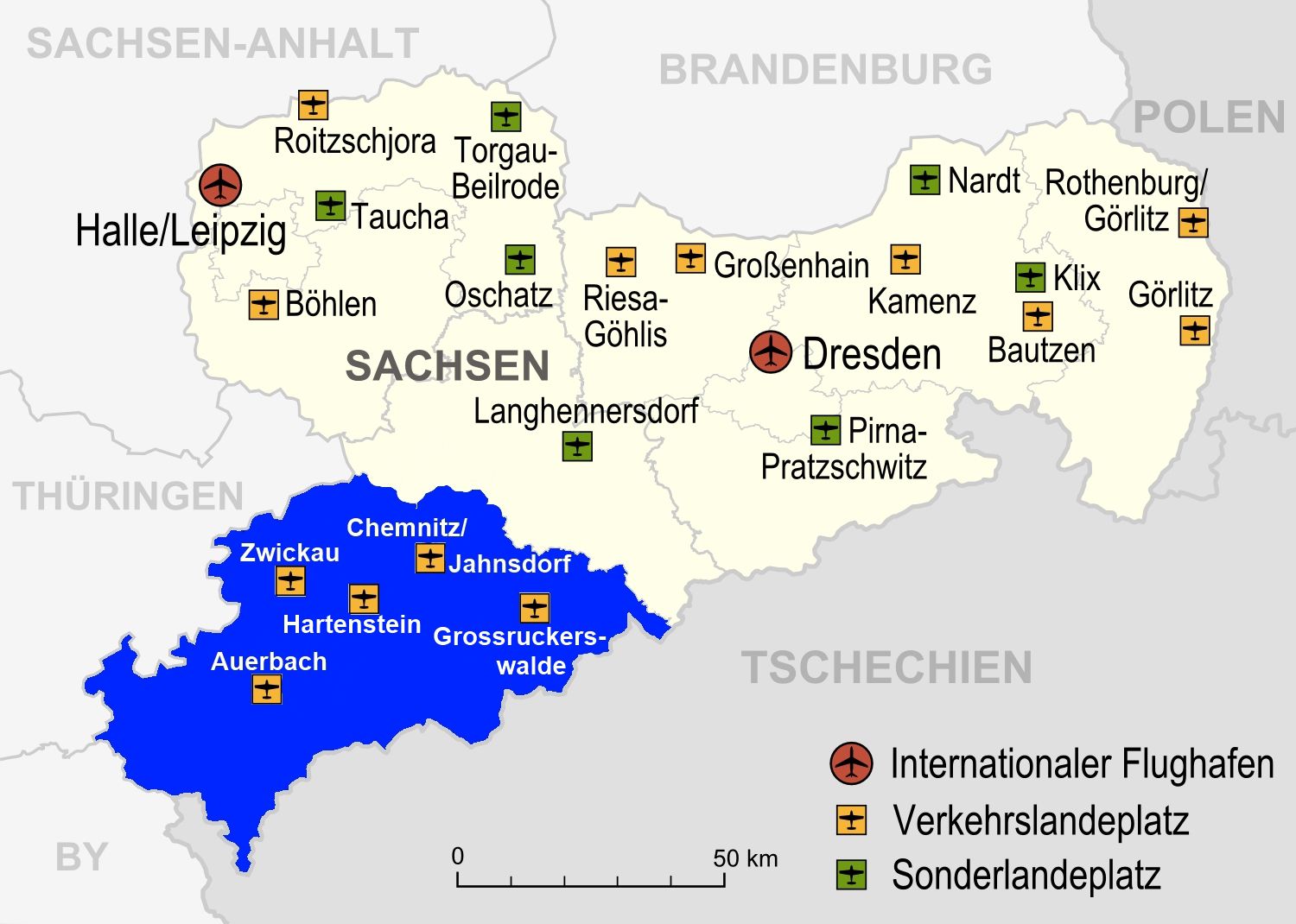
Saxony Airfields Scenery Part 1 expands regional flying in eastern Germany with detailed recreations of Zwickau (EDBI), Chemnitz/Jahnsdorf (EDCJ), Auerbach (EDOA), and Grossruckerswalde (EDAG), plus a fictional Hartenstein/Thierfeld strip. Designed for FSX, it adds authentic local airfield variety for VFR routes and circuit practice.


 Germany
 - File: saxony_airfields_part1.zip
- Size:4.01 MB
- Scan:
Clean (25d)

- Access:Freeware
- Content:Everyone
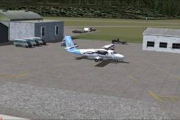
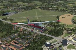
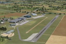
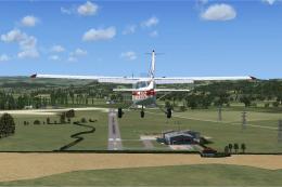
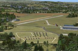
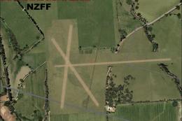
Saxony Airfields Part 1. This scenery package includes the airfields Zwickau (EDBI), Chemnitz/ Jahnsdorf (EDCJ), Auerbach (EDOA), Grossruckerswalde (EDAG) and Hartenstein/ Thierfeld. The Free State of Saxony is a state in Germany. It is located in the east of Germany. By Maximilian Pechstein.
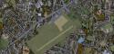
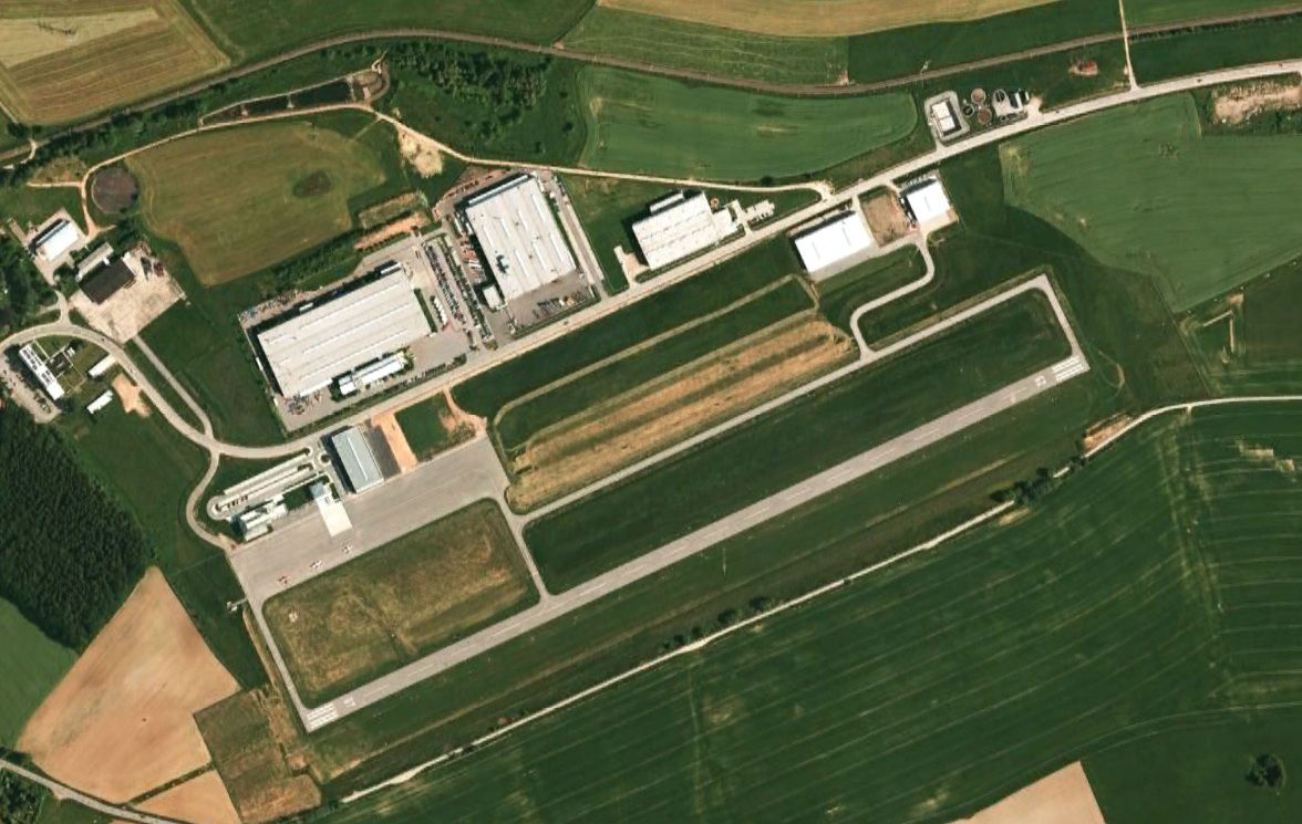
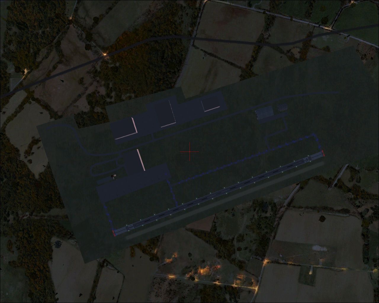
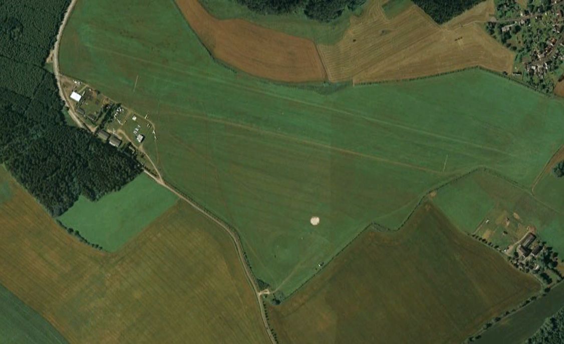
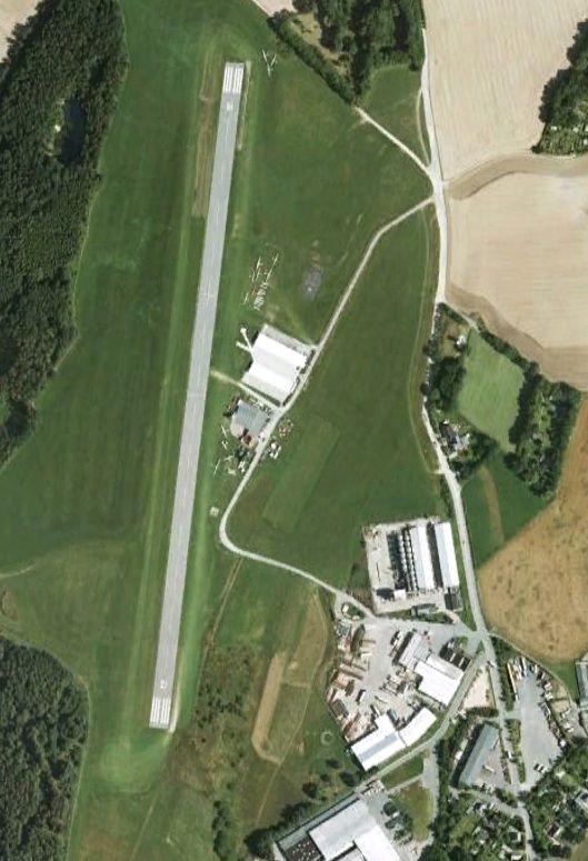
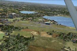
Aerial shot of Saxony Airfields, EDAG.
Included Airports:
- Zwickau (EDBI)
- Auerbach (EDOA)
- Chemnitz/ Jahnsdorf (EDCJ)
- Grossruckerswalde (EDAG)
- Hartenstein (fictional: EHST) --> this airfield isn't included in default FSX and didn't has an ICAO-Code in real life
Installation:
1.) Unzip the RAR-Archive to a folder of your choise.
2.) copy the folders Zwickau, Chemnitz, Auerbach, Hartenstein, Grossruckerswalde to your Addon-Scenery folder wich is located at \Microsoft Games\Microsoft Flight Simulator X\Addon Scenery.
3.) start Microsoft Flight Simulator X.
4.) activate the scenery.
This scenery package for FSX is delivered as is.
The author does not grant any warranty and won't be responsible for any hardware or software damages on the user's system.
The user does apply this addon on his/her own responsibility.
HAPPY FLYING around Saxony.
Maximilian Pechstein.
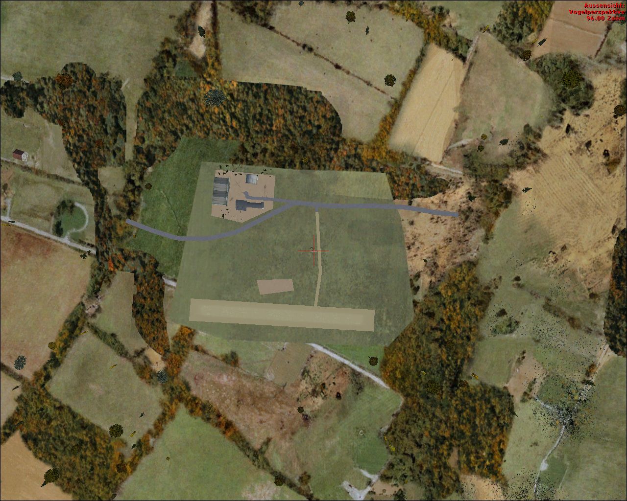
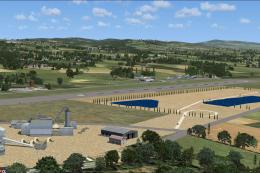
Aerial shot of Saxony Airfields, EDOA.
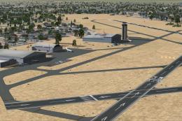
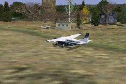
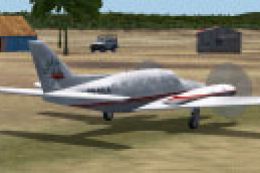
Images & Screenshots


Finding the Scenery
- FSX/Prepar3D Coordinates:
-
51.05040000,13.73730000
Use the downloaded flight plan file by launching FSX/P3D, selecting "Load Flight Plan" in the flight planner, and choosing the .pln file. Your aircraft will be positioned directly at the add-on’s location. - Decimal Degrees (DD):
-
Latitude: 51.050400°
Longitude: 13.737300° - Degrees, Minutes, Seconds (DMS):
-
Latitude: 51° 03' 01.440" N
Longitude: 13° 44' 14.280" E
Map Location
The archive saxony_airfields_part1.zip has 35 files and directories contained within it.
File Contents
This list displays the first 500 files in the package. If the package has more, you will need to download it to view them.
| Filename/Directory | File Date | File Size |
|---|---|---|
| Airfields-Saxony-Part1 | 10.08.11 | 0 B |
| Auerbach | 10.08.11 | 0 B |
| EDOA-fsx.jpg | 10.08.11 | 599.05 kB |
| EDOA_real.jpg | 10.08.11 | 133.61 kB |
| scenery | 10.08.11 | 0 B |
| EDOA_ADEX_MP.BGL | 10.08.11 | 4.74 kB |
| EDOA_ADEX_MP_CVX.bgl | 10.08.11 | 247 B |
| Chemnitz | 10.08.11 | 0 B |
| EDCJ_fsx.jpg | 10.08.11 | 268.46 kB |
| EDCJ_real.jpg | 10.08.11 | 274.40 kB |
| scenery | 10.08.11 | 0 B |
| EDCJ_ADEX_MP.BGL | 10.08.11 | 5.01 kB |
| EDCJ_ADEX_MP_CVX.bgl | 10.08.11 | 251 B |
| Grossruckerswalde | 10.08.11 | 0 B |
| EDAG_fsx.jpg | 10.08.11 | 550.44 kB |
| EDAG_real.jpg | 10.08.11 | 168.46 kB |
| scenery | 10.08.11 | 0 B |
| EDAG_ADEX_MP.BGL | 10.08.11 | 2.70 kB |
| EDAG_ADEX_MP_CVX.bgl | 10.08.11 | 410 B |
| Hartenstein | 10.08.11 | 0 B |
| EHST_fsx.jpg | 10.08.11 | 453.39 kB |
| EHST_real.jpg | 10.08.11 | 186.74 kB |
| scenery | 10.08.11 | 0 B |
| EHST_ADEX_MP.BGL | 10.08.11 | 2.15 kB |
| EHST_ADEX_MP_CVX.bgl | 10.08.11 | 244 B |
| readme.txt | 10.08.11 | 950 B |
| saxony_part1.jpg | 10.08.11 | 479.09 kB |
| Zwickau | 10.08.11 | 0 B |
| EDBI_fsx.jpg | 10.08.11 | 650.76 kB |
| EDBI_real.jpg | 10.08.11 | 350.55 kB |
| scenery | 10.08.11 | 0 B |
| EDBI_ADEX_MP.BGL | 10.08.11 | 2.70 kB |
| EDBI_ADEX_MP_CVX.bgl | 10.08.11 | 244 B |
| flyawaysimulation.txt | 10.29.13 | 959 B |
| Go to Fly Away Simulation.url | 01.22.16 | 52 B |
Installation Instructions
Most of the freeware add-on aircraft and scenery packages in our file library come with easy installation instructions which you can read above in the file description. For further installation help, please see our Flight School for our full range of tutorials or view the README file contained within the download. If in doubt, you may also ask a question or view existing answers in our dedicated Q&A forum.

0 comments
Leave a Response