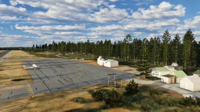
Blue Canyon (KBLU) & Scott Valley (A30) Released for X-Plane 12 by X-Codr
Experience ultra-realistic flight operations across two scenic Californian aerodromes that showcase robust weather modeling,…
 A collection of high-resolution relief images from the ordnance
survey database, including over 26,000 km2 of aerial photographs
(2.50m resolution), will provide you with a realistic bird's eye view
of the terrain in the French departments of Loire-Atlantique,
Maine-et-Loire, Indre et Loire and Loir et Cher. From the Loire
estuary to the Chateau de Chambord, you can also fly over Europe's
last wild river, and admire the major historic sites and
architectural gems of this region through the many finely modelled 3D
objects featuring in this first volume.
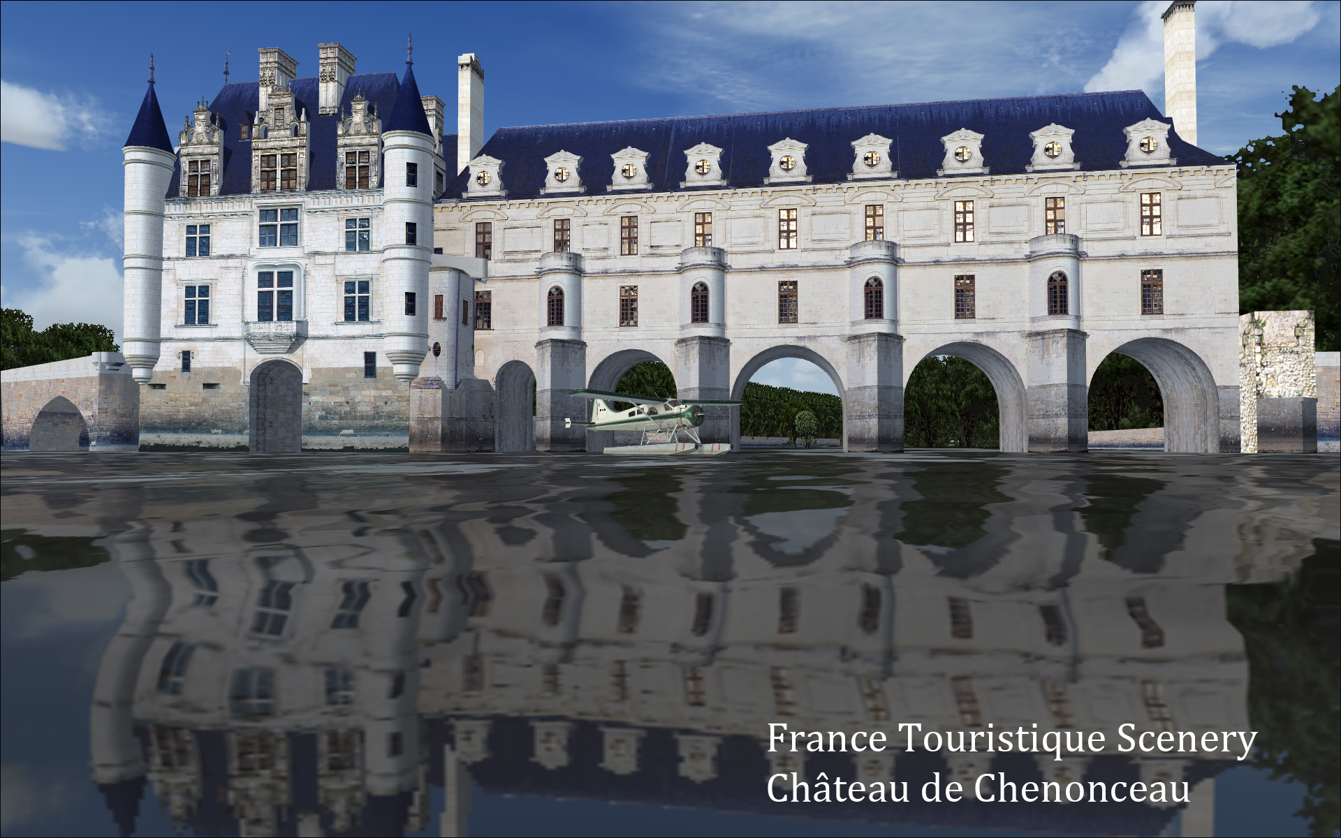
A collection of high-resolution relief images from the ordnance
survey database, including over 26,000 km2 of aerial photographs
(2.50m resolution), will provide you with a realistic bird's eye view
of the terrain in the French departments of Loire-Atlantique,
Maine-et-Loire, Indre et Loire and Loir et Cher. From the Loire
estuary to the Chateau de Chambord, you can also fly over Europe's
last wild river, and admire the major historic sites and
architectural gems of this region through the many finely modelled 3D
objects featuring in this first volume.Historic sites: Chateau de Chambord, Chateau de Chenonceau, Chateau de Cheverny, Chateau d'Angers, Pagode de Chanteloup.
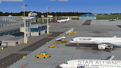
Finely detailed airports: Tour Val de Loire civil and military airport, Angers-Marce airport, Amboise Dierre aerodrome and the historic Angers-Avrille aerodrome, where the first flying club in France was founded in 1906, and which no longer exists.
All aerodromes are accurately positioned on the texture, with compliant taxiways.
Autogen vegetation areas are placed around the edges of the aerodromes and historical sites.
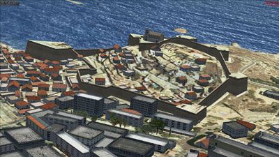
Industrial sites, architectural gems and specific reference points: Bridge of Saint-Nazaire, Port facilities of Saint-Nazaire, Chevire bridge, Avoine nuclear power plant, Saint-Laurent des-eaux nuclear power plant, television relay station, wind farms.
Night shades and complete management over the water effects and transparency of all scenery.
High-resolution mesh from the ordnance survey database.
Upgrade Microsoft Flight Simulator, FSX, P3D & X-Plane in minutes with our curated file library packed with aircraft, scenery, liveries, and utilities.
Ready to upgrade your hangar?
Browse the free file library
Ian Stephens is a flight simulation industry expert with over 20 years of experience and also has a keen interest in aviation and technology. Ian spends a lot of his time experimenting with various simulator packages but has a love for Microsoft Flight Simulator X because of the huge selection of add-ons available. However, Ian also has copies of Prepar3D and X-Plane installed.
Ian has been writing for Fly Away Simulation for over 9 years. Should you wish, you can contact Ian via email at ian.stephens@flyawaysimulation.com.
Experience ultra-realistic flight operations across two scenic Californian aerodromes that showcase robust weather modeling,…
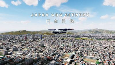
Experience SamScene’s Japan Wow Vol. 1 for FSX/P3D, showcasing refined autogen, photoreal ground textures with seasonal variety, and…
Featuring meticulously detailed scenery for EPRZ Rzeszów-Jasionka, EPKT Katowice-Pyrzowice, and EPGD Gdańsk Lech Wałęsa, this expansive…

Uncover a comprehensive selection of top-tier freeware expansions for Microsoft Flight Simulator, spanning intricately detailed aircraft…
This meticulously crafted Balearic Islands X environment from Sim-Wings merges precise coastlines, photoreal ground textures, and…

Discover a curated set of no-cost upgrades for Microsoft Flight Simulator X that enrich your virtual cockpit, from high-fidelity photoreal…
0 comments
Leave a Response