 FSX Scenery
Inegi Mexico 38 M Terrains (Part A)
FSX Inegi Mexico 38 M Terrains. Includes complete coverage of FSX terrain mes…
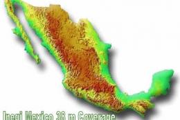
INEGI Mexico 38 m terrain mesh refreshes the country’s topography with near-nationwide coverage built from the official Inegi Elevation Model, delivering sharper mountains, valleys, and coastlines for more convincing VFR and IFR flying in Microsoft Flight Simulator X. Part B continues the split package for seamless elevation detail across Mexico.

FSX Inegi Mexico 38 M Terrains. Includes complete coverage of FSX terrain mesh in 38 m resolution for the whole of Mexico. Designed using the Inegi Elevation Model. The scenery is split into two files, INEGI38X.ZIP and INE38GI2.ZIP. By Raimondo Taburet.
Free for all simmers · 102 MB · Scanned clean
Download speed: Free tier is capped at 0.5 Mbps (this file takes approximately 29 mins at the cap). PRO members download at full line speed.
This add-on may require the following files to function properly. If this is a repaint, the dependency below is likely the base aircraft package.
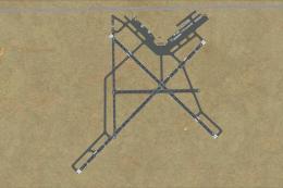
FSX\Addon Scenery\ containing scenery and texture sub-folders.readme.txt or README file. It tells you exactly where files go, what dependencies are needed, and any quirks specific to this add-on.Use these coordinates to fly directly to this location once the mod is installed.
19.43260000,-99.13320000
Launch FSX or Prepar3D and use Flights → Load to open the downloaded .pln file. Your aircraft will be positioned at this location.
The archive inegi382.zip has 11 files and directories contained within it.
This list displays the first 500 files in the package. If the package has more, you will need to download it to view them.
| Filename/Directory | File Date | File Size |
|---|---|---|
| mex38_14.bgl | 10.21.06 | 25.74 MB |
| mex38_15.bgl | 10.21.06 | 23.39 MB |
| mex38_9.bgl | 10.21.06 | 15.92 MB |
| mex38_10.bgl | 10.21.06 | 3.78 MB |
| mex38_11.bgl | 10.21.06 | 23.11 MB |
| mex38_12.bgl | 10.21.06 | 5.88 MB |
| mex38_13.bgl | 10.21.06 | 14.85 MB |
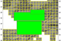
| mexico38_coverage.gif | 10.18.06 | 43.89 kB |
| README.txt | 10.21.06 | 838 B |
| flyawaysimulation.txt | 10.29.13 | 959 B |
| Go to Fly Away Simulation.url | 01.22.16 | 52 B |
More FSX & P3D add-ons hand-picked based on this download.
FSX Scenery
FSX Inegi Mexico 38 M Terrains. Includes complete coverage of FSX terrain mes…
 FSX Scenery
FSX Alps 38 m Terrains. Terrain mesh covering the Alps at 38 m resolution. De…
 FSX Scenery
New Mexico. Carved high into the mountains of New Mexico, sits a small but de…
 FSX Scenery
Hobbs, New Mexico Air Cargo. This scenery package adds an air cargo hangar to…
 FSX Scenery
Alaska 38 Terrain Mesh Part 1 & 2. FSX Alaska 38 Terrain Mesh Replacement ter…
 FSX Scenery
FSX France 38 m Terrain, version 3. Terrain mesh covering France at 38m resol…
 FSX Scenery
Flymex Mexico DF Textures. New ground textures for Mexico D.F. and Toluca for…
 FSX Scenery
Papua New Guinea Airports Part 1. PNG has more airfields and heliports than t…
Be the first to leave a comment on this download.
Be the first to share your thoughts on this download.