 FSX Scenery
Alaska 38 Terrain Mesh (All Parts)
Alaska 38 Terrain Mesh Part 1 & 2. FSX Alaska 38 Terrain Mesh Replacement ter…
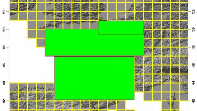
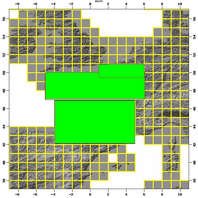
France 38 m Terrain mesh sharpens the country’s topography with a consistent 38-meter elevation grid, bringing crisper ridgelines, valleys, and coastlines to VFR and IFR flying in Microsoft Flight Simulator X. Built with the FSX SDK, version 3 replaces earlier releases and delivers cleaner, more accurate terrain shaping across France.
Free for all simmers · 49.68 MB · Scanned clean Aug 2026
Download speed: Free tier is capped at 0.5 Mbps (this file takes approximately 14 mins at the cap). PRO members download at full line speed.
FSX\Addon Scenery\ containing scenery and texture sub-folders.readme.txt or README file. It tells you exactly where files go, what dependencies are needed, and any quirks specific to this add-on.Use these coordinates to fly directly to this location once the mod is installed.
46.22760000,2.21370000
Launch FSX or Prepar3D and use Flights → Load to open the downloaded .pln file. Your aircraft will be positioned at this location.
The archive fra38xv3.zip has 12 files and directories contained within it.
This list displays the first 500 files in the package. If the package has more, you will need to download it to view them.
| Filename/Directory | File Date | File Size |
|---|---|---|
| README.txt | 12.01.06 | 980 B |
| france_38_coverage.gif | 10.17.06 | 94.23 kB |
| france38_4.bgl | 11.07.06 | 4.59 MB |
| france38_8.bgl | 11.07.06 | 519.40 kB |
| france38_7.bgl | 11.07.06 | 2.41 MB |
| france38_6.bgl | 11.07.06 | 4.65 MB |
| france38_5.bgl | 12.01.06 | 12.75 MB |
| france38_3.bgl | 11.07.06 | 7.82 MB |
| france38_1.bgl | 12.01.06 | 7.90 MB |
| france38_2.bgl | 11.07.06 | 14.48 MB |
| flyawaysimulation.txt | 10.29.13 | 959 B |
| Go to Fly Away Simulation.url | 01.22.16 | 52 B |
Only PRO members can place votes.
More FSX & P3D add-ons hand-picked based on this download.
FSX Scenery
Alaska 38 Terrain Mesh Part 1 & 2. FSX Alaska 38 Terrain Mesh Replacement ter…
 FSX Scenery
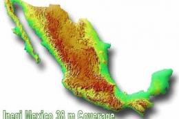
FSX Inegi Mexico 38 M Terrains. Includes complete coverage of FSX terrain mes…
 FSX Scenery
FSX Inegi Mexico 38 M Terrains. Includes complete coverage of FSX terrain mes…
 FSX Scenery
For users of Flight Simulator X (and FSX: Steam Edition) and/or Prepar3D, ter…
 FSX Scenery
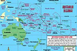
Oceania - Asia SRTM Terrain Mesh. Covers Australia, New Zealand (including Au…
 FSX Scenery
This freeware scenery enhances the German landscape in FSX by incorporating d…
 FSX Scenery
New Zealand Terrain Mesh. These files have had extensive work done on them to…
 FSX Scenery
This freeware release enriches the default environment in Flight Simulator by…
Be the first to leave a comment on this download.
Be the first to share your thoughts on this download.