


 FSX Scenery
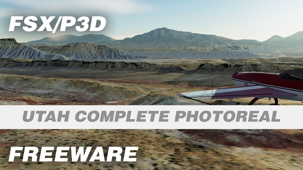
Utah Complete
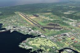
Utah Complete, including Salt Lake City International Airport (KSLC), UT. Thi…
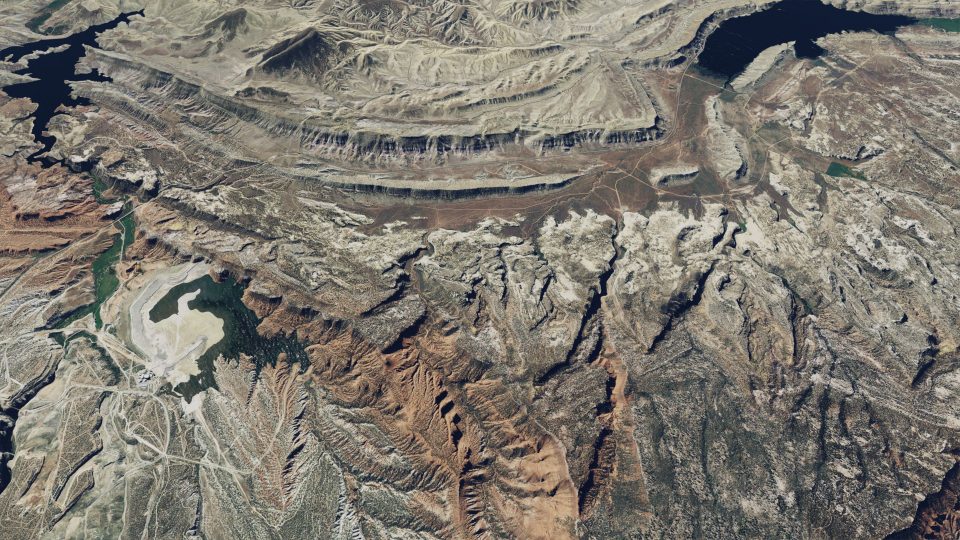
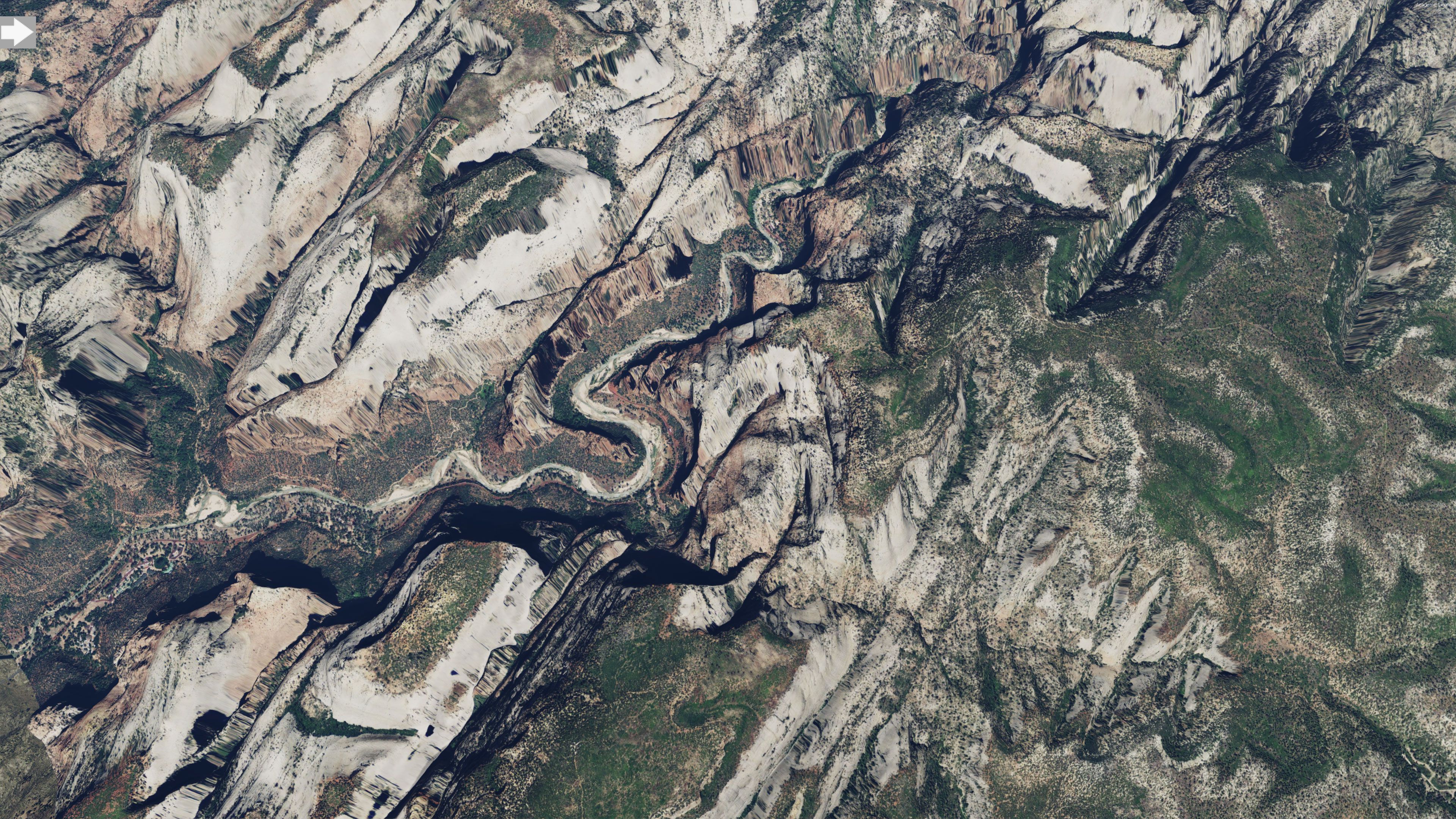
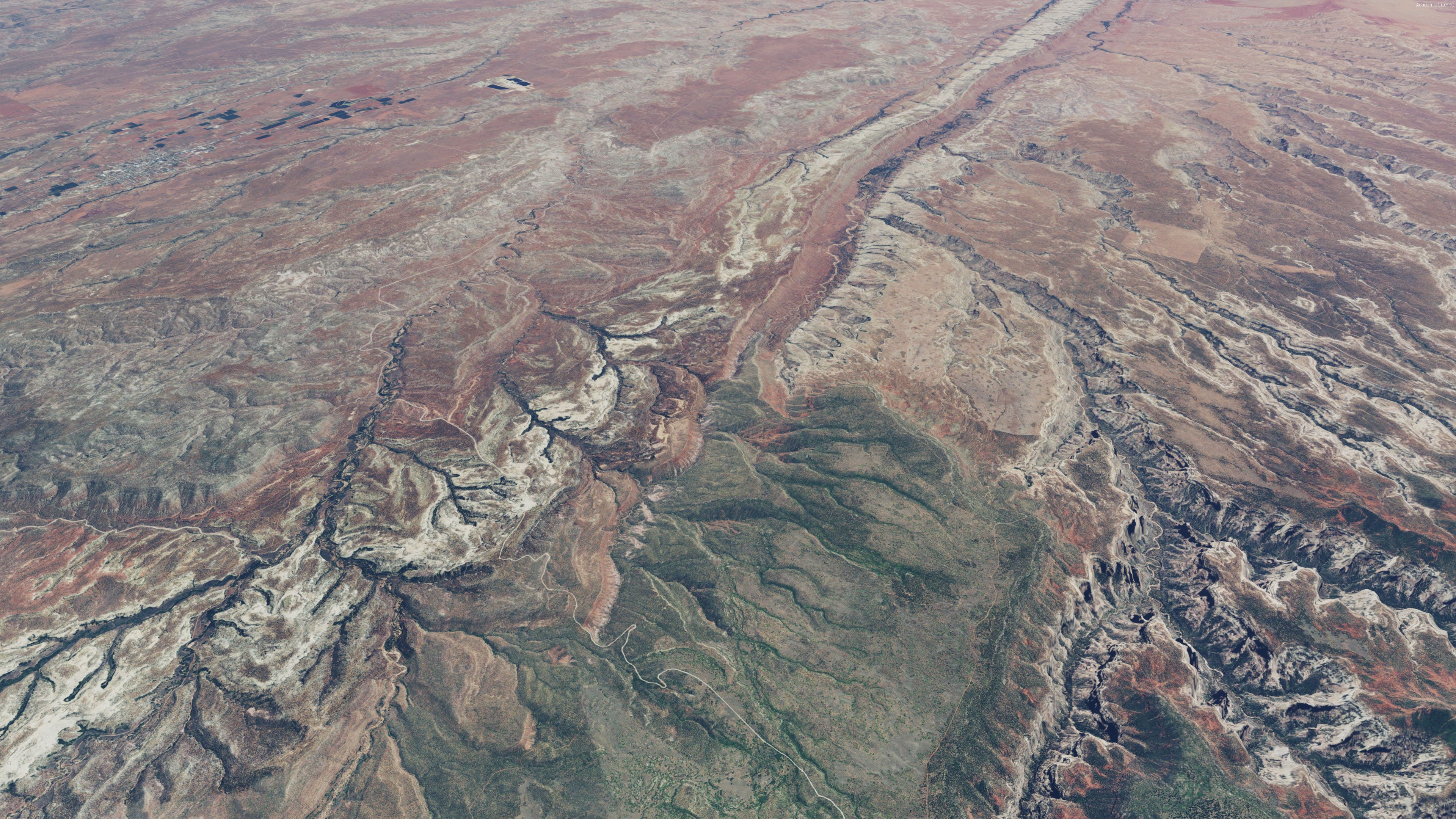
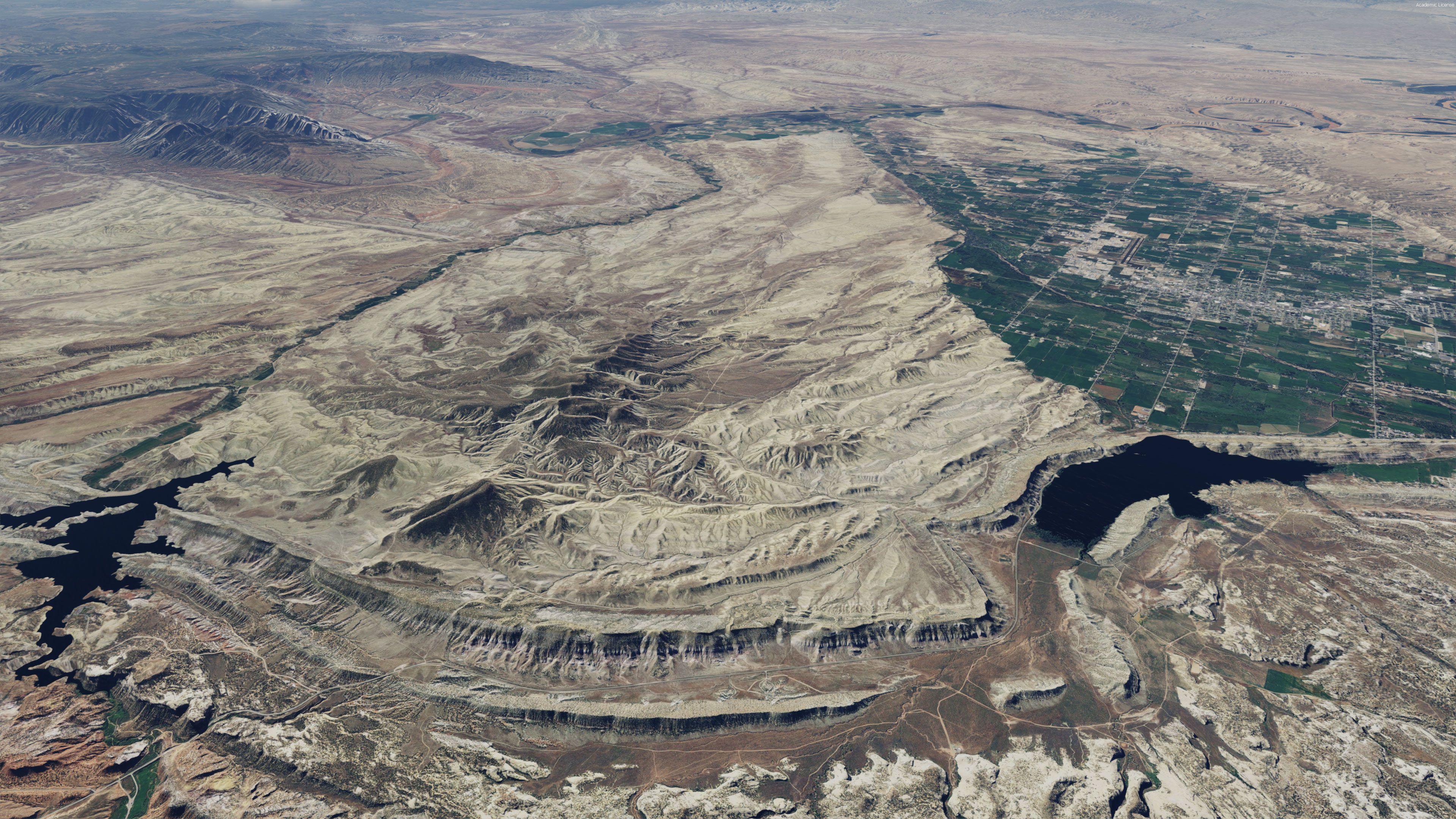
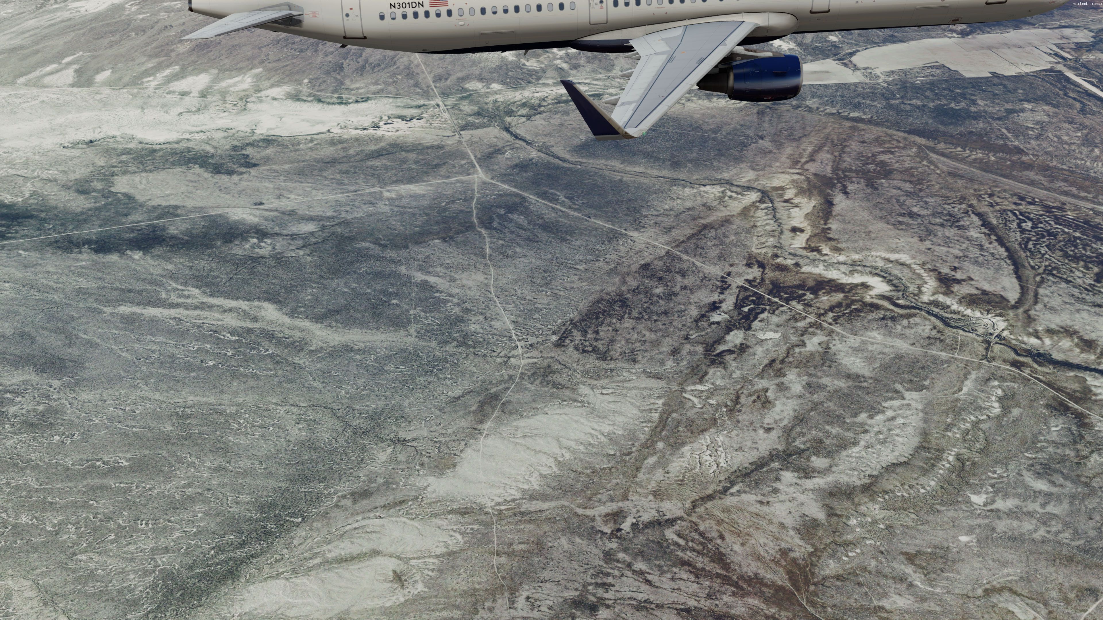
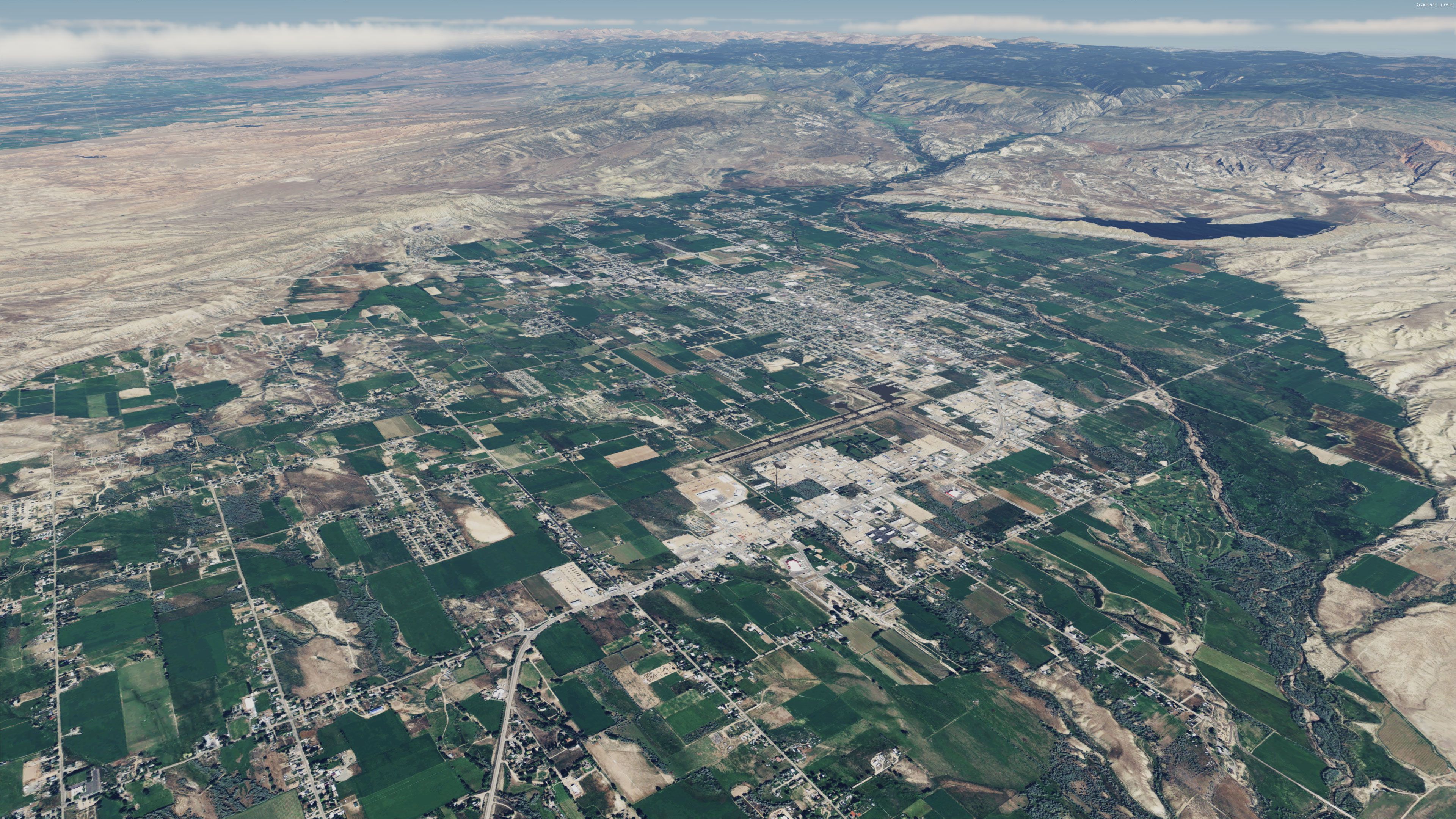
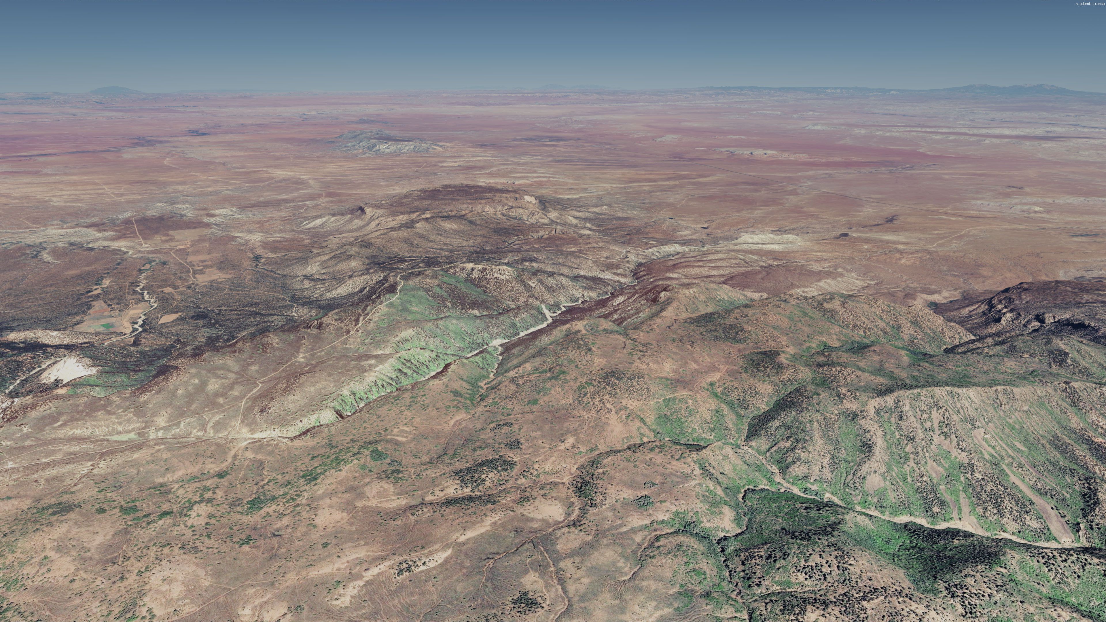
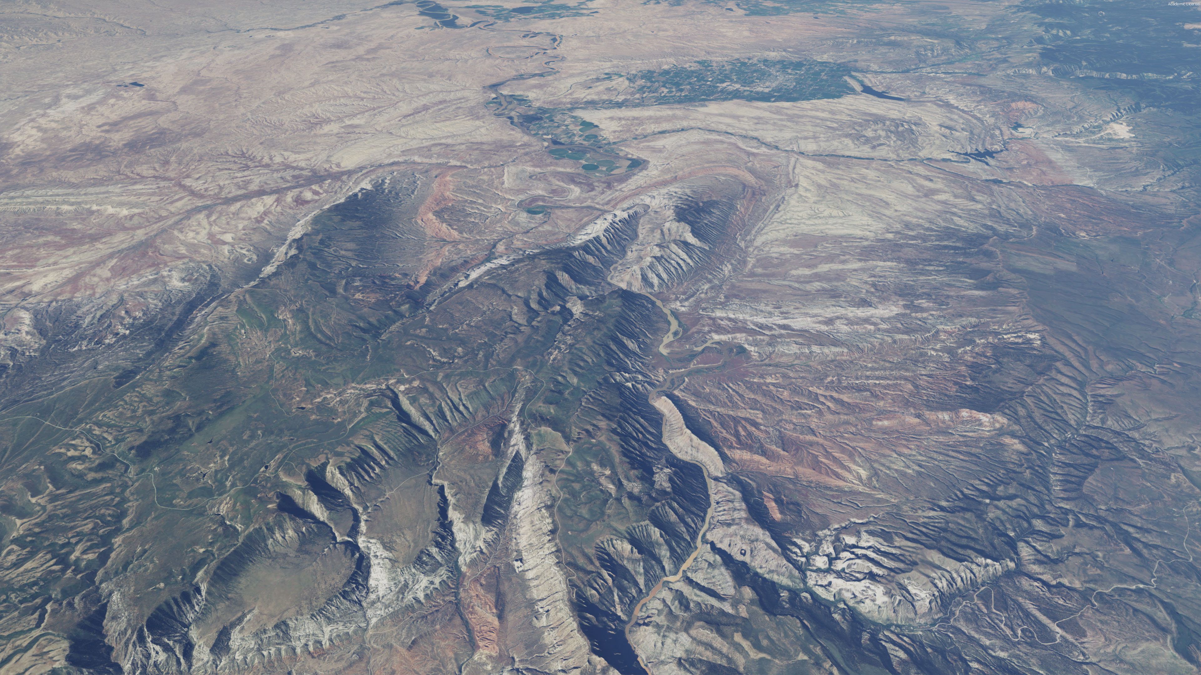
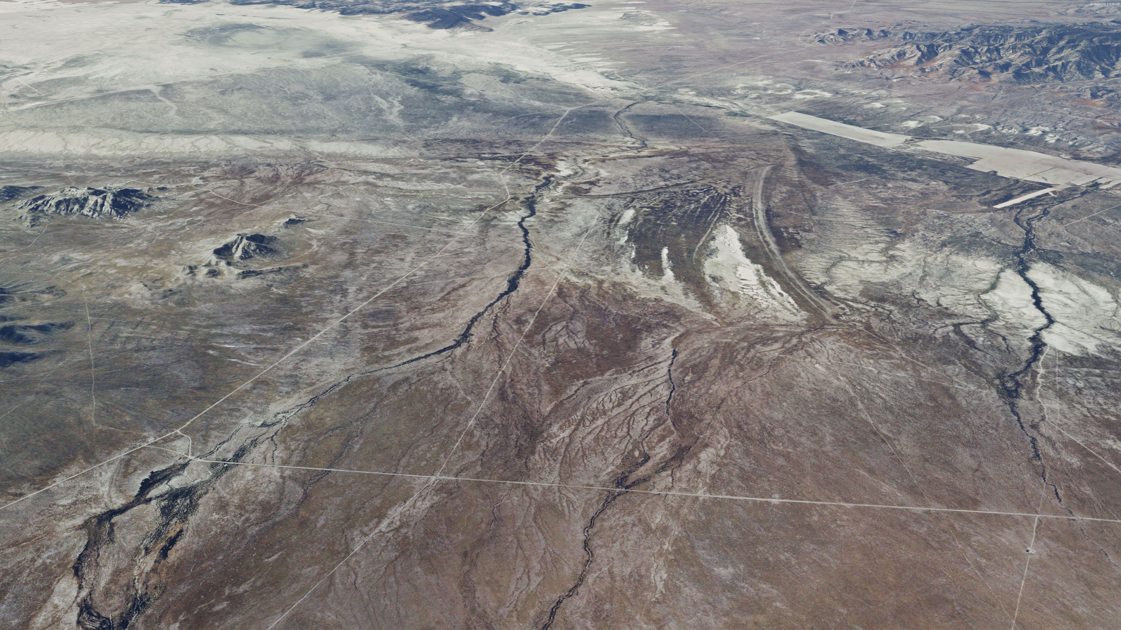
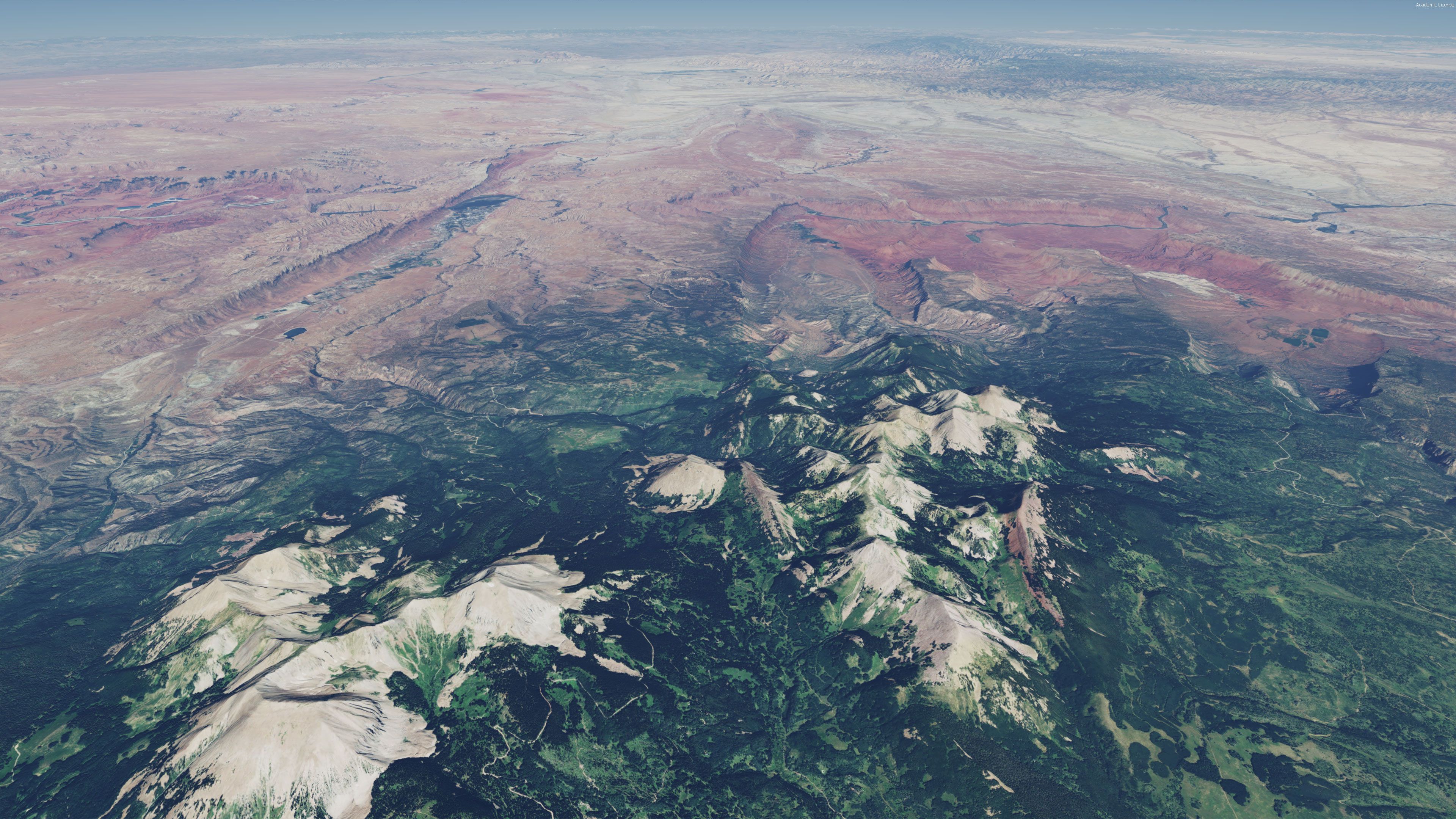
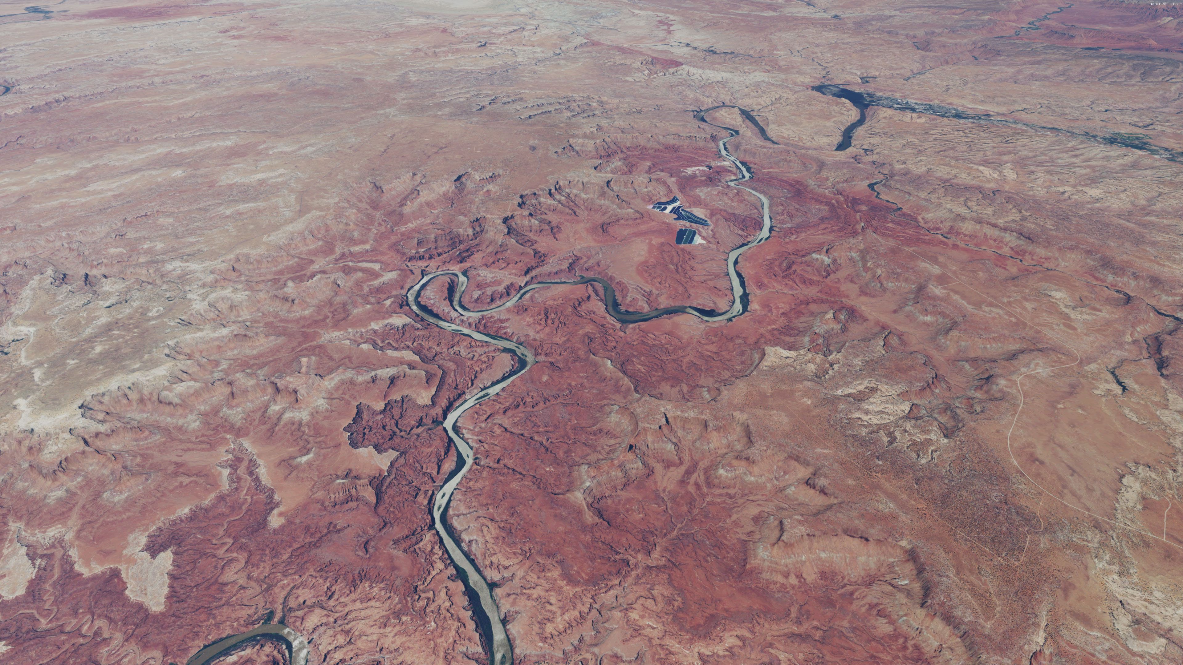
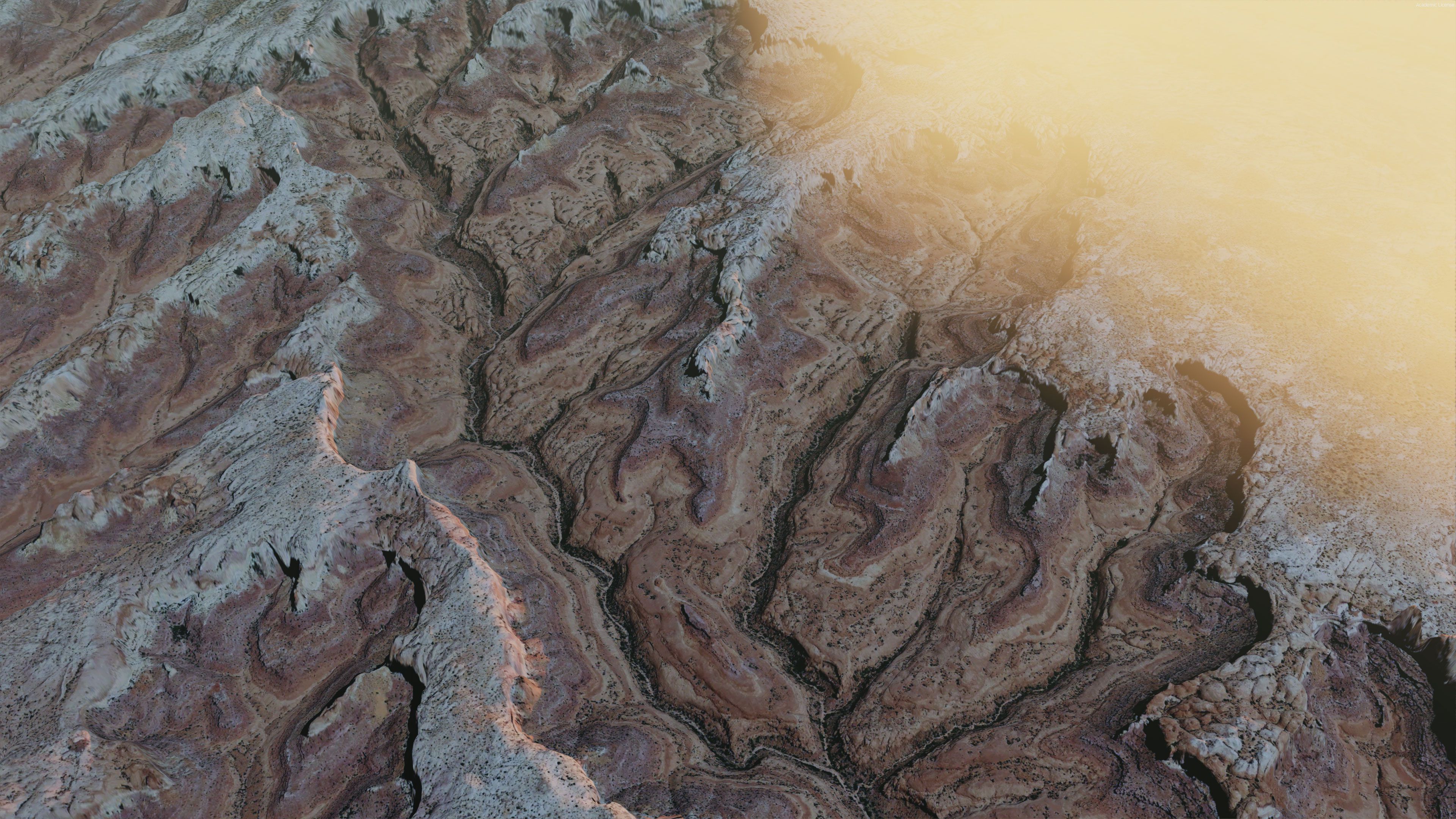
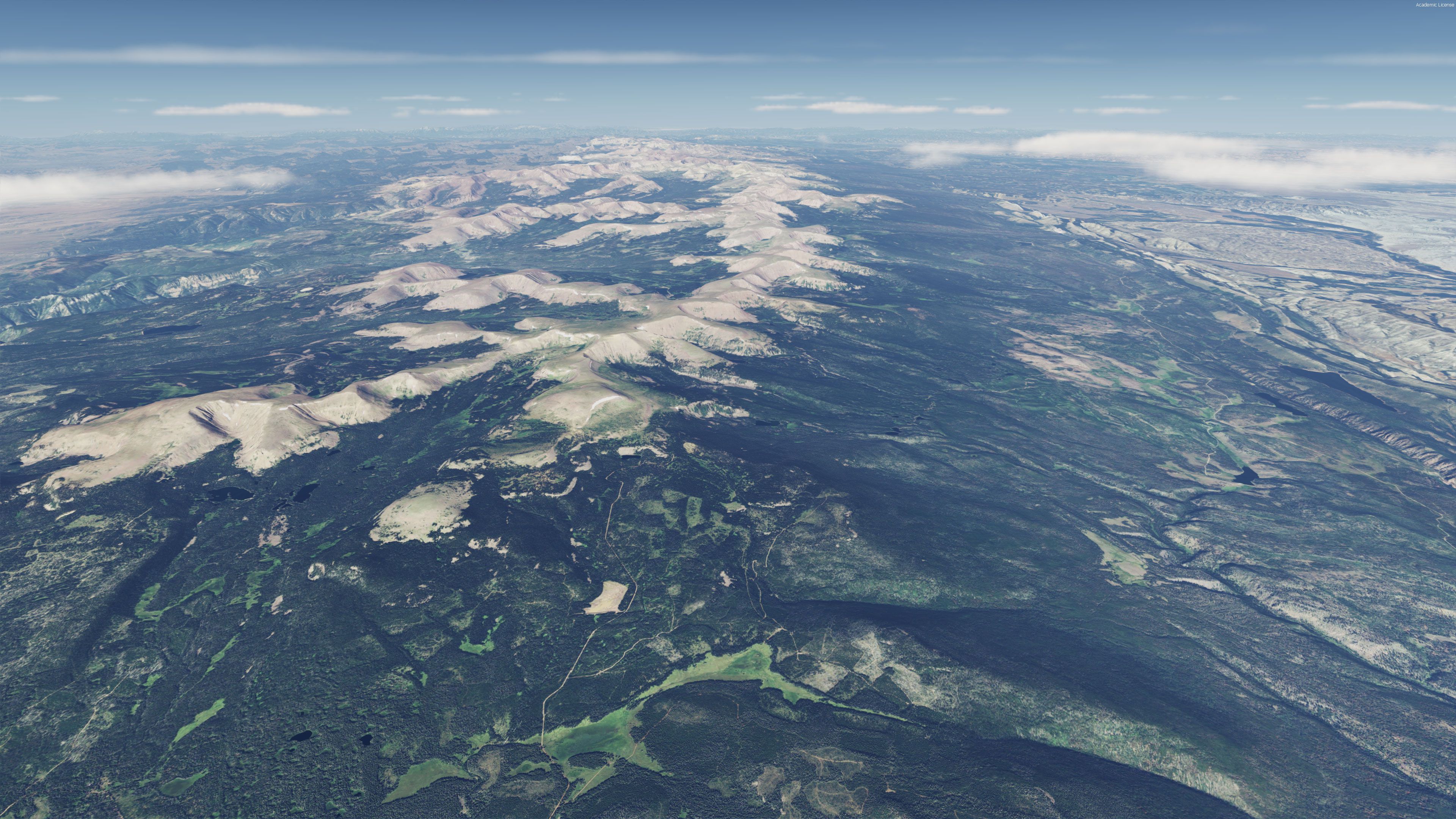
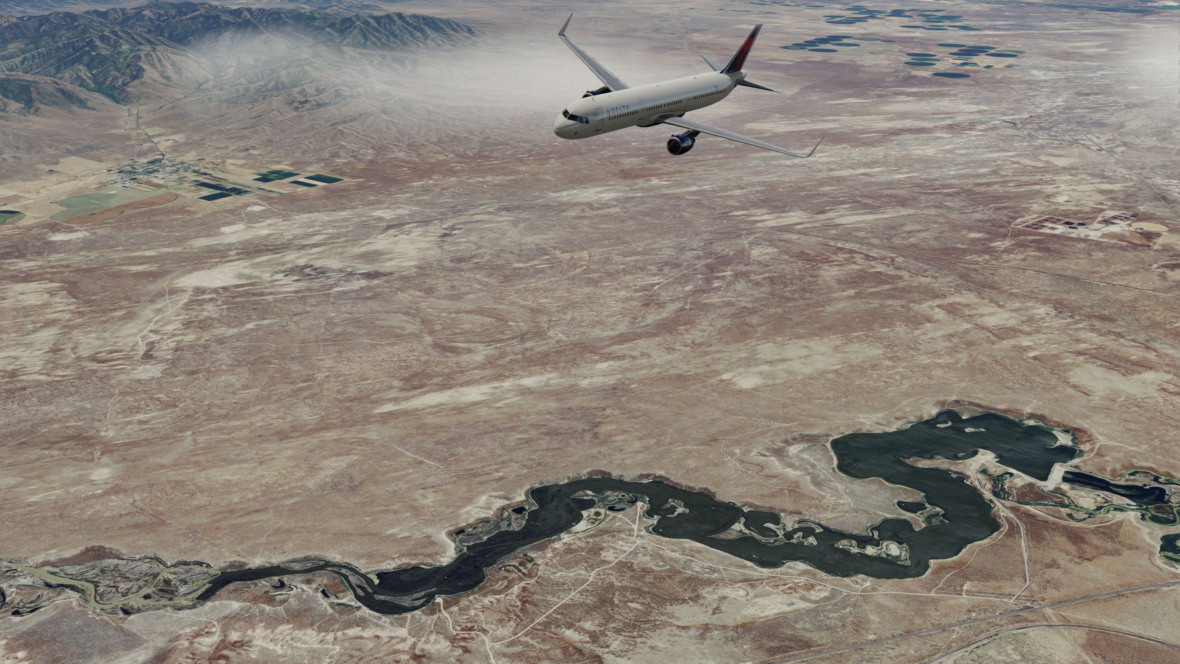
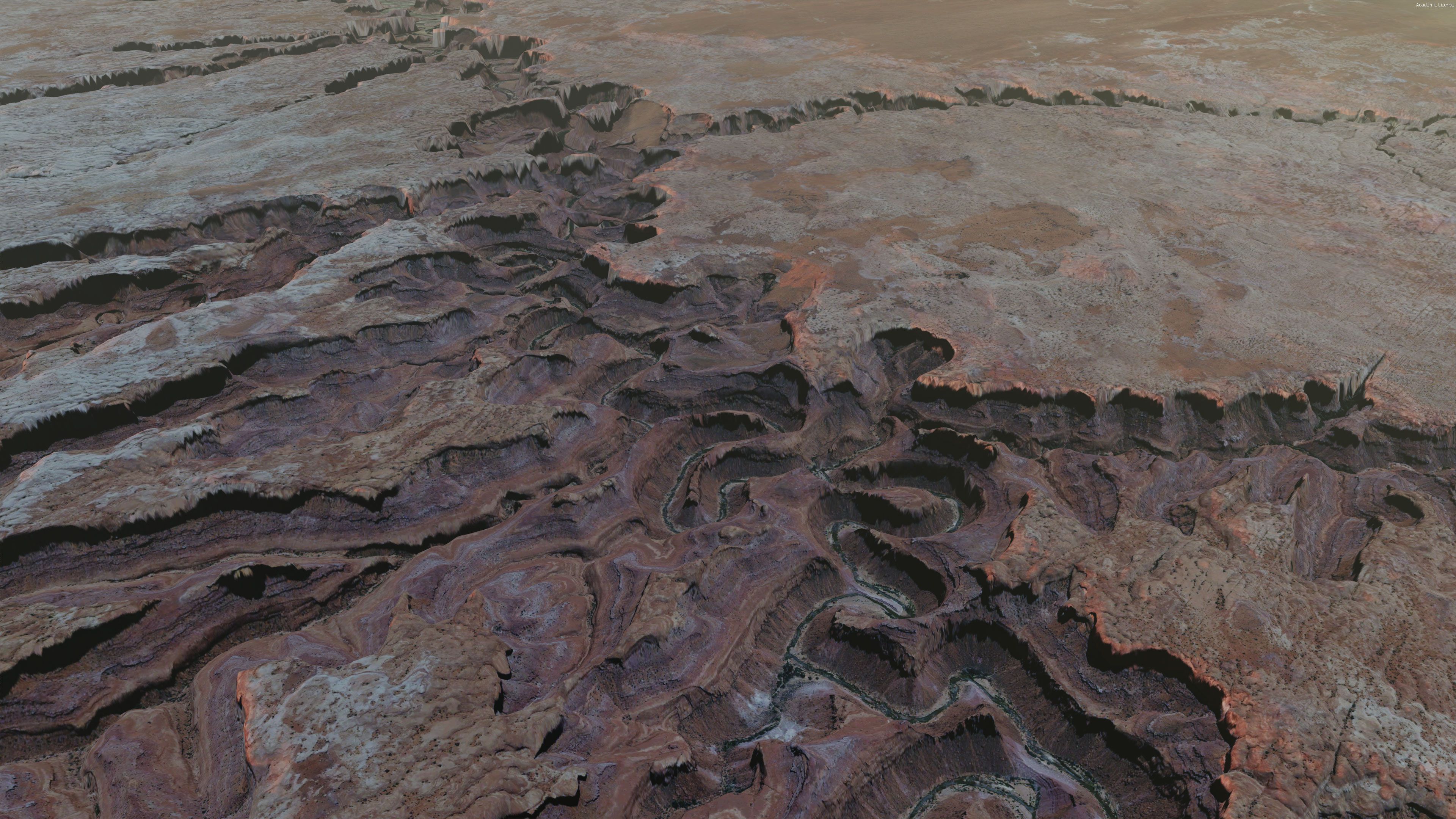
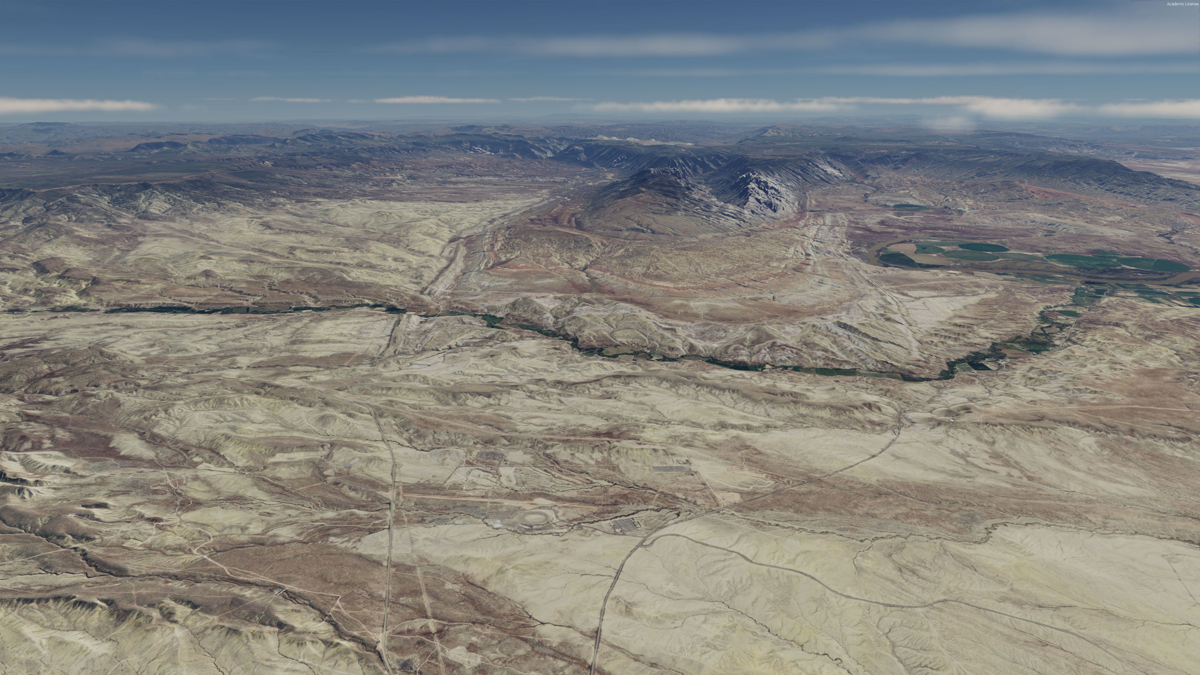
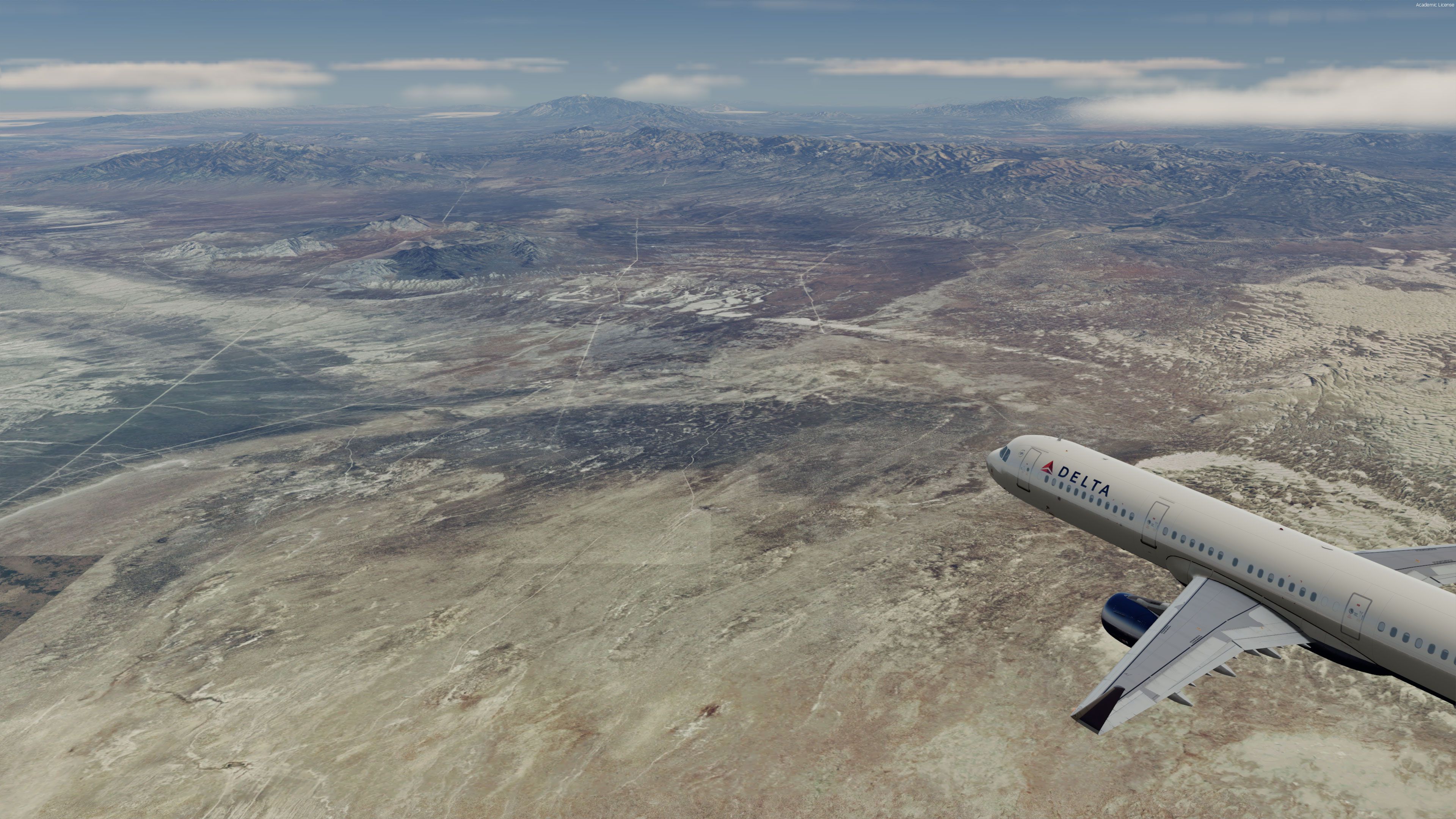
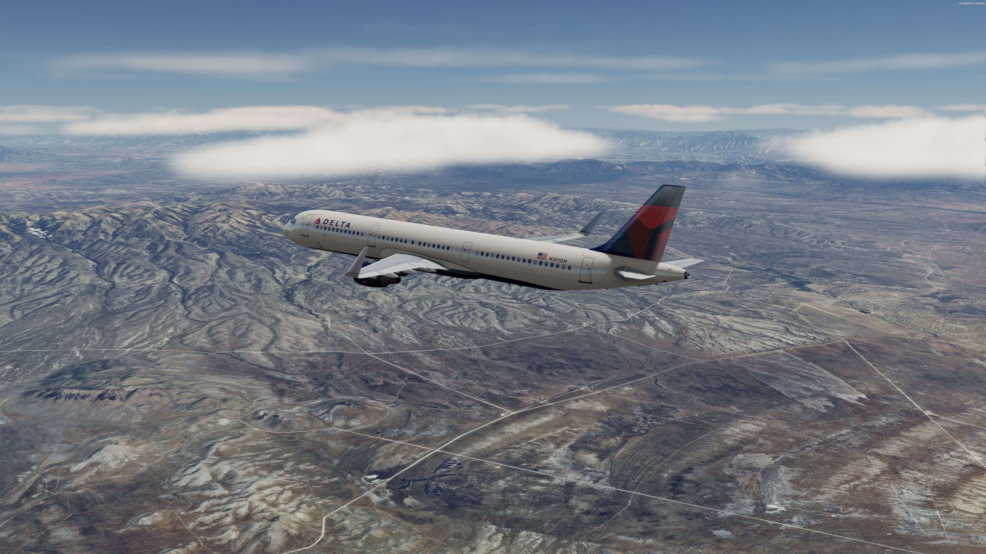
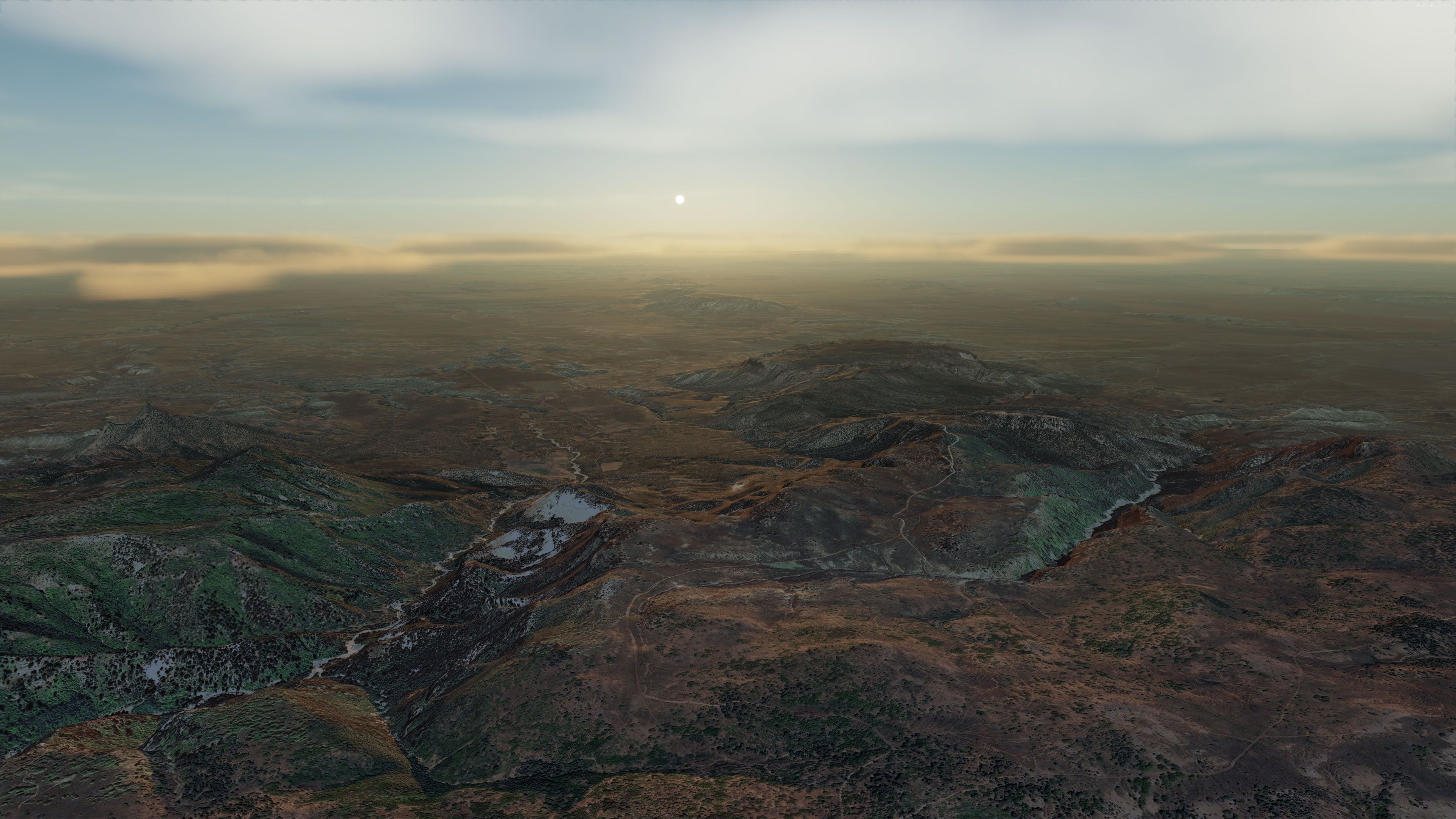
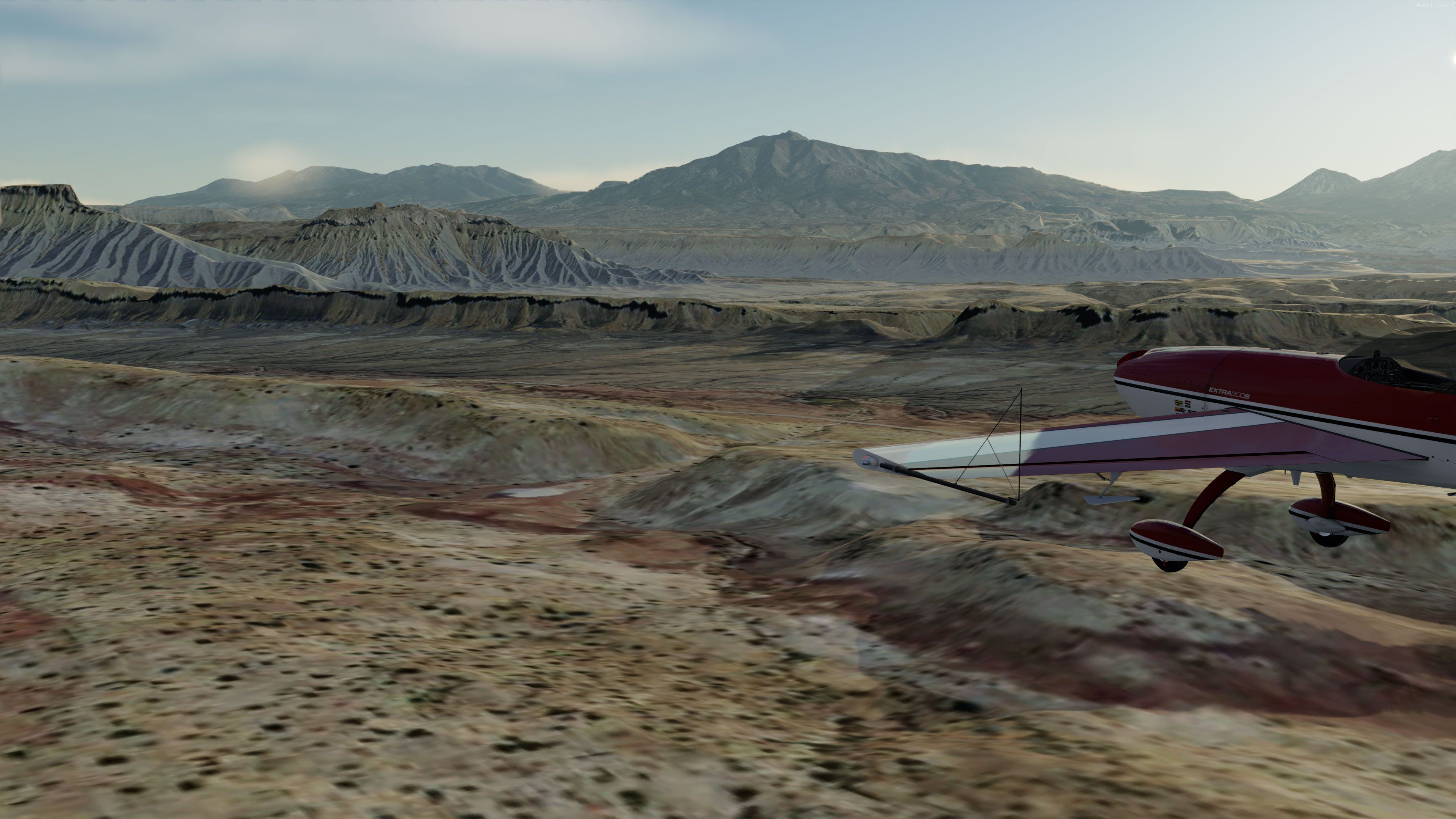
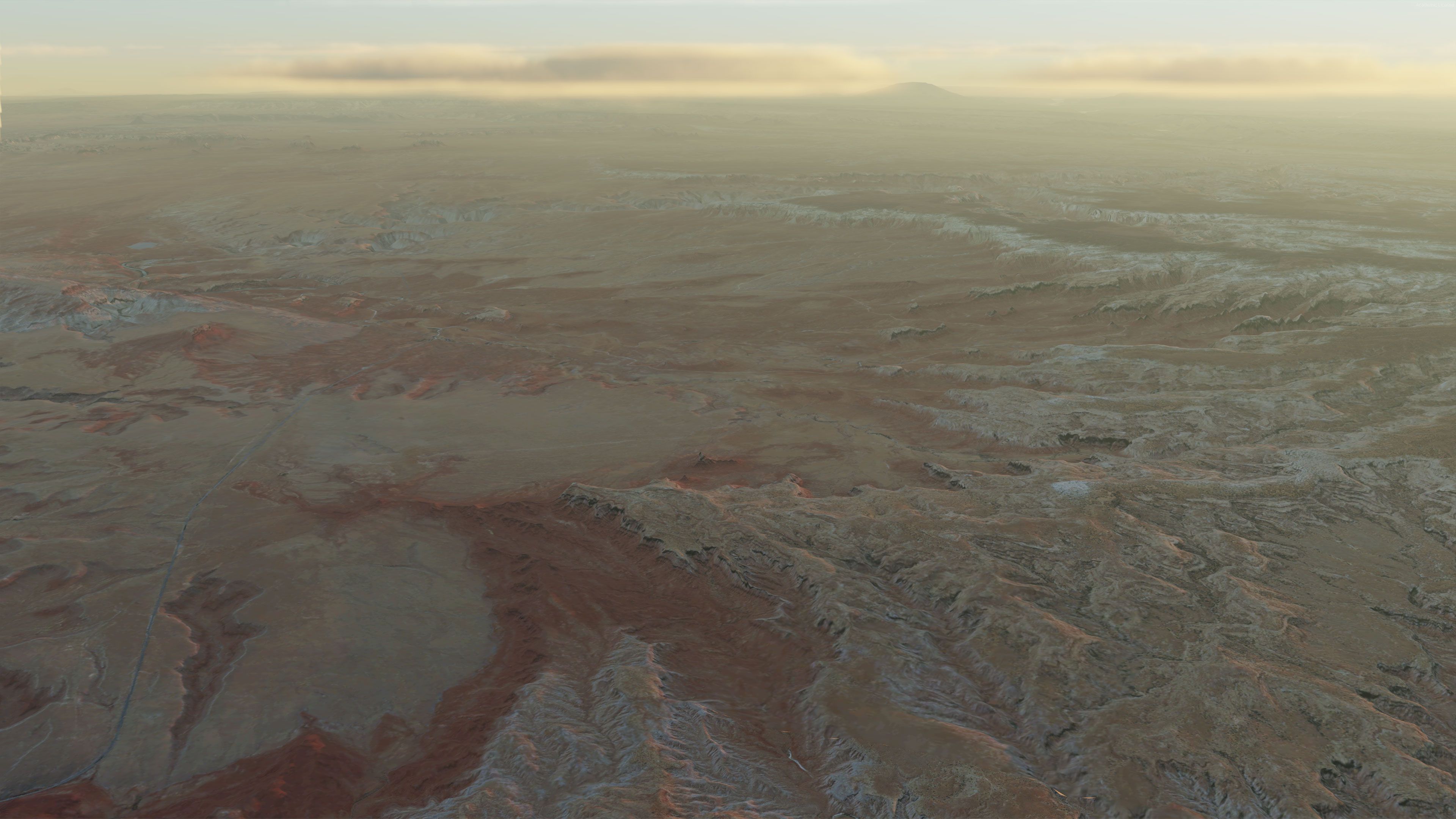
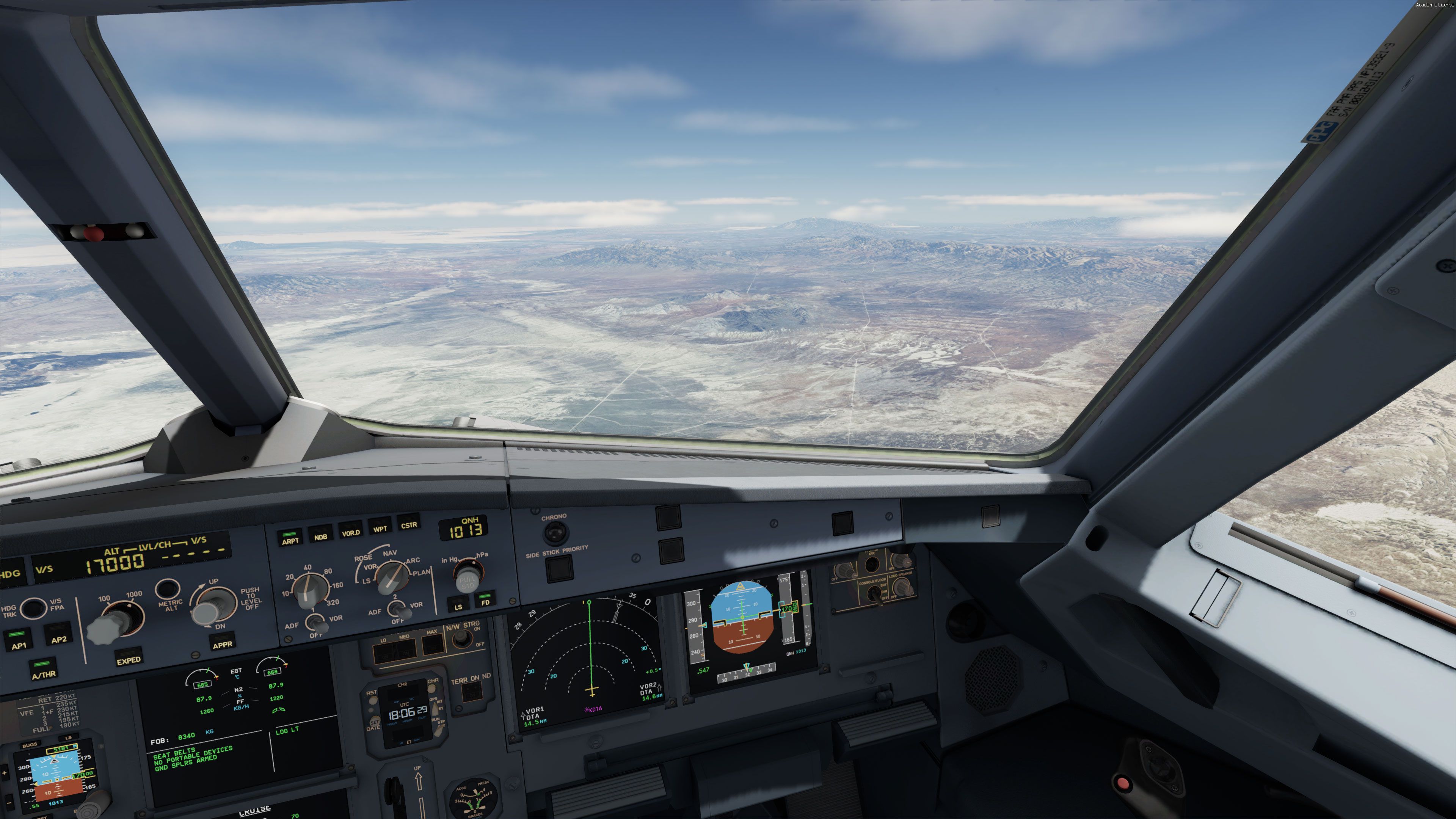
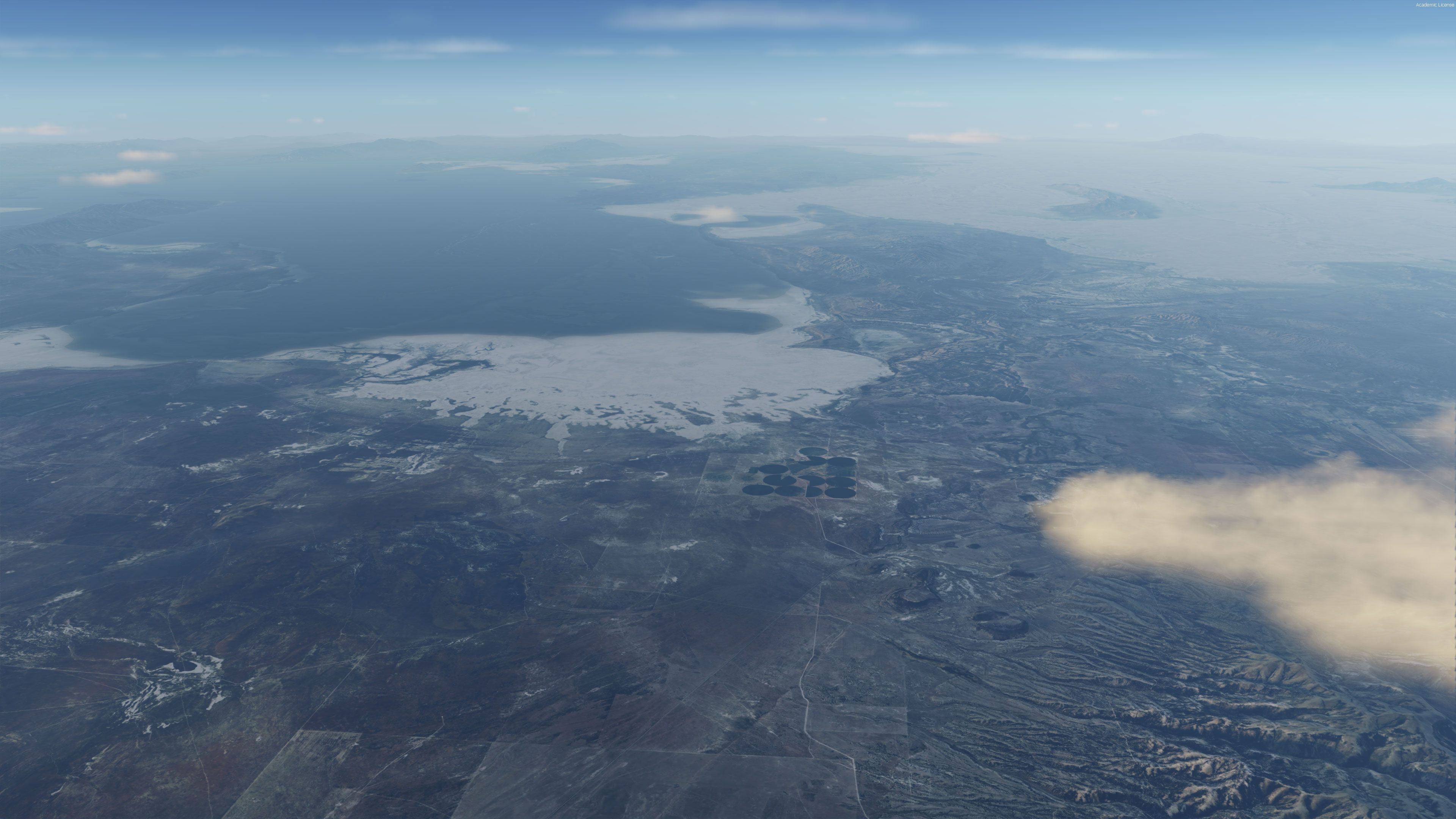
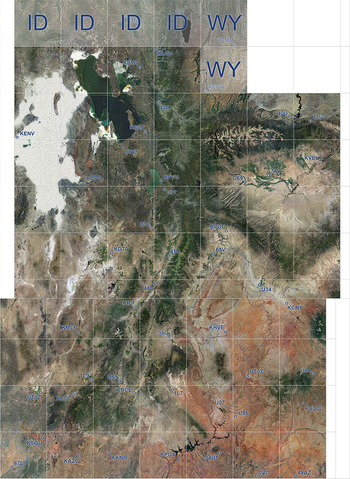
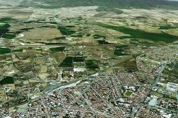
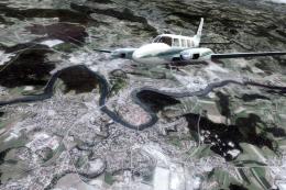
Utah’s deserts, canyons, and salt flats gain full-state photoreal coverage with crisp 1m/pixel aerial imagery, a 10m high-resolution mesh, and accurate landmarks from the Great Salt Lake to Lake Powell, enhancing everything from Canyonlands Airport to remote dirt strips. Built for FSX, FSX: Steam Edition, Prepar3D v4/v5, it works best with a quality mesh and requires FreeMeshX Global for optimal.
This is a complete package containing photoreal scenery for the whole state of Utah.

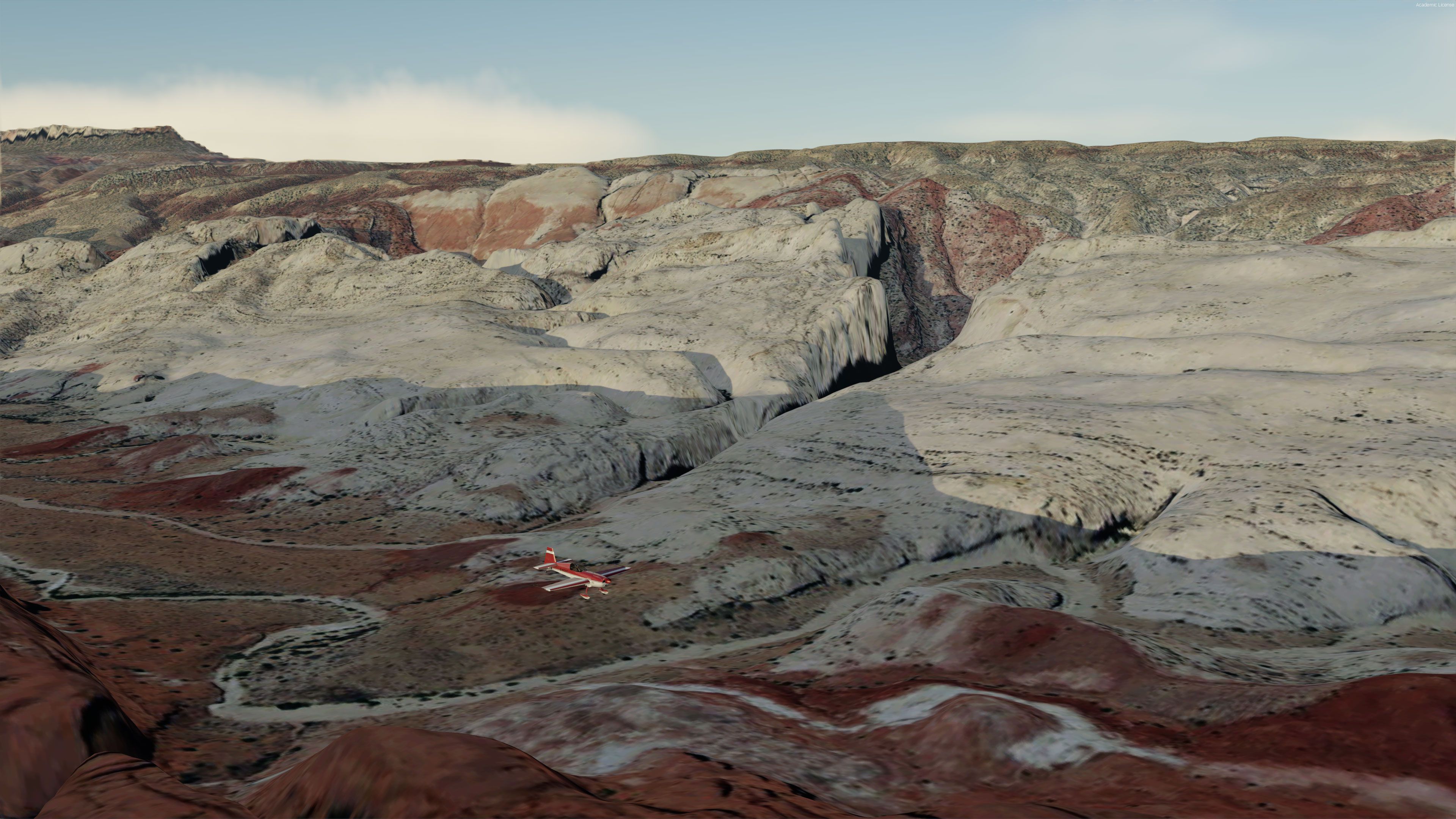
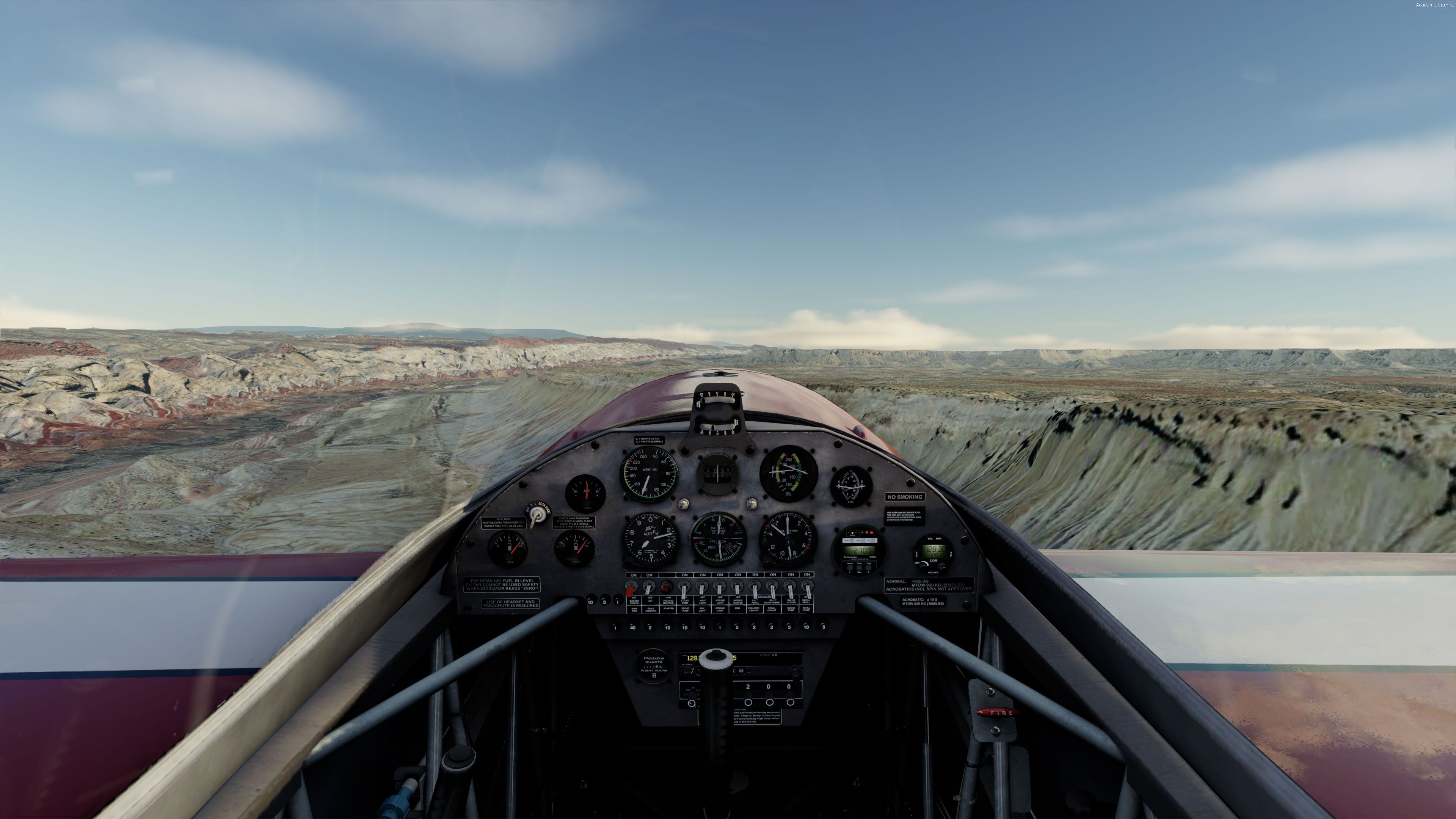
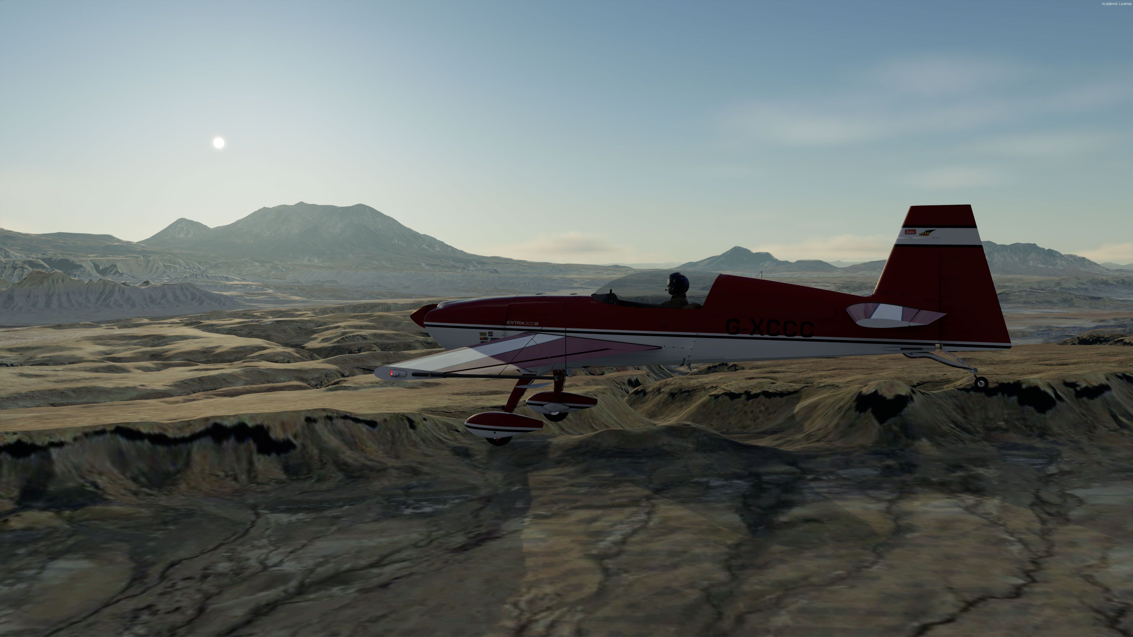
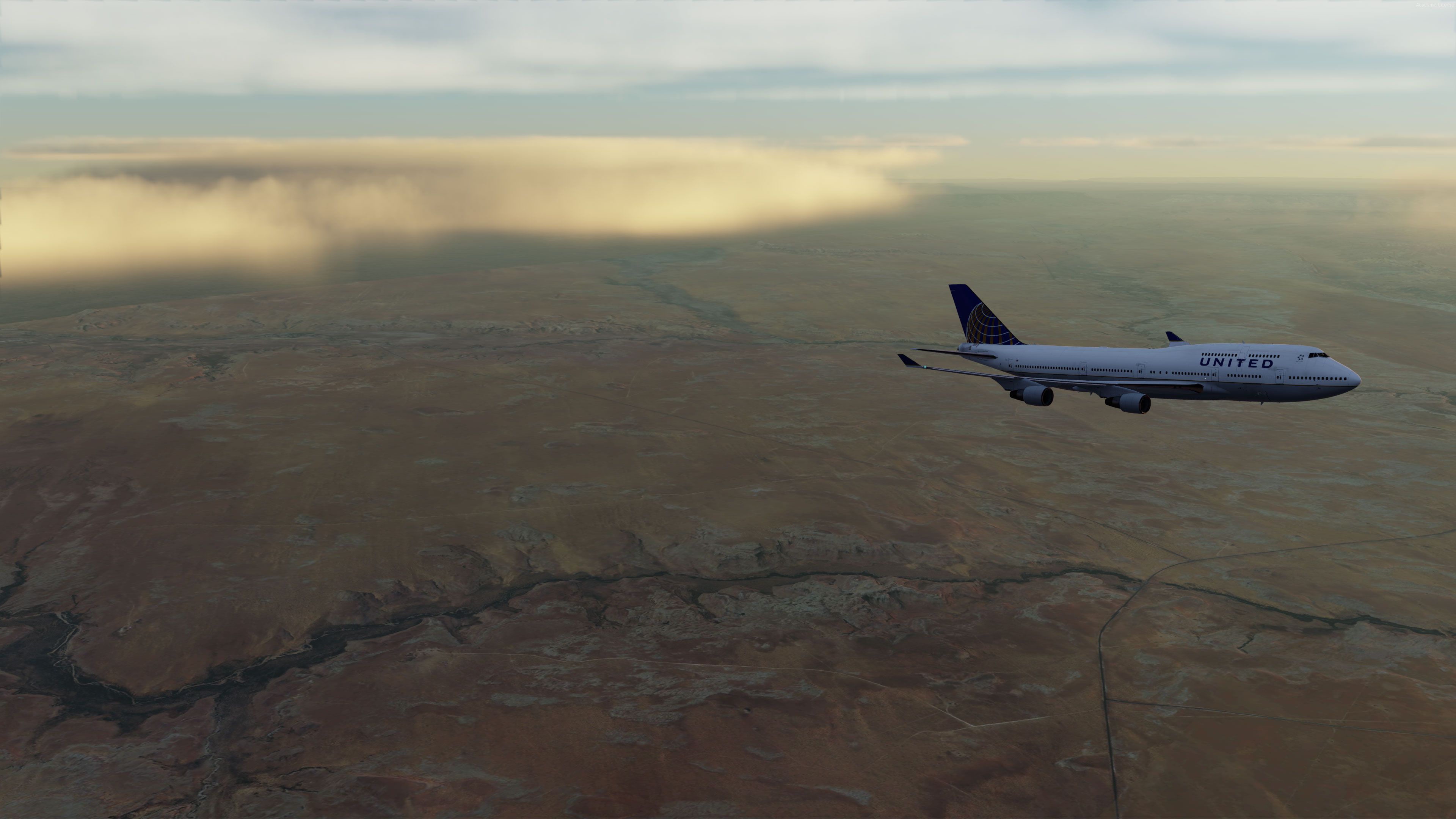
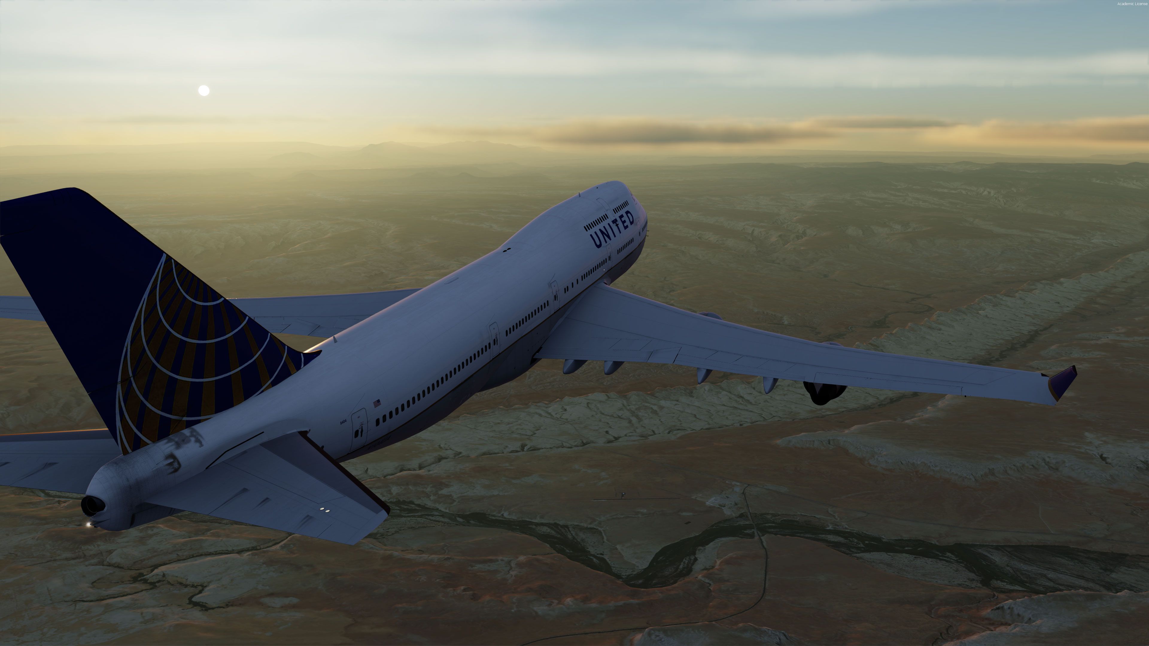
As one of the most beautiful parts of the United States of America, Utah now shows that off in the flight sim world. Free from generic layouts and using the right aerial photography to populate the skyline, this freeware photoreal package adds extra realism to the whole state.
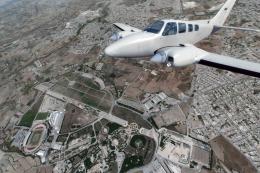
Experience airports such as Canyonlands Airport and smaller dirt strips like Needles Outpost with true-to-life terrain surrounding them.
Tested with FSX, FSX: Steam Editon and Prepar3D v4/v5. This is a very large file download.
Note: This scenery would work best with a high-quality mesh texture package. We recommend FreeMeshX Global (FreeMeshX-Global-2.0.zip) which you can download here.
INSTALLATION
Developer: BlueSkyScenery
Coverage Map
Free for all simmers · 37.49 GB · Scanned clean
Download speed: Free tier is capped at 2 Mbps (this file takes approximately 24h+ at the cap). PRO members download at full line speed.
This add-on may require the following files to function properly. If this is a repaint, the dependency below is likely the base aircraft package.
FSX\Addon Scenery\ containing scenery and texture sub-folders.readme.txt or README file. It tells you exactly where files go, what dependencies are needed, and any quirks specific to this add-on.Use these coordinates to fly directly to this location once the mod is installed.
39.32100000,-111.09370000
Launch FSX or Prepar3D and use Flights → Load to open the downloaded .pln file. Your aircraft will be positioned at this location.
The archive utah-complete-photoreal-fsx-p3d.zip has 1609 files and directories contained within it.
This list displays the first 500 files in the package. If the package has more, you will need to download it to view them.
| Filename/Directory | File Date | File Size |
|---|---|---|
| readme.txt | 01.20.12 | 3.65 kB |
| Scenery | 11.08.18 | 0 B |
| 67L_ADEX.BGL | 05.19.12 | 5.11 kB |
| CNY_East2_FSXSX.bgl | 04.02.14 | 27.06 MB |
| CNY_East3_FSXSX.bgl | 04.02.14 | 23.68 MB |
| CNY_East4_FSXSX.bgl | 04.02.14 | 34.06 MB |
| CNY_East_FSXSX.bgl | 04.02.14 | 23.04 MB |
| CNY_FSX_LR.bgl | 04.02.14 | 46.07 MB |
| CNY_FSXSX.bgl | 04.02.14 | 18.65 MB |
| CNY_Mesh.bgl | 04.02.14 | 28.46 MB |
| CNY_North_FSXSX.bgl | 04.02.14 | 17.86 MB |
| CNY_NorthEast2_FSXSX.bgl | 04.02.14 | 20.76 MB |
| CNY_NorthEast3_FSXSX.bgl | 04.02.14 | 23.21 MB |
| CNY_NorthEast4_FSXSX.bgl | 04.02.14 | 26.30 MB |
| CNY_NorthEast_FSXSX.bgl | 04.02.14 | 22.73 MB |
| CNY_NorthWest16_FSXSX.bgl | 02.22.14 | 41.34 MB |
| CNY_NorthWest17_FSXSX.bgl | 02.22.14 | 33.54 MB |
| CNY_NorthWest18_FSXSX.bgl | 02.22.14 | 20.66 MB |
| CNY_NorthWest19_FSXSX.bgl | 02.22.14 | 18.60 MB |
| CNY_NorthWest20_FSXSX.bgl | 02.22.14 | 19.92 MB |
| CNY_NorthWest21_FSXSX.bgl | 02.23.14 | 19.92 MB |
| CNY_NorthWest22_FSXSX.bgl | 02.23.14 | 22.37 MB |
| CNY_NorthWest23_FSXSX.bgl | 02.23.14 | 9.39 MB |
| CNY_NorthWest24_FSXSX.bgl | 02.23.14 | 18.99 MB |
| CNY_NorthWest25_FSXSX.bgl | 02.23.14 | 22.36 MB |
| CNY_NorthWest26_FSXSX.bgl | 02.26.14 | 25.63 MB |
| CNY_NorthWest27_FSXSX.bgl | 02.26.14 | 20.53 MB |
| CNY_NorthWest28_FSXSX.bgl | 02.26.14 | 25.73 MB |
| CNY_NorthWest29_FSXSX.bgl | 02.26.14 | 18.73 MB |
| CNY_NorthWest2_FSXSX.bgl | 04.10.14 | 12.04 MB |
| CNY_NorthWest30_FSXSX.bgl | 02.26.14 | 30.95 MB |
| CNY_NorthWest3_FSXSX.bgl | 04.10.14 | 12.51 MB |
| CNY_NorthWest4_FSXSX.bgl | 04.10.14 | 14.18 MB |
| CNY_NorthWest5_FSXSX.bgl | 04.10.14 | 33.41 MB |
| CNY_NorthWest_FSXSX.bgl | 04.10.14 | 12.35 MB |
| CNY_South10_FSXSX.bgl | 04.23.14 | 35.15 MB |
| CNY_South10East2_FSXSX.bgl | 04.23.14 | 29.44 MB |
| CNY_South10East3_FSXSX.bgl | 04.23.14 | 33.53 MB |
| CNY_South10East4_FSXSX.bgl | 04.23.14 | 36.83 MB |
| CNY_South10East_FSXSX.bgl | 04.23.14 | 37.98 MB |
| CNY_South10West10_FSXSX.bgl | 05.05.14 | 21.36 MB |
| CNY_South10West11_FSXSX.bgl | 03.23.14 | 26.28 MB |
| CNY_South10West12_FSXSX.bgl | 03.23.14 | 42.99 MB |
| CNY_South10West13_FSXSX.bgl | 03.23.14 | 44.91 MB |
| CNY_South10West14_FSXSX.bgl | 03.23.14 | 38.90 MB |
| CNY_South10West15_FSXSX.bgl | 03.23.14 | 34.27 MB |
| CNY_South10West21_FSXSX.bgl | 03.22.14 | 31.49 MB |
| CNY_South10West22_FSXSX.bgl | 03.22.14 | 31.16 MB |
| CNY_South10West23_FSXSX.bgl | 03.22.14 | 24.97 MB |
| CNY_South10West24_FSXSX.bgl | 03.22.14 | 35.30 MB |
| CNY_South10West25_FSXSX.bgl | 03.22.14 | 38.52 MB |
| CNY_South10West2_FSXSX.bgl | 04.21.14 | 33.68 MB |
| CNY_South10West3_FSXSX.bgl | 04.21.14 | 28.20 MB |
| CNY_South10West4_FSXSX.bgl | 04.21.14 | 20.60 MB |
| CNY_South10West5_FSXSX.bgl | 04.21.14 | 19.17 MB |
| CNY_South10West6_FSXSX.bgl | 05.05.14 | 11.49 MB |
| CNY_South10West7_FSXSX.bgl | 05.05.14 | 17.47 MB |
| CNY_South10West8_FSXSX.bgl | 05.05.14 | 28.01 MB |
| CNY_South10West9_FSXSX.bgl | 05.05.14 | 25.79 MB |
| CNY_South10West_FSXSX.bgl | 04.21.14 | 39.51 MB |
| CNY_South11_FSXSX.bgl | 04.23.14 | 41.05 MB |
| CNY_South11East2_FSXSX.bgl | 04.23.14 | 26.23 MB |
| CNY_South11East3_FSXSX.bgl | 04.23.14 | 30.20 MB |
| CNY_South11East4_FSXSX.bgl | 04.23.14 | 29.84 MB |
| CNY_South11East_FSXSX.bgl | 04.23.14 | 32.56 MB |
| CNY_South11West10_FSXSX.bgl | 05.05.14 | 22.01 MB |
| CNY_South11West11_FSXSX.bgl | 03.23.14 | 37.32 MB |
| CNY_South11West12_FSXSX.bgl | 03.23.14 | 45.03 MB |
| CNY_South11West13_FSXSX.bgl | 03.23.14 | 42.49 MB |
| CNY_South11West14_FSXSX.bgl | 03.23.14 | 39.23 MB |
| CNY_South11West15_FSXSX.bgl | 03.23.14 | 33.92 MB |
| CNY_South11West21_FSXSX.bgl | 03.22.14 | 30.34 MB |
| CNY_South11West22_FSXSX.bgl | 03.22.14 | 24.22 MB |
| CNY_South11West23_FSXSX.bgl | 03.22.14 | 28.46 MB |
| CNY_South11West24_FSXSX.bgl | 03.22.14 | 30.83 MB |
| CNY_South11West25_FSXSX.bgl | 03.22.14 | 36.43 MB |
| CNY_South11West2_FSXSX.bgl | 04.21.14 | 32.76 MB |
| CNY_South11West3_FSXSX.bgl | 04.21.14 | 23.19 MB |
| CNY_South11West4_FSXSX.bgl | 04.21.14 | 26.05 MB |
| CNY_South11West5_FSXSX.bgl | 04.21.14 | 21.60 MB |
| CNY_South11West6_FSXSX.bgl | 05.05.14 | 13.29 MB |
| CNY_South11West7_FSXSX.bgl | 05.05.14 | 18.49 MB |
| CNY_South11West8_FSXSX.bgl | 05.05.14 | 25.95 MB |
| CNY_South11West9_FSXSX.bgl | 05.05.14 | 23.43 MB |
| CNY_South11West_FSXSX.bgl | 04.21.14 | 41.93 MB |
| CNY_South12_FSXSX.bgl | 04.23.14 | 35.84 MB |
| CNY_South12East2_FSXSX.bgl | 04.23.14 | 17.29 MB |
| CNY_South12East3_FSXSX.bgl | 04.23.14 | 19.46 MB |
| CNY_South12East4_FSXSX.bgl | 04.23.14 | 22.86 MB |
| CNY_South12East_FSXSX.bgl | 04.23.14 | 23.02 MB |
| CNY_South12West10_FSXSX.bgl | 05.05.14 | 35.92 MB |
| CNY_South12West11_FSXSX.bgl | 03.23.14 | 42.45 MB |
| CNY_South12West12_FSXSX.bgl | 03.23.14 | 43.73 MB |
| CNY_South12West13_FSXSX.bgl | 03.23.14 | 42.62 MB |
| CNY_South12West14_FSXSX.bgl | 03.23.14 | 39.57 MB |
| CNY_South12West15_FSXSX.bgl | 03.23.14 | 41.00 MB |
| CNY_South12West21_FSXSX.bgl | 03.22.14 | 33.45 MB |
| CNY_South12West22_FSXSX.bgl | 03.22.14 | 29.12 MB |
| CNY_South12West23_FSXSX.bgl | 03.22.14 | 31.71 MB |
| CNY_South12West24_FSXSX.bgl | 03.22.14 | 30.59 MB |
| CNY_South12West25_FSXSX.bgl | 03.22.14 | 33.13 MB |
| CNY_South12West2_FSXSX.bgl | 04.21.14 | 30.23 MB |
| CNY_South12West3_FSXSX.bgl | 04.21.14 | 19.74 MB |
| CNY_South12West4_FSXSX.bgl | 04.21.14 | 27.37 MB |
| CNY_South12West5_FSXSX.bgl | 04.21.14 | 20.10 MB |
| CNY_South12West6_FSXSX.bgl | 05.05.14 | 14.82 MB |
| CNY_South12West7_FSXSX.bgl | 05.05.14 | 19.08 MB |
| CNY_South12West8_FSXSX.bgl | 05.05.14 | 17.55 MB |
| CNY_South12West9_FSXSX.bgl | 05.05.14 | 20.43 MB |
| CNY_South12West_FSXSX.bgl | 04.21.14 | 41.75 MB |
| CNY_South13_FSXSX.bgl | 04.23.14 | 17.58 MB |
| CNY_South13East2_FSXSX.bgl | 04.23.14 | 13.69 MB |
| CNY_South13East3_FSXSX.bgl | 04.23.14 | 14.96 MB |
| CNY_South13East4_FSXSX.bgl | 04.23.14 | 16.21 MB |
| CNY_South13East_FSXSX.bgl | 04.23.14 | 16.56 MB |
| CNY_South13West10_FSXSX.bgl | 05.05.14 | 29.47 MB |
| CNY_South13West11_FSXSX.bgl | 03.23.14 | 26.81 MB |
| CNY_South13West12_FSXSX.bgl | 03.23.14 | 34.14 MB |
| CNY_South13West13_FSXSX.bgl | 03.23.14 | 40.33 MB |
| CNY_South13West14_FSXSX.bgl | 03.23.14 | 35.34 MB |
| CNY_South13West15_FSXSX.bgl | 03.23.14 | 38.88 MB |
| CNY_South13West21_FSXSX.bgl | 03.22.14 | 34.29 MB |
| CNY_South13West22_FSXSX.bgl | 03.22.14 | 34.08 MB |
| CNY_South13West23_FSXSX.bgl | 03.22.14 | 29.24 MB |
| CNY_South13West24_FSXSX.bgl | 03.22.14 | 31.59 MB |
| CNY_South13West25_FSXSX.bgl | 03.22.14 | 37.17 MB |
| CNY_South13West2_FSXSX.bgl | 04.21.14 | 26.08 MB |
| CNY_South13West3_FSXSX.bgl | 04.21.14 | 20.32 MB |
| CNY_South13West4_FSXSX.bgl | 04.21.14 | 17.39 MB |
| CNY_South13West5_FSXSX.bgl | 04.21.14 | 25.39 MB |
| CNY_South13West6_FSXSX.bgl | 05.05.14 | 18.39 MB |
| CNY_South13West7_FSXSX.bgl | 05.05.14 | 16.13 MB |
| CNY_South13West8_FSXSX.bgl | 05.05.14 | 16.71 MB |
| CNY_South13West9_FSXSX.bgl | 05.05.14 | 30.69 MB |
| CNY_South13West_FSXSX.bgl | 04.21.14 | 28.66 MB |
| CNY_South14_FSXSX.bgl | 05.17.14 | 12.36 MB |
| CNY_South14East2_FSXSX.bgl | 05.17.14 | 12.01 MB |
| CNY_South14East3_FSXSX.bgl | 05.17.14 | 12.55 MB |
| CNY_South14East4_FSXSX.bgl | 05.17.14 | 17.16 MB |
| CNY_South14East_FSXSX.bgl | 05.17.14 | 12.90 MB |
| CNY_South14West11_FSXSX.bgl | 05.30.14 | 17.82 MB |
| CNY_South14West12_FSXSX.bgl | 05.30.14 | 21.98 MB |
| CNY_South14West13_FSXSX.bgl | 05.30.14 | 20.03 MB |
| CNY_South14West14_FSXSX.bgl | 05.30.14 | 22.57 MB |
| CNY_South14West15_FSXSX.bgl | 05.30.14 | 30.17 MB |
| CNY_South14West16_FSXSX.bgl | 05.12.14 | 41.66 MB |
| CNY_South14West17_FSXSX.bgl | 05.12.14 | 42.48 MB |
| CNY_South14West18_FSXSX.bgl | 05.12.14 | 43.17 MB |
| CNY_South14West19_FSXSX.bgl | 05.12.14 | 44.04 MB |
| CNY_South14West20_FSXSX.bgl | 05.12.14 | 41.65 MB |
| CNY_South14West26_FSXSX.bgl | 05.19.12 | 33.42 MB |
| CNY_South14West27_FSXSX.bgl | 05.19.12 | 36.40 MB |
| CNY_South14West28_FSXSX.bgl | 05.19.12 | 33.85 MB |
| CNY_South14West29_FSXSX.bgl | 05.19.12 | 36.35 MB |
| CNY_South14West2_FSXSX.bgl | 05.22.14 | 16.22 MB |
| CNY_South14West30_FSXSX.bgl | 05.19.12 | 37.28 MB |
| CNY_South14West3_FSXSX.bgl | 05.22.14 | 17.88 MB |
| CNY_South14West4_FSXSX.bgl | 05.22.14 | 15.36 MB |
| CNY_South14West5_FSXSX.bgl | 05.22.14 | 21.19 MB |
| CNY_South14West_FSXSX.bgl | 05.22.14 | 14.37 MB |
| CNY_South15_FSXSX.bgl | 05.17.14 | 11.82 MB |
| CNY_South15East2_FSXSX.bgl | 05.17.14 | 11.56 MB |
| CNY_South15East3_FSXSX.bgl | 05.17.14 | 10.76 MB |
| CNY_South15East4_FSXSX.bgl | 05.17.14 | 13.94 MB |
| CNY_South15East_FSXSX.bgl | 05.17.14 | 12.80 MB |
| CNY_South15West11_FSXSX.bgl | 05.30.14 | 14.83 MB |
| CNY_South15West12_FSXSX.bgl | 05.30.14 | 20.15 MB |
| CNY_South15West13_FSXSX.bgl | 05.30.14 | 22.20 MB |
| CNY_South15West14_FSXSX.bgl | 05.30.14 | 17.85 MB |
| CNY_South15West15_FSXSX.bgl | 05.30.14 | 30.09 MB |
| CNY_South15West16_FSXSX.bgl | 05.12.14 | 37.18 MB |
| CNY_South15West17_FSXSX.bgl | 05.12.14 | 37.95 MB |
| CNY_South15West18_FSXSX.bgl | 05.12.14 | 41.05 MB |
| CNY_South15West19_FSXSX.bgl | 05.12.14 | 42.72 MB |
| CNY_South15West20_FSXSX.bgl | 05.12.14 | 40.16 MB |
| CNY_South15West26_FSXSX.bgl | 05.19.12 | 36.09 MB |
| CNY_South15West27_FSXSX.bgl | 05.19.12 | 36.81 MB |
| CNY_South15West28_FSXSX.bgl | 05.19.12 | 39.32 MB |
| CNY_South15West29_FSXSX.bgl | 05.19.12 | 38.81 MB |
| CNY_South15West2_FSXSX.bgl | 05.22.14 | 13.32 MB |
| CNY_South15West30_FSXSX.bgl | 05.19.12 | 32.90 MB |
| CNY_South15West3_FSXSX.bgl | 05.22.14 | 11.79 MB |
| CNY_South15West4_FSXSX.bgl | 05.22.14 | 17.38 MB |
| CNY_South15West5_FSXSX.bgl | 05.22.14 | 25.27 MB |
| CNY_South15West_FSXSX.bgl | 05.22.14 | 9.62 MB |
| CNY_South16_FSXSX.bgl | 05.17.14 | 20.76 MB |
| CNY_South16East2_FSXSX.bgl | 05.17.14 | 16.65 MB |
| CNY_South16East3_FSXSX.bgl | 05.17.14 | 15.40 MB |
| CNY_South16East4_FSXSX.bgl | 05.17.14 | 15.57 MB |
| CNY_South16East_FSXSX.bgl | 05.17.14 | 18.69 MB |
| CNY_South16West11_FSXSX.bgl | 05.30.14 | 22.47 MB |
| CNY_South16West12_FSXSX.bgl | 05.30.14 | 26.92 MB |
| CNY_South16West13_FSXSX.bgl | 05.30.14 | 32.77 MB |
| CNY_South16West14_FSXSX.bgl | 05.30.14 | 28.80 MB |
| CNY_South16West15_FSXSX.bgl | 05.30.14 | 33.37 MB |
| CNY_South16West16_FSXSX.bgl | 05.12.14 | 44.32 MB |
| CNY_South16West17_FSXSX.bgl | 05.12.14 | 34.18 MB |
| CNY_South16West18_FSXSX.bgl | 05.12.14 | 29.69 MB |
| CNY_South16West19_FSXSX.bgl | 05.12.14 | 28.67 MB |
| CNY_South16West20_FSXSX.bgl | 05.12.14 | 36.85 MB |
| CNY_South16West26_FSXSX.bgl | 05.19.12 | 31.29 MB |
| CNY_South16West27_FSXSX.bgl | 05.19.12 | 31.80 MB |
| CNY_South16West28_FSXSX.bgl | 05.19.12 | 36.29 MB |
| CNY_South16West29_FSXSX.bgl | 05.19.12 | 36.46 MB |
| CNY_South16West2_FSXSX.bgl | 05.22.14 | 18.43 MB |
| CNY_South16West30_FSXSX.bgl | 05.19.12 | 32.78 MB |
| CNY_South16West3_FSXSX.bgl | 05.22.14 | 15.19 MB |
| CNY_South16West4_FSXSX.bgl | 05.22.14 | 27.53 MB |
| CNY_South16West5_FSXSX.bgl | 05.22.14 | 31.34 MB |
| CNY_South16West_FSXSX.bgl | 05.22.14 | 17.64 MB |
| CNY_South17_FSXSX.bgl | 05.17.14 | 21.05 MB |
| CNY_South17East2_FSXSX.bgl | 05.17.14 | 21.63 MB |
| CNY_South17East3_FSXSX.bgl | 05.17.14 | 31.71 MB |
| CNY_South17East4_FSXSX.bgl | 05.17.14 | 42.60 MB |
| CNY_South17East_FSXSX.bgl | 05.17.14 | 23.95 MB |
| CNY_South17West11_FSXSX.bgl | 05.30.14 | 25.63 MB |
| CNY_South17West12_FSXSX.bgl | 05.30.14 | 29.48 MB |
| CNY_South17West13_FSXSX.bgl | 05.30.14 | 35.02 MB |
| CNY_South17West14_FSXSX.bgl | 05.30.14 | 32.05 MB |
| CNY_South17West15_FSXSX.bgl | 05.30.14 | 37.64 MB |
| CNY_South17West16_FSXSX.bgl | 05.12.14 | 46.09 MB |
| CNY_South17West17_FSXSX.bgl | 05.12.14 | 39.40 MB |
| CNY_South17West18_FSXSX.bgl | 05.12.14 | 36.10 MB |
| CNY_South17West19_FSXSX.bgl | 05.12.14 | 21.77 MB |
| CNY_South17West20_FSXSX.bgl | 05.12.14 | 22.00 MB |
| CNY_South17West26_FSXSX.bgl | 05.19.12 | 31.45 MB |
| CNY_South17West27_FSXSX.bgl | 05.19.12 | 35.34 MB |
| CNY_South17West28_FSXSX.bgl | 05.19.12 | 34.84 MB |
| CNY_South17West29_FSXSX.bgl | 05.19.12 | 26.50 MB |
| CNY_South17West2_FSXSX.bgl | 05.22.14 | 27.94 MB |
| CNY_South17West30_FSXSX.bgl | 05.19.12 | 29.34 MB |
| CNY_South17West3_FSXSX.bgl | 05.22.14 | 26.98 MB |
| CNY_South17West4_FSXSX.bgl | 05.22.14 | 32.87 MB |
| CNY_South17West5_FSXSX.bgl | 05.22.14 | 41.13 MB |
| CNY_South17West_FSXSX.bgl | 05.22.14 | 26.91 MB |
| CNY_South18_FSXSX.bgl | 05.17.14 | 17.27 MB |
| CNY_South18East2_FSXSX.bgl | 05.17.14 | 21.33 MB |
| CNY_South18East3_FSXSX.bgl | 05.17.14 | 34.33 MB |
| CNY_South18East4_FSXSX.bgl | 05.17.14 | 47.52 MB |
| CNY_South18East_FSXSX.bgl | 05.17.14 | 21.02 MB |
| CNY_South18West11_FSXSX.bgl | 05.30.14 | 28.80 MB |
| CNY_South18West12_FSXSX.bgl | 05.30.14 | 28.00 MB |
| CNY_South18West13_FSXSX.bgl | 05.30.14 | 22.43 MB |
| CNY_South18West14_FSXSX.bgl | 05.30.14 | 30.27 MB |
| CNY_South18West15_FSXSX.bgl | 05.30.14 | 27.95 MB |
| CNY_South18West16_FSXSX.bgl | 05.12.14 | 43.95 MB |
| CNY_South18West17_FSXSX.bgl | 05.12.14 | 46.16 MB |
| CNY_South18West18_FSXSX.bgl | 05.12.14 | 43.89 MB |
| CNY_South18West19_FSXSX.bgl | 05.12.14 | 32.40 MB |
| CNY_South18West20_FSXSX.bgl | 05.12.14 | 13.36 MB |
| CNY_South18West26_FSXSX.bgl | 05.19.12 | 37.24 MB |
| CNY_South18West27_FSXSX.bgl | 05.19.12 | 42.14 MB |
| CNY_South18West28_FSXSX.bgl | 05.19.12 | 37.31 MB |
| CNY_South18West29_FSXSX.bgl | 05.19.12 | 29.45 MB |
| CNY_South18West2_FSXSX.bgl | 05.22.14 | 15.62 MB |
| CNY_South18West30_FSXSX.bgl | 05.19.12 | 31.49 MB |
| CNY_South18West3_FSXSX.bgl | 05.22.14 | 19.24 MB |
| CNY_South18West4_FSXSX.bgl | 05.22.14 | 32.95 MB |
| CNY_South18West5_FSXSX.bgl | 05.22.14 | 40.65 MB |
| CNY_South18West_FSXSX.bgl | 05.22.14 | 21.09 MB |
| CNY_South2_FSX_LR.bgl | 04.23.14 | 45.79 MB |
| CNY_South2_FSXSX.bgl | 04.02.14 | 28.23 MB |
| CNY_South2_Mesh.bgl | 04.23.14 | 27.63 MB |
| CNY_South2East2_FSXSX.bgl | 04.02.14 | 28.17 MB |
| CNY_South2East3_FSXSX.bgl | 04.02.14 | 32.43 MB |
| CNY_South2East4_FSXSX.bgl | 04.02.14 | 28.91 MB |
| CNY_South2East_FSXSX.bgl | 04.02.14 | 22.80 MB |
| CNY_South2West16_FSXSX.bgl | 02.22.14 | 26.85 MB |
| CNY_South2West17_FSXSX.bgl | 02.22.14 | 33.17 MB |
| CNY_South2West18_FSXSX.bgl | 02.22.14 | 31.91 MB |
| CNY_South2West19_FSXSX.bgl | 02.22.14 | 27.13 MB |
| CNY_South2West20_FSXSX.bgl | 02.22.14 | 20.47 MB |
| CNY_South2West21_FSXSX.bgl | 02.23.14 | 17.80 MB |
| CNY_South2West22_FSXSX.bgl | 02.23.14 | 19.98 MB |
| CNY_South2West23_FSXSX.bgl | 02.23.14 | 23.95 MB |
| CNY_South2West24_FSXSX.bgl | 02.23.14 | 25.30 MB |
| CNY_South2West25_FSXSX.bgl | 02.23.14 | 18.05 MB |
| CNY_South2West26_FSXSX.bgl | 02.26.14 | 23.38 MB |
| CNY_South2West27_FSXSX.bgl | 02.26.14 | 8.54 MB |
| CNY_South2West28_FSXSX.bgl | 02.26.14 | 30.53 MB |
| CNY_South2West29_FSXSX.bgl | 02.26.14 | 31.80 MB |
| CNY_South2West2_FSX_LR.bgl | 05.05.14 | 39.42 MB |
| CNY_South2West2_FSXSX.bgl | 04.10.14 | 17.36 MB |
| CNY_South2West2_Mesh.bgl | 05.05.14 | 29.20 MB |
| CNY_South2West30_FSXSX.bgl | 02.26.14 | 23.36 MB |
| CNY_South2West3_FSX_LR.bgl | 03.23.14 | 62.09 MB |
| CNY_South2West3_FSXSX.bgl | 04.10.14 | 12.93 MB |
| CNY_South2West3_Mesh.bgl | 03.23.14 | 30.08 MB |
| CNY_South2West4_FSXSX.bgl | 04.10.14 | 15.60 MB |
| CNY_South2West5_FSX_LR.bgl | 03.22.14 | 50.79 MB |
| CNY_South2West5_FSXSX.bgl | 04.10.14 | 14.12 MB |
| CNY_South2West5_Mesh.bgl | 03.22.14 | 33.63 MB |
| CNY_South2West_FSX_LR.bgl | 04.21.14 | 47.58 MB |
| CNY_South2West_FSXSX.bgl | 04.10.14 | 23.58 MB |
| CNY_South2West_Mesh.bgl | 04.21.14 | 28.98 MB |
| CNY_South3_FSX_LR.bgl | 05.17.14 | 27.10 MB |
| CNY_South3_FSXSX.bgl | 04.02.14 | 22.55 MB |
| CNY_South3_Mesh.bgl | 05.17.14 | 24.01 MB |
| CNY_South3East2_FSXSX.bgl | 04.02.14 | 29.41 MB |
| CNY_South3East3_FSXSX.bgl | 04.02.14 | 35.71 MB |
| CNY_South3East4_FSXSX.bgl | 04.02.14 | 30.51 MB |
| CNY_South3East_FSXSX.bgl | 04.02.14 | 23.56 MB |
| CNY_South3West16_FSXSX.bgl | 02.22.14 | 23.45 MB |
| CNY_South3West17_FSXSX.bgl | 02.22.14 | 30.92 MB |
| CNY_South3West18_FSXSX.bgl | 02.22.14 | 32.29 MB |
| CNY_South3West19_FSXSX.bgl | 02.22.14 | 31.72 MB |
| CNY_South3West20_FSXSX.bgl | 02.22.14 | 26.53 MB |
| CNY_South3West21_FSXSX.bgl | 02.23.14 | 29.06 MB |
| CNY_South3West22_FSXSX.bgl | 02.23.14 | 20.04 MB |
| CNY_South3West23_FSXSX.bgl | 02.23.14 | 23.13 MB |
| CNY_South3West24_FSXSX.bgl | 02.23.14 | 21.64 MB |
| CNY_South3West25_FSXSX.bgl | 02.23.14 | 17.39 MB |
| CNY_South3West26_FSXSX.bgl | 02.26.14 | 33.03 MB |
| CNY_South3West27_FSXSX.bgl | 02.26.14 | 12.20 MB |
| CNY_South3West28_FSXSX.bgl | 02.26.14 | 33.42 MB |
| CNY_South3West29_FSXSX.bgl | 02.26.14 | 30.27 MB |
| CNY_South3West2_FSXSX.bgl | 04.10.14 | 19.11 MB |
| CNY_South3West30_FSXSX.bgl | 02.26.14 | 35.44 MB |
| CNY_South3West3_FSX_LR.bgl | 05.30.14 | 37.97 MB |
| CNY_South3West3_FSXSX.bgl | 04.10.14 | 21.52 MB |
| CNY_South3West3_Mesh.bgl | 05.30.14 | 25.93 MB |
| CNY_South3West4_FSX_LR.bgl | 05.12.14 | 53.89 MB |
| CNY_South3West4_FSXSX.bgl | 04.10.14 | 16.33 MB |
| CNY_South3West4_Mesh.bgl | 05.12.14 | 30.32 MB |
| CNY_South3West5_FSXSX.bgl | 04.10.14 | 17.49 MB |
| CNY_South3West6_Mesh.bgl | 05.19.12 | 18.85 MB |
| CNY_South3West_FSX_LR.bgl | 05.22.14 | 32.66 MB |
| CNY_South3West_FSXSX.bgl | 04.10.14 | 21.41 MB |
| CNY_South3West_Mesh.bgl | 05.22.14 | 25.33 MB |
| CNY_South4West10_FSXSX.bgl | 04.13.14 | 31.59 MB |
| CNY_South4West11_FSXSX.bgl | 03.16.14 | 29.06 MB |
| CNY_South4West12_FSXSX.bgl | 03.16.14 | 27.01 MB |
| CNY_South4West13_FSXSX.bgl | 03.16.14 | 12.79 MB |
| CNY_South4West14_FSXSX.bgl | 03.16.14 | 15.90 MB |
| CNY_South4West15_FSXSX.bgl | 03.16.14 | 25.93 MB |
| CNY_South4West21_FSXSX.bgl | 03.08.14 | 30.39 MB |
| CNY_South4West22_FSXSX.bgl | 03.08.14 | 16.55 MB |
| CNY_South4West23_FSXSX.bgl | 03.08.14 | 20.53 MB |
| CNY_South4West24_FSXSX.bgl | 03.08.14 | 23.82 MB |
| CNY_South4West25_FSXSX.bgl | 03.08.14 | 33.01 MB |
| CNY_South4West26_FSXSX.bgl | 03.12.14 | 38.70 MB |
| CNY_South4West27_FSXSX.bgl | 03.12.14 | 25.48 MB |
| CNY_South4West28_FSXSX.bgl | 03.12.14 | 35.25 MB |
| CNY_South4West29_FSXSX.bgl | 03.12.14 | 33.73 MB |
| CNY_South4West2_FSXSX.bgl | 04.09.14 | 24.05 MB |
| CNY_South4West30_FSXSX.bgl | 03.12.14 | 36.24 MB |
| CNY_South4West3_FSXSX.bgl | 04.09.14 | 29.27 MB |
| CNY_South4West4_FSXSX.bgl | 04.09.14 | 20.53 MB |
| CNY_South4West5_FSXSX.bgl | 04.09.14 | 18.80 MB |
| CNY_South4West6_FSXSX.bgl | 04.13.14 | 11.84 MB |
| CNY_South4West7_FSXSX.bgl | 04.13.14 | 10.47 MB |
| CNY_South4West8_FSXSX.bgl | 04.13.14 | 13.32 MB |
| CNY_South4West9_FSXSX.bgl | 04.13.14 | 19.33 MB |
| CNY_South4West_FSXSX.bgl | 04.09.14 | 20.27 MB |
| CNY_South5West10_FSXSX.bgl | 04.13.14 | 36.17 MB |
| CNY_South5West11_FSXSX.bgl | 03.16.14 | 31.48 MB |
| CNY_South5West12_FSXSX.bgl | 03.16.14 | 27.22 MB |
| CNY_South5West13_FSXSX.bgl | 03.16.14 | 10.03 MB |
| CNY_South5West14_FSXSX.bgl | 03.16.14 | 15.48 MB |
| CNY_South5West15_FSXSX.bgl | 03.16.14 | 25.12 MB |
| CNY_South5West21_FSXSX.bgl | 03.08.14 | 24.43 MB |
| CNY_South5West22_FSXSX.bgl | 03.08.14 | 16.27 MB |
| CNY_South5West23_FSXSX.bgl | 03.08.14 | 20.10 MB |
| CNY_South5West24_FSXSX.bgl | 03.08.14 | 19.21 MB |
| CNY_South5West25_FSXSX.bgl | 03.08.14 | 41.25 MB |
| CNY_South5West26_FSXSX.bgl | 03.12.14 | 34.83 MB |
| CNY_South5West27_FSXSX.bgl | 03.12.14 | 27.98 MB |
| CNY_South5West28_FSXSX.bgl | 03.12.14 | 32.62 MB |
| CNY_South5West29_FSXSX.bgl | 03.12.14 | 32.87 MB |
| CNY_South5West2_FSXSX.bgl | 04.09.14 | 29.43 MB |
| CNY_South5West30_FSXSX.bgl | 03.12.14 | 38.84 MB |
| CNY_South5West3_FSXSX.bgl | 04.09.14 | 30.05 MB |
| CNY_South5West4_FSXSX.bgl | 04.09.14 | 25.18 MB |
| CNY_South5West5_FSXSX.bgl | 04.09.14 | 17.78 MB |
| CNY_South5West6_FSXSX.bgl | 04.13.14 | 18.86 MB |
| CNY_South5West7_FSXSX.bgl | 04.13.14 | 25.29 MB |
| CNY_South5West8_FSXSX.bgl | 04.13.14 | 18.44 MB |
| CNY_South5West9_FSXSX.bgl | 04.13.14 | 26.84 MB |
| CNY_South5West_FSXSX.bgl | 04.09.14 | 28.59 MB |
| CNY_South6West10_FSXSX.bgl | 04.13.14 | 32.12 MB |
| CNY_South6West11_FSXSX.bgl | 03.16.14 | 27.21 MB |
| CNY_South6West12_FSXSX.bgl | 03.16.14 | 30.75 MB |
| CNY_South6West13_FSXSX.bgl | 03.16.14 | 27.61 MB |
| CNY_South6West14_FSXSX.bgl | 03.16.14 | 25.34 MB |
| CNY_South6West15_FSXSX.bgl | 03.16.14 | 28.32 MB |
| CNY_South6West21_FSXSX.bgl | 03.08.14 | 20.87 MB |
| CNY_South6West22_FSXSX.bgl | 03.08.14 | 22.92 MB |
| CNY_South6West23_FSXSX.bgl | 03.08.14 | 21.95 MB |
| CNY_South6West24_FSXSX.bgl | 03.08.14 | 22.45 MB |
| CNY_South6West25_FSXSX.bgl | 03.08.14 | 27.48 MB |
| CNY_South6West26_FSXSX.bgl | 03.12.14 | 35.27 MB |
| CNY_South6West27_FSXSX.bgl | 03.12.14 | 34.89 MB |
| CNY_South6West28_FSXSX.bgl | 03.12.14 | 21.14 MB |
| CNY_South6West29_FSXSX.bgl | 03.12.14 | 39.70 MB |
| CNY_South6West2_FSXSX.bgl | 04.09.14 | 30.29 MB |
| CNY_South6West30_FSXSX.bgl | 03.12.14 | 36.88 MB |
| CNY_South6West3_FSXSX.bgl | 04.09.14 | 27.99 MB |
| CNY_South6West4_FSXSX.bgl | 04.09.14 | 21.88 MB |
| CNY_South6West5_FSXSX.bgl | 04.09.14 | 22.43 MB |
| CNY_South6West6_FSXSX.bgl | 04.13.14 | 24.53 MB |
| CNY_South6West7_FSXSX.bgl | 04.13.14 | 31.29 MB |
| CNY_South6West8_FSXSX.bgl | 04.13.14 | 26.29 MB |
| CNY_South6West9_FSXSX.bgl | 04.13.14 | 31.34 MB |
| CNY_South6West_FSXSX.bgl | 04.09.14 | 32.28 MB |
| CNY_South7West10_FSXSX.bgl | 04.13.14 | 34.22 MB |
| CNY_South7West11_FSXSX.bgl | 03.16.14 | 33.04 MB |
| CNY_South7West12_FSXSX.bgl | 03.16.14 | 34.17 MB |
| CNY_South7West13_FSXSX.bgl | 03.16.14 | 33.96 MB |
| CNY_South7West14_FSXSX.bgl | 03.16.14 | 32.58 MB |
| CNY_South7West15_FSXSX.bgl | 03.16.14 | 25.93 MB |
| CNY_South7West21_FSXSX.bgl | 03.08.14 | 24.88 MB |
| CNY_South7West22_FSXSX.bgl | 03.08.14 | 24.57 MB |
| CNY_South7West23_FSXSX.bgl | 03.08.14 | 18.36 MB |
| CNY_South7West24_FSXSX.bgl | 03.08.14 | 18.60 MB |
| CNY_South7West25_FSXSX.bgl | 03.08.14 | 22.16 MB |
| CNY_South7West26_FSXSX.bgl | 03.12.14 | 15.01 MB |
| CNY_South7West27_FSXSX.bgl | 03.12.14 | 17.53 MB |
| CNY_South7West28_FSXSX.bgl | 03.12.14 | 27.68 MB |
| CNY_South7West29_FSXSX.bgl | 03.12.14 | 40.44 MB |
| CNY_South7West2_FSXSX.bgl | 04.09.14 | 36.15 MB |
| CNY_South7West30_FSXSX.bgl | 03.12.14 | 40.69 MB |
| CNY_South7West3_FSXSX.bgl | 04.09.14 | 25.88 MB |
| CNY_South7West4_FSXSX.bgl | 04.09.14 | 21.87 MB |
| CNY_South7West5_FSXSX.bgl | 04.09.14 | 22.68 MB |
| CNY_South7West6_FSXSX.bgl | 04.13.14 | 26.37 MB |
| CNY_South7West7_FSXSX.bgl | 04.13.14 | 34.65 MB |
| CNY_South7West8_FSXSX.bgl | 04.13.14 | 32.99 MB |
| CNY_South7West9_FSXSX.bgl | 04.13.14 | 34.57 MB |
| CNY_South7West_FSXSX.bgl | 04.09.14 | 37.94 MB |
| CNY_South8West10_FSXSX.bgl | 04.13.14 | 31.19 MB |
| CNY_South8West11_FSXSX.bgl | 03.16.14 | 32.44 MB |
| CNY_South8West12_FSXSX.bgl | 03.16.14 | 36.85 MB |
| CNY_South8West13_FSXSX.bgl | 03.16.14 | 43.12 MB |
| CNY_South8West14_FSXSX.bgl | 03.16.14 | 40.41 MB |
| CNY_South8West15_FSXSX.bgl | 03.16.14 | 29.29 MB |
| CNY_South8West21_FSXSX.bgl | 03.08.14 | 21.01 MB |
| CNY_South8West22_FSXSX.bgl | 03.08.14 | 23.10 MB |
| CNY_South8West23_FSXSX.bgl | 03.08.14 | 20.28 MB |
| CNY_South8West24_FSXSX.bgl | 03.08.14 | 15.35 MB |
| CNY_South8West25_FSXSX.bgl | 03.08.14 | 22.35 MB |
| CNY_South8West26_FSXSX.bgl | 03.12.14 | 23.78 MB |
| CNY_South8West27_FSXSX.bgl | 03.12.14 | 17.28 MB |
| CNY_South8West28_FSXSX.bgl | 03.12.14 | 21.42 MB |
| CNY_South8West29_FSXSX.bgl | 03.12.14 | 42.59 MB |
| CNY_South8West2_FSXSX.bgl | 04.09.14 | 38.19 MB |
| CNY_South8West30_FSXSX.bgl | 03.12.14 | 39.94 MB |
| CNY_South8West3_FSXSX.bgl | 04.09.14 | 26.40 MB |
| CNY_South8West4_FSXSX.bgl | 04.09.14 | 19.08 MB |
| CNY_South8West5_FSXSX.bgl | 04.09.14 | 25.78 MB |
| CNY_South8West6_FSXSX.bgl | 04.13.14 | 25.55 MB |
| CNY_South8West7_FSXSX.bgl | 04.13.14 | 17.67 MB |
| CNY_South8West8_FSXSX.bgl | 04.13.14 | 24.12 MB |
| CNY_South8West9_FSXSX.bgl | 04.13.14 | 38.72 MB |
| CNY_South8West_FSXSX.bgl | 04.09.14 | 40.93 MB |
| CNY_South9_FSXSX.bgl | 04.23.14 | 35.28 MB |
| CNY_South9East2_FSXSX.bgl | 04.23.14 | 36.49 MB |
| CNY_South9East3_FSXSX.bgl | 04.23.14 | 31.11 MB |
| CNY_South9East4_FSXSX.bgl | 04.23.14 | 28.19 MB |
| CNY_South9East_FSXSX.bgl | 04.23.14 | 38.08 MB |
| CNY_South9West10_FSXSX.bgl | 05.05.14 | 27.97 MB |
| CNY_South9West11_FSXSX.bgl | 03.23.14 | 30.08 MB |
| CNY_South9West12_FSXSX.bgl | 03.23.14 | 32.68 MB |
| CNY_South9West13_FSXSX.bgl | 03.23.14 | 46.66 MB |
| CNY_South9West14_FSXSX.bgl | 03.23.14 | 42.25 MB |
| CNY_South9West15_FSXSX.bgl | 03.23.14 | 37.05 MB |
| CNY_South9West21_FSXSX.bgl | 03.22.14 | 31.43 MB |
| CNY_South9West22_FSXSX.bgl | 03.22.14 | 28.37 MB |
| CNY_South9West23_FSXSX.bgl | 03.22.14 | 26.70 MB |
| CNY_South9West24_FSXSX.bgl | 03.22.14 | 23.92 MB |
| CNY_South9West25_FSXSX.bgl | 03.22.14 | 32.37 MB |
| CNY_South9West2_FSXSX.bgl | 04.21.14 | 37.04 MB |
| CNY_South9West3_FSXSX.bgl | 04.21.14 | 25.41 MB |
| CNY_South9West4_FSXSX.bgl | 04.21.14 | 21.70 MB |
| CNY_South9West5_FSXSX.bgl | 04.21.14 | 23.37 MB |
| CNY_South9West6_FSXSX.bgl | 05.05.14 | 21.25 MB |
| CNY_South9West7_FSXSX.bgl | 05.05.14 | 15.02 MB |
| CNY_South9West8_FSXSX.bgl | 05.05.14 | 25.02 MB |
| CNY_South9West9_FSXSX.bgl | 05.05.14 | 29.82 MB |
| CNY_South9West_FSXSX.bgl | 04.21.14 | 35.09 MB |
| CNY_South_FSXSX.bgl | 04.02.14 | 29.93 MB |
| CNY_SouthEast2_FSXSX.bgl | 04.02.14 | 26.31 MB |
| CNY_SouthEast3_FSXSX.bgl | 04.02.14 | 32.78 MB |
| CNY_SouthEast4_FSXSX.bgl | 04.02.14 | 33.39 MB |
| CNY_SouthEast_FSXSX.bgl | 04.02.14 | 25.40 MB |
| CNY_SouthWest16_FSXSX.bgl | 02.22.14 | 20.53 MB |
| CNY_SouthWest17_FSXSX.bgl | 02.22.14 | 30.78 MB |
| CNY_SouthWest18_FSXSX.bgl | 02.22.14 | 32.55 MB |
| CNY_SouthWest19_FSXSX.bgl | 02.22.14 | 26.67 MB |
| CNY_SouthWest20_FSXSX.bgl | 02.22.14 | 15.30 MB |
| CNY_SouthWest21_FSXSX.bgl | 02.23.14 | 16.26 MB |
| CNY_SouthWest22_FSXSX.bgl | 02.23.14 | 18.60 MB |
| CNY_SouthWest23_FSXSX.bgl | 02.23.14 | 20.32 MB |
| CNY_SouthWest24_FSXSX.bgl | 02.23.14 | 16.72 MB |
| CNY_SouthWest25_FSXSX.bgl | 02.23.14 | 19.53 MB |
| CNY_SouthWest26_FSXSX.bgl | 02.26.14 | 24.51 MB |
| CNY_SouthWest27_FSXSX.bgl | 02.26.14 | 9.00 MB |
| CNY_SouthWest28_FSXSX.bgl | 02.26.14 | 21.45 MB |
| CNY_SouthWest29_FSXSX.bgl | 02.26.14 | 31.91 MB |
| CNY_SouthWest2_FSX_LR.bgl | 04.13.14 | 44.24 MB |
| CNY_SouthWest2_FSXSX.bgl | 04.10.14 | 17.54 MB |
| CNY_SouthWest2_Mesh.bgl | 04.13.14 | 29.43 MB |
More FSX & P3D add-ons hand-picked based on this download.
FSX Scenery
Utah Complete, including Salt Lake City International Airport (KSLC), UT. Thi…
 FSX Scenery
This is a complete package containing photoreal scenery for the whole state o…
 FSX Scenery
A complete and fully featured photoreal, airport, building, and autogen scene…
 FSX Scenery
Take a trip to the small nation of Malta in any simulation package, and you w…
 FSX Scenery
A trip to the Southern European nation of Cyprus in a flight simulator should…
 FSX Scenery
This is a complete package containing photoreal scenery for the whole state o…
 FSX Scenery
A complete photoreal scenery add-on for Microsoft Flight Simulator X covering…
 FSX Scenery
Take a trip to the Southern European nation of Slovenia, and you’ll soon see …
Read what other simmers think, or add your own.
After installing this addon, the buildings and the trees near Salt Lake City International Airport became flat in FSX: SE. I unzipped the download file and put the whole folder in the main directory. Therefore, I did not follow the exact instructions. It could or could not be a mistake of my own.
Hi, I downloaded the complete 38 GB successfully, but large areas are missing in the FSX.
Flying over this during the day it really looks amazing! Night time though, unfortunately, a lot of the tiles, especially around the Salt Lake County area, the lights are all out so it creates massive black areas when you are flying. Maybe there is a patch somewhere to fix this?