 FSX Scenery
Utah Complete Photoreal
This is a complete package containing photoreal scenery for the whole state o…
Utah Complete scenery refreshes much of the Beehive State with improved landclass, corrected landmarks, richer terrain colors, and expanded airport details from Salt Lake City International (KSLC) to Provo, Ogden, St. George, Moab, and more. Built for Microsoft Flight Simulator X, it also updates AFCADs, gates, taxiways, parking, and select terrain fixes.


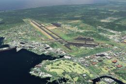
Utah Complete, including Salt Lake City International Airport (KSLC), UT.
 This package includes all patches and updates including v1.1 and v1.2 patches.
The scenery covers most of the state and upgrades the landscape, scenery objects, airports, etc. Other airports featured include
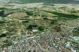
Thank you for your interest in Utah Complete for FSX. Utah Complete v1.0 is a scenery add-on which covers much of the state of Utah, USA. Utah is a beautiful state with many picturesque locations. While its beauty cannot fully be reproduced in FSX, this scenery add-on enhances many areas when compared with default FSX scenery.
Utah is one of the most mountainous states in the U.S. with the lowest point near St. George being 2,178 feet (664 meters) and its highest point is 13,528 feet (4123 meters) at Kings Peak in the Uinta Mountains. Utah has five National Parks, the third most of any other state after Alaska and California.
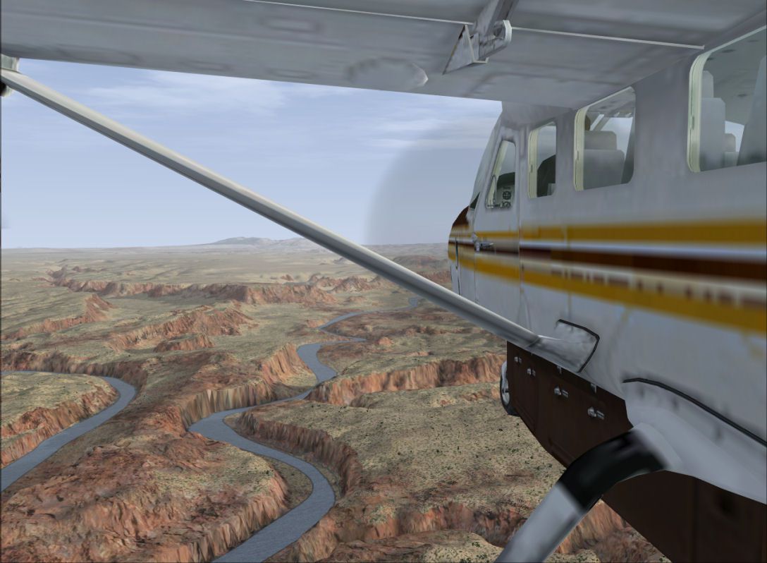
Utah’s landscape is very diverse. From green forest-covered mountains to red rock cliffs, from wooded valleys to bare desert, many colors can be found within more than 80,000 square miles of the state’s border.
Utah has developed into a major film and television hub mainly due to the varying and beautiful landscapes within such short distances. For many of the same reasons, tourism in Utah flourishes because of its natural beauty and sources of adventure. Utah is also well known for having its world-class ski resorts and having the “Greatest Snow on earth”. In 2002, Salt Lake City hosted the Winter Olympics.
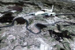
I hope this scenery will enable you to explore the state and visit its many beautiful locations. Whether you want to go mountain flying through scenic canyons, fly your helicopter up to the tops of mountains to let your ski buddies experience the thrill of Heliskiing, or go soaring over mountain thermals in a glider, or fly the complex airspace above Salt Lake City in your favorite IFR aircraft, there is a little bit of everything for everyone.
This project is many months in the making and has many new and improved features. A revamped land class covering most of the state with much more detail in select locations (see list below) is obvious when flying around.
One of the biggest motivations for this extensive project was to fix the persistent problem of desert only textures almost everywhere, especially in places it shouldn’t be, like the mountains. This was one of my major criticisms with default FSX scenery, as it is for many. In addition, this project adds new scenery objects and repositions others that were incorrectly placed or facing the wrong way in the default scenery. For example, the Utah State Capitol in Salt Lake City was placed on the wrong hill and was facing the wrong way in the FSX default scenery.
The Salt Palace Convention Center, also in Salt Lake City, was facing the wrong way. Both of these errors and many others have been corrected. Many of the cities and towns depicted in default scenery were misrepresented or missing altogether. This will add missing towns and more correctly portray the cities and towns within most of the state by means of land class correction.
Agricultural areas which are lacking in many places in default scenery have been added where appropriate. Much time has been taken in order to accurately depict an area within given limitations of course.
I hope you find the landscapes much more authentic than you do in default scenery. I encourage you to fly in the scenery both before the add-on and after the add-on to see the difference.
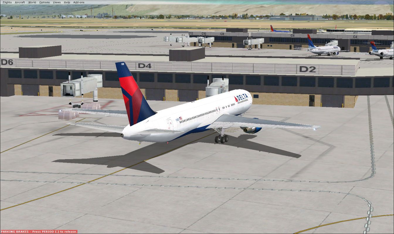
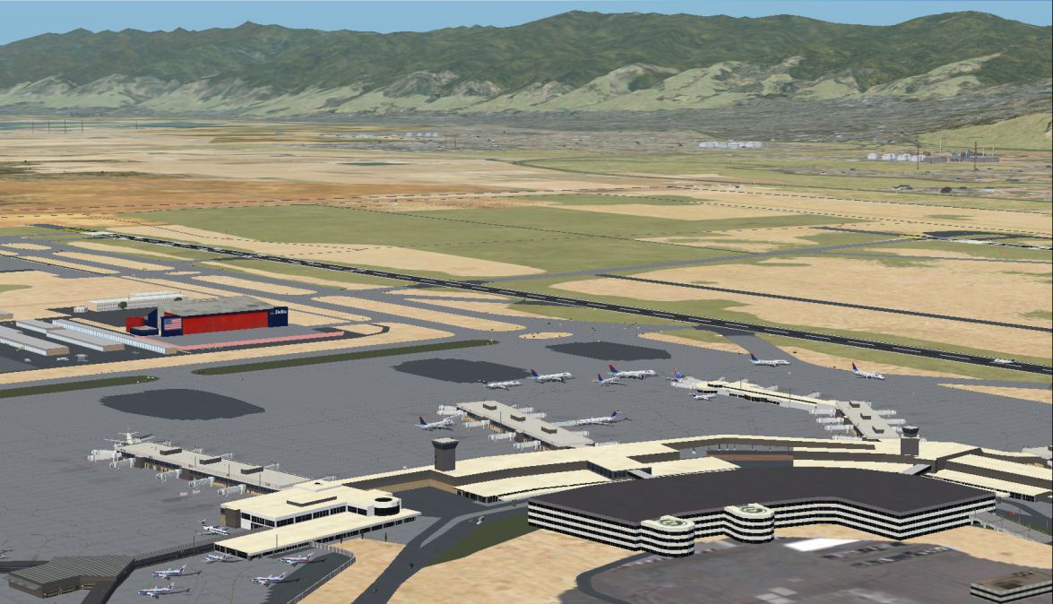
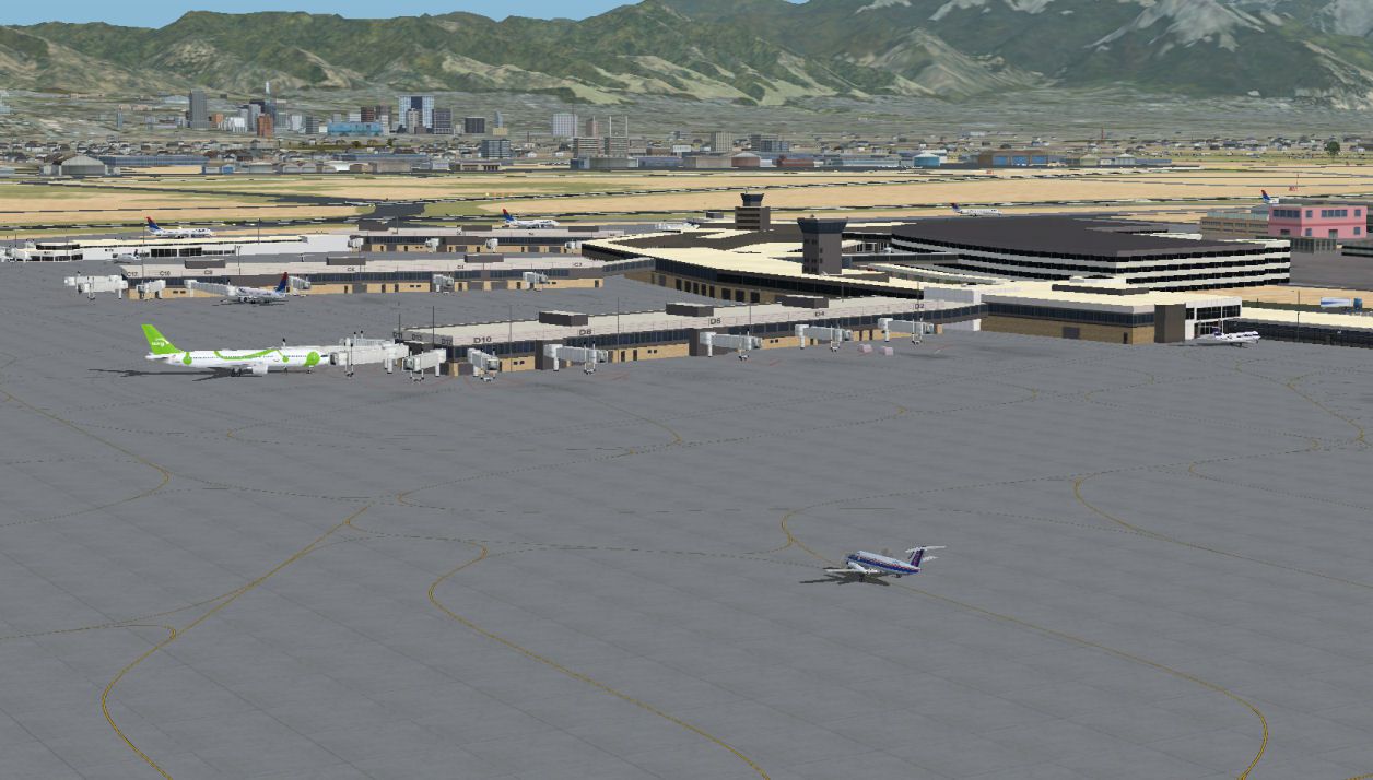
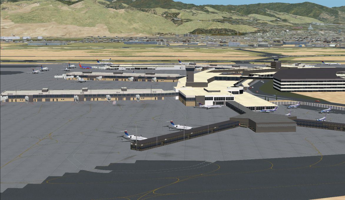
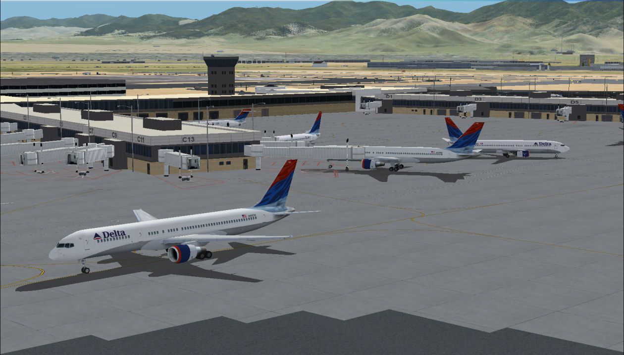
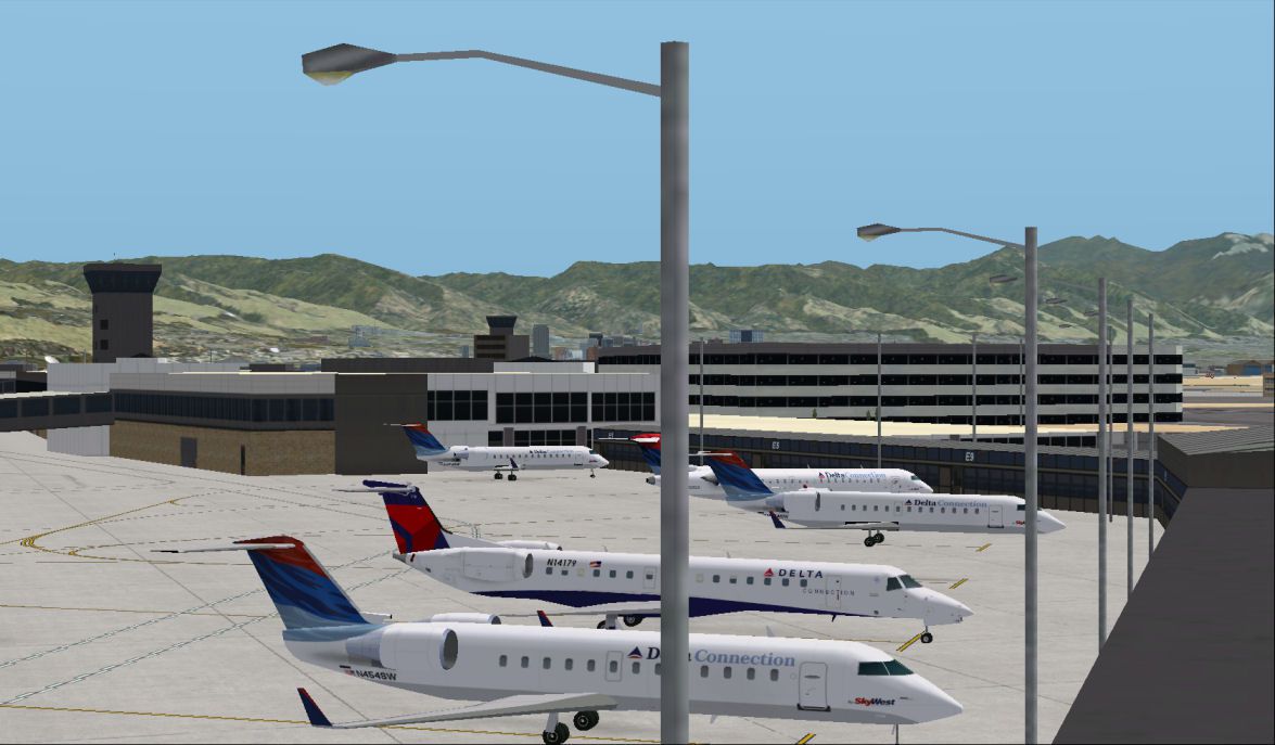
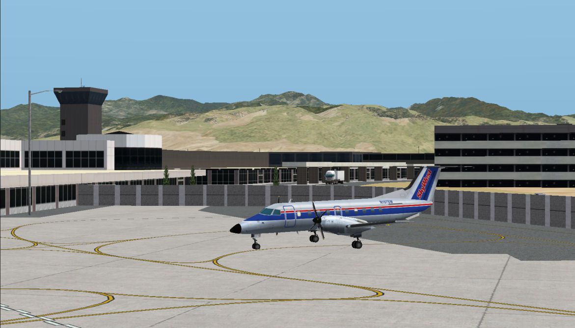
Salt Lake City International Airport (KSLC) has been upgraded considerably and is where I have spent much of my attention during this project. Microsoft created a fairly realistic rendition of KSLC in FSX. Unfortunately, the terminal Microsoft created is missing several gates and several of the concourses and other buildings are not the correct size or otherwise inaccurate.
I created several new objects from scratch which greatly improves the realism of the airport. Buildings are correctly sized and placed with help from Google Earth and other aids. All gates are properly represented and sized for the appropriate aircraft. The gates are accurately sized and associated to the respective airline the gate belongs to. The AFCAD was also corrected for minor mistakes and missing features.
Provo Municipal (KPVU), which is now tower controlled, has been updated to add tower communications and adds a control tower on the field where it is located in reality. New taxiways at the airport, which are missing in the default version, have also been added.
At Ogden-Hinckley Airport (KOGD), I have fixed and added many recent changes to taxiway and runway configurations as well as added the new ramp and FBO terminal to the south end of the airport next to runway 34. Various scenery objects were also added for realism.
The extra objects will appear with a dense or higher setting in your scenery density menu.
At St. George Municipal Airport (KSGU), taxiways were resized and repositioned for better realism. Several Parking spots have been added and a more realistic terminal building, similar to the one at the airport, has replaced the default one. As mentioned before, the land class and terrain modifications around KSGU are quite extensive when compared to default scenery.
Once you have flown into KSGU, you will notice how landlocked the airport is as it sits atop a mesa roughly 500-600 feet above the city below. St. George is one of the fastest-growing cities in the nation and is in dire need of a new airport to even keep up with the increasing population and to allow larger aircraft to fly there. Therefore a brand new and much larger airport is being built southeast of the city. It will likely open in 2010 or 2011.
I highly suggest making KSGU a frequent stop on your journeys before it’s replaced! Flying into this airport in real life is even more thrilling. St. George is also where the corporate headquarters of SkyWest Airlines have been for over 35 years.
Airports with updated AFCADs include:
Generally, the AFCAD and airport updates fix runway and taxiway placement and errors. For example, in default scenery, displaced thresholds are on the wrong side of the runway at several airports.
The updates fix this and taxiway width and placement, apron size and placement, you get the idea. More parking spots were added for your AI traffic and some airports feature various scenery objects when scenery density is set to dense or above.
Much time was spent researching each of these airports and doing my best to make them accurate and more realistic than the default. In future releases, I plan including more airports with updates and fixes.
Detailed land class locations include but are not limited to:
At locations with the detailed land class, you will see much more accurate and realistic scenery. Cities are updated to reflect the most recent development and urban sprawl.
Google Earth and other aerial photography were used for enhanced accuracy. The mountains are textured much more realistically and are blended much better into the surrounding environment. Ski runs can be found at some of the popular ski resorts in the Salt Lake area (mentioned above).
A less detailed land class (but still more accurate and realistic than the default) covers much of the remainder of the state. Future versions will include detailed land class in other areas. The less detailed land class corrects many cities and towns for size, the accuracy of location, and texture.
Other land class highlights include:
PLEASE READ CAREFULLY
This is an add-on for Microsoft Flight Simulator X. Any person who downloads or otherwise obtains this add-on for use does so at his or her own risk. The creator of this work is not responsible for any negative affects this add-on may cause to one’s computer.
The creator makes no warranty, expressed or implied, and bears no liability.
Using this project with other Utah scenery add-ons.
This project was tested with default FSX scenery and with the Flight1 Ultimate Terrain add-on (not required, but a nice product to have). If you have any other add-ons covering any area this project covers, you may experience different results.
You should ensure this add-on is placed in a higher priority (lower number) within your scenery library if you want to show this project over any other conflicting scenery. This includes placing this scenery as a higher priority over such products as Ultimate Terrain.
If you do use it with Ultimate Terrain, placing this scenery as a higher priority in your scenery library should not affect other areas outside of Utah.
Important: If you have any other scenery add-ons which cover anywhere in Utah (this includes add-ons like Ultimate Terrain or other country-wide or land class add-ons), and you want the scenery from this project to show instead of the other one, it is important to make sure Utah Complete is set as a higher priority (lower number) within your scenery library.
If at any time you do not like the end result of this scenery being installed, simply deactivate or remove the Utah Complete scenery from the scenery library.
This product was produced using FSX_KML by Innova Software, EZ Landclass by Russel Dirks, ObPlacer XML by Arno Gerretsen, FSX Planner by zBlueSoftware, and GMAX by TurboSquid. A special thanks go to these developers for their creation and work on their respective products. I would also like to thank Jim Vile and Bill Womack for their expertise. And of course, I want to thank Microsoft and the ACES team for continuing to deliver us new versions of Microsoft Flight Simulator.
The Future of Utah Complete
Version 1.0 is what I hope to be the first of several versions, which I plan on updating and expanding in the future. I hope to include more airports and areas with more detailed scenery in future revisions. I have plenty of my own, but I am always in need of good quality pictures of airport buildings (preferably head-on at ground level) of any Utah airport. If you have any you would be willing to send to me (e-mail address below), it will help move the project along. I don’t need links to photos from well-known aviation photography websites as I already see these pictures regularly.
And Finally
This is my first major scenery add-on for Microsoft Flight Simulator. I am releasing this project free of charge to the Flight Simulator community. This project took hundreds if not thousands of hours to complete and test. Not only would I like to provide you with revisions of this scenery, but I would also like to start new projects. In order to devote more time to this endeavor, it must make sense for me financially to take time away from other work to do these sorts of projects. Therefore, I will be accepting donations via PayPal.
Donating through Paypal is a secured process which allows you to use a major credit card to make a donation in the amount of your choice. If this scenery has improved your Flight Sim experience and if you have the means to do so, I would greatly appreciate any donation you wish to offer.
If this add-on proves to be well accepted within the FS community and there is a desire for more projects in the future, and I feel like it would be worth the time and effort required, you will see more to come. I’d also be happy to hear any ideas you have for future projects (I also have some ideas in mind).
To make a donation, click on the file donations.htm in the main UtahComplete folder. Thank you!
Happy Flying!
This package includes all updates issued to the scenery.
This update fixes minor issues with airport AFCAD files.
The airports updated are:
This update fixes minor problems with some of the AFCAD's at airports included in Utah Complete 1.0. The ATIS at KPVU (Provo) should also work now. Make sure you have downloaded and installed Utah Complete 1.0 before installing these new files.
St. George (KSGU) - Some users have reported problems with terrain at the airport and have described "mounds" of terrain built up along the runway. A fix for this is included. However, if you are currently not experiencing any such problems at KSGU with terrain, you shouldn't install the updated .bgl. See 'Installation' for more details.
Salt Lake City Int'l (KSLC) - Users running FSX with crash detection turned on receive building crashes while taxiing near some of the concourses. The updated file should alleviate that problem or at least reduce the number of building crashes. I still recommend turning off crash detection in your FSX settings. If you choose to keep it activated, and are still experiencing building crashes while taxiing near the concourses (or anywhere you wouldn't expect a building crash), please e-mail me with details of where it is occurring.
The AFCAD for KSLC has also been updated for some minor fixes.
Ogden (KOGD) - The airport recently completed a parallel taxiway to runway 3/21. An updated AFCAD reflects that and updates taxiway names.
Provo (KPVU) - Minor AFCAD fixes.
Salt Lake City Airport #2 (U42) - Minor AFCAD fixes.
Logan-Cache (KLGU) - Adds the new ILS Approach to the airport for RWY 17.
Developer: James Udall.
Free for all simmers · 4.25 MB · Scanned clean Aug 2026
Download speed: Free tier is capped at 0.5 Mbps (this file takes approximately 1 min at the cap). PRO members download at full line speed.
FSX\Addon Scenery\ containing scenery and texture sub-folders.readme.txt or README file. It tells you exactly where files go, what dependencies are needed, and any quirks specific to this add-on.Use these coordinates to fly directly to this location once the mod is installed.
40.78990000,-111.97910000
Launch FSX or Prepar3D and use Flights → Load to open the downloaded .pln file. Your aircraft will be positioned at this location.
The archive utahcomp.zip has 90 files and directories contained within it.
This list displays the first 500 files in the package. If the package has more, you will need to download it to view them.
| Filename/Directory | File Date | File Size |
|---|---|---|
| donations.htm | 09.18.07 | 7.37 kB |
| Readme.txt | 09.18.07 | 15.39 kB |
| Readme_Important.htm | 09.18.07 | 40.40 kB |
| Readme_Important_files | 09.18.07 | 0 B |
| editdata.mso | 09.18.07 | 7.26 kB |
| filelist.xml | 09.18.07 | 174 B |
| Scenery | 09.18.07 | 0 B |
| 3SLCIA_Scenery.BGL | 09.17.07 | 112 B |
| Bolinder-Tooele Valley KTVY.bgl | 09.18.07 | 6.87 kB |
| CANALS_Scenery.BGL | 08.16.07 | 1.82 kB |
| Canyonlands KCNY.bgl | 08.16.07 | 5.74 kB |
| Cedar City Regl KCDC.bgl | 08.16.07 | 11.15 kB |
| Centralut.bgl | 08.16.07 | 2.79 kB |
| COTTONWOOD_Scenery.BGL | 08.16.07 | 956 B |
| cvx3SLCIA.BGL | 09.17.07 | 6.42 kB |
| cvxCANALS.BGL | 08.16.07 | 59.28 kB |
| cvxCOTTONWOOD.BGL | 08.16.07 | 111.37 kB |
| cvxDAVISWEBER.BGL | 08.16.07 | 48.83 kB |
| cvxHEBER.BGL | 08.16.07 | 7.82 kB |
| cvxLAKEPOWELL.BGL | 08.16.07 | 53.60 kB |
| cvxPARK CITY.BGL | 08.16.07 | 81.21 kB |
| cvxPROVO_2.BGL | 08.16.07 | 16.10 kB |
| cvxPROVO1.BGL | 08.16.07 | 42.49 kB |
| cvxSAINTGEORGE.BGL | 08.16.07 | 124.11 kB |
| cvxSLCDETAIL.BGL | 08.16.07 | 244.20 kB |
| cvxVARCITIES.BGL | 08.16.07 | 99.07 kB |
| DAVISWEBER_Scenery.BGL | 08.16.07 | 3.17 kB |
| Delta.bgl | 08.16.07 | 1.49 kB |
| Dixie.bgl | 08.16.07 | 3.10 kB |
| Dixiewater.bgl | 08.16.07 | 552 B |
| Heber City Mun-Mcdonald 36U.bgl | 09.03.07 | 8.10 kB |
| Hill AFB KHIF.bgl | 09.18.07 | 23.83 kB |
| kslc_obj1.bgl | 08.16.07 | 37.45 kB |
| kslcobj2.bgl | 09.14.07 | 411.33 kB |
| LAKEPOWELL_Scenery.BGL | 08.16.07 | 276 B |
| Logan-Cache KLGU.bgl | 08.16.07 | 12.71 kB |
| Moab.bgl | 08.16.07 | 16.83 kB |
| Morgan Co 42U.bgl | 08.16.07 | 3.00 kB |
| Ogden-Hinckley KOGD.bgl | 09.17.07 | 16.97 kB |
| PARK CITY_Scenery.BGL | 08.16.07 | 1.73 kB |
| Provo Mun KPVU.bgl | 09.17.07 | 14.39 kB |
| PROVO1_Scenery.BGL | 08.16.07 | 740 B |
| Richfield Mun KRIF.bgl | 08.16.07 | 5.16 kB |
| Salt Lake City Intl KSLC.bgl | 09.18.07 | 130.34 kB |
| Salt Lake City Mun No 2 U42.bgl | 09.17.07 | 13.21 kB |
| Skypark KBTF.bgl | 08.16.07 | 5.60 kB |
| SLCarea.bgl | 08.16.07 | 10.45 kB |
| SLCDETAIL_Scenery.BGL | 08.16.07 | 9.86 kB |
| slcwater.bgl | 08.16.07 | 1.70 kB |
| Spanish Fork-Springville U77.bgl | 08.16.07 | 4.47 kB |
| St George Mun KSGU.bgl | 09.18.07 | 12.68 kB |
| Tooele.bgl | 08.16.07 | 2.74 kB |
| utahobj.bgl | 09.17.07 | 7.42 kB |
| VARCITIES_Scenery.BGL | 08.16.07 | 740 B |
| Vernal KVEL.bgl | 09.17.07 | 8.07 kB |
| Vernal.bgl | 08.16.07 | 3.06 kB |
| Screenshots | 09.18.07 | 0 B |
| 36u.jpg | 09.18.07 | 109.92 kB |
| ksgu.jpg | 09.18.07 | 158.51 kB |
| kslc2.jpg | 09.18.07 | 144.57 kB |
| kslc3.jpg | 09.18.07 | 151.14 kB |
| kslc4.jpg | 09.18.07 | 151.91 kB |
| kslc5.jpg | 09.18.07 | 115.18 kB |
| kslc6.jpg | 09.18.07 | 118.41 kB |
| kslc7.jpg | 09.18.07 | 149.53 kB |
| kslc8.jpg | 09.18.07 | 172.85 kB |
| morganvalley.jpg | 09.18.07 | 142.22 kB |
| parkcity.jpg | 09.18.07 | 158.84 kB |
| river.jpg | 09.18.07 | 189.77 kB |
| river2.jpg | 09.18.07 | 130.23 kB |
| uc9.jpg | 09.18.07 | 162.56 kB |
| Texture | 09.18.07 | 0 B |
| dlres.dds | 09.17.07 | 1.00 MB |
| dlres_lm.dds | 09.17.07 | 1.00 MB |
| econc1.dds | 08.29.07 | 512.12 kB |
| econc1_lm.dds | 08.20.07 | 512.12 kB |
| hangar1.dds | 09.17.07 | 1.00 MB |
| hangar1_lm.dds | 09.17.07 | 1.00 MB |
| kslc_mx1.dds | 09.17.07 | 1.00 MB |
| kslc_mx1_lm.dds | 09.17.07 | 1.00 MB |
| kslcconc1.dds | 09.14.07 | 512.12 kB |
| kslcconc1_lm.dds | 09.14.07 | 512.12 kB |
| kslcterm1.dds | 09.14.07 | 512.12 kB |
| kslcterm1_lm.dds | 09.14.07 | 512.12 kB |
| northcargo.dds | 09.17.07 | 128.12 kB |
| northcargo_lm.dds | 09.17.07 | 128.12 kB |
| Skywest.dds | 09.17.07 | 1.00 MB |
| Skywest_lm.dds | 09.17.07 | 1.00 MB |
| flyawaysimulation.txt | 10.29.13 | 959 B |
| Go to Fly Away Simulation.url | 01.22.16 | 52 B |
Only PRO members can place votes.
More FSX & P3D add-ons hand-picked based on this download.
FSX Scenery
This is a complete package containing photoreal scenery for the whole state o…
 FSX Scenery
This is a complete package containing photoreal scenery for the whole state o…
 FSX Scenery
A complete and fully featured photoreal, airport, building, and autogen scene…
 FSX Scenery
Take a trip to the small nation of Malta in any simulation package, and you w…
 FSX Scenery
A trip to the Southern European nation of Cyprus in a flight simulator should…
 FSX Scenery
This is a complete package containing photoreal scenery for the whole state o…
 FSX Scenery
A complete photoreal scenery add-on for Microsoft Flight Simulator X covering…
 FSX Scenery
Take a trip to the Southern European nation of Slovenia, and you’ll soon see …
Read what other simmers think, or add your own.
Thank you for this excellent scenery. It is a state I have visited several times and will visit again. My oldest son spent the last two years there and loved it.
Question: In the Logan area, there are two square areas that are greyed out and say something like, "Data Unavailable". I think I installed it correctly. Is this a known bug?
This is a big improvement to the standard FSX scenery of Utah. Can't see any arches or colorful rock formations around the state, but there are a lot of great improvements to the whole state! I have visited Many areas around Utah and this really makes flying VFR a treat. Totally worth it and all the airport upgrades.