Page 6
Searches the whole library — filter by sim & category on the results page
Three locations anchor the presentation, including Bass Harbour Light House and Cranberry Field, along with Tom's Lobster House from the lobster festival, and an accompanying adventure. The selecti…

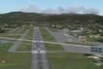
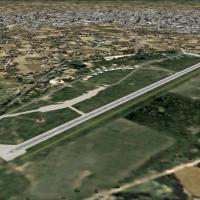
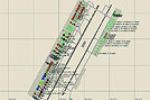
The add-on recreates LIDF, a small public general aviation airport near Fano in Marche, Italy, located 1 kilometer southeast of Fano and 10 kilometers northwest of Mondolfo at 43°49'25.62"N 013°01'…

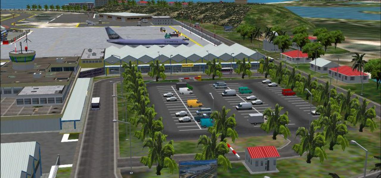
Located between Royal Albert dock and King George V dock, the small air facility serves mainly short flights. It is used by BAE's and Folkers, and the A318 may join the group; the file EGLC12882743…

Two small general aviation airports anchor this Brisbane-area pair, with Redcliffe hosting two flying schools and a GA and sport aircraft presence, while Caboolture sits on a WWII-era grass strip n…
Diego Garcia base representation transforms the default layout into a more realistic depiction of the base as it exists today, centered on a 12,000ft runway and supporting B-52, B-1, and B-2 operat…
The coastal strip of Queensland receives a revamp that spans from the Burdekin River south of Townsville to the Cairns area near Babinda in North Queensland, reshaping coastlines, towns, islands, r…
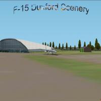
An F-15 stands outside the American Hangar at Duxford Air Museum in the UK, giving clear context for this outdoor placement. By Thomas Moger, the duxF-15.jpg image file anchors the reference to the…
The files add thermals to the Queensland Region’s default airport network in Australia, spanning 27 aerodromes with ICAO codes such as YBMC, YGYW, YGLA and YBWP. Three intermediate reference points…
Monterey Peninsula context shows a missing file tied to kmry_v1.zip, indicating it should have been included originally; an image located at userimages/kmryv1fx.jpg, with height=88, width=189, bord…
An airport sits in the northern part of Saskatchewan, Canada, described as small in scale for regional traffic. Prince Albert acts as a northern hub, with access to many lakes that invite flights i…

Dunedin Airport in New Zealand uses NZAIP data and aerial photographs to achieve accurate placement of buildings, fences, trees, vechiles, navaids and runways, yielding a third-version build (V3.0)…

Kai Tak as it existed in 1963 features a single runway of 8405 ft, with Kowloon Bay undeveloped and Chek Lap Kok removed. Mesh files by Holger Sandmann and era charts scanned by Chic Eather accompa…
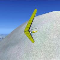
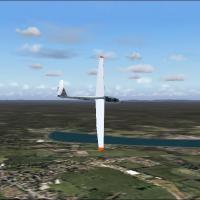
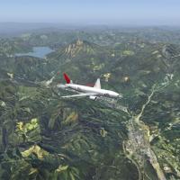
Thermals populate the default environment across select regions, and hang glider flights unfold for three mountains: Mt. Aconcagua near Santiago on the Chile-Argentina border, Mt. Fuji near Tokyo a…
Situated southeast of Budapest, the Kecskemét area base hosts the Hungarian 59th Fighter Regiment. The unit operates two airframes, including a combat aircraft and a trainer, with a modernization p…
This photo depiction covers areas around Lake Chuzenji and highlights Nikko’s sightseeing spots. Nikko lies 43 km northwest of Utsunomiya Air Base RJTU, and the file nikko_ph.jpg accompanies the de…
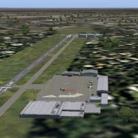
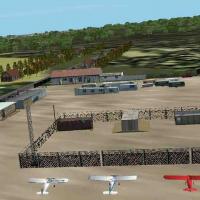
In the Mekong Delta, this base hosts the 114th Aviation Company and its UH-1 Huey helicopters, circa 1968. The 3,500-foot asphalt runway features large water-filled basins on both sides, defining t…
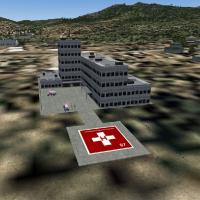
Version 2 adds hospital macros and Airport IDs, expanding the Missoula EMS footprint, while two hospitals and three S&R missions remain in the Missoula Area, preserving the original geographic scop…
 Patch
PatchBen Meesterman provides an adjustment to Martin Strong's Bangkok 2004 project for the Bangkok, Thailand area, anchored by the Suvarnabhumi Airport context. It is intended for use with VTBD2004.ZIP,…
Located near Berlin in Camden County, New Jersey, the field sits about one mile from the town, at 150 feet elevation with a 3102-foot runway. K Kleinberg, Albion A/p Inc., owns the field, and ASDv2…
An enhanced depiction of the Wismar airfield refines the former release, presenting a detailed view of the Mecklenburg/Germany site on the Baltic. A file named edcw_2k4.jpg is included, anchoring t…