Page 12
Searches the whole library — filter by sim & category on the results page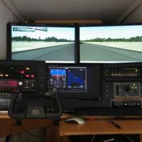
By Gera Godoy Canova, the guidance shows how to dedicate a separate monitor for the gauges or instrument panel, streamlining cockpit visibility. An accompanying photo depicts a multi-monitor arrang…
An Americas-wide landscape expansion integrates North, Central and South America with a high-precision GPS database and SRTM relief capturing plains, plateaus, hills and mountains. Hydrography cove…
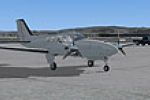
Fictional flight plans cover the sole Dornier 328 Jet registered HB-AEU and operated by SwissJet, a private Swiss airline headquartered in Samedan with branches in Zurich and Buochs, based at Zuric…
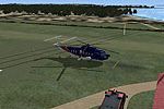
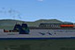
AI models the helicopter link between Penzance heliport, Tresco heliport, and St. Marys airport off the coast of Cornwall, covering the island cluster over six decades. It requires PENZANCE_HELIPOR…

By Antoine Calleja, globusworld, flight plans document the country's air force fleet of Ilyushin IL-76 and IL-78, with emphasis on their operational types. Two versions appear, IL-76 and IL-78, wit…
By Ted Andrews, over 500 autogen models are converted into an XML look-up file accompanied by JPG previews. Five new Autogen categories appear in the Object Parameters window, with the first object…

A Word-format .doc supports the Voice Commander Edition for the PMDG747X/8i, outlining the captain’s tasks to perform before and during preflight events while preparing the aircraft from cold and d…
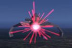
Based on FX_wing_guns effects, photon torpedo visuals attach to Bruce Fitzgerald's Star Trek ships, including NX01.ZIP, ENTRPR2.ZIP, ENTRPRD.ZIP, RELIANT.ZIP, DEFIANT.ZIP, BIRDOPRY.ZIP, and WARBIRD…
An enterprise fleet-control file allows multiple ships to be governed as a coordinated unit through AI Carriers. Created by Tyler Shotwell, the file centers on enabling fleet-level management for v…
By Matthew Krawczyk, flight plan data for the San Francisco region expands automated schedules for default aircraft, directing IFR or VFR legs from the core directory to mirror West Coast traffic p…
A flow chart form guides use with the payware Level-D B767, outlining nearly every action and reaction of the Captain and First Officer as flows pass through the flight phases, and it is attributed…
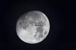
The default moon imagery receives an upgrade by swapping 64x64 BMPs for 512x512 BMPs, with the Alpha channel replaced by higher resolution data; enhanced via MIP mapping by NickN, this change reduc…
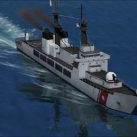
Five named vessels model the Cook Strait corridor in New Zealand, including the modern Arahura, Kaitaki, Aratere, the high-speed Lynx, and the Wallenius car carrier built by Barry Minister. MARLB.Z…
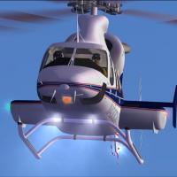
These lights provide 22-degree down lighting and emergency illumination for the Bell 430 model, and require Shockwave Redux Lights from a2a Simulations for operation. Brad Stolte is credited as the…
A wave file for user interface music carries an arrangement of the Oscar-winning score by William Conti, performed by the Prauge Philharmonic for a celebrated aviation film. The track runs 4:35 and…
Tom Tiedman provides a smoke effect for the Embraer EMB-120, created for Erick Cantu's freeware edition EMB120-2.ZIP. The setup uses the fx_smoke_f6.fx file and two SMOKESYSTEM lines, smoke.0 and s…
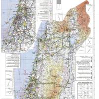
Muli Ivanir provides saved flights above CVFR navigation points across Israeli airspace, specifically prepared for CVFR practice. An illustrated map depicts the included waypoints and flight paths …
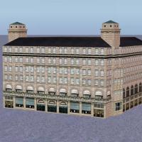
Winfried Orthmann contributes a ship library designed for designers, paired with a Gmax gamepack and not compatible with earlier iterations. Unzipping reveals two folders housing ships and image as…

Arron Sweeney provides the callsign identifier for Air Nostrum, also known as Iberia Regional, with Valencia as its main hub. It requires EditVoicepack 4.0.6 or higher, with EVPX40.ZIP serving as t…
Jim Driscoll presents a jpg image of every string table, offering a concise visual reference for each entry, accompanied by a screenshot-style caption describing a typical string table view. The im…