FSX Tokoroa Aerodrome Scenery
Tokoroa Aerodrome (NZTO) scenery recreates this southern Waikato general aviation field with accurate object placement, refined terrain, and realistic runway and taxiway surfaces, plus club facilities and parking that match the real layout. Built for Microsoft Flight Simulator X and requires FSX SP2 without Acceleration, it also benefits from VECTOR LANDCLASS textures and objects.

 New Zealand
 - File: nzto_tokoroa-4x.zip
- Size:1.35 MB
- Scan:
Clean (19d)

- Access:Freeware
- Content:Everyone
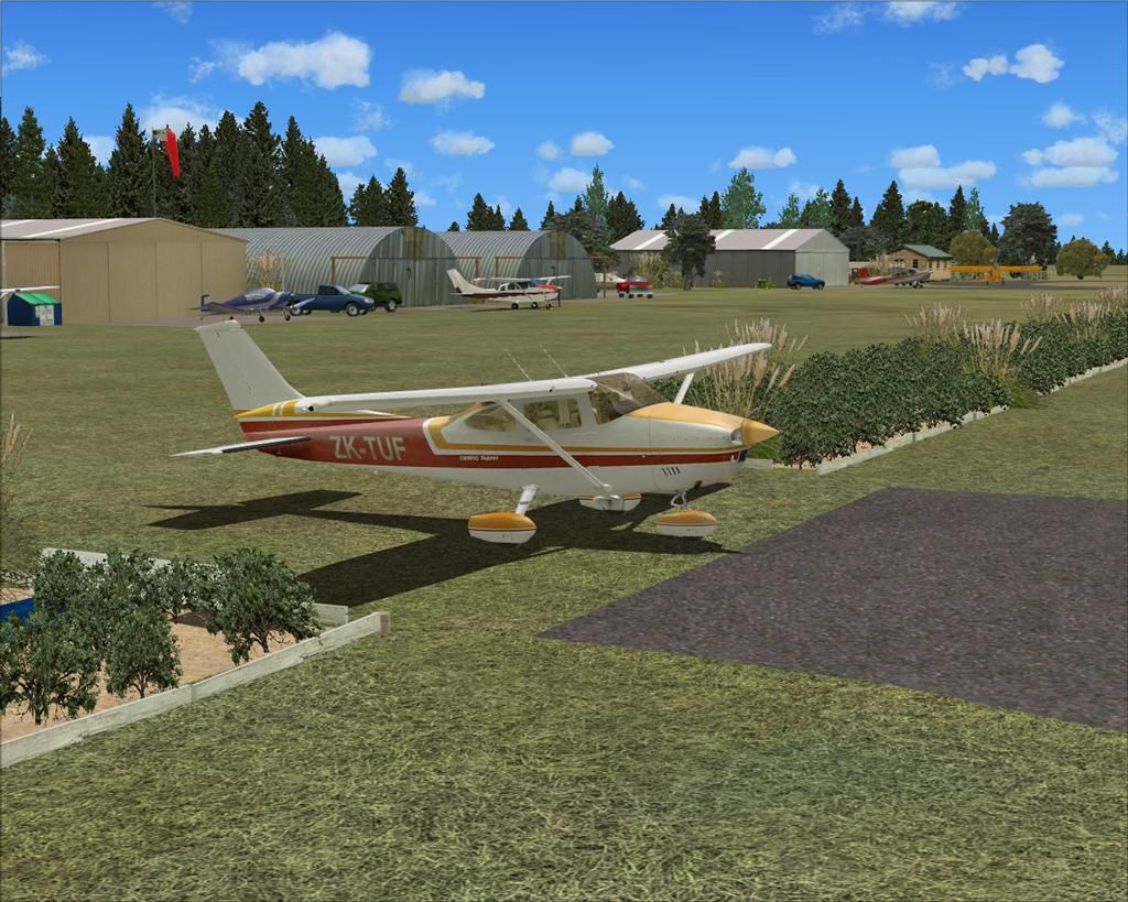
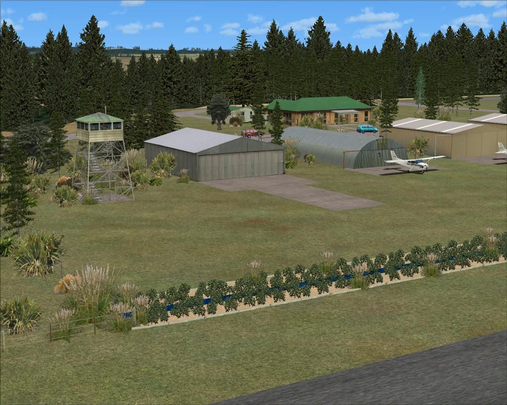
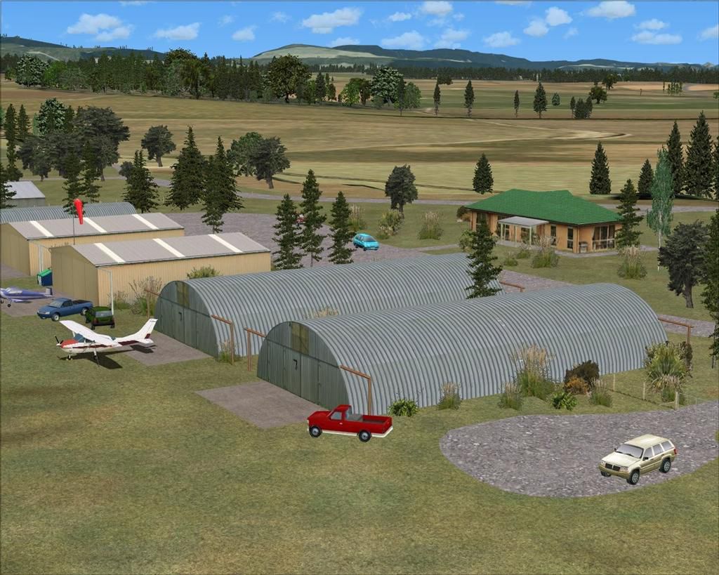
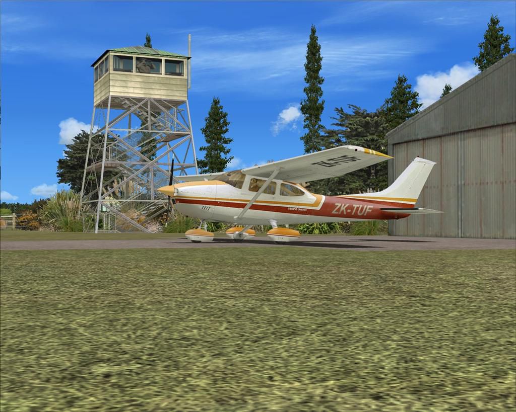
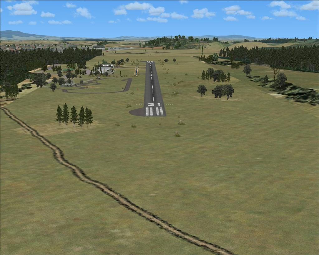
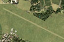
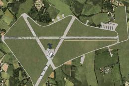
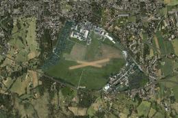
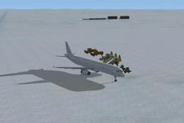
Positioned in the heart of New Zealand’s southern Waikato region, this updated Tokoroa Aerodrome scenery (ICAO: NZTO) provides an immersive environment for general aviation operations. Featuring a paved runway spanning 2,800 feet (approximately 850 meters), it is administered by the South Waikato District Council and is often visited by the Tokoroa and Districts Aeroclub alongside various local motorsport groups. Created by developer Lawrie Roache, with contributions by Robin Corn, this freeware add-on enhances Microsoft Flight Simulator X by introducing precise object placement, accurate runway surfaces, and refined terrain adjustments.
Detailed Layout and Unique Points of Interest
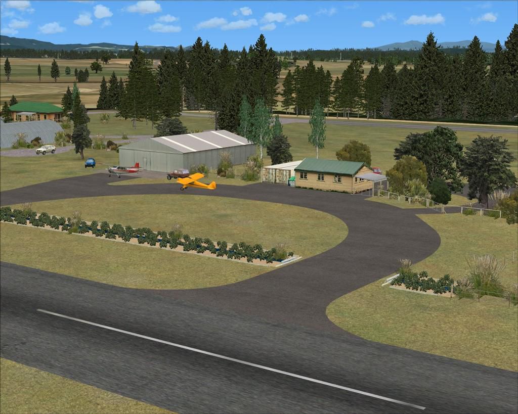
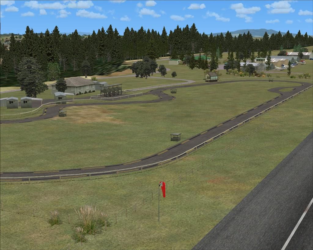
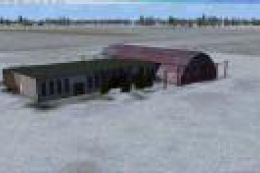
The aerodrome’s carefully modeled runway supports a variety of small aircraft and fosters an authentic recreational flying atmosphere. Aviation enthusiasts can explore elements such as realistic club facilities, correct taxiway alignments, and multiple parking spaces. Nearby attractions, including the South Waikato Motorcycle and Go-Kart Clubs, enrich the setting with additional visual references, reflecting the true multi-use nature of this location.
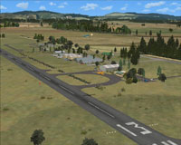
Aerial view of Tokoroa Aerodrome scenery.
Technical Software and Compatibility
This release is tailored for FSX SP2 (without Acceleration) and is designed to function optimally with the VECTOR LANDCLASS (VLC) payware product. The developer utilized Flight1 Software’s Instant Scenery Object Placer and Airport Facilitator X (AFX) to ensure accurate elevations, updated ground polygons, and dependable navigational features. The textures and object libraries from Robin Corn’s VLC further refine the visual fidelity, especially around hangars, clubhouses, and ancillary structures.
Author, Credits, and Licensing
- Primary Developer:
- Lawrie Roache – responsible for Afcad creation, terrain flattening, exclusion data, and scenery object placement.
- Object Libraries:
- Robin Corn – provided the free VLC Object Libraries for enhanced realism.
This package is distributed as freeware for individual, non-commercial usage. Redistributing, repacking, or selling any components of this bundle without explicit permission from the authors is strictly forbidden.
Disclaimer and System Testing
Although the scenery has been tested successfully on various hardware configurations—from modest setups to high-performance systems—it is offered without any form of warranty. Users install and run these files at their own risk, and no liability is assumed by the creators for any potential issues encountered. There have been no reports of harmful effects or fatal errors arising from this package.
Images & Screenshots


Finding the Scenery
- FSX/Prepar3D Coordinates:
-
-38.22740000,175.60140000
Use the downloaded flight plan file by launching FSX/P3D, selecting "Load Flight Plan" in the flight planner, and choosing the .pln file. Your aircraft will be positioned directly at the add-on’s location. - Decimal Degrees (DD):
-
Latitude: -38.227400°
Longitude: 175.601400° - Degrees, Minutes, Seconds (DMS):
-
Latitude: 38° 13' 38.640" S
Longitude: 175° 36' 05.040" E
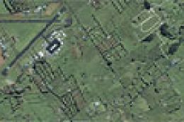
Map Location
The archive nzto_tokoroa-4x.zip has 34 files and directories contained within it.
File Contents
This list displays the first 500 files in the package. If the package has more, you will need to download it to view them.
| Filename/Directory | File Date | File Size |
|---|---|---|
| Tokoroa-4X INSTALL.doc | 07.20.12 | 292.50 kB |
| Scenery | 07.19.12 | 0 B |
| AFX_NZTO.bgl | 07.19.12 | 14.46 kB |
| NZTO_BdyFce.bgl | 07.19.12 | 11.20 kB |
| NZTO_ClbHse.bgl | 07.12.12 | 284 B |
| NZTO_DrnMkr.bgl | 07.13.12 | 5.34 kB |
| NZTO_DrnWed.bgl | 09.29.10 | 10.87 kB |
| NZTO_GatHse.bgl | 07.12.12 | 188 B |
| NZTO_GenTre.bgl | 07.19.12 | 8.67 kB |
| NZTO_GenVeh.bgl | 07.16.12 | 668 B |
| NZTO_GenWed.bgl | 07.13.12 | 9.18 kB |
| NZTO_HngFce.bgl | 07.14.12 | 2.62 kB |
| NZTO_HngRow.bgl | 07.12.12 | 428 B |
| NZTO_MiscObj.bgl | 07.15.12 | 236 B |
| NZTO_RacTrkBdg.bgl | 07.14.12 | 908 B |
| NZTO_RacTrkFce.bgl | 07.14.12 | 6.61 kB |
| NZTO_RwyMkr.bgl | 07.13.12 | 1.12 kB |
| NZTO_StcAft.bgl | 07.19.12 | 236 B |
| NZTO_TwrBdg.bgl | 09.29.10 | 140 B |
| NZTO_WndSck.bgl | 07.12.12 | 236 B |
| Texture | 07.19.12 | 0 B |
| NZTO_Tokoroa-4X | 07.19.12 | 0 B |
| AFX_NZTO_ALT.bgl | 07.19.12 | 521 B |
| NZTO-X (0).jpg | 07.20.12 | 123.67 kB |
| NZTO-X (1).jpg | 07.20.12 | 102.55 kB |
| NZTO-X (2).jpg | 07.20.12 | 129.65 kB |
| NZTO-X (3).jpg | 07.20.12 | 156.81 kB |
| NZTO-X (4).jpg | 07.20.12 | 137.84 kB |
| NZTO-X (5).jpg | 07.20.12 | 156.26 kB |
| NZTO-X (6).jpg | 07.20.12 | 142.73 kB |
| NZTO-X (7).jpg | 07.20.12 | 162.31 kB |
| Read Me.txt | 07.19.12 | 3.89 kB |
| flyawaysimulation.txt | 10.29.13 | 959 B |
| Go to Fly Away Simulation.url | 01.22.16 | 52 B |
Installation Instructions
Most of the freeware add-on aircraft and scenery packages in our file library come with easy installation instructions which you can read above in the file description. For further installation help, please see our Flight School for our full range of tutorials or view the README file contained within the download. If in doubt, you may also ask a question or view existing answers in our dedicated Q&A forum.


0 comments
Leave a Response