Download free New Zealand scenery for Microsoft Flight Simulator X. This hand-picked collection brings together enhanced and photoreal airports, detailed cities, terrain and landmarks across New Zealand — from major international hubs to smaller regional airfields. Every file is free to download, checked by our team, and updated as new releases land.
Substitutes obsolete runway 05L/23R at NZAA with functional taxiway A, updating stock FSX AFCAD for accurate charts; deactivates related approach lighting, deletes the redundant bridge near thresho…
Spanning Karamea to Jackson Bay, this FSX/P3D photoreal scenery injects 1-m orthoimagery, water-masking and custom autogen into New Zealand’s West Coast, aligning with ORBX NZSI and VLC landclass f…

Updated AFCAD for NZQN (Queenstown Airport) refines runway 05/23 geometry, aligns taxiway routing with current AIP NZ, inserts correct gates, GA parking spots, and revised hold-short nodes, improvi…
Covering 30 × 40 km around Mt Taranaki / Mt Egmont, this FSX photoreal scenery applies 2.5 m-per-pixel LINZ imagery, subtle blend-mask transitions and adapted autogen vegetation and buildings, alig…

High-resolution 76 m SRTM-derived terrain mesh for Microsoft Flight Simulator X refines New Zealand’s digital elevation model, clearing voids across North and South Islands; expect sharper ridgelin…
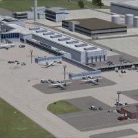
FSX AFCAD File for NZAA updates Auckland International Airport scenery with revised parking stands, A380-rated gate geometry, re-profiled taxiways, custom vehicle pathways, extra fuel nodes, and th…
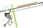
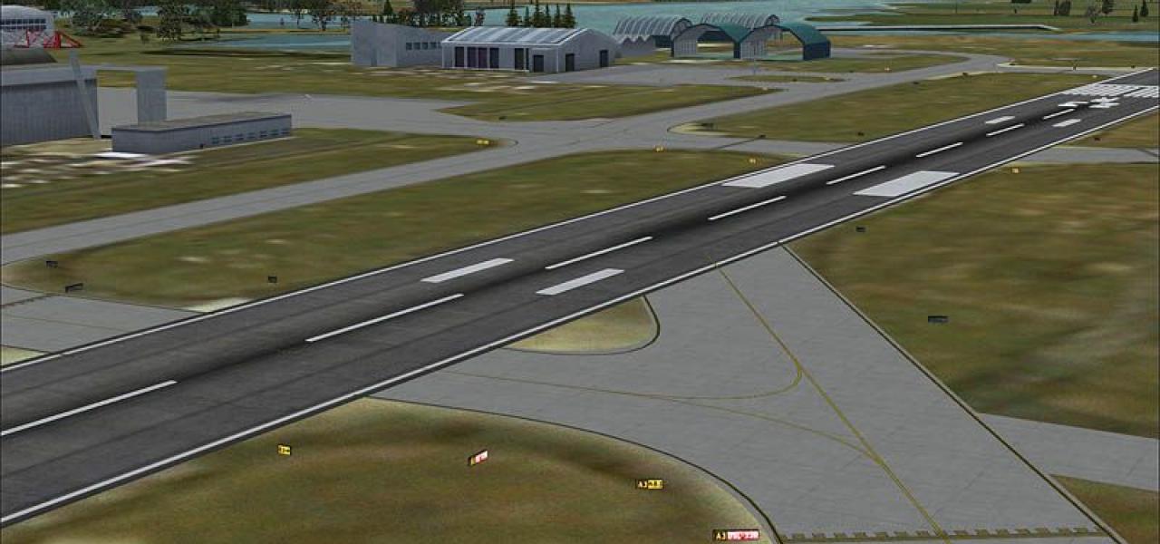
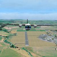
Covering NZQN Queenstown in the Wakatipu Basin, this FSX scenery refresh introduces a functional ILS, defined threshold edge-lines, coded runway turning circles and expanded apron stands for wide-b…
Enabling high-altitude patrols over New Zealand’s Mount Ruapehu, this FSX and FS2004 add-on blends 2 m photoreal textures, 10 m terrain mesh, custom landclass, dynamic snow layers and subtle volcan…
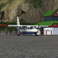
Milford Sound Airport (NZMF) for FSX refines New Zealand’s iconic fjord outpost with high-resolution orthoimagery, precise AFCAD layouts, custom terminal models, a subtly sloped runway profile, rea…
This freeware update for Christchurch International Airport (NZCH) in Microsoft Flight Simulator X supplies a revised AFCAD with Nov-2007 AIP-aligned taxiway geometry, corrected signage, activated …
Wellington International Airport NZWN update supplies a tailored BGL for FSX that refreshes the default scenery by inserting additional jetway-equipped gates, redefined parking codes, a western apr…
Spanning the length of Aotearoa’s North and South Islands along with Chatham and adjacent Pacific archipelagos, this freeware SRTM-3 v2 digital elevation mesh for Microsoft Flight Simulator X inser…
Christchurch International Airport NZCH for FSX gains an updated AFCAD with real-world taxiway geometry, correct gate numbering, revised parking stands, and a functional apron linking the main fiel…
Covering Marlborough Sounds, Blenheim township and adjoining RealNZ Nelson, Marlborough X 2015 supplies 2011–2012 high-definition photoreal orthoimagery, calibrated autogen, and Robin Corn’s detail…
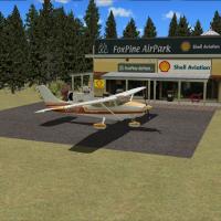
Targeted at FSX SP2 users flying New Zealand routes, this Foxpine Airpark (NZFP) scenery enhancement depicts the Foxton coastal strip with revised AFCAD data, photoreal ground polys, VLC-aligned au…
NZNR Napier Airport scenery for FSX SP2 presents Hawkes Bay’s regional hub with precisely placed custom terminals, the signature Godwit statue, helipads and GA hangars, assembled via Instant Scener…
Designed for FSX SP2 with Vector Landclass, this Nelson Regional Airport (NZNS) package refines runway 02/20 geometry, aprons and taxiway markings, introduces bespoke Gmax structures, calibrated PA…
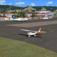
Covering Ardmore Aerodrome (NZAR) on Auckland’s southern fringe, this FSX add-on supplies photoreal ground imagery, geo-referenced building placement, a revised AFCAD with precise runway, taxiway a…
Whangarei Regional Airport (NZWR) scenery for FSX SP2 aligns with VLC’s photoreal Northland imagery, adding refined AFCAD, runway profiles, flattens, and bespoke terminal, tower and signage assets.…
Invercargill Airport NZNV for Microsoft Flight Simulator X adds bespoke terminals, photoreal hangars and an overhauled groundpoly that mirrors current AIP charts, complete with dynamic tarmac light…