
FSX Landclass For Southern Africa Scenery Update 5
Southern Africa landclass update 5 sharpens terrain classification and regional placement across Namibia, Botswana, Mozambique, Zimbabwe, Lesotho, the Free State, and Northern Cape, tuned to satellite references for more believable towns, water bodies, and landforms. Built for Microsoft Flight Simulator X, it bundles prior updates and requires the latest Aeroworx mesh for best elevation matching.
 Global (World)
 - File: fsxworx20upd5.zip
- Size:1.27 MB
- Scan:
Clean (25d)

- Access:Freeware
- Content:Everyone
This comprehensive update refines terrain class design throughout southern Africa and integrates multiple enhancements into a single streamlined package. It covers key regions such as Namibia, Botswana, Mozambique, and Zimbabwe while also making improvements across the Free State and Northern Cape. In addition, it refines details in Lesotho’s surrounding towns, extending as far as Kimberley, and from Upington to the Gariep area. Although specifically developed for Microsoft Flight Simulator X, users of other platforms may also appreciate the adjustments made to underlying vector data and how meticulously each location has been aligned with authentic satellite references. In order to experience these refinements at their best, it is highly recommended to combine this scenery with the latest Aeroworx mesh add-ons for southern Africa. Simulation and scenery enthusiasts looking to explore these sub-Saharan landscapes will find a high degree of accuracy in elevation levels, water bodies, and landforms thanks to the careful calibration of this land class update. Created by Hannes Steyn from Aeroworx, this freeware not only enhances visual immersion but also refines overall geographic fidelity during virtual flights.
Broad Geographical Enhancements
All previous scenery updates, such as fsxWorx20upd1 through 4, are included as part of this new build. By merging these files, it streamlines the installation process and ensures maximum consistency across the African region. Each zone—from desert expanses in Namibia to wetland regions in Botswana and coastal stretches in Mozambique—has been carefully checked to align land class data with real-life imagery. The developers have paid close attention to both large metropolitan areas and smaller outlying settlements.

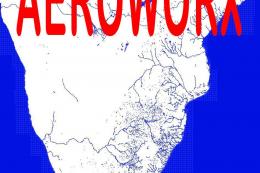
Southern Africa Scenery Poster.
Integration With Aeroworx Mesh
This release aligns perfectly with Aeroworx terrain updates. The landscape’s contours, especially around dams and other water facilities, have been tilted to match the more precise elevations found in Aeroworx’s FSXMesh0604 Part 1 to 4, FSXMESH0605 Part 1 to 3, FSXMESH0704 Part 1 to 3, and FSXMESH0705. If you choose to run default or alternative digital elevation models, the altitudes of these water assets may not position themselves accurately.
Installation Steps
- Decompress: Extract “fsxWorx20upd5.zip” to a temporary directory. It is advisable to store all Aeroworx scenery downloads in a dedicated folder for organizational purposes.
- Auto Installer: Run “fsxWorx20upd5.exe”. It will detect the necessary Microsoft Flight Simulator X installation path from the registry, allowing you to follow the on-screen prompts without complications.
- Scenery Folder Creation: The installer will place its output in your main simulator Scenery directory under a folder named “AeroworxLC”. Future land class add-ons from Aeroworx will also reside here.
- Alternative Manual Installation: If you wish to review the directory structure first, simply direct the installer into a temporary folder. Then manually move the resulting files into your simulator's directories exactly as provided. Ensure you do not reposition them into custom folders, as future incremental updates will reference the default installation path.
- Scenery Library Activation: If you are installing Aeroworx scenery for the first time, launch your simulator, navigate to the “Scenery Library,” select “Add Area,” and point to the new “AeroworxLC” folder. Press “OK,” close the simulator, and restart it, which should activate the scenery automatically.
Practical Constraints
- Use a mesh resolution of 1m in your simulator to ensure that the water and terrain align correctly.
- Roads may occasionally appear to cross water features, as bridge structures have not yet been incorporated.
- Some airports might feature overlapping roads or waterways on runways due to original default airport coordinates.
- The 76m mesh format can sometimes cause minor discrepancies between the water line and dam edges unless you run at high terrain resolution settings.
Development Resources Employed
- Microsoft Scenery SDK SP2
- Facilitates creation and editing of scenery objects for Microsoft Flight Simulator X (also known as FSX).
- Scenery Builder – Luis Sá
- Used for advanced scenery compilation and layout tasks.
- Airport Design Editor – ScruffyDuck Software
- Enables editing of airfield layouts, including runways and taxiways.
- Whisplacer 0.9
- Allows placement and fine-tuning of scenery objects in a 3D environment.
- Various Scanning and Digitizing Programs
- Assist in converting geographical data into accurate scenery elements.
Gratitude to the Developer
This refined scenery update and its underlying land class improvements were created by Hannes Steyn from Aeroworx, who continues to advance the quality of virtual flights over Africa with consistent releases and thorough attention to detail.
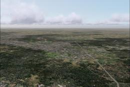
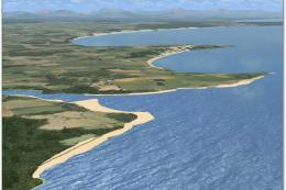
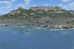
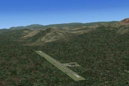
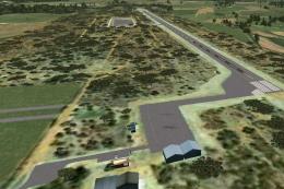
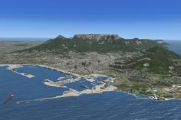
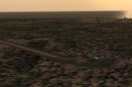
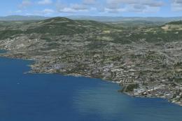
Images & Screenshots

Finding the Scenery
- FSX/Prepar3D Coordinates:
-
-24.00000000,25.00000000
Use the downloaded flight plan file by launching FSX/P3D, selecting "Load Flight Plan" in the flight planner, and choosing the .pln file. Your aircraft will be positioned directly at the add-on’s location. - Decimal Degrees (DD):
-
Latitude: -24.000000°
Longitude: 25.000000° - Degrees, Minutes, Seconds (DMS):
-
Latitude: 24° 00' 00.000" S
Longitude: 25° 00' 00.000" E
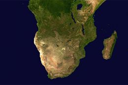
Map Location
The archive fsxworx20upd5.zip has 9 files and directories contained within it.
File Contents
This list displays the first 500 files in the package. If the package has more, you will need to download it to view them.
| Filename/Directory | File Date | File Size |
|---|---|---|
| Aeroworx_License_Agreement.PDF | 04.29.08 | 66.69 kB |
| fsxWorx20upd5.exe | 03.17.12 | 1.05 MB |
| license.txt | 04.04.09 | 7.38 kB |
| ReadmefsxWorx20upd5.txt | 03.17.12 | 3.72 kB |
| fsxWorx20upd5 | 03.17.12 | 0 B |
| FILE_ID.DIZ | 03.18.12 | 650 B |
| fsxWorx20upd5.jpg | 12.18.10 | 183.16 kB |
| flyawaysimulation.txt | 10.29.13 | 959 B |
| Go to Fly Away Simulation.url | 01.22.16 | 52 B |
Installation Instructions
Most of the freeware add-on aircraft and scenery packages in our file library come with easy installation instructions which you can read above in the file description. For further installation help, please see our Flight School for our full range of tutorials or view the README file contained within the download. If in doubt, you may also ask a question or view existing answers in our dedicated Q&A forum.


0 comments
Leave a Response