 FSX Scenery
Madagascar Lakes Flatten
Many lakes of Madagascar still appear in FSX as FS9 "tyre-like" walls or moon…
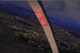
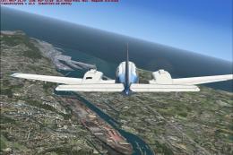
Tanzania’s major lakes get corrected shorelines and realistic elevations, eliminating “floating” water when flying over SRTM-based terrain meshes. Built from SRTM Water Body Data, the scenery improves coastline accuracy and terrain fit in FSX, creating a more believable East African landscape for low-level VFR routes and sightseeing.
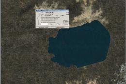
Most major lakes in Tanzania reworked from SRTM Water Body Data (SWBD) and altitude adjusted to fit in SRTM-based mesh sceneries. By Chris Butenschoen.
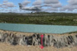
There are quite a few mesh sceneries out there, that are based on data from Nasa's Shuttle Radar Topography Mission (SRTM), producing very detailed landscape models in FS. The downside of this approach is, that things like airports and an lakes keep their original elevation. In east africa this leads to the phenomenon that most lakes appear as elevated pools.
For this project most of Tanzanias lakes were reworked from SRTM Water Body Data, to produce exact coastlines and adjusted to real world elevations.
This file was made for my personal flying pleasure. So it's quite possible, that it contains errors in areas, that i don't frequent in FSX.I take no responsibility for any damage you cause by using this file. Especially bathing in East African lakes is not advisable, as almost all are inhabited by parasites.
Installation:
Simply drop the bgl-file in any active scenery-folder or create a new folder and activate as usual.
Free for all simmers · 218.94 KB · Scanned clean Jul 2026
Download speed: Free tier is capped at 0.5 Mbps. PRO members download at full line speed.
SimObjects\Airplanes\, Addon Scenery\, Effects\, or Gauges\.readme.txt or README file. It tells you exactly where files go, what dependencies are needed, and any quirks specific to this add-on.Use these coordinates to fly directly to this location once the mod is installed.
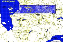
-6.16300000,35.75160000
Launch FSX or Prepar3D and use Flights → Load to open the downloaded .pln file. Your aircraft will be positioned at this location.
The archive tz_lakes.zip has 4 files and directories contained within it.
This list displays the first 500 files in the package. If the package has more, you will need to download it to view them.
| Filename/Directory | File Date | File Size |
|---|---|---|
| tz_lakes_readme.txt | 01.01.13 | 1000 B |
| CVX_Tanzania_lakes.BGL | 11.06.12 | 316.24 kB |
| flyawaysimulation.txt | 10.29.13 | 959 B |
| Go to Fly Away Simulation.url | 01.22.16 | 52 B |
Only PRO members can place votes.
More FSX & P3D add-ons hand-picked based on this download.
FSX Scenery
Many lakes of Madagascar still appear in FSX as FS9 "tyre-like" walls or moon…
 FSX Scenery
Province Of Quebec Lakes, Shorelines And Rivers, Canada. Includes territory b…
 FSX Scenery
Sicily VFR X - Lakes and Reservoir, Italy, v1.0. Tested with SP2. A remodelli…
 FSX Scenery
Finger Lakes Regional Airport (0G7), Seneca Falls, New York (NY). Here is an …
 FSX Scenery
Scenery 09FA Placid Lakes Airport, Florida (FL). Private airstrip using FSX s…
 FSX Scenery
Whole scenery of the Iberian Peninsula (except Portugal). an adaptation of th…
 FSX Scenery
FSX Loney's Alaska For FSX. This is a compilation of the author's Alaskan sce…
 FSX Scenery
Skara Scenery Bonaire X. Flamingo International Airport or Bonaire Internatio…
Be the first to leave a comment on this download.
Be the first to share your thoughts on this download.