FSX Detailed Terrain Features For Southern Africa
 This freeware add-on enriches Microsoft Flight Simulator X by expanding the level of detail across Southern Africa, specifically below the Equator. It offers coastline refinements, enhanced river networks, updated dam layouts, accurate roads, visible traffic, fully annotated rail lines, and even ...
- Country
-
") Global (World)
Global (World)
- Download hits
- 907
- Compatibility
- Flight Simulator X
 Prepar3D
 - Filename
- fsxworx01.zip
- File size
- 75.4 MB
- Virus Scan
- Scanned 12 days ago (clean)
- Access to file
- Free (Freeware)
- Content Rating
- Everyone
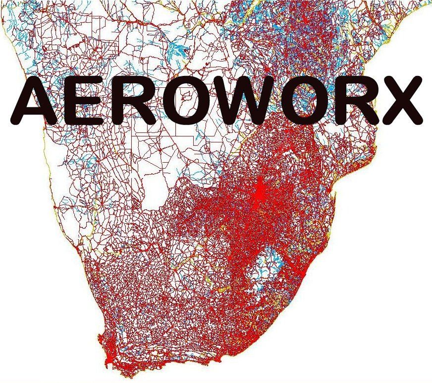
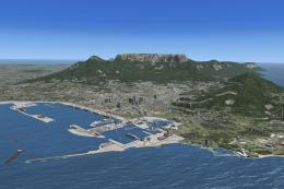
This freeware add-on enriches Microsoft Flight Simulator X by expanding the level of detail across Southern Africa, specifically below the Equator. It offers coastline refinements, enhanced river networks, updated dam layouts, accurate roads, visible traffic, fully annotated rail lines, and even modeled power lines and extrusion bridges. Created by Hannes Steyn, Aeroworx, this complete package incorporates multiple updates (fsxworx01upd4, fsxworx01upd3, fsxworx01upd1, fsxworx01upd2) in a single installation and relies heavily on satellite imagery as a design foundation.
Elevated Terrain Accuracy with Satellite Data
This scenery improvement was carefully shaped using high-resolution satellite backdrops. By referencing authentic topographical sources, the pack ensures rugged mountains, gently rolling hills, and precise water bodies appear as close to reality as possible. As a result, users can anticipate a striking representation of shorelines, river courses, and inland hydrology throughout the region, without compromising on simulator performance.
Roads, Traffic, and Transportation
With a significant focus on regional infrastructure, the scenery introduces an extensive highway system and populated traffic nodes to complement the major routes. In addition, railroads are precisely defined to depict vital rail corridors. Power lines further enhance immersion by illustrating the electrical distribution network crisscrossing the subequatorial territories.
Updates for Future Expansions
Aeroworx plans to integrate this detailed foundation in upcoming releases, making the presence of these terrain features crucial for full compatibility. All required updates are already included in this download, ensuring that upon installation, simmers benefit from the most current evolution of these enhancements.
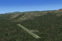
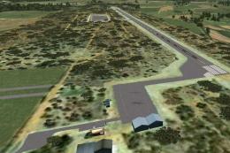
Overview of detailed terrain features for Southern Africa scenery.
Optimal Integration with Aeroworx Mesh
This add-on complements the recommended Aeroworx mesh (specifically the Southern Africa 0604, 0605, 0704, and 0705 mesh packages) to maximize elevation accuracy. Each dam, water reservoir, and other vector-based data has been carefully adjusted to align with the Aeroworx FSX Mesh. Although some default dam elevations in Microsoft Flight Simulator X may still appear off, the refined data ensures most bodies of water fit neatly into the surrounding terrain.
Key Notes
- Combining this scenery with the Aeroworx mesh delivers the most seamless topographic representation of subequatorial Africa.
- All updates are merged into one bundle, making installation straightforward and eliminating the need for incremental patches.
- Certain default water features might exhibit elevated or depressed edges when not matched with recommended mesh files.
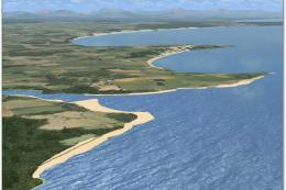
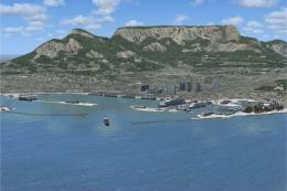
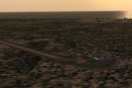
Images & Screenshots

Finding the Scenery
- FSX/Prepar3D Coordinates:
-
-26.20410000,28.04730000
Use the downloaded flight plan file by launching FSX/P3D, selecting "Load Flight Plan" in the flight planner, and choosing the .pln file. Your aircraft will be positioned directly at the add-on’s location. - Decimal Degrees (DD):
-
Latitude: -26.204100°
Longitude: 28.047300° - Degrees, Minutes, Seconds (DMS):
-
Latitude: 26° 12' 14.760" S
Longitude: 28° 02' 50.280" E
Map Location
The archive fsxworx01.zip has 27 files and directories contained within it.
File Contents
This list displays the first 500 files in the package. If the package has more, you will need to download it to view them.
| Filename/Directory | File Date | File Size |
|---|---|---|
| Go to Fly Away Simulation.url | 01.22.16 | 52 B |
| ReadmefsxWorx01.txt | 10.28.12 | 3.31 kB |
| flyawaysimulation.txt | 10.30.13 | 959 B |
| fsxWorx01 | 08.25.12 | 0 B |
| fsxWorx01.jpg | 08.25.12 | 260.82 kB |
| Aeroworx_License_Agreement.PDF | 04.29.08 | 66.69 kB |
| fsxWorx01.exe | 08.25.12 | 27.75 MB |
| license.txt | 04.04.09 | 7.38 kB |
| fsxWorx01upd1 | 10.19.12 | 0 B |
| Aeroworx_License_Agreement.PDF | 04.29.08 | 66.69 kB |
| fsxWorx01upd1.exe | 10.19.12 | 18.81 MB |
| license.txt | 04.04.09 | 7.38 kB |
| fsxWorx01upd2 | 11.11.12 | 0 B |
| Aeroworx_License_Agreement.PDF | 04.29.08 | 66.69 kB |
| ReadmefsxWorx01upd2.txt | 11.11.12 | 3.50 kB |
| fsxWorx01upd2.exe | 11.11.12 | 10.68 MB |
| license.txt | 04.04.09 | 7.38 kB |
| fsxWorx01upd3 | 12.02.12 | 0 B |
| Aeroworx_License_Agreement.PDF | 04.29.08 | 66.69 kB |
| ReadmefsxWorx01upd3.txt | 12.02.12 | 3.54 kB |
| fsxWorx01upd3.exe | 12.02.12 | 7.87 MB |
| license.txt | 04.04.09 | 7.38 kB |
| fsxWorx01upd4 | 01.27.13 | 0 B |
| Aeroworx_License_Agreement.PDF | 04.29.08 | 66.69 kB |
| ReadmefsxWorx01upd4.txt | 01.27.13 | 3.50 kB |
| fsxWorx01upd4.exe | 01.27.13 | 9.80 MB |
| license.txt | 04.04.09 | 7.38 kB |
Installation Instructions
Most of the freeware add-on aircraft and scenery packages in our file library come with easy installation instructions which you can read above in the file description. For further installation help, please see our Flight School for our full range of tutorials or view the README file contained within the download. If in doubt, you may also ask a question or view existing answers in our dedicated Q&A forum.

0 comments
Leave a Response